The transcendental valley of Soi Yaksa is uncovered on the Soi Yaksa Trek, which is hidden in between the hills and mountains of the mystical country of Bhutan. This hike is also known by a several other names, including the Yaksa Trek, the Jumolhari Trek II, and the Jumolhari Loop.
The trek starts with a visit to Haa Valley, continues on to Jangothang and into the laps of Jumolhari mountain, then continues on to Soi Yaksa Valley after crossing the Bonte La pass, and finally concludes in Thimphu. Some areas of the walk, such Haa Valley and Soi Yaksa, do not see a significant number of tourists, and as a result, the path through these areas is peaceful and unbroken. When you hear the birds chirping near Jangothang, feel the cool and noisy wind blowing at the height of Bonte La early in the morning, and grasp the serenity of the Tsho Phu lakes, you will certainly be able to appreciate the beauty of nature.
The first day of our Soi Yaksa Trek consists of an acclimatization climb to the well-known Taktsang Monastery, which takes place on the day after your arrival in the area. You'll be off to a good start after you reach an altitude of 3120 meters, which is reached after climbing approximately 4200 steps to reach the Tiger's Nest (Taktsang Monastery).
After passing the Bonte La pass (4890 m), which is the highest point of the walk, the path continues on through numerous magnificent mountains, rocky cliffs, wildflower meadows, and lakes, with frequent ascents and descents, until we reach our ultimate target, which is the Soi Yaksa Valley (3800 m).
If all you want to do is see Mount Jumolhari and Jichu Drake from afar without having to trudge your way up to Lingzhi and endure the high altitude, then the Soi Yaksa Trek is the one for you.
The best time to go trekking in Bhutan is in the spring, from March to May, when the country's valleys are at their most colorful and beautiful. In Bhutan, surrounded by nature and all of its beautiful offspring, you are sure to have a great time and take home a memory you will remember for the rest of your life. Because it rains a lot from June to August, those months are called "shoulder season." This is because hiking and other outdoor activities are less fun when it rains.
In the fall, on the other hand, it's the holiday season, and it might be hard to get a travel permit and a good hotel room. There will also be a lot of tourists on the trails, so even though it's one of the best times to go, these are things to think about. Summer is the low season for tourism, when not as many people come to visit.
Accessible Adventure is a travel and tour company that is managed and operated by a group of Nepalese people who have years of expertise in the industry. The team in question has extensive expertise planning and managing holiday destinations in Bhutan, Nepal, and Tibet, all of which are located in the Himalayas.
We are a leading and rising travel company based in Kathmandu, Nepal, with over a decade of experience in successfully executing trips by providing one-of-a-kind quality services at reasonable prices. Our organization is located in Nepal. During the time that you are here with us, you will have access to all of the wonderful holiday spots in the Himalayas that we can provide.
Every one of our trips is painstakingly planned and arranged, and we consistently receive great comments from both previous customers and clients as well as those who are still using our services. They have expressed a high level of happiness and gratitude for the value that we bring to their trips.
At Bhutan's only international airport, Paro, your tour guide will meet you and take you to your hotel. After a nap, you'll do some sight-seeing in and around Paro.
Later, you'll take a short drive away from Paro and walk up to Dzong Drakha. This beautiful group of 16th-century cliff temples is above the small village of Bondhey and looks out over the Paro Valley. Even though it only lasts a few hours, this trek is a great way to stretch your legs and help your body get used to the high altitude. In the evening, we can take a walk through the streets and markets around Paro.
After breakfast, we take a short drive to the foot of Tiger's Nest, where we begin our two-hour ascent to the monastery cafe, where we are rewarded with a breathtaking panorama of Taktsang. After another half-hour of hiking, we'll reach the majestic Taktsang Monastery and be greeted by the resident monks. It is thought that from Singye Dzong in Eastern Bhutan, Guru Rimpoche flew on a flaming tigress to here, Bhutan's holiest monastery, where he meditated for three months. Beginning in the eighth century, under his leadership, Buddhism in Paro flourished. He flew here from Tibet on the back of Yeshe Tsogyal, who he turned into a flying tigress for the trip. He landed on the cliff, which he "anointed" as the place to build a monastery. People have called him the "protector saint of Bhutan" because he brought Buddhism and the Nyingmapa school of Mahayana Buddhism to Bhutan. In the monastery, there are eight caves. Four of them are pretty easy to get to. Padmasambhava is thought to have entered the first cave on the back of a tiger. This cave is called "Tholu Phuk," and the cave where he meditates is called "Pel Phuk."
All of the monastic structures are cut directly into the cliff face, which has extraordinarily steep slopes. Despite its intimidating appearance, the monastery complex may be reached from multiple directions. These include the northwest by a path through the forest, the south via a path used by devotees, and the north via the "Hundred Thousand Fairies".
In the morning, we will go on a drive to the abandoned fortress of Drugyel Dzong in Bhutan. Tenzin Drukdra most likely constructed the dzong in 1649, at the direction of Zhabdrung Ngawang Namgyal, in order to celebrate the triumph over an invasion from Tibet.
Fire broke out at Drukgyal Dzong in the early 1950s and almost entirely burned the structure. Our trek begins at Drukgyal, where we cross the Paro River and stroll through cultivated fields before entering a forest filled with a variety of birds and vividly colored butterflies. At long last, we have arrived at Gunichawa, a military base. At this point, our trek permit will need to be presented for inspection. Our final destination, the campsite known as Shana, is located just one kilometer higher than the military base.
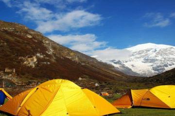
Following breakfast, we make our way along the path that parallels the Paro River. We climb higher and higher while passing through coniferous, oak, and spruce forests. We stop for lunch shortly after across the bridge that stretches over the Paro river. When that, we will travel through the Rhododendron trees, and after we have crossed the bridge once more, we will arrive at our ultimate destination, Thangka, which is located at an elevation of 3,750 meters. When you are standing on the campsite, you will get a breathtaking view of Jomolhari Mountain, which will be directly in front of your eyes.
We continue our journey by following the river as it winds its way through an extremely wooded area. As we make our way down the path that winds up and down the mountain, we eventually reach a junction where another path branches off to take us to Tibet through Tremo La. Following the crossing of the army camp at the beginning of the excursion, we walk for another hour before beginning the ascent that will take us to the summit of the hill, where we will get a beautiful view of the snow-covered mountains on the northern side. During the early days of trade between Bhutan and Tibet, people traveled along this path. Along the route, we travel across a number of different wooden bridges. We reached our campground in Jangothang, which is located at an elevation of 4040 meters, after a fast trek down into the valley. From the location of the camp, we get an unobstructed view of Mount Jomolhari.
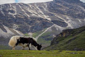
In order to guarantee that we are well acclimated for the following day's ascent, which is going to be the most strenuous of the entire journey, we have decided to take a rest day today. You are able to continue exploring the adjacent mountains by going on shorter hikes. We have some delicious food, decent conversations with our guides, and we explore the areas nearby where yak herds are located. Because acclimatization is highly necessary as we continue to climb to higher altitudes, we will remain here for the day in order to get our legs and the rest of our body ready for the next day.
This is going to be the day when we reach the highest point of the hike. After indulging in a scrumptious breakfast, we will now go toward the north in order to reach the valley's final village. The descent continues till it reaches the Paro Chhu. The next stop is the Tshophu Lake, which is located at an elevation of 4,380 meters and is home to ruddy-shel ducks. These ducks can be seen swimming and having a good time around the lake. After climbing a slope to a crest, descending into a hidden valley, and then climbing sharply to Bonte La Pass at 4890 meters, we come upon a second lake. After crossing the pass, the path winds its way down, passing over yak trails on the way to the Dhumzo Chhu. After making our way downstream, through a handful of huts, we reach the campsite at an elevation of 3,800 meters.
Following a hearty breakfast, we will start our hike for the day with a strenuous but steady ascent that will take us through a valley for around one hour. After that, the path now bears to the south and climbs to the Takhung La pass, which is located at an enormous altitude of 4520 meters. A beautiful sight can be seen from the pass, which is comprised of multiple cairns wrapped in prayer flags. After a short while of rising, you will be able to see mountains such as Jhomolhari, Jitchu Drake, and others. Thombu Shong, our destination for the evening and tonight's campsite, is reached by following a trail that initially keeps high to the left and then descends precipitously for a distance of 4180 meters. The campground is located in yak pastures and is the second highest point of the hike.
After breakfast, we get an early start and make our way toward the bottom of the Thombu La Pass (4380m). The views from Thombu La Pass are spectacular, and they include Mt. Kanchenjunga among other Bhutanese mountains. We travel across the valley across a marshy region, and then we locate a well-defined path that winds its way through rhododendron bushes and ascends precipitously to Thombu la. The vistas that can be seen from here are breathtaking. One of the most enjoyable aspects of the hike is the ridge walk that begins at the pass and continues further; it is located high above the valleys and features an excellent trail. It takes approximately an hour to attain a significant drop in elevation. The path comes to a conclusion close to the military helipad that is located next to the Bhutanese Army Camp in Gunitsawa. The campsite for the final night is located in a scenic area close to the Paro Chhu.
Since this is the last day of our hike, we can start our journey a little bit later than usual. After making our way through the blue pine forest and the farmhouses that line the Paro river, we will arrive back to Drugyel Dzong, where our vehicle will be waiting to take us to the hotel in Paro.
Today, we will say goodbye to this beautiful country in the Himalayas after completing the Soi Yaksa Trek. We hope that by now you have made some friends and taken lots of photos to remember Bhutan. We hope to see you again in this beautiful land of never-ending Enchantments.
Want to make your own customized trip ? Click Here