No cancellation fees. No hassle. Book Now, stay relaxed.Cancellation Terms
Accessible Adventure
Outbound
Trekking in Nepal
Expeditions
Activities
Travel Guide
Company
Accessible Adventure Logo
About Us

As Accessible Adventure, we are a trusted adventure tour operator, crafting unforgettable journeys across Nepal, Tibet, and Bhutan that leave lasting memories for every traveler.

Explore More
  • Blog
  • Travel Guide
  • Our Commitments
  • Online Payment
Company
  • Our Team
  • Terms and Conditions
  • No-risk Booking Policy
  • Legal Documents
Have Questions?
  • Phalful Chwok, Nayabazar-16, Kathmandu, Bagmati, 44600, Nepal
  • +9779851352707
  • info@accessibleadventure.com
Contact Us
👥 Follow us:
FacebookX (Twitter)LinkedInInstagramYouTubePinterestTikTokWhatsAppViber

All content and photographs on this website are copyright © Accessible Adventure Pvt. Ltd. and may not be reproduced without prior written permission.

Developed byTuring Research And Development Private Limited ↗
Island Peak climbing

Starting from

$2,300/ person
Book Now ↓
HomeExpeditionsPeak Climbing In NepalIsland Peak climbing
Featured

Island Peak climbing

Country

Nepal

Duration

16 Days

Difficulty

Strenuous to Challenging

Max Altitude

6,189 m

Style

Mountain climbing

Best Season

March-June & Sept-November

OverviewItineraryHighlightsBookingGuideAdditional InfoFAQs

Why Choose Island Peak climbing?

Last updated August 30, 2026

Island Peak climbing is the most sought-after first technical Himalayan summit for mountaineers ready to move beyond trekking. The peak, officially named Imja Tse, sits at 6,189 meters in Nepal's Khumbu region, rising above the village of Chhukung in a glaciated basin encircled by Lhotse, Nuptse, Ama Dablam, and Makalu. The name came from Tenzing Norgay and members of Eric Shipton's 1952 reconnaissance team, who looked up from Dingboche and saw the mountain standing like an island in a sea of ice.

Island Peak climbing draws a specific kind of participant: the experienced trekker who has stood at Everest Base Camp or Annapurna Base Camp and wants to know what it feels like to actually climb above 6,000 meters with crampons and a rope. The southeast ridge route is graded AD in the French alpine system. It involves genuine glacier travel, fixed rope ascent on a 40 to 50-degree headwall, and an exposed summit ridge at altitude. The skills required are teachable and the route is manageable for any well-prepared and properly guided climber, but it is not a walk. It asks for fitness, commitment, and respect for the altitude.

We specialize exclusively in high-altitude expeditions and trekking peaks. Every guide, every protocol, and every piece of equipment we stock is oriented toward the specific demands of technical mountain objectives in Nepal. The Island Peak guided expedition runs across spring and autumn seasons with small groups and a certified guide team whose members have each summited this peak multiple times. Contact us directly to check current season availability and departure dates.

Island Peak Quick Facts

Official Name: Imja Tse

Common Name: Island Peak

Elevation: 6,189 m / 20,305 ft

Location: Khumbu, Solukhumbu District, Nepal

Range: Mahalangur Himal, Main Himalaya

Type: NMA Trekking Peak

Route: Southeast Ridge

Grade: AD (Assez Difficile)

First Ascent: 1953, Sherpa team led by Tenzing Norgay with Eric Shipton expedition

Best Months: April, May, October, November

Expedition Duration: 16 days from Kathmandu

Summit Success Rate: 72 to 78 percent on guided expeditions

Island Peak Climbing: Complete Guide

Perfect First Himalayan Peak

Island Peak occupies the ideal position in the progression from Himalayan trekker to Himalayan mountaineer. The approach runs through the Khumbu's natural acclimatization corridor. The technical demands are real but learnable with a qualified guide. The altitude at 6,189 meters provides the full physiological experience of climbing above 6,000 meters without the extended high-altitude exposure required on bigger objectives. Every technical skill used on this route, crampon use on steep ice, ascending and descending fixed lines, glacier rope travel, forms the foundation for more ambitious Himalayan climbs later.

Stunning Everest Region Views

The summit panorama of Island Peak ranks among the finest in the Khumbu. Lhotse's massive southern buttress fills the northwestern skyline at close range. Nuptse's long ridge runs parallel to the west. Makalu, the fifth-highest mountain on earth, stands in clear detail to the east. Ama Dablam's unmistakable profile rises to the west. Below, the Imja and Khumbu glacial systems spread across the valley floor. On a clear April or October morning, the combination is extraordinary.

Beginner-Friendly Mountaineering

The term beginner-friendly means the route is structured to accommodate climbers who have not previously used technical climbing gear, with a comprehensive skills session at base camp before the attempt. It does not mean the climb is trivial. The headwall section, the glacier crossing, and the summit altitude all present genuine challenges. What the route does not involve is lead climbing, complex crevasse rescue, or multi-pitch technical terrain, which keeps the objective firmly within the reach of fit and motivated first-time technical climbers.

Glacier Adventure

The Island Peak glacier approach from base camp to high camp is a proper Himalayan glacier experience. Roped travel across crevassed terrain, crampon technique on the ice, and the bergschrund crossing at the headwall base are all managed under guide leadership with fixed lines. The glacier alone provides a level of mountain experience that no amount of trekking at lower altitude replicates.

Sherpa Culture and the Khumbu Approach

Ten days of approach through the Khumbu give significant time in one of the most culturally layered mountain landscapes in the world. The Saturday market in Namche, the puja at Tengboche Monastery, the traditional architecture of Dingboche and Chhukung, and the historical weight of the place where mountaineering's most significant expedition history unfolded all contribute to an experience that goes well beyond a pure climbing objective. Our guides from Sherpa families bring personal stories to every section of this approach.

Island Peak Climbing Highlights

Top Experiences

  • Moving onto the glacier before dawn with headlamps and crampons, the entire Khumbu still dark below

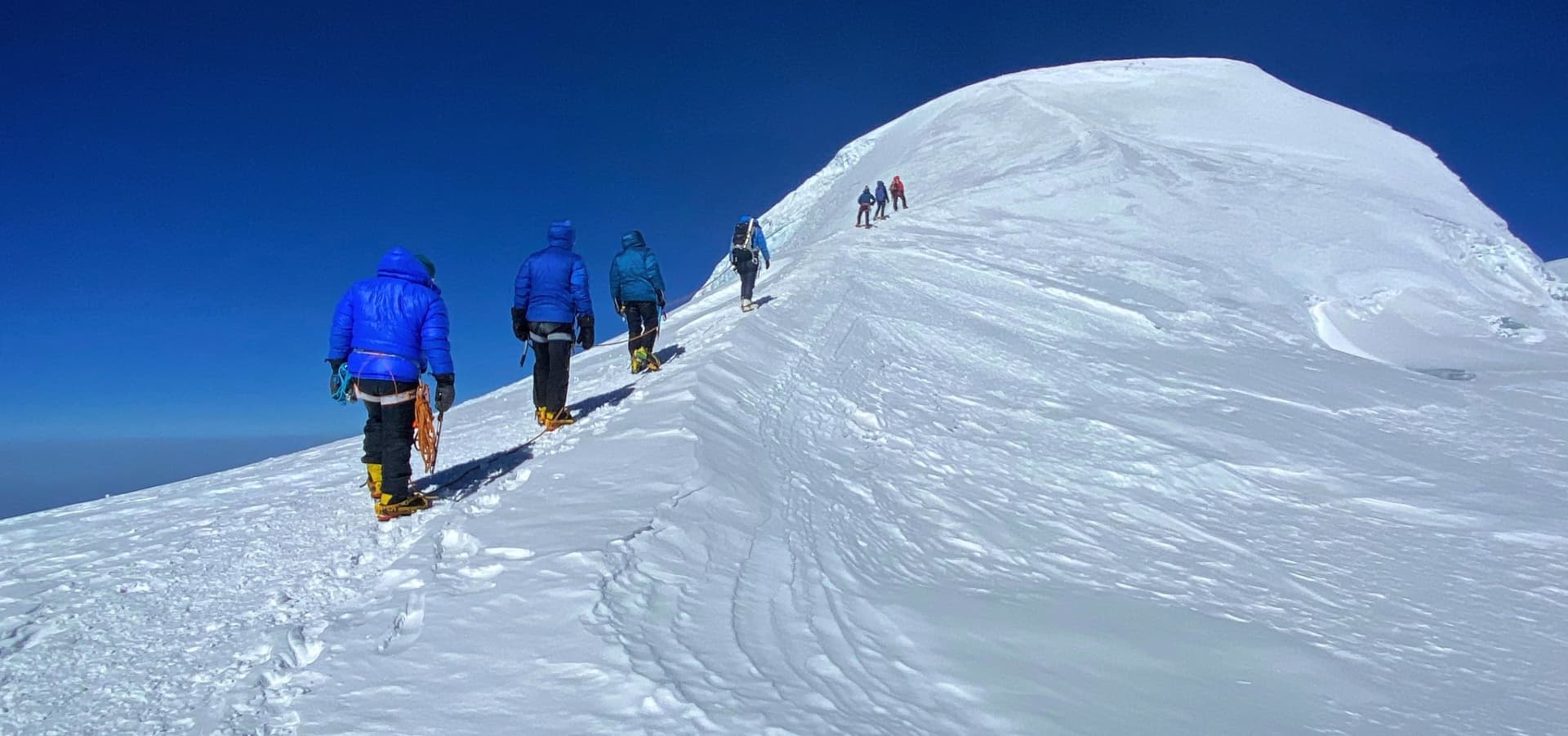
  • Following fixed ropes up the 40-degree headwall as Makalu catches the first light to the east

  • The summit at 6,189 meters: crampons on the snow dome, the full eastern Himalaya in every direction

  • Pre-dawn base camp on summit morning, tea in hand, gear laid out, the guide running the final briefing

  • The descent to Chhukung with the altitude dropping, the air thickening, and the exhaustion becoming satisfaction

  • Walking into Namche on the return with everything completed

Mountains Seen from the Summit

  • Lhotse (8,516 m): Directly northwest, the fourth-highest mountain on earth at close range.

  • Nuptse (7,861 m): The long southwest ridge visible to the west of Lhotse.

  • Makalu (8,481 m): Fifth-highest globally, prominently visible to the east.

  • Ama Dablam (6,812 m): The Khumbu's most recognizable peak, to the west.

  • Baruntse (7,129 m): Rising above the Hongu Basin to the southeast.

  • Cho Polu (6,735 m): Visible above the Imja Valley.

Cultural Highlights

  • Boudhanath Stupa in Kathmandu, one of the world's largest Buddhist monuments

  • Tengboche Monastery morning puja, open to respectful visitors

  • Namche Bazaar Saturday market, the commercial heart of the Khumbu Sherpa community

  • Traditional stone architecture and agricultural terraces of Dingboche and Chhukung

  • Mani walls and prayer flag lines throughout the entire Khumbu approach

Wildlife in the Region

  • Snow leopards in the high glacial zones above 4,500 meters, rarely seen but present

  • Himalayan Monal pheasant in the rhododendron forest between Phakding and Namche

  • Blue sheep (bharal) on the rocky slopes above Dingboche and the Island Peak approach

  • Red pandas are occasionally found in the lower forest sections of the Dudh Kosi valley

Photography Opportunities

  • Ama Dablam from the trail above Sanasa, one of the most photographed compositions in the Himalaya

  • Sunrise from the summit ridge with the eastern range silhouetted and the glaciers lit below

  • Tengboche Monastery against the Nuptse wall in afternoon light

  • The bergschrund and headwall of Island Peak in the blue pre-dawn hour

  • Village life in Chhukung in the autumn harvest period

Island Peak Climbing Route

Kathmandu to Lukla

The expedition starts with the 35-minute domestic flight from Kathmandu's domestic terminal to Tenzing-Hillary Airport in Lukla at 2,860 meters. The 527-meter runway slopes at 12 degrees and terminates at a cliff edge on one side and a mountain wall on the other. The approach is technically one of the most demanding in commercial aviation and is a memorable introduction to the Khumbu before the first step is taken.

Lukla to Namche Bazaar

From Lukla, the trail descends the Dudh Kosi valley through birch and rhododendron forest, crossing the Hillary Suspension Bridge above the river gorge before the long climb to Namche. The Sagarmatha National Park gate at Monjo marks the formal entry into the UNESCO World Heritage Site. The first glimpse of Everest typically appears through the ridgeline gap about 20 minutes below Namche, a brief but unmistakable moment.

Namche to Dingboche

The acclimatization day at Namche uses the hike to the Hotel Everest View ridge at 3,880 meters, then returns to sleep at 3,440 meters. The route continues through Tengboche Monastery and climbs the Imja Valley to Dingboche at 4,410 meters. A mandatory rest day at Dingboche with a hike to 4,800 meters gives the second major acclimatization stimulus before the move toward the technical section.

Chhukung

Chhukung at 4,730 meters is the last teahouse settlement before base camp. It sits at the foot of the Imja Glacier with Lhotse, Nuptse, Baruntse, and Island Peak itself directly visible from the village. A rest or partial acclimatization hike from Chhukung is included before the base camp move.

Base Camp at 5,100 m

Island Peak Base Camp sits on a rocky moraine platform with clear views of the peak above. The approach from Chhukung takes three to four hours on trail that steepens significantly in the final section. A mandatory technical skills session at base camp covers crampon attachment, ice axe use, and fixed rope ascending and descending before any movement above camp.

High Camp at 5,600 m

High Camp sits on a snowfield below the headwall at approximately 5,600 meters. Crampons go on at the glacier transition from base camp, and the route to high camp passes the lower headwall sections where fixed lines are pre-installed by the guide team. High camp gives a summit day altitude gain of approximately 589 meters rather than the 1,089 meters a base-camp-only approach would require.

Summit via the Southeast Ridge

The summit push leaves high camp between 1:00 and 3:00 AM. The bergschrund crossing and the fixed rope headwall at 40 to 50 degrees are the technical crux. Above the headwall, the southeast ridge narrows toward the broad snow dome summit. The descent reverses the ascent line. Return to high camp, then base camp on the same day. 

Return Route

The return from base camp to Lukla covers in two days what the approach took nine. The trail is familiar and the altitude is dropping, which changes the body's energy and the mood in the group. Namche on the return provides the last bakeries, hot showers, and gear shop browsing before Lukla and the flight back to Kathmandu.

Trip Summary

Day 1

Arrive Kathmandu (1,400 m)

The expedition begins at Tribhuvan International Airport, the only international gateway to Nepal, set in the Kathmandu Valley at roughly 1,400 meters, a low enough elevation that arrival day carries no altitude considerations of its own. One of our representatives meets each climber at the arrivals hall and manages the transfer into Thamel, the dense tourist quarter of the old city that has served as the staging ground for Himalayan expeditions since the 1960s, when Nepal first opened to foreign trekkers and mountaineers.

Thamel's narrow lanes are lined with gear shops, bookstores, and the trekking agencies that have historically outfitted almost every Everest region expedition, and the neighborhood remains the practical center of gravity for anyone assembling last-minute equipment before flying into the mountains. The hotel used on arrival and departure nights sits within walking distance of this district, giving climbers an easy first evening to recover from international travel before the itinerary properly begins.

An informal dinner on the first night brings the group together for the first time, guide included, and gives us a chance to take an early read on each climber's condition and travel fatigue. Duffel bags and personal climbing gear are typically checked at this point, since anything requiring last-minute purchase or rental is far easier to sort out in Kathmandu than after the Lukla flight, when the nearest gear shop is a week's walk away.

Daily Summary

Duration1/2 hrs
Distance10 km
AccommodationTeahouse
MealsB,L,D
Mountain SeenOn a clear day: Langtang Lirung, Ganesh Himal
Day 2

Kathmandu: Briefing and Sightseeing

The full preparation day opens with a detailed expedition briefing covering the itinerary, the altitude protocol, the base camp skills session climbers will undergo before the technical climbing begins, and the paperwork required for the Nepal Mountaineering Association permit, the Sagarmatha National Park entry permit, and the Khumbu Pasang Lhamu Rural Municipality fee, all of which must be processed in person in Kathmandu and cannot be arranged in advance from abroad.

The afternoon heritage tour takes in three of the Kathmandu Valley's UNESCO World Heritage monuments. Boudhanath Stupa, among the largest stupas in the world and a spiritual center for the Tibetan refugee community that has lived around it since 1959, dominates its own city square with the painted eyes of the Buddha watching in four directions from its central spire. Pashupatinath, a Hindu temple complex on the banks of the Bagmati River and one of the holiest Shiva shrines on the subcontinent, presents an unfiltered view of Nepali cremation ritual at its riverside ghats. Swayambhunath, the hilltop stupa known informally as the Monkey Temple for its resident macaques, is reached by a stair of several hundred steps and is held by local tradition to be well over a thousand years old, predating most organized settlement in the valley.

Equipment checks close out the day. We inspect mountaineering boots, crampons, and any personally owned technical hardware against the departure gear list, and arrange same-day rental in Thamel for anything a climber has chosen not to bring from home. This is the last point in the expedition where a gear gap can be closed without consequence.

Daily Summary

Duration3-5 hrs
Distance5 km
AccommodationTeahouse
MealsB
Mountain SeenOn a clear day: Langtang Lirung, Ganesh Himal
Day 3

Fly Kathmandu → Lukla → Trek to Phakding

The 35-minute flight from Kathmandu's domestic terminal lands at Tenzing-Hillary Airport in Lukla, a 527-meter runway built under the supervision of Sir Edmund Hillary's Himalayan Trust in 1964 to support the schools and hospitals his foundation was constructing across the Khumbu. The runway's roughly 12-degree upward slope was a deliberate piece of engineering, using gravity to help aircraft brake on landing and assist takeoff on departure, since the strip ends at a stone wall on one side and a 600-meter drop into the valley on the other. It remains one of the most demanding commercial approaches in the world, and weather can hold flights on the ground in Kathmandu for hours or days during the shoulder periods of the climbing seasons.

From Lukla the trail drops gently through Chheplung, where the historic route from Jiri splits away to the south, and continues through Thado Koshi, where Kusum Kanguru's 6,367-meter triple summit comes into view above the Dudh Koshi gorge. Prayer flags and mani walls line the path through pine and rhododendron forest the entire way, a pattern of Tibetan Buddhist devotional markers that will recur at every settlement for the rest of the approach. The final stretch descends gently from Ghat to Phakding, a riverside village at 2,610 meters that sits, by design, slightly lower than Lukla itself, giving the body a soft first exposure to altitude rather than an immediate climb.

The full day's walking covers roughly 8 kilometers in three to four hours, crossing several suspension bridges over the milky glacial water of the Dudh Koshi. It is the easiest day of the entire approach, included deliberately at this gentle pace so that any traveler still adjusting from international flights is not asked to climb hard on day one.

Daily Summary

Duration30-40 min flight + 3-4 hrs walk
Distance8 km
AccommodationTeahouse
MealsB,L,D
Mountain SeenKusum Kanguru, Kongde Range
Day 4

Phakding → Monjo → Jorsale → Namche Bazaar

The trail out of Phakding crosses the Dudh Koshi and continues upriver through forest to Monjo, where climbers pass through the entrance gate of Sagarmatha National Park, a protected area established by royal decree in 1976 and inscribed as a UNESCO World Heritage Site in 1979 in recognition of both its exceptional alpine ecosystem and its cultural landscape. A short distance beyond Monjo, at Jorsale, a second checkpoint verifies park permits before the trail begins its final approach to Namche.

The signature feature of this day is the crossing of the Hillary Suspension Bridge, strung high above the point where the Dudh Koshi and Bhote Koshi rivers meet in a narrow gorge, and widely regarded as the most dramatic of the many suspension crossings on the route. From the bridge, the trail switches back relentlessly through pine forest, gaining roughly 600 meters over the final two hours of the day, a climb every Khumbu veteran remembers as one of the hardest single stretches on the standard approach. About halfway up, weather permitting, the summit pyramid of Everest appears briefly through a gap in the ridgeline, the first sight of the mountain most climbers will get on the entire expedition.

Namche Bazaar itself occupies a natural amphitheater carved into the hillside at 3,440 meters, a horseshoe-shaped basin that has functioned as the Khumbu's principal trading center for centuries. Long before trekking tourism existed, Sherpa and Tibetan traders met here to exchange salt, wool, and yak products carried over the Nangpa La pass for grain, tea, and manufactured goods brought up from lower Nepal, a trade route that functioned until China's 1959 closure of the Tibetan border redirected the local economy toward mountaineering and, eventually, tourism.

Daily Summary

Duration5-6 hrs
Distance12 km
AccommodationTeahouse
MealsB,L,D
Mountain SeenThamserku, Kongde, Kusum Kanguru, Everest glimpses
Day 5

Namche Bazaar Acclimatization Hike

The first scheduled acclimatization day follows the climb-high, sleep-low principle that structures the entire itinerary. The morning hike climbs roughly 440 meters from Namche to the ridge at Syangboche, home to Hotel Everest View, built in 1971 by the Japanese entrepreneur Takashi Miyahara and still recognized by Guinness World Records as the highest-placed hotel on Earth. The hotel's terrace delivers one of the most direct panoramas of Everest, Lhotse, Nuptse, and Ama Dablam available anywhere on the trek, and the guide uses the stop to make a first real assessment of how each climber's body is responding to the thinning air, since the return descends back to sleep at Namche's lower 3,440 meters.

The afternoon is left free for Namche's other attractions. The Sherpa Culture Museum, perched above the town, documents the region's Buddhist heritage and its transformation from an isolated trading post into the operational headquarters of Everest region mountaineering. If the day falls on a Saturday, the famous weekly market fills the central square with traders from across the Khumbu and beyond, selling everything from fresh yak cheese to imported clothing in a scene that has changed only in the details since the town's caravan-trading centuries.

Namche's bakeries, gear shops, and the region's most reliable internet connectivity make this the last comfortable stop before the trail turns genuinely remote. Climbers finalize any last equipment adjustments here, since services thin out dramatically above Tengboche and disappear almost entirely above Chhukung.

Daily Summary

Duration3-4 hrs
Distance5 km
AccommodationTeahouse
MealsB,L,D
Mountain Seen Everest, Lhotse, Ama Dablam, Thamserku, Kongde
Day 6

Namche → Kyangjuma → Phunki Tenga → Tengboche

The trail out of Namche passes through Sanasa, where the route to the Gokyo lakes splits away to the west, and delivers some of the finest close-range views of Ama Dablam's serrated ridge line found anywhere on the approach. A long descent through rhododendron forest reaches the Dudh Koshi at Phunki Tenga, where a row of water-powered prayer wheels turns constantly in the current, before the trail commits to a steady two-hour climb up to the ridge at Tengboche.

Tengboche Monastery, at 3,867 meters, is the largest gompa in the Khumbu and one of the most storied religious sites in the Everest region. It was founded in 1916 by Lama Gulu, a Nyingma-school monk trained at Rongbuk Monastery on the Tibetan side of Everest, and it has been rebuilt twice since: first after the 1934 Nepal-Bihar earthquake collapsed the original structure and killed Lama Gulu shortly afterward, and again after a 1989 electrical fire, sparked by the monastery's newly installed micro-hydro power system, destroyed the rebuilt hall along with irreplaceable murals, scriptures, and ritual objects. Both reconstructions drew on Sherpa community labor and, in 1989, on international donations that included support from the Himalayan Trust that Sir Edmund Hillary had founded decades earlier.

Trekkers who time their arrival for the tenth lunar month, corresponding to October or November, may catch the Mani Rimdu festival, a three-day cycle of masked dances performed by the resident monks that reenacts Buddhism's historical triumph over the older Bon religion of the Himalaya. On any other day, the dawn and dusk puja ceremonies remain open to respectful visitors, and the monastery's ridge delivers an unobstructed view across to Ama Dablam, Everest, Nuptse, and Lhotse in a single frame.


Daily Summary

Duration5-6 hrs walk
Distance10 km
AccommodationTeahouse
MealsB,L,D
Mountain SeenEverest, Lhotse, Nuptse, Ama Dablam, Thamserku
Day 7

Tengboche → Deboche → Pangboche → Somare → Dingboche

 The trail descends from Tengboche through more rhododendron forest to Deboche, home to a small Buddhist nunnery, before crossing the Imja Khola and climbing to Pangboche, at roughly 3,985 meters the highest permanent Sherpa settlement in the Khumbu and the site of the valley's oldest monastery, founded well over three centuries ago by the lama Sangwa Dorje, the same figure credited with having first prophesied Tengboche's founding.

Beyond Pangboche the landscape changes noticeably. Tree cover thins into scattered juniper and open alpine scrub as the trail climbs into the broad, sun-filled bowl of the Imja Valley, with Ama Dablam now filling the skyline at close range and Lhotse's summit wall visible for the first time. Dingboche itself, at 4,410 meters, is built around small stone-walled fields where barley and potatoes are grown behind windbreaks constructed from the valley's abundant loose rock, a farming adaptation unique to this altitude band in the Khumbu.

This is typically the point in the trek where the first genuine altitude symptoms appear for climbers who have moved quickly through the lower villages, and it marks the junction where the standard Everest Base Camp route continues north toward Lobuche while the Island Peak route will branch east toward Chhukung two days later. Notably, despite the proximity to the world's highest peak, Everest itself remains hidden from Dingboche behind the intervening walls of Nuptse and Lhotse.

Daily Summary

Duration5-6 hrs
Distance11 km
AccommodationTeahouse
MealsB,L,D
Mountain Seen Ama Dablam, Lhotse, Nuptse, Island Peak
Day 8

Dingboche: Acclimatization Day

The second scheduled acclimatization day sends climbers up the steep ridge behind the village to Nangkartshang Peak, sometimes called Nagarjun Hill, which tops out at approximately 5,083 meters after a climb of three to four hours. Guides and veteran trekkers consistently rank this among the steepest single ascents on the entire itinerary, considerably harder underfoot than the walk to Hotel Everest View despite the shorter distance, and it repays the effort with a genuine 360-degree survey of the eastern Himalaya: Makalu, the world's fifth-highest peak, standing clear to the east; Ama Dablam close enough to feel its scale; and the full sweep of Lhotse's south face with Island Peak visible in the valley below.

The return to sleep at Dingboche's 4,410 meters completes the day's climb-high, sleep-low cycle, and the guide uses the hike to run a second, more detailed health check, watching in particular for the balance and coordination issues that can signal early high-altitude cerebral involvement. Afternoon weather in this part of the valley tends to cloud over by early afternoon, which is why the ascent is always made in the morning.

We schedule the technical briefing on the climbing section for this same afternoon, once climbers have returned and rested. This is the point in the itinerary where the trip's character visibly shifts from trekking toward mountaineering, and the guide uses the session to walk through the equipment, the rope systems, and the specific hazards of the glacier and headwall that lie three days ahead.

Daily Summary

Duration3-5 hrs
Distance6 km
AccommodationTeahouse
MealsB,L,D
Mountain Seen Ama Dablam, Island Peak, Lhotse, Nuptse, Makalu
Day 9

Dingboche → Bibre → Chhukung

The route east from Dingboche leaves the main Everest Base Camp trail behind entirely and follows the northern bank of the Imja Khola for roughly 8 kilometers, a walk of three to four hours across open yak pasture and along the lateral moraine of the Lhotse Glacier. The valley narrows steadily as the trail progresses, with ice-streaked rock walls closing in on both sides until Chhukung's cluster of stone buildings appears at the head of the valley.

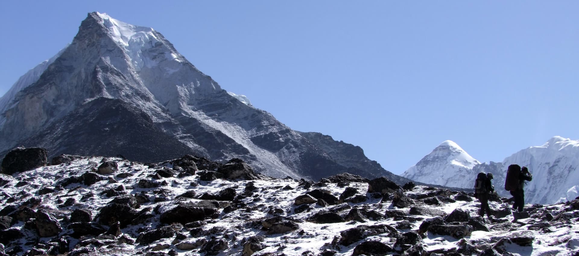
At 4,730 meters, Chhukung is the last permanent teahouse settlement before Island Peak Base Camp and functions as the staging village for climbers, trekkers, and Ama Dablam expedition teams alike. Lhotse's massive south wall rises directly north of the village, Nuptse's ridge runs parallel to the west, and Island Peak itself is visible for the first time as more than a distant name on an itinerary, sitting at the head of the Imja drainage exactly as its Sherpa name, Imja Tse, describes.

Climbers with acclimatization to spare often add the optional afternoon scramble to Chhukung Ri, a viewpoint above the village at roughly 5,546 meters that delivers views deep into the Hongu basin and across to Baruntse and Makalu, though the exertion is significant and we treat it as optional rather than mandatory given the technical climbing still to come.

Daily Summary

Duration3–4 hrs walk
Distance6 km
AccommodationTeahouse
MealsB,L,D
Mountain Seen Island Peak, Ama Dablam, Lhotse, Nuptse, Baruntse
Day 10

Chhukung → Island Peak Base Camp

The three to four hour walk from Chhukung gains roughly 370 meters over increasingly steep and rocky terrain, arriving at the rock and moraine platform that serves as Island Peak Base Camp. The site is known locally as Pareshaya Gyab and sits at approximately 5,100 meters with a direct view up toward the peak's southeast ridge, though the summit itself remains hidden behind the intervening headwall from this angle.

The technical skills session held here is the single most consequential briefing of the expedition for any climber without prior mountaineering experience. Under the guide's direction, climbers fit and test crampons on their mountaineering boots, practice basic ice axe grip and self-arrest position, and run through the mechanics of ascending and descending a fixed line using a jumar and a belay device, the exact sequence that will be required, under far more consequential circumstances, on summit night.

Base camp's dining tent, cook tent, and toilet tent give the site a level of comfort noticeably above what the bare moraine setting might suggest, and the two nights typically spent here (one on arrival, one after returning from the summit) make it the closest thing to a home base the expedition has above Chhukung.


Daily Summary

Duration4-5 hrs
Distance7 km
AccommodationTeahouse
MealsB,L,D
Mountain Seen Island Peak, Lhotse, Nuptse, Ama Dablam, Baruntse
Day 11

Island Peak Base Camp → High Camp

Crampons go on at the point where the trail meets the glacier above base camp, and the character of the climb changes immediately. What follows is genuine roped glacier travel across a field of crevasses, the first section of the route where a misplaced step carries real consequence, and the guide leads the rope team along a path chosen fresh each season as the glacier's surface shifts and opens new cracks while closing others.

High Camp itself sits on a snowfield at roughly 5,600 meters directly below the headwall, a location chosen specifically to shorten summit day. Climbing from high camp rather than from base camp cuts the vertical gain required on summit night from more than 1,000 meters to under 600, a difference that matters enormously given the altitude and the hour at which the climb must begin. The guide team fixes advance rope on the lower sections of the headwall during this rotation, work that will make the following night's ascent measurably faster and safer.

Arrival at high camp typically comes by early afternoon, leaving the rest of the day for the unglamorous but essential business of pre-expedition altitude: forcing down fluids, eating despite a suppressed appetite, and getting into a sleeping bag early for what is usually a short and interrupted night's rest before the pre-dawn departure.

Daily Summary

Duration3-4 hrs
Distance3-4 km
AccommodationTented Camp
MealsB,L,D
Mountain Seen Lhotse, Nuptse, Ama Dablam, Baruntse, Makalu
Day 12

Summit Day: Island Peak (6,189 m), Descend to Base Camp

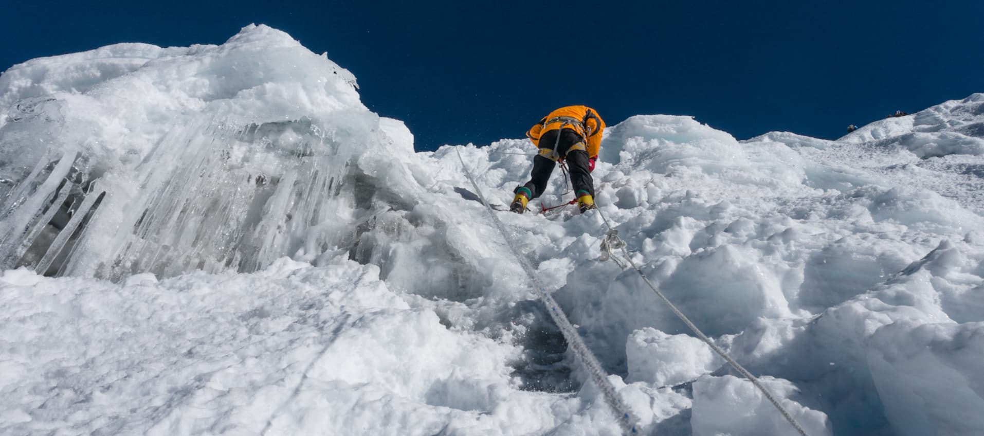
Teams typically leave high camp between 1:00 and 3:00 AM, moving by headlamp across the glacier to the base of the headwall, where the bergschrund, the crevasse that separates the moving glacier ice from the more stable snow and ice above, must be crossed at its narrowest and most stable point. The headwall itself climbs at 40 to 50 degrees on fixed rope for a stretch of close to 100 meters, the technical crux of the climb and the section where crampon technique and jumar efficiency matter most.

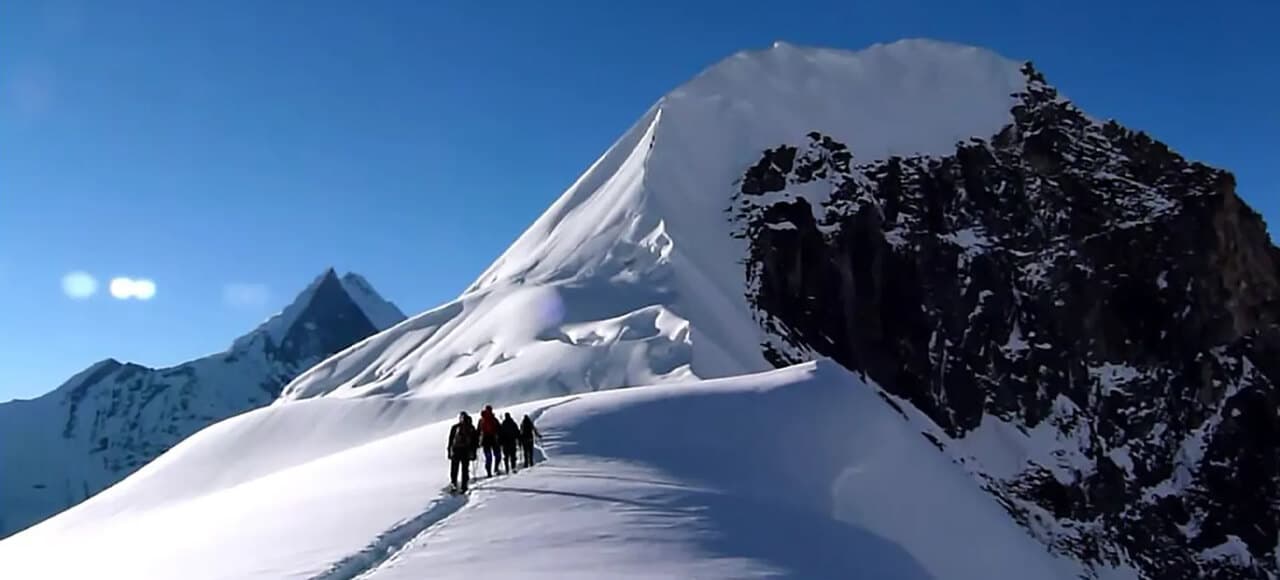
Above the headwall the route gains the southeast ridge, narrowing to a crest with real exposure on both sides before opening onto the broad snow dome of the summit at 6,189 meters, the elevation Nepal's mountaineering authorities have used officially since the peak was first opened to climbers, although a later GPS survey placed the true high point closer to 6,165 meters. From the top, Everest itself remains hidden, blocked by the sheer wall of Lhotse rising more than 2,300 meters directly above the summit, but Lhotse, Nuptse, Makalu, Ama Dablam, and Baruntse fill the rest of the horizon in a panorama that few peaks of Island Peak's modest technical demands can match.

The mountain's climbing history reaches back to the same spring that made Everest famous. In 1953, weeks before Tenzing Norgay and Edmund Hillary reached the world's highest summit, a party from Colonel John Hunt's British Mount Everest Expedition, comprising Tenzing Norgay, Charles Evans, Alfred Gregory, and Charles Wylie together with seven Sherpas, climbed the peak's southwest summit as an acclimatization and equipment trial ahead of the main attempt. The peak's now-common English name had already been given the previous year by Eric Shipton's 1951 to 1952 reconnaissance party, who saw it from Dingboche standing clear above a surrounding sea of glacier ice, though Shipton himself did not lead the 1953 climbing team. The technically harder main summit was not reached until 1956, when Hans-Rudolf von Gunten and two Sherpas, members of a Swiss expedition preparing for the first ascent of Lhotse, completed the final section of ridge that the 1953 party had left untouched. Nepal officially renamed the mountain Imja Tse in 1983, though Island Peak has never lost its place in common use. Descent reverses the ascent line, returning the team to high camp for a short rest before continuing down to base camp the same day.


Daily Summary

Duration10-14 hrs
Distance8-10 km
AccommodationTeahouse
MealsB,L,D
Mountain Seen Everest, Lhotse, Nuptse, Ama Dablam, Makalu, Baruntse, Cho Oyu
Day 13

Island Peak Base Camp → Dingboche → Pangboche → Tengboche → Namche

The descent from base camp retraces the outbound route through Chhukung, Dingboche, and Pangboche in a single long push, a day made easier by the psychological and physical relief of descending altitude after the effort of summit day. Energy that had been rationed carefully on the way up returns quickly below 4,500 meters, and the pace of the group typically picks up noticeably through Tengboche and the final descent into Namche.

Covering this much ground, roughly the distance of three normal trekking days compressed into one, is only possible because the trail is already familiar and because oxygen availability improves with every kilometer of descent. Even so, this is consistently the longest single day of the entire itinerary, and we build in flexibility to split it across two shorter days if weather, fatigue, or an individual climber's condition calls for it.

Arrival in Namche after the technical section is complete carries its own quiet significance. Hot showers, a real bed, and the town's bakeries feel disproportionately luxurious after nights spent in a high camp tent, and the descent from over 6,000 meters to Namche's 3,440 in the space of a few days is itself a meaningful physiological transition worth respecting with an early night.

Daily Summary

Duration7-8 hrs
DistanceApprox. 20 km
AccommodationTeahouse
MealsB,L,D
Mountain SeenAma Dablam, Everest, Lhotse, Nuptse, Thamserku
Day 14

Namche Bazaar → Jorsale → Monjo → Phakding → Lukla

The final trekking day retraces the lower Khumbu trail in reverse, crossing the Hillary Suspension Bridge one last time, passing back through the Sagarmatha National Park checkpoints at Jorsale and Monjo, and following the Dudh Koshi back down through Phakding to Lukla. Covering close to 20 kilometers, the day typically takes six to seven hours, made easier by the net loss of elevation but still a substantial final effort after two weeks on the trail.

Arrival in Lukla in the late afternoon or early evening marks the practical end of the expedition's physical demands, even though the flight and the return to Kathmandu remain ahead. This is traditionally when tips for the guide, assistant guide, cook, and porters are distributed, following the informal but well-established gratuity customs of the Khumbu trekking economy, and when a final crew dinner brings the full support team together with the climbers for the first time since Kathmandu.

Repacking duffels for the flight home begins this evening as well, since Lukla's baggage handling operates under the same tight weight limits and unpredictable weather as the inbound flight, and climbers who reorganize their gear the night before generally have a smoother departure the following morning.

Daily Summary

Duration6-7 hrs
Distance17 km
AccommodationTeahouse
MealsB,L,D
Mountain SeenThamserku, Kusum Kanguru, Kongde
Day 15

Fly Lukla to Kathmandu

The return flight retraces the 35-minute route back to Kathmandu's domestic terminal, typically departing in the earlier part of the morning when Khumbu weather is most reliably clear, since afternoon cloud buildup is the most common cause of delay on this route. Climbers arriving back in the noise, traffic, and oxygen-rich air of the Kathmandu Valley after two weeks in the high Khumbu often describe the sensory transition as more disorienting than the initial climb into thin air had been.

The free afternoon gives climbers their first real opportunity for hot showers without time pressure, laundry, and any last souvenir shopping in Thamel before departure. Our summit dinner that evening brings the full team together for a final celebratory meal, typically the first moment the entire group can properly reflect on the three weeks since they first met in the same city.

Daily Summary

Duration30-40 mins
Accommodation3* Hotel
MealsB
Mountain Seen Everest, Lhotse, Nuptse, Ama Dablam (weather permitting)
Day 16

Departure

 A private transfer delivers each climber to Tribhuvan International Airport in time for their onward international connection, closing out the expedition. Sixteen days after landing in the Khumbu, most climbers leave with more than a summit certificate: a working knowledge of crampon technique, fixed rope systems, and glacier travel that few other introductory Himalayan objectives can offer in a single guided trip.

Daily Summary

AccommodationTeahouse
MealsB
Mountain Seen-
Altitude in:
Scroll to view full route

Scenic Highlights Along the Island Peak climbing

  1. Trek through the breathtaking Khumbu Valley, surrounded by towering Himalayan peaks.
  2. Experience the cultural richness of Sherpa villages, including Namche Bazaar and Tengboche.
  3. Conquer Island Peak Nepal, standing tall at 6,189 meters, with panoramic stunning views of the Everest region.
  4. Camp at the iconic Island Peak Base Camp, a serene haven for acclimatization and preparation.
  5. Navigate thrilling glaciers and ridges during your ascent, making it a memorable peak adventure.
  6. Be guided by experienced Sherpa Guides, ensuring safety and success throughout the journey.
  7. Witness the unparalleled beauty of Himalayan giants, including Lhotse, Makalu, and Ama Dablam.

Island Peak climbing Departures

Select Departure Date

Trip duration: 16 Days

Sep - Oct 2026

September 2026

Su
Mo
Tu
We
Th
Fr
Sa
1
2
3
4
5
6
7
8
9
10
11
12
13
14
15
16
17
18
19
20
21
22
23
24
25
26
27
28
29
30

October 2026

Su
Mo
Tu
We
Th
Fr
Sa
1
2
3
4
5
6
7
8
9
10
11
12
13
14
15
16
17
18
19
20
21
22
23
24
25
26
27
28
29
30
31
Your Trip
USD 2,350SAVE $50
USD 2,300/ person

Best Price Guaranteed

1-0 People
USD 2,394.6/ Person
2-3 People
USD 2,350/ Person
4-7 People
USD 2,250/ Person
8-13 People
USD 2,199.99/ Person
14-21 People
USD 2,150/ Person
CUSTOMIZE TRIP

Speak to an Expert

Laxmi Malla
Hari Kumar Shrestha
Himal Shrestha
Shiva Kumar Shrestha
UR Ghale

Himal Shrestha

Director 🇳🇵

Chat on WhatsApp

Expedition Success

100%

Expeditions
to Summit

100%

Climber
Summit Rate

15

Climbers
Guided

Meet Our Expert Guides

Ongchhu Sherpa

Ongchhu Sherpa

Peak Climbing Guide

15 years of experience

Meet the Legendary Mr. Ongchu Sherpa, our expert peak climbing guide. He is an experienced climber with a passion for adventure and a wealth of knowledge in the Himalayas. Ongchu Sherpa is a professional climber who has accomplished many notable summits, especially Mera Peak, Island Peak, and Lobuche Peak. His deep familiarity with the mountains and his unwavering commitment to professionalism and safety make him a priceless colleague on our team.
Lakpa Sherpa

Lakpa Sherpa

Climbing Guide

16 years of experience

Lakpa Sherpa is a seasoned mountaineer with a remarkable history of climbing numerous mountain peaks with groups and climbers from all over the world. He has more than ten years of experience and is widely regarded as one of the most trustworthy hiking and climbing guides. Peaks such as Tukuche, Island Peak, Mera Peak, Everest, Kanchenjunga, Makalu, and Lobuche are among those he has successfully ascended.
Kipa Sherpa

Kipa Sherpa

Climbing Guide

17 years of experience

Kipa is an experienced climber working as a climbing guide and has been active in this sector since 2006. He evaluates your capability for climbing and mountaineering and guides you to snowy summits accordingly. With an extensive background in climbing and mountaineering, he has successfully completed the ascent of 7000-meter massifs on multiple occasions.
Rengi Lakpa Sherpa

Rengi Lakpa Sherpa

Climbing Guide

18 years of experience

Rengi Lakpa Sherpa was born in the Makalu region and has completed the ascent of Mount Everest twice, along with summiting a number of other notable mountains. He has climbed a significant number of peaks in Nepal and Tibet and leads expeditions as a professional trek and climbing leader.

Additional Information

Island Peak Oxygen Level Chart: SpO2 Levels by Altitude


Oxygen Level Chart During Island Peak Climbing

S.N Altitude  Oxygen Level
1 Lukla (2,860 m) 21%
2 Phakding (2,610 m) 20.50%
3 Namche Bazaar (3,440 m) 19.50%
4 Tengboche (3,860 m) 18.50%
5 Chhukung (4,410 m) 17.50%
6 Island Base Camp (5,087 m) 16.50%
7 High Camp (5,500 m) 15.50%
8 Summit (6,189 m) 14.50%


How Difficult Is Island Peak? Climbing Grade & Skill Level Explained

Technical Difficulty

The standard route is graded AD (Assez Difficile). The crux is the headwall below the summit ridge, a section of 40 to 50-degree snow and ice protected with fixed ropes installed by the guide team. Ascending these lines with a jumar device, managing crampon footwork on the ice, and crossing the bergschrund at the glacier base all constitute genuine alpine mountaineering. We run a comprehensive skills session at base camp before any climber moves above it.

Physical Difficulty

The approach covers 10 days of mountain trekking with progressive altitude gain. Summit day adds 589 meters from high camp at 5,600 meters to the 6,189-meter top, at an altitude where oxygen availability is roughly 47 percent of sea level values. Every step costs more than twice the energy of its sea-level equivalent. The ability to sustain output across back-to-back high-altitude days is the primary physical requirement.

Mental Challenge

A 2:00 AM start at high camp in temperatures below minus 20 degrees Celsius demands motivational reserves that lower-altitude training does not fully prepare. The exposed summit ridge with significant drop-offs on both sides asks for a calm that purely physical fitness alone does not guarantee. Experienced guide leadership, clear turnaround protocols agreed in advance, and realistic expectations before the summit attempt all significantly improve mental performance on the day.

Summit Day Breakdown

Typical summit day timing: wake at 1:00 to 2:00 AM, depart by 2:30 to 3:00 AM, reach the bergschrund by 4:00 to 5:00 AM, gain the southeast ridge by 6:00 to 7:00 AM, summit by 7:00 to 9:00 AM, begin descent immediately, return to high camp by midday, reach base camp by late afternoon. Total active time 10 to 14 hours. Afternoon weather patterns on the summit ridge make timing critical.

Glacier Crossing

The Island Peak glacier involves crevasse zones requiring roped team travel and the guide's route assessment. The bergschrund crossing point varies each season with glacier movement and is assessed by our guides each year before expedition season. The team crosses the bergschrund in the early morning when the snow is firmer and the risk of collapsing the snow bridge is lower.


Best Time to Climb Island Peak: Season-by-Season Guide

Spring (March to May)

The primary climbing season. The jet stream shifts northward through March and April, opening summit windows above 6,000 meters. April is optimal: stable weather, manageable temperatures at altitude, consolidating snow on the route, and fully operational Khumbu teahouse infrastructure.

Spring Temperature and Conditions

  • Kathmandu: 14 to 28 degrees Celsius daytime.

  • Namche (3,440 m): 2 to 14 degrees daytime, -2 to 4 degrees at night.

  • Base Camp (5,100 m): -5 to 4 degrees daytime, -15 to -8 degrees at night.

  • Summit (6,189 m): -12 to 0 degrees on good days with light winds.

  • Visibility: Excellent before 10 AM; afternoon cloud common below summit altitude.

  • Crowds: Peak season; advance accommodation booking essential.

  • Advantages: Best weather reliability, warmest conditions, full Khumbu operation.

  • Disadvantages: Busiest season; higher teahouse rates; Lukla flights fully booked early.

Autumn (September to November)

Post-monsoon clarity gives the sharpest views of the year. October is the optimal autumn month: stable pressure, fully operational teahouses, fresh-post-monsoon landscape. November becomes colder through the month and some facilities begin closing.

Autumn Temperature and Conditions

  • Kathmandu: 15 to 26 degrees Celsius daytime.

  • Namche (3,440 m): 0 to 10 degrees daytime, -6 to 0 degrees at night.

  • Base Camp (5,100 m): -8 to 2 degrees daytime, -18 to -10 degrees at night.

  • Summit (6,189 m): -15 to -3 degrees with variable winds.

  • Visibility: Post-monsoon air is the clearest of the year; views exceed spring clarity.

  • Crowds: Peak season; same volume as spring, book early.

  • Advantages: Sharpest views, post-monsoon green landscape on the approach.

  • Disadvantages: Cold increases rapidly through November; some facilities close after mid-November.

Winter (December to February)

Possible but significantly more demanding. Jet stream winds reach 80 to 100 km/h at the summit. High camp temperatures drop to -25 to -35 degrees Celsius. Teahouse services above Namche are reduced. Success rates are lower and only climbers with specific high-altitude cold-weather competence should attempt winter Island Peak.

Winter Conditions

  • Advantages: Absolute solitude; lowest package costs; exceptional views on clear days.

  • Disadvantages: Severe cold and wind; reduced services; significantly lower success rates.

Monsoon (June to September)

Standard expeditions do not operate in monsoon season. Heavy rain on the lower approach, fresh unstable snow on the glacier and headwall, and high Lukla flight cancellation rates make this an unsuitable period for most teams. Some specialist expeditions visit specifically for the solitude and the wildflower displays on the approach, accepting lower summit probability.

Monsoon Conditions

  • Advantages: Solitude; wildflower bloom on the lower approach; lower costs.

  • Disadvantages: Heavy rain below Namche; leeches below treeline; unstable snow on route; high flight cancellation rates.


Island Peak Weather and Temperature: Month-by-Month Breakdown

Monthly Weather Overview

  • January: Summit temperature -20 to -5 at summit degrees Celsius. Winter jet stream conditions. Very cold. Specialist expeditions only.

  • February: Summit temperature -18 to -4 at summit degrees Celsius. Warming slightly but still winter conditions near the top.

  • March: Summit temperature -16 to -2 at summit degrees Celsius. Pre-season. Conditions improving. Occasional storm systems.

  • April: Summit temperature -12 to 0 at summit degrees Celsius. Optimal spring window. Most stable. Highest success rates.

  • May: Summit temperature -14 to -2 at summit degrees Celsius. Good through third week. Pre-monsoon cloud builds from south.

  • June: Summit temperature -10 to 2 at summit degrees Celsius. Monsoon onset. Fresh snow on route. Low success probability.

  • July: Summit temperature -8 to 4 at summit degrees Celsius. Full monsoon. Not recommended for standard expeditions.

  • August: Summit temperature -8 to 4 at summit degrees Celsius. Monsoon continues. Similar to July conditions.

  • September: Summit temperature -12 to -2 at summit degrees Celsius. Monsoon withdraws. Fresh snow consolidating by late month.

  • October: Summit temperature -15 to -3 at summit degrees Celsius. Optimal autumn window. Clearest skies of the year.

  • November: Summit temperature -18 to -5 at summit degrees Celsius. Good early in month; cold increases quickly.

  • December: Summit temperature -22 to -8 at summit degrees Celsius. Winter conditions return. Very limited expeditions viable.

Wind on Island Peak

Wind is the single variable most affecting summit success. The exposed southeast ridge becomes unsafe above 40 km/h. We use Mountain Forecast and Meteoblue summit-specific forecasts, cross-referenced with a second model, from Day 10 at base camp. Summit departure decisions are made no later than 11 PM on the night before any attempt. Early morning departures target the pre-midday calm window before thermal-driven afternoon winds develop.

Snowfall

The headwall holds permanent snow. Fresh accumulation above 20 to 30 centimeters increases avalanche risk and typically requires a 24 to 48-hour consolidation wait. Three contingency days are built into the itinerary for exactly this situation. Autumn expeditions can encounter more fresh snow than spring because the monsoon accumulates through the summer.

Summit Weather Windows

A viable summit window means winds below 30 km/h at 6,000 meters, stable pressure, and acceptable temperature. In prime seasons these windows occur in runs of three to five days separated by brief unsettled periods. The three contingency days in the itinerary give the team realistic opportunity to wait at base camp or high camp for the right conditions.

Climate Change and the Glacier

The lower margin of the Island Peak glacier has retreated measurably over the past three decades. The bergschrund crossing point shifts annually with glacier movement. Our guides assess the current route each season before leading client teams, and the fixed rope placement on the headwall is re-evaluated each year to account for changing snow and ice coverage.

Island Peak Altitude and Acclimatization: How to Avoid AMS

Acute Mountain Sickness (AMS)

AMS is the most common altitude-related health issue on this route and the one the guide monitors most closely from Namche upward. Symptoms include persistent headache, nausea, reduced appetite, and disturbed sleep. Mild AMS is very common above 4,000 meters and is manageable with rest and hydration at the same altitude. The guide's rule is firm: if symptoms worsen rather than improve, descent is required before any further altitude gain.

High Altitude Pulmonary Edema (HAPE)

HAPE is fluid accumulation in the lungs, the leading cause of altitude-related death worldwide. Symptoms include progressive breathlessness, reduced exercise tolerance at rest, and a wet cough. Immediate descent, supplemental oxygen, and medical evacuation are the required responses. The itinerary's acclimatization schedule is specifically designed to minimize HAPE risk by providing adequate time at each altitude band.

High Altitude Cerebral Edema (HACE)

HACE is fluid accumulation in the brain, presenting as loss of coordination, confusion, and eventually unconsciousness. The guide performs a daily balance test for each climber above 5,000 meters. HACE requires immediate descent, supplemental oxygen, and Dexamethasone. The guide carries Dexamethasone and is trained in its use. Our no-ascent-with-symptoms protocol is the primary prevention measure.

Acclimatization Schedule

  • Day 3: Lukla, 2,860 m. First altitude exposure. Body begins adjusting.

  • Day 4: Namche, 3,440 m. Notable altitude. SpO2 monitoring starts.

  • Day 5: Hike to 3,880 m, sleep 3,440 m. First climb-high-sleep-low cycle.

  • Day 7: Dingboche, 4,410 m. High altitude effects likely. Rest day follows.

  • Day 8: Hike to 4,800 m, sleep 4,410 m. Second acclimatization stimulus.

  • Day 9: Chhukung, 4,730 m. Short day maintaining altitude gain rate.

  • Day 10: Base Camp, 5,100 m. Third major altitude step. Skills session.

  • Day 11: High Camp, 5,600 m. Body now well adapted for summit day.

  • Day 12: Summit, 6,189 m. Full acclimatization gives best chance of success.

How to Train for Island Peak: Fitness & Preparation Guide

Cardiovascular Training

Three to four months of progressive aerobic conditioning builds the engine for this expedition. Running, cycling, rowing, and swimming all work. The specific target is sustaining moderate-intensity aerobic output for four to six hours without significant performance decline. Build weekly volume progressively, reaching 40 to 60 running-equivalent kilometers per week in the final month. Interval sessions two to three times per week in the last eight weeks raise the lactate threshold and translate directly to high-altitude performance.

Strength Training

Leg strength is the most relevant physical attribute for the technical sections of Island Peak. The headwall demands pushing upward through crampon front points on steep ice, loading the calves, quadriceps, and hip flexors under load. Single-leg step-ups, wall sits, calf raises, and split squats with a weighted vest target these groups directly. Core strength improves stability on the exposed summit ridge. Two to three strength sessions per week alongside the cardiovascular program creates the right physical profile.

Loaded Hiking

Loaded hiking is the most direct simulation of the approach trail and the summit day movement pattern. From month two, include one to two full hiking days per week with 10 to 15 kilograms, building to six to eight-hour days on varied terrain. The ability to complete back-to-back loaded hiking days without requiring more than one recovery day is the most reliable single indicator of approach trail readiness.

Endurance Building

Multi-day endurance, sustaining physical output across consecutive days, is a distinct quality from single-day cardiovascular fitness. Multi-day trekking trips of three to five consecutive days with a loaded pack in the months before the expedition directly build this quality. Gym fitness translates imperfectly to mountain performance without this multi-day component.

Technical Skill Practice

Practice crampon walking before the expedition, ideally on actual snow or ice, to confirm boot compatibility and basic technique. Self-arrest with an ice axe should be practiced until the movement is automatic. Ascending and descending a fixed rope with a jumar and ATC should be done until the hand sequence requires no thought. We run a base camp skills refresher session, but arriving with these skills partially developed improves the quality of that session and the team's confidence on the mountain.

Island Peak Climbing Gear List: Essential Equipment Checklist

Personal Gear Overview

The equipment list divides into clothing layers, technical climbing hardware, sleeping gear, and practical items. Technical hardware above base camp is non-negotiable. Clothing should be layered and tested before the expedition rather than purchased new in Kathmandu. Most technical items can be rented in Kathmandu at reputable outfitters; we provide specific rental contacts at booking.

Footwear

  • Mountaineering Boots

Double-boot system rated to at least minus 30 degrees Celsius, compatible with step-in crampons. The most important and most commonly mishandled item on the list. Boots must be broken in before the expedition (minimum 30 to 40 hours of wear), sized with the specific socks being used on the climb, and tested with the crampons. A new boot fitting on the glacier approach creates blisters that affect every subsequent section of the climb.

  • Trekking Boots

Waterproof hiking boots with ankle support for the approach sections below base camp. These differ from the mountaineering boots and should be carried separately.

Clothing Layers

Base Layer

  • Thermal tops and bottoms, two to three sets. Merino wool preferred for multi-week odor resistance.

Mid Layer

  • Heavyweight fleece or insulated softshell jacket for active climbing use at altitude.

Insulation

  • Down jacket rated to at least minus 25 degrees Celsius. Mandatory for high camp evenings and under the shell on summit day.

  • Down trousers for high camp.

Outer Shell

  • Waterproof and windproof hardshell jacket with hood.

  • Hardshell trousers, waterproof and windproof.

Head, Hands, Feet

  • Warm hat covering ears, two units. Balaclava for summit approach.

  • Liner gloves, insulated trekking gloves, expedition mitts rated to minus 30 degrees.

  • Thick expedition socks, four to five pairs. Liner socks for the mountaineering boot section.

Technical Climbing Equipment

  • Crampons

Twelve-point technical crampons with front points, fully compatible with the mountaineering boots. Bring a crampon wrench and spare bail wires. Test the attachment in Kathmandu before departure.

  • Ice Axe

Standard 60 to 65 cm technical alpine ice axe with a wrist leash. Used throughout the glacier approach and on the summit ridge. Available for rent in Kathmandu.

  • Harness

Full-strength mountaineering harness tested for fit over the down jacket and trousers worn at high camp. A harness sized for street clothing fits differently over expedition insulation.

  • Helmet

Certified mountaineering helmet, mandatory above base camp. Rockfall and ice fall on the headwall and ridge are real hazards. We provide one if not carried.

  • Ascender and Descender

One jumar ascender and one belay/rappel device (ATC or equivalent) for fixed rope management on the headwall.

  • Sleeping Bag

Rated to minus 25 to minus 30 degrees Celsius for high camp. This rating is the thermal minimum, not a guideline. A night at 5,600 meters in an inadequate sleeping bag before summit day is a serious performance problem.

Where to Stay on Island Peak: Accommodation and Food Guide

Kathmandu Hotel

We arrange accommodation at a comfortable mid-range hotel in Thamel for arrival and departure nights. Private en-suite rooms with hot water, Wi-Fi, and breakfast included. Equipment storage is available for items not being carried to the mountain.

Teahouses on the Approach

Locally owned teahouses from Lukla through Chhukung. Quality ranges from near-hotel standard in Namche (private rooms, attached bathrooms, proper hot showers) to basic twin rooms with shared facilities above Tengboche. All teahouse dining rooms have a central stove that serves as the warmest and most social space each evening. Above Namche, cold outside temperatures make the dining room the primary place to spend evenings.

Base Camp and High Camp Tents

Four-season expedition tents at both camps, with foam sleeping mats provided. Base camp includes a dining tent with table and chairs, cook tent, and toilet tent. High camp is sleeping tents only with the cook team remaining at base camp. Gear for summit day is sorted, packed, and laid out in the tent the night before departure.

Meals Throughout the Expedition

Standard Khumbu teahouse menu on the approach covers dal bhat, noodles, pasta, soup, eggs, and bread. The range narrows above Dingboche but caloric content stays adequate. At base camp, the expedition cook produces three-course meals: soup starter, hot main with rice or pasta and protein, dessert. At high camp, meals simplify to hot soups, instant noodles, and dense snacks. Appetite decreases significantly above 5,500 meters and eating must be deliberate regardless of hunger signals.

Drinking Water

Purified water is provided by the cook team at all camps. At teahouses, boiled water is available at NPR 100 to 200 per liter. Above base camp, all water is collected, boiled, and managed by the cook team. The minimum target is three liters per day on trekking days and four on summit day and glacier sections.

Island Peak Climbing Permits: Cost, Requirements & How to Apply

Island Peak Climbing Permit (NMA)

Issued by the Nepal Mountaineering Association. Cost NPR 25,000 per person in peak season (spring and autumn), NPR 10,000 in off-season. Covers a specific season window. We process all permit applications and include the cost in the package price.

Sagarmatha National Park Permit

Required for all foreign nationals entering the park, checked at the Monjo gate. Cost NPR 3,000 per person plus 13 percent VAT. The park was established in 1976 and designated a UNESCO World Heritage Site in 1979.

Khumbu Pasang Lhamu Rural Municipality Permit

Local government trekking fee. Cost NPR 2,000 per person, checked at the Lukla checkpoint. All three permits are included in our package price and are arranged before the team departs Kathmandu.

Island Peak Climbing Cost: Hidden Expenses You Should Know

The main unplanned expenses participants encounter are Lukla flight delays requiring additional Kathmandu hotel nights, teahouse hot shower and charging fees accumulating across 12 nights, and personal snack purchases above Namche where options narrow quickly. Budget NPR 20,000 to 30,000 (approximately USD 150 to 225) for personal trail spending above included meals.

Tips

Standard gratuity practice: lead guide USD 10 to 20 per day, assistant Sherpa guide USD 7 to 12 per day, cook USD 7 to 10 per day, porter USD 5 to 8 per day. A per-climber tip contribution of USD 200 to 350 distributed at the final crew dinner is the typical range.

Personal Expenses

Visa fee on arrival USD 30 to 50, Kathmandu personal meals and shopping USD 50 to 100 per day, gear rental if needed, and personal trail spending add USD 400 to 600 above the package cost for most participants.


Island Peak Safety Measures: How We Keep Climbers Safe

Rescue and Evacuation

Emergency helicopter evacuation is available from any point on the route, including base camp at 5,100 meters, in acceptable weather conditions. The guide initiates rescue via satellite phone, contacts the insurance company emergency line, and coordinates with the helicopter operator. Our Kathmandu office provides simultaneous coordination support. Response time from call to landing at base camp is typically two to four hours.

Supplemental Oxygen

Supplemental oxygen is not used as a climbing aid on Island Peak at 6,189 meters. One emergency oxygen cylinder and regulator are carried at base camp for medical management of severe AMS while evacuation is organized. This is distinct from the performance oxygen used on 8,000-meter expeditions.

Weather Monitoring

Daily weather monitoring from Day 10 at base camp uses Mountain Forecast and Meteoblue summit-specific forecasts cross-referenced with a second model. The guide adds direct morning observation of cloud formation and wind behavior. A go/no-go briefing is held each evening. The turnaround time for summit day is set the previous evening and is respected regardless of position on the mountain.

Certified Guides

All our lead guides hold NMA certification and current Wilderness First Responder or equivalent credentials. The lead guide assignment for Island Peak expeditions requires a minimum of five guided Island Peak summits and specific altitude medicine training. The guide-to-climber ratio above base camp does not exceed 1:3 on the technical sections.

Travel Insurance Requirement

Comprehensive mountaineering insurance covering helicopter evacuation from 6,500 meters and technical climbing at Island Peak's technical grade is mandatory. Policy details including the 24-hour emergency assistance number must be provided to us before Day 3 departure. Recommended providers: Global Rescue, IMG Global, World Nomads (with mountaineering extension).

Why Climb Island Peak With Accessible Adventure?

Specialist Expedition Company

We operate exclusively in the space of technical mountain expeditions. No cultural tours, no non-technical trekking packages, no day trips. The guides, the equipment, the protocols, and the operational experience are all oriented entirely toward high-altitude climbing objectives. When you book an Island Peak expedition with us, every element of the service comes from an organization that does this work full time.

Certified Local Guides

The guides leading our expeditions are Nepali, predominantly from Sherpa and Gurung communities with family connections to the mountains they guide on. NMA certification and current first aid credentials are minimum requirements. The lead guide on any Island Peak expedition has personally summited Island Peak multiple times as a guide and is directly familiar with the route's current condition, not just its historical description.

Safety as the Primary Standard

Our safety protocols were developed with high-altitude medicine practitioners and are reviewed each season. The protocols are operational requirements rather than aspirational statements. No climber ascends with unresolved AMS symptoms. No summit attempt proceeds without confirmed weather from two independent sources. No equipment operates above base camp without the guide's inspection. These standards have produced a zero fatality record across our operations.

Small Groups

Maximum eight climbers per lead guide on Island Peak. Average group size is four to six. Small groups allow individual health monitoring, flexible pacing for different fitness levels, and real technical attention on the headwall and summit ridge sections. We do not combine groups from separate bookings without explicit consent from all participants.

Success Rate

Our guided Island Peak expeditions achieve summit success rates of 72 to 78 percent of participants across both prime seasons, consistently above the industry average. The rate reflects the itinerary's acclimatization design, the weather monitoring protocol, and the guide team's decision quality on summit day. Successful turnarounds due to correctly identified health issues are counted as safety successes.

Sustainable Tourism

We pay guides and porters above NMA and TAAN minimum wage standards, provide appropriate high-altitude equipment to all support staff at no cost to the worker, enforce strict waste management on all expeditions, source fresh food from local community suppliers where possible, and contribute a fixed percentage of expedition revenue to the Khumbu Environmental Fund.

Island Peak vs Other Trekking Peaks in Nepal

Island Peak vs Mera Peak (6,476 m)

Mera Peak is higher but technically easier. The standard Mera route is predominantly a high-altitude snow walk with a gradual summit gradient and no headwall requiring fixed ropes. Island Peak demands more technically: the headwall, the bergschrund, and more complex glacier navigation give it a meaningfully higher technical challenge at a slightly lower altitude. Climbers who want a first 6,000-meter summit focused on altitude achievement tend toward Mera; those wanting a technical learning experience at genuine mountaineering grade tend toward Island Peak.

Island Peak vs Lobuche East (6,119 m)

Lobuche East is Island Peak's most direct comparable, both located in the Khumbu with similar technical grades. The key differences are approach (Lobuche East sits directly on the EBC trail, making a combined EBC and Lobuche East expedition very natural) and summit ridge character (Lobuche East's summit cornice is often described as slightly more exposed than Island Peak's snow dome). The choice usually comes down to which approach itinerary fits the climber's schedule.

Island Peak vs Pisang Peak (6,091 m)

Pisang Peak is on the Annapurna Circuit, a completely different cultural and geographic setting. The route is graded slightly easier than Island Peak with less fixed rope dependence. It is a strong choice for climbers wanting a combined Annapurna Circuit and summit experience rather than the Khumbu region. Island Peak's position among the Khumbu peaks and its access to the Everest region views distinguishes it for those specifically drawn to that landscape.

Island Peak vs Yala Peak (5,520 m)

Yala Peak in Langtang is graded F (facile) and accessible to trekkers with minimal mountaineering preparation. It provides a genuine summit experience above 5,000 meters in a beautiful and distinct region. Yala serves well as a first mountain step; Island Peak is the natural next objective for climbers ready to move into the AD grade range with glacier, headwall, and 6,000-meter altitude.

Responsible and Sustainable Climbing on Island Peak

Leave No Trace in the Khumbu

The Leave No Trace principles apply with particular force in Sagarmatha National Park. Everything carried in must be carried out. We enforce this with a waste management briefing on Day 2 and a waste audit at base camp on departure day. Food waste is packed out, waste streams are separated at base camp into burnable and non-burnable categories, and all non-biodegradable materials are transported to the waste collection facility in Namche.

Waste Management at High Altitude

Island Peak Base Camp has an ongoing waste problem resulting from years of expedition volume. We contribute to the annual Khumbu base camp cleanup through a fixed-rate contribution from each expedition's revenue. Human waste at high camp is managed with cat-hole protocols positioned downhill from camp and water sources. The guide briefs the team on these protocols on the first evening at base camp.

Supporting Local Communities

Every overnight in a locally owned teahouse is a direct contribution to the Khumbu community economy. Our policy is to use family-run teahouses at all approach stops rather than the larger non-community-owned lodge operators. Fresh food purchases are made at the Namche market and supplemented from Chhukung's small trader network where possible.

Porter Welfare Standards

No porter carries more than 25 kilograms. All porters receive appropriate footwear and clothing for their working altitude at no personal cost. All porters are insured for the full expedition duration. Porter wages are paid above the TAAN industry minimum. No porter is sent above Namche without the guide's direct assessment of their equipment and physical condition for the altitude involved.

Essential Travel Tips for Your Island Peak Expedition

Currency

Nepali Rupee (NPR). Approximate rate NPR 133 to 135 per USD 1. Best exchange at licensed Thamel money changers. All trail transactions are cash-only from Lukla upward. Cards accepted at Kathmandu hotels and some restaurants.

ATM and Cash Access

ATMs available across Kathmandu and in Namche Bazaar. The last reliable ATM before the remote section is in Namche. Withdraw all needed NPR for personal trail spending from Namche before continuing. Recommended: carry NPR 25,000 to 35,000 for personal trail expenses from Lukla to Lukla.

Internet Access and Wi-Fi

Wi-Fi available at teahouses from Lukla through Dingboche at NPR 200 to 500 per session. Above Dingboche, unreliable. Above Chhukung, none. Download offline maps and any important content before entering the upper Khumbu. The guide's satellite messenger handles emergency communication in no-signal zones.

SIM Cards

Ncell (purple SIM) provides better Khumbu coverage. Available at Kathmandu airport and Thamel at NPR 200 to 300 with starter balance. Registration requires passport. Coverage exists from Lukla through Namche; intermittent above, absent above Chhukung.

Charging and Electricity

Solar-powered charging at teahouses from Lukla through Chhukung, NPR 200 to 400 per device per cycle. Outlet types: European two-pin, Indian round-pin, and UK three-pin. Universal adapter covers all. Above Chhukung: no charging infrastructure. A 20,000 mAh power bank is essential for base camp and above sections. Keep it inside the sleeping bag at high camp to prevent cold discharge.

Wi-Fi Specifically

The Wi-Fi available at Khumbu teahouses is adequate for messaging and email, not for data-heavy use. Sessions are time-limited and speeds are slow. Connectivity is a supplement rather than a reliable communication channel above Namche.

Laundry

Full laundry service available in Namche at NPR 200 to 500 per kilogram, 24-hour turnaround. This is the only reliable laundry stop on the route. Above Namche, cold water hand-washing only. Three to four base layer changes plus two to three trekking outfits cover 16 days without laundry access. Merino wool base layers resist odor significantly better than synthetic alternatives.

Book Your Island Peak Climbing Trip With Accessible Adventure

We run guided Island Peak expeditions across spring and autumn seasons with small groups, certified high-altitude guides, and a safety infrastructure built around this specific peak. The 16-day package includes everything from Kathmandu permits to summit day fixed ropes, with a guide team whose members have each summited Island Peak multiple times.
Check current season availability and departure dates directly with us. Our team responds within 24 hours to inquiries about fitness requirements, equipment, expedition logistics, or any other aspect of the climb this guide does not cover.

Frequently Asked Questions About Island Peak climbing

GeneralWeather and TemperatureArrival and VisasTrek CostWho Can Climb?Physical FitnessTrek Preparation and PackingTrek AccommodationHealth and SafetyPractical Matters Transportation and Flights

General

15 Qs
What is Island Peak climbing?

Island Peak climbing is a guided high-altitude mountaineering expedition to the summit of Imja Tse at 6,189 meters in Nepal's Khumbu region, following the southeast ridge route with glacier travel, fixed rope ascent, and a summit snow dome accessible to well-prepared climbers.

Where is Island Peak located?

In the Khumbu sub-region of Solukhumbu District, eastern Nepal, directly north of Chhukung village and east of Dingboche, within Sagarmatha National Park.

How high is Island Peak?

6,189 meters / 20,305 feet above sea level.

Is Island Peak also known as Imja Tse?

Yes. Imja Tse is the official Sherpa name. Island Peak is the English name given by Eric Shipton's 1952 expedition. Both names refer to the same mountain and are used interchangeably.

Why is Island Peak famous?

It is Nepal's most climbed peak above 6,000 meters. The combination of genuine technical mountaineering challenge, spectacular summit views, and an accessible guided route for non-specialist climbers gives it a unique appeal among Himalayan objectives.

Is Island Peak a trekking peak?

Yes, classified as an NMA trekking peak. The classification is administrative. The actual climbing demands go well beyond what the term trekking suggests.

Is Island Peak suitable for beginners?

Yes, for motivated beginners with prior high-altitude trekking experience and a willingness to learn the required technical skills. No prior climbing experience is mandatory, but prior experience above 4,500 meters is strongly recommended.

How difficult is Island Peak climbing?

Graded AD in the French alpine system. The technical crux is the 40 to 50-degree headwall with fixed ropes. The altitude at 6,189 meters is the most significant challenge for most first-time technical climbers.

How long does Island Peak climbing take?

Our standard package is 16 days from Kathmandu, including the full Khumbu approach, two acclimatization days, base and high camp phases, summit attempt, and return.

What is the success rate of Island Peak climbing?

We achieve 72 to 78 percent summit success rates on guided expeditions. The industry-wide average runs 65 to 75 percent depending on operator and season.

Why should I climb Island Peak?

It delivers a genuine high-altitude mountaineering experience accessible to non-specialist climbers, with a summit panorama that places Lhotse, Makalu, and Ama Dablam at close range. For anyone ready to take the step beyond trekking, it is the most logical and rewarding objective in Nepal.

Is Island Peak worth climbing?

For any climber who has looked at the Himalaya from a trekking trail and wanted to know what it feels like to be on the mountain rather than below it, Island Peak is worth it.

What mountains can be seen from Island Peak summit?

Lhotse (8,516 m), Nuptse (7,861 m), Makalu (8,481 m), Ama Dablam (6,812 m), Baruntse (7,129 m), and a wide view across the Khumbu and Imja glacial systems.

Can I combine Island Peak with Everest Base Camp?

Yes, and it is one of the most popular combinations in Nepal. The approach shares the trail through Namche and Dingboche. We run combined EBC and Island Peak packages in 18 to 20-day itineraries.

What makes Island Peak different from other trekking peaks?

Its combination of altitude, genuine AD-grade technical challenge, extraordinary summit views, and position in the Khumbu among the world's most iconic mountains makes it the most complete accessible high-altitude mountaineering objective in Nepal.

Weather and Temperature

15 Qs
What is the best time to climb Island Peak?

April and October, offering the most stable weather, reliable summit windows, and fully operational Khumbu teahouse services.

What is the weather like on Island Peak?

Variable by altitude and season. The approach below Namche follows general Khumbu patterns. Above base camp, summit conditions depend on jet stream position in spring and post-monsoon pressure systems in autumn.

What is the temperature at Island Peak Base Camp?

At 5,100 meters, daytime ranges from -5 to 4 degrees Celsius and nights from -15 to -8 degrees in the prime seasons.

How cold is the summit of Island Peak?

-12 to 0 degrees Celsius on a good spring or autumn day. Wind chill significantly extends the effective cold on exposed ridge sections.

Can I climb Island Peak in winter?

Technically possible but substantially more demanding. Jet stream winds reach 80 to 100 km/h at the summit in winter and high camp temperatures drop to -25 to -35 degrees. Only experienced high-altitude mountaineers with full cold-weather equipment should attempt winter.

Is Island Peak climb possible during the monsoon?

Standard guided expeditions do not operate in monsoon season. Fresh unstable snow on the route, heavy rain on the lower approach, and high Lukla flight cancellation rates all work against safe expedition operation from June through August.

Which month has the best weather for Island Peak?

April and October consistently produce the highest summit success rates across all guided expeditions.

Does it snow on Island Peak?

Fresh snowfall can occur year-round. Accumulation above 20 to 30 centimeters on the headwall requires a 24 to 48-hour consolidation wait before summit attempts are safe.

How strong are the summit winds?

On viable summit days in the prime seasons, 10 to 25 km/h at the summit ridge. Above 40 km/h the exposed ridge becomes unsafe and summit attempts are not made.

What is the weather in October on Island Peak?

October delivers some of the finest conditions of the year. Clear post-monsoon skies, stable pressure, and reliable summit windows make it the most popular single month for Island Peak climbing.

What is the weather in April on Island Peak?

The jet stream typically clears by mid-April. Daytime at base camp runs -2 to 4 degrees Celsius; nights -12 to -18. Summit conditions on good days: -12 to 0 degrees with manageable winds.

How does weather affect summit success?

Wind is the primary variable. The guide's weather monitoring from Day 10 identifies low-wind windows and aligns summit departure timing accordingly. Unexpected rapid deterioration after departure is the main weather-related risk.

Can bad weather delay the expedition?

Yes. Three contingency days are built into the itinerary at base camp specifically to absorb weather delays and provide multiple summit window opportunities.

How accurate are weather forecasts on Island Peak?

At 48 hours, Mountain Forecast and Meteoblue summit-specific forecasts are reliable enough to make summit departure decisions. The guide cross-references two models and adds local observation before any go decision.

What clothing is suitable for different seasons?

The same full expedition layering system is required in spring and autumn. Temperature ranges are similar between the two seasons. Winter adds additional insulation requirements. The gear list provided at booking is season-specific.

Arrival and Visas

15 Qs
Do I need a visa to visit Nepal?

Yes. Tourist visas are required for most nationalities. Indian citizens are exempt. Citizens of some countries require advance visas from their nearest Nepal Embassy.

Can I get a Nepal visa on arrival?

Yes, for most nationalities, at Tribhuvan International Airport. Bring one passport-sized photo and USD 30 for 15 days, USD 50 for 30 days, or USD 125 for 90 days.

Which airport should I fly into for Island Peak climbing?

Tribhuvan International Airport (KTM) in Kathmandu is the only international gateway.

How do I reach Kathmandu?

By international flight to KTM. Major connections include Delhi, Dubai, Doha, Istanbul, London, Singapore, and Bangkok.

How many days should I arrive before the expedition?

The itinerary includes a full preparation day on Day 2. Arriving one day early (making Day 0 your arrival) provides additional buffer for jet lag and last-minute needs.

What documents are required for Island Peak climbing?

A valid passport, two passport-sized photos, travel insurance policy details, and the Nepal visa. We provide a complete documentation checklist at booking.

Do I need passport-sized photos?

Yes, at least four. Required for the NMA permit, national park permit, and TIMS card applications.

What is the passport validity requirement?

Minimum six months validity beyond the planned Nepal departure date.

Is travel insurance mandatory?

Yes. It must explicitly cover helicopter evacuation from 6,500 meters and technical mountaineering at Island Peak's grade.

Can my trekking company arrange airport transfers?

Yes. We include airport pickup on arrival and drop-off on departure in the package.

Do I need vaccination certificates?

No certificates are required for entry from most countries. Hepatitis A, Typhoid, Tetanus, and Rabies vaccinations are recommended by travel medicine practitioners.

How long does immigration take in Nepal?

With e-Visa pre-registration, 15 to 30 minutes. Without pre-registration in peak October season, 60 to 90 minutes at the on-arrival counter.

What currencies are accepted on arrival?

USD, EUR, GBP, and major Asian currencies are accepted for visa payment. Exchange to NPR is available at airport counters.

Can I obtain permits before arriving?

No. The NMA permit, national park permit, and TIMS card all require in-person processing in Kathmandu. We handle this on Day 2.

Is a multiple-entry visa required?

Only if leaving Nepal and re-entering during the expedition window. A standard single-entry visa is sufficient for the 16-day package.

Trek Cost

15 Qs
How much does Island Peak climbing cost?

Our 16-day guided package costs USD 1,890 per person for groups of two or more, USD 2,290 for solo expeditions.

What is included in the package cost?

All permits, round-trip Lukla flights, Kathmandu hotel, all teahouse accommodation, full board meals from Day 3 to Day 15, certified guide and assistant Sherpa, porter to base camp, cook and kitchen team, base and high camp equipment, group technical gear, emergency oxygen, satellite communication, and ground transport in Kathmandu.

What is excluded from the package?

International flights, Nepal visa, travel insurance, personal climbing equipment, personal sleeping bag, personal clothing, teahouse extras (showers, charging, Wi-Fi), extra drinks, helicopter rescue, tips, and personal snacks.

Are permits included?

Yes. NMA Island Peak permit, Sagarmatha National Park permit, and Khumbu Pasang Lhamu Municipal permit are all included.

Are climbing gears included?

Group fixed ropes, ice screws, and anchors are included. Group crampons and ice axes are available if personal equipment is not carried. Personal harness, helmet, ascender, and descender are not included but are available for rent in Kathmandu.

What extra expenses should I expect?

Teahouse hot showers, device charging, Wi-Fi, personal snacks, additional drinks, Kathmandu personal spending, and Lukla delay accommodation if applicable.

How much should I budget for personal expenses?

USD 400 to 600 above the package cost covers visa, Kathmandu personal spending, trail extras, and tips for most participants.

Are tips mandatory?

Customary rather than contractual. The standard range is USD 200 to 350 per climber distributed across the guide team.

Is helicopter rescue included?

Helicopter rescue is covered by the mandatory travel insurance, not the package fee. We coordinate the process.

Does travel insurance cover Island Peak?

Standard travel insurance typically does not cover technical mountaineering. A specific mountaineering extension or specialist adventure policy is required.

Are porter services included?

Yes. One porter per two climbers, carrying to base camp with a 25-kilogram maximum.

What is the cost of renting climbing equipment?

In Kathmandu: crampons USD 3 to 8 per day, ice axe USD 3 to 7 per day, harness USD 3 to 6 per day, helmet USD 2 to 4 per day. We provide rental contacts at booking.

Is a private trip more expensive?

Solo private expeditions are USD 2,290. Custom private group dates carry an additional supplement.

Are group departures cheaper?

Yes. The group rate of USD 1,890 reflects shared guide and logistical costs. Larger groups may qualify for further per-person reductions.

Are there hidden costs during the expedition?

No costs are hidden. The main unplanned expenses are Lukla delay hotels, teahouse hot showers, charging fees, and personal snacks above Namche where options narrow.

Who Can Climb?

15 Qs
Can beginners climb Island Peak?

Yes, with prior high-altitude trekking experience and genuine commitment to the three to four-month preparation program. No prior technical climbing experience is required.

Is previous climbing experience required?

Not required but beneficial. Prior experience with crampons or ice axe in any mountain context significantly improves both safety and enjoyment on this climb.

What is the minimum age?

We set a practical minimum of 16 years with parental consent and prior high-altitude experience. This is a genuine technical high-altitude expedition.

What is the maximum recommended age?

No upper age limit. Climbers in their 60s summit Island Peak regularly. Current cardiovascular health and joint condition matter more than chronological age.

Can children climb Island Peak?

Children under 16 are not recommended for this expedition given the altitude, technical demands, and emergency response implications at high camp.

Can senior travelers join?

Yes, with appropriate medical clearance and preparation. We recommend cardiovascular assessment from a physician familiar with high-altitude risks for participants over 55.

Can solo travelers join a group?

Yes. We welcome solo bookings on scheduled group departures, with a maximum of eight climbers per lead guide.

Is Island Peak suitable for women?

Completely. Women make up a significant proportion of Island Peak summit statistics and face no route-specific difficulty by gender. Accommodation privacy is managed appropriately by the guide team.

Can families join the expedition?

Family groups where all members meet age and fitness criteria are welcome. Mixed-ability families need to consider the non-flexible acclimatization schedule.

Is Island Peak suitable for first-time trekkers?

Not recommended as a first-ever trekking experience. Prior multi-day mountain trekking above 4,000 meters is the baseline requirement.

Can non-swimmers climb Island Peak?


Swimming ability has no relevance. There are no water crossings or water hazards on the route.

Do I need technical climbing skills?

Basic crampon and ice axe technique, learned before or during the expedition, is required. Advanced technical skills such as lead climbing are not needed on the standard route.

Who should avoid climbing Island Peak?

Individuals with uncontrolled hypertension, significant cardiac history, severe respiratory conditions, or insufficient physical preparation. Consult a physician before booking if any of these apply.

Can overweight people climb Island Peak?

Excess weight is not a disqualifier but directly increases the altitude performance challenge. Fitness standard rather than weight threshold is the appropriate measure.

Is Island Peak harder than Everest Base Camp?

Yes, considerably. EBC is a walking route to 5,364 meters. Island Peak adds 825 meters of altitude, a glacier crossing, a technical headwall with fixed ropes, and all the skills of genuine mountaineering.

Physical Fitness

15 Qs
How fit do I need to be?

Able to walk six to eight hours per day with a 10-kilogram pack on multiple consecutive days without requiring more than one full rest day to recover. This is achievable with three to four months of structured preparation.

What level of fitness is required?

Moderate-to-high cardiovascular fitness with specific leg strength and multi-day endurance. Sustaining 80 percent max heart rate for four to six hours is a practical benchmark.

How should I train for Island Peak?

Progressive cardiovascular training, loaded hiking days twice per week, leg strength exercises, and technical skill practice across three to four months. Full details are in the training section.

How many months should I train?

Three months minimum, four months gives meaningful additional margin.

Is running enough preparation?

Running builds cardiovascular fitness but does not adequately prepare the specific muscles needed for heavy uphill pack carrying. Add loaded hiking from month two.

Should I do strength training?

Yes. Leg strength exercises targeting the quadriceps, calves, and hip flexors directly improve headwall performance.

Is hiking the best training?

Loaded hiking is the most direct preparation. The more done in the three to four months before departure, the better the performance on trail.

How much weight should I carry during training?

Build from 7 to 8 kilograms in early training to 10 to 12 kilograms in the final weeks before departure.

Do I need endurance training?

Multi-day endurance is specifically required and best built through consecutive-day hiking trips rather than gym training alone.

Can I climb if I have asthma?

Well-controlled mild asthma with appropriate medication is manageable at this altitude. Discuss the altitude profile with a physician before booking.

Can I climb with high blood pressure?

Well-controlled hypertension is not an automatic disqualifier but altitude can increase blood pressure independently. A cardiovascular evaluation from a physician familiar with high-altitude medicine is required.

What VO2 Max is recommended?

45 to 50 ml/kg/min or above. Roughly equivalent to running 5 kilometers in under 25 minutes for a typical adult.

Should I practice using crampons?

Yes, ideally on actual snow or ice before the expedition to confirm boot compatibility and basic technique.

Is altitude training necessary?

Not available to most participants. The expedition's acclimatization schedule provides the necessary altitude adaptation.

Can I prepare at sea level?

Yes. Sea-level cardiovascular training is effective. The body's altitude adaptation happens through the itinerary's acclimatization schedule.

Trek Preparation and Packing

15 Qs
What should I pack for Island Peak?

Full packing list divides into clothing layers, technical climbing hardware, sleeping gear, and practical items. The equipment section covers each item with the rationale for carrying it.

What climbing equipment is required?

Mountaineering boots, crampons, ice axe, harness, locking carabiners, ascender, belay/rappel device, and helmet above base camp.

Do I need mountaineering boots?

Yes, for above base camp. Stiff double boots rated to at least minus 30 degrees, compatible with step-in crampons.

Can I rent climbing gear in Kathmandu?

Yes. Crampons, ice axes, harnesses, and helmets are available at reputable Thamel outfitters. Mountaineering boots should not be rented without prior experience with the exact model.

What sleeping bag is recommended?

Minus 25 to minus 30 degrees Celsius for high camp. A lighter bag rated to minus 15 degrees covers teahouse and base camp sections.

Do I need a down jacket?

Yes. Heavyweight down rated to at least minus 25 degrees for high camp and under the shell on summit day.

How many layers should I bring?

Three-layer system plus down insulation: thermal base (two to three sets), fleece or softshell mid, waterproof hardshell, heavyweight down, and down trousers for high camp.

What gloves are best?

Liner gloves, insulated trekking gloves, and expedition mitts rated to minus 30 degrees. Three levels for three temperature environments.

Do I need trekking poles?

Highly recommended for the approach trail and descents. Essential for reducing knee impact on the long return days.

What medicines should I carry?

Ibuprofen for altitude headache, anti-diarrhea medication, antihistamine, and personal prescriptions. Discuss Diamox and Dexamethasone with a travel medicine physician before departure.

How much luggage can I bring?

Porter load limit is 25 kilograms total. Target duffel weight of 10 to 13 kilograms for the porter load. Items not needed on the mountain can be stored at the Kathmandu hotel.

What daypack size is recommended?

35 to 40 liters for summit day. The pack carries technical gear, food, water, extra layers, and emergency items.

Is there Laundry service during Island Peak Climbing?

Laundry service in Namche. Cold water hand-washing above Namche. No laundry above Dingboche.

Should I carry energy snacks?

Yes. Purchase energy bars, gels, nuts, and electrolyte sachets in Kathmandu. Stock availability above Namche is very limited.

What electronics should I bring?

Camera, phone, 20,000 mAh minimum power bank, headlamp with spare batteries, and optionally a GPS device.

Trek Accommodation

15 Qs
Where will I stay during the trek?

Locally owned teahouses from Lukla through Chhukung, expedition tents at base camp (5,100 m) and high camp (5,600 m), and Kathmandu hotel on arrival and departure nights.

Are tea houses comfortable?

Quality ranges from near-hotel standard in Namche to basic but adequate twin rooms above Tengboche. All have heated dining rooms that serve as the social center of each evening.

Will I stay in tents?

Yes, at base camp and high camp. Four-season expedition tents with foam sleeping mats are provided.

What are the rooms like?

Below Dingboche: twin beds, foam mattresses. Above Dingboche: simpler rooms, thinner walls, cooler temperatures. All adequate for the mountain context.

Are bathrooms private?

Private attached bathrooms available in some Namche lodges. Shared bathrooms standard above Namche. Toilet tent at base camp.

Is hot water available?

Solar-heated showers at most stops from Lukla to Namche. Cold water or bucket options above Namche.

Is Wi-Fi available?

At teahouses from Lukla through Dingboche. Not above Chhukung.

Is electricity available?

Solar power from Lukla through Chhukung, with charging fees. No charging above Chhukung.

Can I charge my devices?

At teahouses up to Chhukung for NPR 200 to 400. A 20,000 mAh power bank is essential for base camp and above.

Are blankets provided?

Teahouses provide blankets. A personal sleeping bag is required from Dingboche upward and essential at base and high camp.

What food is served?

Standard Khumbu teahouse menu: dal bhat, noodles, pasta, eggs, soup, bread. Three-course meals at base camp by the expedition cook.

Can vegetarians join?

Yes. Vegetarian options at all teahouses and specifically accommodated by the expedition cook at base camp.

Are vegan meals available?

Vegan options exist on the approach with communication to the kitchen. Notify us at booking.

Is drinking water safe?

All water provided by the cook team is boiled and treated. Teahouse boiled water is available on request. Treat trail water with tablets or filter.

Can special diets be accommodated?

Most common dietary requirements can be accommodated with advance notice. Above Namche, options narrow, but we accommodate where possible.

Health and Safety

15 Qs
What is Acute Mountain Sickness (AMS)?

The body's response to reduced oxygen at altitude: persistent headache, nausea, reduced appetite, disturbed sleep. Common above 3,500 m and manageable with rest and hydration at the same altitude. Worsening AMS requires descent.

How can I prevent altitude sickness?

Follow the itinerary's acclimatization schedule, drink three to four liters of fluid daily, avoid alcohol above 4,000 m, and report any symptoms to the guide immediately.

What happens if I get sick?

The guide assesses severity daily. Mild AMS is managed at the same altitude. Worsening symptoms trigger immediate descent. The guide's decision on descent is not subject to override.

Is oxygen carried during the expedition?

One emergency cylinder at base camp for medical AMS management during evacuation coordination. Supplemental oxygen is not used as a climbing aid on this expedition.

Is a helicopter rescue available?

Yes, from any point on the route including base camp. Guide coordinates via satellite phone. Response time to base camp is typically two to four hours.

Are guides trained in first aid?

Yes. All our lead guides hold current Wilderness First Responder or equivalent credentials with specific altitude medicine training.

What medical kit is carried?

Altitude medications (Diamox, Dexamethasone, Nifedipine), wound care, blister treatment, oral rehydration salts, pain management, and a pulse oximeter. Full kit list available on request.

Should I take Diamox?

Discuss with a travel medicine physician before departure. The guide can address questions about usage but does not prescribe.

How safe is Island Peak climbing?

With proper acclimatization, professional guide leadership, appropriate equipment, and mandatory insurance, Island Peak is a well-managed high-altitude objective. Risks cannot be eliminated at 6,189 m but are effectively managed through established protocols.

What is the biggest risk?

Altitude illness, specifically HAPE and HACE, represents the most significant health risk. The acclimatization schedule and guide's strict no-ascent-with-symptoms policy are the primary risk management tools.

What happens if the summit attempt fails?

Weather and health-related summit failure is a normal outcome on a percentage of expeditions. We do not refund for weather or health-related non-summits but assist with future season rebooking.

Can weather cause evacuation?

Rapid deterioration after high camp deployment can create evacuation situations. The guide's weather monitoring aims to prevent this scenario but cannot eliminate it entirely.

Is satellite communication available?

Yes. The guide carries a satellite messenger from Day 10 onward, providing two-way communication from any point on the expedition.

How is emergency rescue arranged?

Guide contacts insurance emergency line via satellite phone, identifies landing zone, coordinates with helicopter operator. Our Kathmandu office provides simultaneous support.

What insurance is recommended?

Specialist mountaineering policy covering helicopter evacuation from 6,500 m. Recommended providers: Global Rescue, IMG Global, World Nomads with mountaineering extension.

Practical Matters

15 Qs
What currency is used in Nepal?

Nepali Rupee (NPR). Approximate rate NPR 133 to 135 per USD 1. All trail transactions are cash-only.

Can I use credit cards?

In Kathmandu at hotels and larger restaurants. Cash-only from Lukla upward.

Are ATMs available during the trek?

Last reliable ATM is in Namche Bazaar. Withdraw all needed NPR from Namche before continuing.

Is mobile network coverage available?

Ncell and NTC provide coverage in Lukla and Namche. Intermittent above Namche, absent above Chhukung.

Which SIM card is best?

Nepal Telecom provides better Khumbu coverage. Available at Kathmandu airport and in Thamel.

Is Wi-Fi available?

At teahouses from Lukla through Dingboche for NPR 200 to 500 per session. Not available above Chhukung.

Can I charge my electronics?

At teahouses up to Chhukung for NPR 200 to 400. A 20,000 mAh power bank is essential above Chhukung.

What plug type is used in Nepal?

Mix of European two-pin, Indian round-pin, and UK three-pin. A universal adapter covers all.

Are there laundry services?

In Namche at NPR 200 to 500 per kilogram. Cold water hand-washing only above Namche.

Can I buy snacks during the trek?

Namche has good snack and energy bar availability. Stock up there for the upper sections where options narrow significantly.

Are there showers?

Hot showers from Lukla through approximately Tengboche. Cold bucket wash above that. No showers at base camp.

How much cash should I carry?

NPR 25,000 to 35,000 (approximately USD 185 to 260) from Lukla covers personal trail spending through to the return.

Are drones allowed?

Drones require Civil Aviation Authority of Nepal permits and are restricted within Sagarmatha National Park. Commercial drone use requires prior park authority approval.

Can I drink tap water?

No. Treat all water with boiling, tablets, or filter. Tap and untreated stream water are not safe.

Is tipping expected in Nepal?

Yes. Tipping is a significant part of guide and porter income and the cultural expectation is well-established.

Transportation and Flights

15 Qs
How do I get to Lukla?

By domestic flight from Kathmandu's domestic terminal (35 minutes) or by helicopter.

Are Lukla flights reliable?

Reliable in good conditions. Weather delays affect approximately 15 to 25 percent of peak-season departures. Most delays resolve within the same day.

What happens if my Lukla flight is cancelled?

We rebook on the earliest available flight. Additional Kathmandu hotel nights are at personal expense. Plan international connections with at least 48 hours of buffer.

Can I take a helicopter to Lukla?

Yes. Charter helicopters are available from Kathmandu as an alternative when fixed-wing flights are delayed. We can arrange these at additional cost.

How long is the flight to Lukla?

Approximately 35 minutes from Kathmandu's domestic terminal.

Where do Lukla flights depart from?

Domestic Terminal at Tribhuvan International Airport, Kathmandu. A separate building from the international terminal.

Can I drive instead of flying?

Road access via Salleri to Phaplu adds three to four days. Used primarily as a backup when flights are cancelled for extended periods.

Is there a baggage weight limit on Lukla flights?

15 kilograms checked plus 5 kilograms carry-on. Excess charged at NPR 300 to 600 per kilogram.

Can extra baggage be purchased?

Yes at the airport before the flight, per kilogram over the limit.

Are helicopter flights shared?

Charter helicopters carry five to six passengers. We book block seats or full charters based on group size.

What transportation is included in the package?

Round-trip Kathmandu to Lukla domestic flights and all airport transfers in Kathmandu.

Is airport pickup included?

Yes. We include arrival pickup from the international terminal and departure drop-off.

How early should I arrive for my Lukla flight?

Check in 1.5 to 2 hours before departure. Morning departures often require hotel departure at 4:00 to 4:30 AM.

Can I book helicopter return from Base Camp?

Non-emergency helicopter return from base camp at 5,100 m is possible as a charter at significant personal cost. Emergency evacuation is coordinated through insurance.

What is the best transportation option for Island Peak?

The domestic fixed-wing flight is standard. Helicopter is the reliable alternative when fixed-wing is unavailable.

Now Offering 100% Private Treks

Explore Nepal's breathtaking trails at your own pace with our exclusive private treks. No strangers, no rushed schedules—just you, your adventure, and complete flexibility. Enjoy personalized itineraries, expert guides, and a safety-first approach designed for unforgettable experiences.

Tailor-Made Itineraries

Plan your trek exactly how you want it. Choose destinations, duration, and activities that suit you.

Dedicated Guide & Porter

Enjoy expert guidance and personal assistance every step of the way.

Safety & Health Focus

We ensure proper acclimatization, medical support, and emergency readiness.

Flexible Scheduling

Pick your own travel dates and move at a pace that suits your adventure style.

Privacy & Comfort

Ideal for couples, families, and friends who want a fully private experience.

Discover Your Private Trek