Is Nepal Safe to Travel After the 2026 Floods? Region-by-Region Guide
Field-reviewed by Hari Kumar Shrestha
Before anything else, this needs to be said plainly. What happened in Rasuwa district on the morning of August 26, 2026, is a tragedy, not a travel inconvenience. Hundreds of families have lost people they loved. Entire settlements along the Bhote Koshi and Trishuli rivers have been swept away. Search and rescue teams are still working through debris fields days later, and the number of confirmed dead has continued to climb through the final days of August. Any conversation about travel plans has to start from that reality, not skip past it to get to logistics.
Nepal After the August 2026 Floods: A Region-by-Region Travel Update
At the same time, a genuine question has been landing in inboxes and search bars all week, from people with treks already booked, people mid-planning for the autumn season, and people who simply saw the headlines and wondered what they meant for a country they love or hope to visit. This piece exists to answer that question as honestly and carefully as possible: what actually happened, where, to whom, and what it means, region by region, for anyone thinking about traveling to Nepal in the weeks and months ahead.
What Happened on August 26
In the early morning hours of August 26, 2026, a catastrophic glacial collapse struck the slopes near Langtang Lirung, close to the Nepal-Tibet border. Preliminary analysis from geological agencies points to a rapid slope failure involving glacial ice high in the Langtang National Park catchment, the kind of event scientists have long warned becomes more likely as warming temperatures destabilize the permafrost that holds fractured rock and ice together in these high mountain zones. The collapse sent an enormous volume of ice, rock, and debris down into the Lhende Khola, which feeds into the Bhote Koshi River and, further downstream, the Trishuli.
What followed was not an ordinary monsoon flood. Witnesses and hydrological monitors described water levels in the Trishuli rising by as much as nine meters in thirty minutes, a wall of mud and debris moving with a speed and force that gave people in its path almost no time to react. The event was powerful enough that it registered as a tremor of roughly magnitude 5.2 on seismometers around the world.
The flood tore through Rasuwa district first, hitting the towns of Timure and Syabrubesi hard, along with the Rasuwagadhi border crossing that connects Nepal to Tibet. From there, the wall of water and debris continued nearly 100 kilometers downstream through Nuwakot and Dhading, eventually reaching Gorkha, Tanahun, and both Nawalparasi districts before spreading into the plains of Chitwan. A flash flood early warning system that has for years been credited with preventing casualties along this same river corridor could not detect this particular disaster in time. The monitoring stations were built to catch seasonal monsoon floods, not a sudden glacial collapse, and several of the upstream stations were themselves destroyed by the floodwaters before any alert could go out.
The Human Cost
As of the most recent update available while writing this, more than 900 people have been confirmed dead, with over 4,000 still listed as missing. Search teams have described bodies being recovered far downstream, sometimes tens of kilometers from where people were last seen, which has made identification and the process of informing families agonizingly slow. Local morgues in the affected districts have been reported at capacity.
A significant share of those still missing were workers at hydropower construction sites along the river corridor, many of them in tunnels or camps that were directly in the flood's path when it struck. Others were travelers and pilgrims. The Rasuwagadhi-Kyirong crossing is the primary overland gateway for pilgrims making the Kailash Mansarovar Yatra, a journey held sacred across Hindu, Buddhist, Jain, and Bon traditions, and late August sits at the peak of that pilgrimage season. Every overland pilgrim moving between Nepal and the Kailash region in recent weeks would have funneled through this single valley, which helps explain why the list of missing includes so many people from outside Nepal, with nationals of dozens of countries among those still unaccounted for.
We are not going to pretend to have tidy, final numbers here. Casualty figures in a disaster of this scale continue to shift for days and weeks afterward, and by the time you are reading this, the confirmed totals will likely have changed again, in one direction or the other. What we can say with confidence is that this ranks among the most severe natural disasters Nepal has faced in recent memory, and the country's rescue services, hospitals, and communities are still very much in the middle of responding to it.
What This Means for Travel: The Short, Honest Answer
If you are asking whether Nepal is safe to visit right now, the honest answer is not a single word. It is a map.
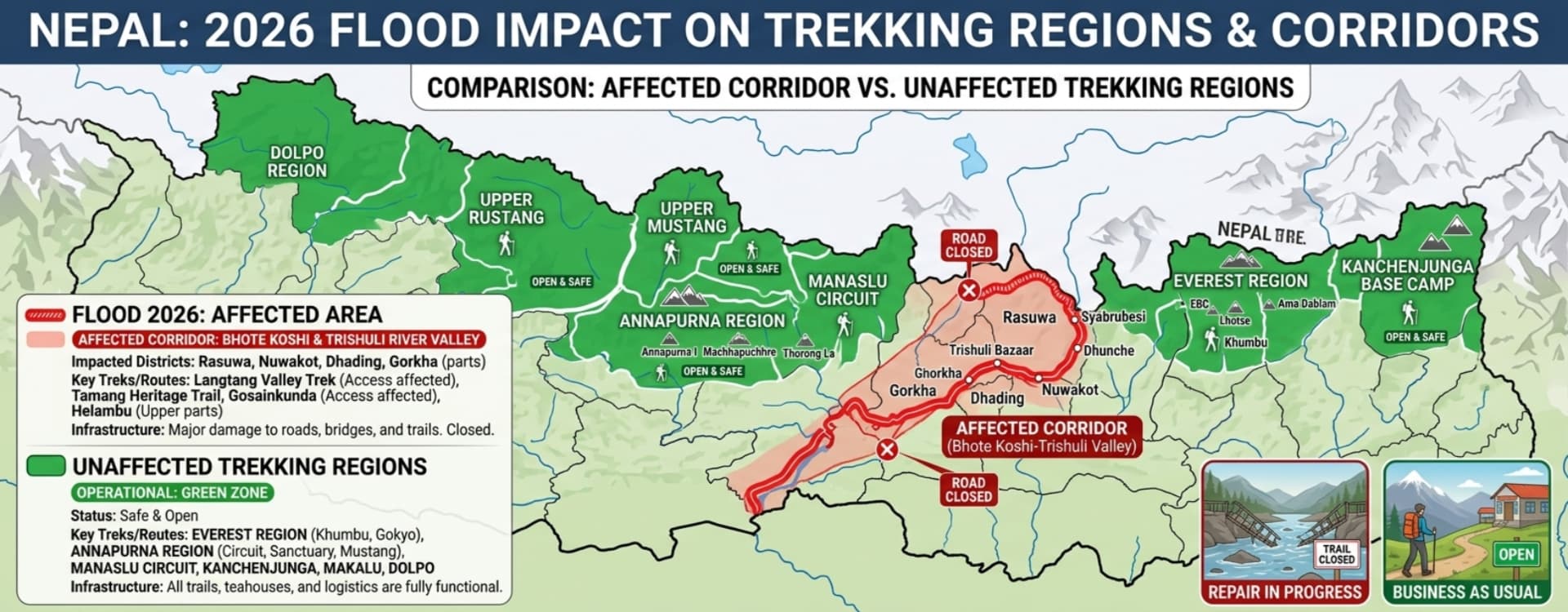
This disaster struck a specific, narrow river corridor: the Bhote Koshi and Trishuli system running south from the Rasuwa border through Nuwakot and Dhading, with downstream effects reaching Gorkha, Tanahun, Nawalparasi, and parts of Chitwan district along the riverbanks themselves. Within that corridor, the situation remains genuinely serious, and travel there should be avoided entirely for the foreseeable future, both out of basic safety and out of respect for communities that are grieving and rebuilding, not hosting visitors.
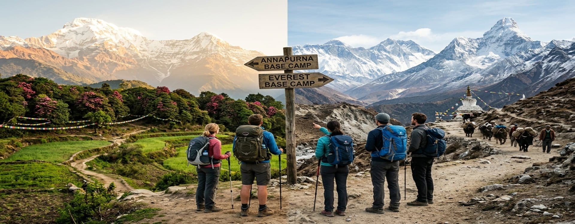
Outside that corridor, the picture is very different. Kathmandu's Tribhuvan International Airport has continued normal flight operations throughout. Hotels in Kathmandu and Pokhara are open. Cultural sites across the Kathmandu Valley are unaffected. The Trekking Agencies' Association of Nepal, known as TAAN, issued a formal safety assessment in the days following the disaster confirming that Nepal's other major trekking destinations, including Everest, Annapurna, Manaslu, Kanchenjunga, and Makalu, were not affected by the floods and remain open to travelers. These regions sit on entirely separate river systems and mountain ranges from the one that failed on August 26.
That distinction matters enormously, and it is worth being precise about it rather than reaching for a comforting generalization in either direction. A blanket statement that "Nepal is flooded" does a disservice to the size and geographic diversity of the country, and risks discouraging travel to regions and communities that depend on tourism and had nothing to do with this disaster. At the same time, a blanket statement that "Nepal is fine, business as usual" would do a disservice to the families in Rasuwa, Nuwakot, and Dhading who are living through the aftermath of a genuine catastrophe. Both extremes get it wrong. The truth sits in the specifics.
Region by Region: What's Affected and What Isn't
Langtang Region: Directly Affected
The Langtang region is the one major trekking destination genuinely caught up in this disaster, and it deserves the most careful, specific explanation.
Syabrubesi, the gateway town for the Langtang Valley Trek, the Tamang Heritage Trail, and Gosaikunda, sustained direct structural damage. The road north of Syabrubesi toward Timure and the Rasuwagadhi border, the route pilgrims and traders use to cross into Tibet, was severely damaged, with entire sections of highway and multiple bridges washed away. Reports indicate that roughly 25 miles of road and more than thirty bridges were lost across the wider disaster zone, including the full stretch between Betrawati and the Rasuwagadhi crossing.
Here is the detail that gets lost in a lot of the early coverage, and it matters: the Langtang Valley trekking trail itself, which climbs east from Syabrubesi up a separate valley along the Langtang Khola, following a different drainage than the Bhote Koshi that flooded, was not physically destroyed by the disaster. TAAN's safety assessment specifically noted that the Langtang, Kyanjin Valley, and Gosaikunda trekking areas remain intact. What is affected is the access, not necessarily the trail itself. The Kathmandu to Syabrubesi road, the same route used at the start of any Langtang itinerary, passes through Betrawati and Dhunche, both of which sit within the zone still being cleared and rebuilt.
The practical result is that all trekking activity in the Langtang region should be treated as suspended for the time being. Syabrubesi is in no position to receive trekkers while it works through its own recovery, road access remains unreliable, and the appropriate posture for any agency or traveler right now is to wait for confirmed, on-the-ground clearance rather than to test the situation. Several operators are estimating a recovery window measured in weeks rather than days, with the possibility of normal access returning in time for the main autumn trekking season in October and November, though nobody can promise a specific date with real confidence yet. If you have a Langtang trek booked for this autumn, the honest advice is to stay in close contact with your operator, expect the itinerary to shift, and treat any firm reopening date you hear right now as provisional.
One further note worth flagging clearly: reports referring to "Langtang flooding" in headlines are sometimes conflating the trekking valley with the border area around Timure and Rasuwagadhi, which is a separate excursion entirely, well north of the trekking trail, and the part of the region that took the most direct and severe damage. If your itinerary was never going to include a side trip to the border crossing itself, understanding this distinction helps put the scale of disruption to your specific plans into clearer perspective, even as the region as a whole remains closed for now.
Everest Region: Unaffected
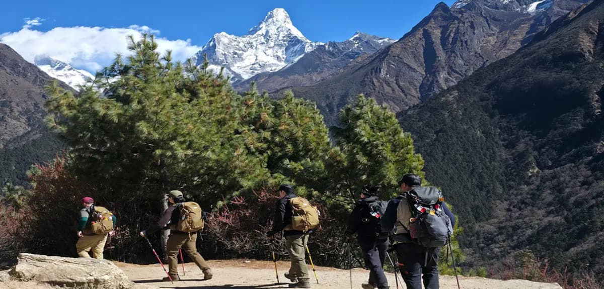
The Everest region, including the Everest Base Camp Trek and all its variations, sits on an entirely different river system in the Khumbu, accessed by flight into Lukla rather than the Kathmandu-Syabrubesi road corridor. TAAN's assessment explicitly listed Everest among the destinations untouched by this disaster. Flights, teahouses, and trail conditions in the Khumbu are operating as they normally would at this point in the season.
Annapurna Region: Unaffected, With Minor Local Disruption
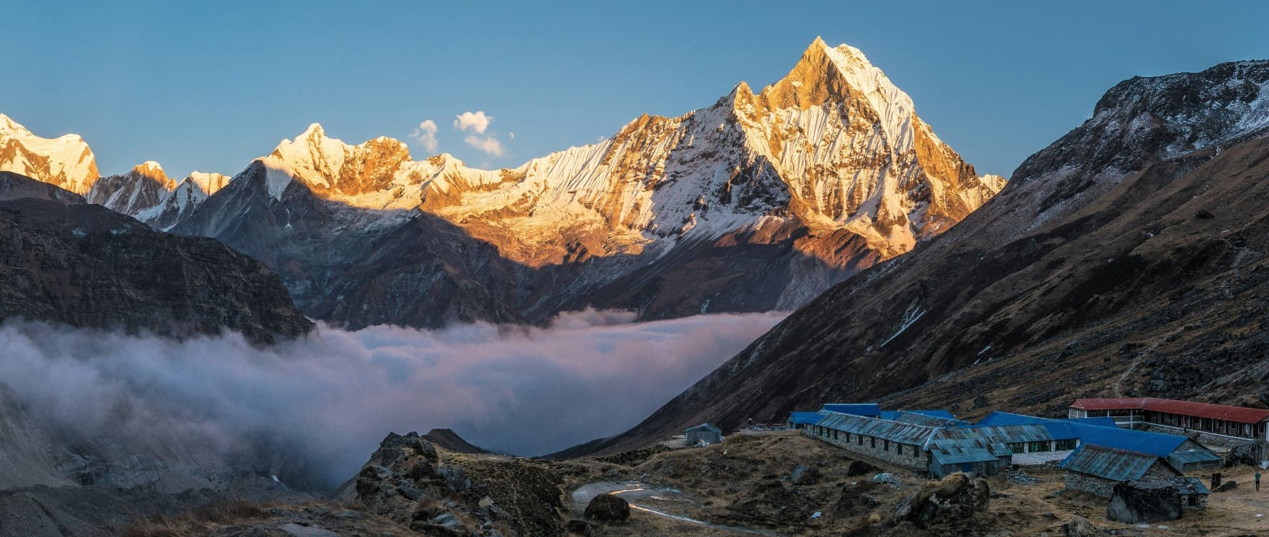
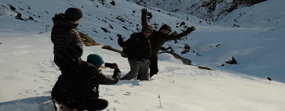
The Annapurna region, including the Annapurna Base Camp Trek, the Annapurna Circuit, and the Poon Hill route, also sits well outside the disaster zone and was confirmed as unaffected by TAAN. Some minor, short-lived disruption has been reported on the Prithvi Highway, the road connecting Kathmandu and Pokhara, related to ordinary monsoon-season conditions rather than this specific disaster, and localized trail damage of the kind that occurs most years during the rainy season has been reported on some approach roads. None of this compares in scale or seriousness to what struck Rasuwa, and none of it has meaningfully disrupted the trekking season in this region.
Manaslu, Kanchenjunga, and Makalu: Unaffected
TAAN's assessment also confirmed that the Manaslu region, including the Tsum Valley and the Larke Pass route, along with the more remote Kanchenjunga and Makalu regions in eastern Nepal, were not affected by the floods. These areas remain open and operating under normal conditions.
Ganesh Himal and Ruby Valley: Access Affected
The Ganesh Himal and Ruby Valley trekking areas, which sit near the wider Rasuwa and Dhading region, remain physically safe according to TAAN's assessment, but access through Dhunche and Syabrubesi, the same road corridor affected by the Langtang closure, has been disrupted. Travelers considering these less-visited routes should expect the same access delays affecting Langtang and should confirm current road conditions before finalizing transport plans.
Kathmandu, Pokhara, and Chitwan: Operating Normally
Kathmandu Valley's cultural heritage sites, Pokhara's lakeside district, and Chitwan National Park itself are all functioning normally. Some confusion has circulated online conflating flood damage in outlying, low-lying parts of the wider Chitwan district, downstream areas along the Trishuli and Narayani riverbanks that are unrelated to the park or the tourist town of Sauraha, with the national park and its wildlife safaris, which have not been affected. As with Langtang, precision about geography matters here. A district can be large and administratively include areas many kilometers from the places travelers actually visit.
Why the Confusion Online Is Understandable, and What to Trust Instead
Disasters generate noise long before they generate clarity, and this one has been no exception. Video clips from Rasuwa have circulated widely without context, sometimes captioned in ways that suggest a nationwide catastrophe rather than a serious but geographically contained one. A damaged section of road near the Annapurna Base Camp trailhead, in reality a straightforward detour of about half an hour, has been shared in ways that imply the entire Annapurna region is impassable. None of this circulation is necessarily malicious. Fear spreads fast, and when the underlying disaster is genuinely severe, people are primed to believe the worst about everything adjacent to it.
The way through this is to rely on sources that are updating in real time and speaking specifically, rather than general news aggregation or social media. Nepal's Trekking Agencies' Association, known as TAAN, has been issuing region-by-region assessments since the days immediately following the flood. The Nepal Tourism Board has published localized advisories, particularly around the Trishuli and Bhote Koshi corridor, and maintains a toll-free number and a tourist police contact line for travelers with specific concerns. Nepal's Department of Hydrology and Meteorology tracks river conditions and flood warnings on an ongoing basis. Embassies with a presence in Kathmandu, including the United States Embassy, have published their own advisories specific to the Rasuwa flooding, which are worth checking regardless of your nationality for their detail on affected roads.
If you are working with a registered trekking agency for an upcoming trip, the single most useful thing you can do is ask them directly, by name, whether your specific route touches the affected corridor. A good agency will give you a precise answer rather than a reassuring one, and if your itinerary happens to fall within the Langtang or Rasuwa area, they should be proactively reaching out to discuss rescheduling or rerouting rather than waiting for you to ask.
If You Have an Upcoming Trip Booked
For travelers with existing bookings, the right response depends entirely on where your itinerary goes.
If your trek or tour is in the Everest, Annapurna, Manaslu, Kanchenjunga, or Makalu regions, or is a cultural itinerary centered on Kathmandu, Pokhara, or Chitwan, there is no reason at this point to cancel or postpone based on this disaster. These regions are operating normally, and the flood has not touched the rivers, trails, or infrastructure your trip depends on. That said, it is always sensible during monsoon season, disaster or no disaster, to build a day or two of schedule flexibility into any Nepal itinerary, since localized weather disruption of one kind or another is a normal feature of travel here between June and September regardless of this particular event.
If your itinerary includes the Langtang Valley, Gosaikunda, the Tamang Heritage Trail, Ganesh Himal, Ruby Valley, or any overland route toward Tibet through Rasuwagadhi, the honest guidance right now is to expect changes. Reach out to your operator as early as possible. Ask specifically what they know about current road and trail conditions, and ask what alternatives they are offering, whether that means a postponed date later in the autumn season, a substitution to a different region entirely, or a modified itinerary that avoids the affected corridor. Reputable agencies are actively working through exactly this kind of rebooking right now, and most are approaching it with real flexibility given the scale of what has happened.
Whatever your itinerary, this is also a moment to make sure your travel insurance is in good order and to understand what it covers around trip interruption, evacuation, and rescheduling due to natural disasters, since even travelers whose specific route is unaffected may encounter secondary disruptions, from flight schedule changes to short-notice road closures elsewhere in the country, while recovery efforts continue.
A Note on How to Think About Traveling to Nepal Right Now
There is a real and understandable tension for anyone weighing a trip to Nepal in the coming weeks. On one hand, no itinerary is worth risking safety over, and no traveler should treat an active disaster zone as a curiosity to route around. On the other hand, Nepal's tourism economy supports an enormous number of families, guides, porters, lodge owners, and small operators across the country, in regions that had nothing to do with this disaster and are, in a very real sense, depending on travelers continuing to visit responsibly while the affected areas recover. Canceling a trip to Everest or Annapurna out of a general, undifferentiated sense that "something bad happened in Nepal" does not help anyone in Rasuwa. If anything, it adds an unnecessary second layer of hardship in parts of the country far from where help is actually needed.
The most useful thing any traveler can do right now is exactly what this piece has tried to model: get specific, verify against real-time official sources rather than headlines alone, and let the actual geography of your trip, not the emotional weight of the news, guide the decision. For the districts of Rasuwa, Nuwakot, and Dhading, and for the communities still searching for missing loved ones along the Bhote Koshi and Trishuli rivers, this is a moment for grief, patience, and support, not tourism. For the rest of Nepal, the mountains, valleys, and trails that make this country what it is remain exactly as they were, and the people who depend on visitors returning are still very much open to welcoming them.
Our thoughts remain with everyone affected by this disaster, and with the rescue workers, medical staff, and volunteers who continue working through an extraordinarily difficult recovery. We will continue to update our own trip planning guidance as the situation on the ground develops, and we encourage anyone with specific questions about an upcoming booking to reach out directly rather than relying on secondhand summaries, including this one, as the final word.
Note: This article reflects information available as of early September 2026. Casualty figures, road conditions, and regional access are changing quickly. For the most current information, consult the Trekking Agencies' Association of Nepal (TAAN), the Nepal Tourism Board, Nepal's Department of Hydrology and Meteorology, and your embassy's travel advisory for Nepal.
About the author: Himal Shrestha
Government-licensed trekking guide & travel writer · Accessible Adventure
Himal Shrestha is a government-licensed trekking guide and travel writer with 10 years and counting in the mountains. Trained in first aid and hospitality, he brings firsthand trekking experience to his articles on Nepal, itinerary planning, and travel preparation for Accessible Adventure.
Meet Himal ShresthaRelated Articles
Explore more stories and guides from the Trekking Regions collection