Everest Region
Everest Region Trekking in Nepal
The Everest Region is one of those places that doesn't need much of an introduction. It sits in the northeastern corner of Nepal, inside Sagarmatha National Park, surrounded by some of the highest mountains on Earth. People come here from every continent. Some want to stand at Everest Base Camp and look up at the South Face. Others just want to walk through Sherpa villages, drink butter tea, and watch the sun hit the peaks at six in the morning. Either way, this region delivers in a way that's genuinely hard to replicate anywhere else.
What makes it compelling isn't just Everest itself, though the scale of that mountain is hard to process in person. It's the whole package. The Khumbu Valley is a living landscape: ancient trade routes, high-altitude farming communities, Buddhist monasteries built into cliffsides, suspension bridges swaying over glacial rivers. The trekking infrastructure is among the best in the Himalaya, with a well-established teahouse network that makes the route accessible without stripping out the sense of remoteness.
Visitor numbers have grown substantially over the past decade. The trail between Lukla and Namche Bazaar in October can feel busy. But step off the main corridor, or arrive in the right season, and you still get long stretches of trail where the only sounds are your own footsteps and the wind coming off the glacier. The Everest region rewards people who research it, plan sensibly, and don't rush.
That said, planning an Everest region trek takes more thought than most people expect. The altitude is serious. The logistics are specific. And the experience varies significantly depending on when you go, how long you have, and what you're actually after. This guide covers all of it.
Where Is the Everest Region and What Makes It Different
Geographic Overview and How to Get There
The Everest region, also called the Khumbu, sits in the Solukhumbu district of northeastern Nepal. The whole area is wrapped inside Sagarmatha National Park, a UNESCO World Heritage Site that covers 1,148 square kilometers of high-altitude terrain. Getting there almost always means flying. The mountain flight from Kathmandu to Lukla Airport takes about 35 minutes, and it's one of the more memorable airstrips in the world. The runway is short, sloped, and flanked by mountains. Most trekkers describe the landing as somewhere between thrilling and genuinely alarming. It's fine. Millions of people have done it.
From Lukla at 2,860 m, the trail climbs gradually through the Khumbu Valley. The main stops are Phakding, Namche Bazaar, Tengboche, Dingboche, Lobuche, Gorakshep, and finally Everest Base Camp at 5,364 m. The classic route is 130 km round trip. Most itineraries run 12 to 17 days.
Landscape and Biodiversity
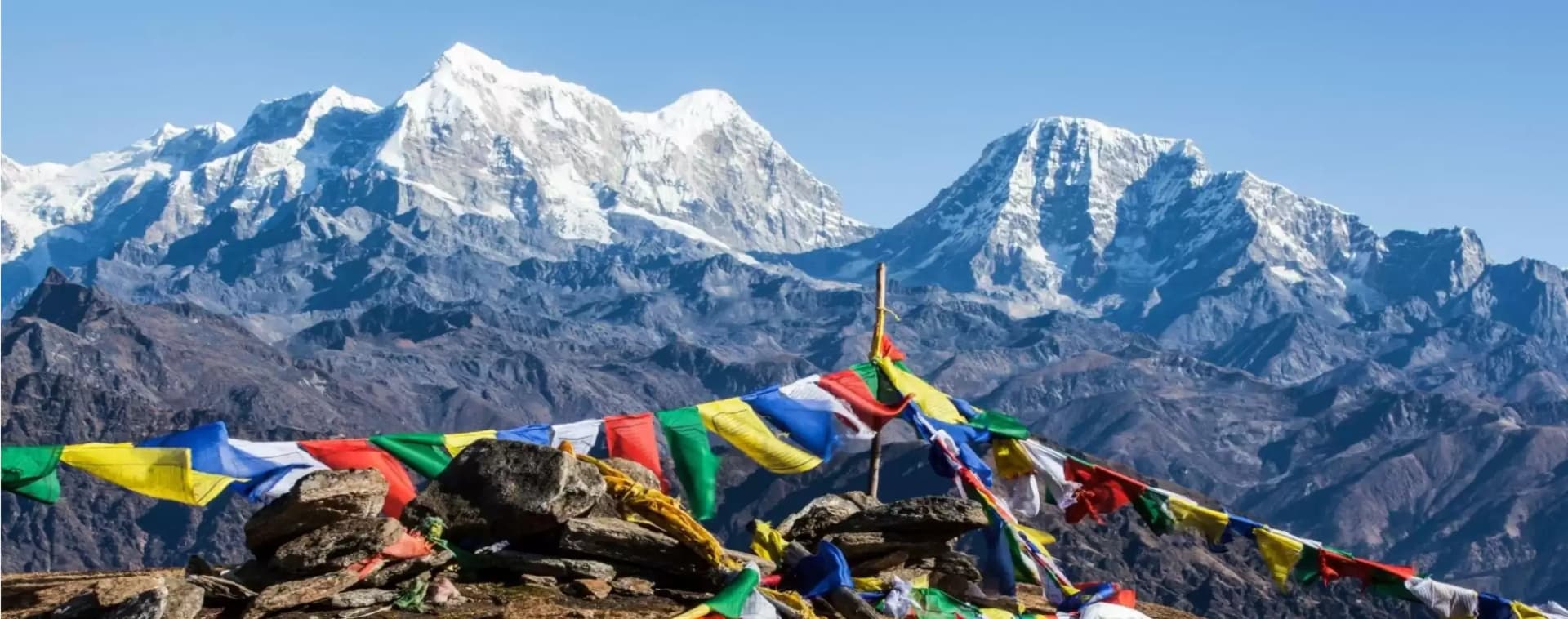
The terrain changes substantially as you gain altitude. The lower sections of the trek pass through forests of rhododendron, birch, and juniper, with the Dudh Koshi river cutting through the valley below. Above the tree line, the landscape opens up into rocky high-altitude terrain, glacial moraines, and eventually the raw ice and stone of the Khumbu Glacier. The peaks surrounding the trail are extraordinary: Everest, Lhotse, Nuptse, Ama Dablam, Thamserku. On a clear day, you can see all of them from the same viewpoint.
Wildlife is present in the lower sections of the park, though you need some patience and luck to see it. The region supports Himalayan tahr, musk deer, and, very rarely, snow leopard. Red pandas have been recorded in the forests around Phakding. Bird life is varied and easier to spot, particularly at lower elevations.
Sherpa Culture and the Human Side of the Khumbu
The Sherpa people are the heartbeat of this region. Their villages, their monasteries, and their relationship with the mountains are what separate the Everest trek from a pure alpine adventure. Namche Bazaar is the commercial center, a horseshoe-shaped town at 3,440 m that has everything from gear shops and bakeries to Nepali banks and small museums. Tengboche Monastery is the spiritual center, one of the most important Buddhist sites in the country, positioned at 3,867 m with an unobstructed view of Ama Dablam.
At every teahouse, you'll interact with Sherpa families who have been running lodges for generations. That hospitality is genuine. The conversations you have over a wood stove at 4,000 m tend to be memorable long after the mountain views have faded.
Best Time for Everest Region Trekking
Peak Seasons: Spring and Autumn
Two seasons dominate the Everest trekking calendar. Autumn, from September through November, is the most popular and arguably the best. The monsoon has cleared the dust from the air, skies are stable, and mountain visibility is as sharp as it gets all year. October in particular is peak season on the trail, which means teahouses fill up fast and the busier sections near Namche can feel congested. Book accommodation in advance if you're going in October.
Spring, from March through May, is the second-best window. Temperatures are warmer than autumn, the lower elevations are covered in blooming rhododendrons, and the days are long enough to handle longer walking sections comfortably. The main trade-off is visibility. Late spring can bring some atmospheric haze, making the mountain views slightly less crisp than what you'd get in autumn. April is generally the sweet spot, balancing good weather with manageable crowds.
Off-Season: What to Expect
Winter trekking, from December through February, is possible on the Everest route but comes with real limitations. High passes above 4,000 m can be snow-covered and bitterly cold at night. The teahouses stay open, but many reduce services or close sections of their kitchens. If you can handle the cold and want genuinely empty trails, it's an option worth considering. The mountain views in winter are often crystal clear.
The monsoon months, June through August, are the most challenging. Rain makes lower sections muddy and slippery, clouds obscure mountain views for days at a time, and flight delays in and out of Lukla are frequent. Most experienced trekkers avoid the Everest region during monsoon season. Unlike Mustang or Dolpo, the Khumbu doesn't sit in a rain shadow, so there's no real workaround.
Temperature and Altitude Variation
Temperatures in the Everest region are largely determined by altitude rather than season alone. At Namche Bazaar (3,440 m), autumn daytime temperatures sit around 10–15°C and drop below freezing at night. By the time you reach Gorakshep (5,164 m), nighttime temperatures in peak autumn can fall to -15°C or lower. The day-to-night temperature swing at high altitude is dramatic and affects everything from what you pack to how you sleep. Layering is not optional here.
How to Plan Your Everest Region Trek
Permits and Entry Requirements
Two permits are mandatory for Everest region trekking. The first is the Sagarmatha National Park Entry Permit, which costs NPR 3,000 per person for foreign nationals (roughly USD 22). You can get this at the Nepal Tourism Board office in Kathmandu or at the park entrance gate in Monjo, about two days into the trek from Lukla.
The second is the Khumbu Pasang Lhamu Rural Municipality Permit, introduced to support local infrastructure and community development in the Sherpa villages. This costs NPR 2,000 to 3,000 per person, depending on current municipality rates, and is available in Lukla or Monjo. Importantly, the old TIMS card is no longer required in the Everest region. It was replaced by this municipal permit. If a trekking agency includes TIMS in their package for the Khumbu, ask them to clarify.
Carry photocopies of both permits. Checkpoints on the trail verify them at multiple points, and having copies reduces hassle if originals get wet or misplaced.
The Mandatory Guide Requirement
Since April 2023, solo unguided trekking is not permitted on Nepal's major trekking routes, including the Everest trail. Foreign trekkers are required to hire a licensed guide employed through a government-registered trekking agency. The rule is enforced at checkpoints, and attempting to bypass it can result in fines or removal from the trail. One licensed guide can accompany up to seven trekkers in a group.
Beyond the legal requirement, a good guide genuinely adds to the experience. They handle logistics, provide cultural context, monitor for altitude sickness, and know the trail conditions in ways that can only come from repeated exposure. Licensed guide rates run approximately USD 25 to 35 per day, depending on experience and the specific route.
Porters are separate from guides and carry your load, typically at USD 10 to 20 per day. If you hire a porter, ensure they have adequate gear for the altitude they'll be reaching. Lightweight porters crossing high passes in inadequate clothing is a real issue on the Everest trail. The Porters' Progress organization publishes ethical guidelines on load limits and equipment that are worth reading before you hire.
Fitness, Preparation, and Acclimatization
The Everest Base Camp trek is rated moderate to challenging. The daily walking distances are manageable, typically five to seven hours. The altitude is what makes it hard. Above 3,500 m, your body needs time to adjust to reduced oxygen levels. Skipping acclimatization days to save time is how most mountain emergencies start.
The standard itinerary builds in rest days at Namche Bazaar (3,440 m) and Dingboche (4,410 m). The principle is straightforward: climb high during the day for a short excursion, descend back to sleep at a lower altitude. This pattern, done consistently, allows the body to adapt without triggering acute mountain sickness (AMS).
Symptoms of AMS include persistent headache, nausea, dizziness, and difficulty sleeping. If symptoms appear, do not ascend further. Descending even 300 to 500 meters brings fast relief. Your guide is trained to recognize AMS and should be your first call if something feels off. Diamox (acetazolamide) is commonly used as a preventive measure, but it's a prescription drug and should be discussed with a doctor before your trip.
Three months of cardio training before the trek makes a real difference. Running, cycling, swimming, and hiking with a loaded pack are all useful. The goal is aerobic endurance rather than raw strength. The trail is not technically demanding. The altitude is.
Logistics: Flights, Teahouses, and the Route
The standard entry point is Lukla, reached by a 35-minute domestic flight from Kathmandu's Tribhuvan International Airport. Round-trip flights currently run USD 350 to 420 per person, with significant variation by season and how far in advance you book. October and April flights sell out early. Book two to three months ahead if you're traveling during peak season.
Flight delays in and out of Lukla are common, particularly in spring when afternoon weather builds quickly. Budget at least one or two buffer days in Kathmandu on both ends of your trip. It's not a question of whether delays happen; it's a question of when.
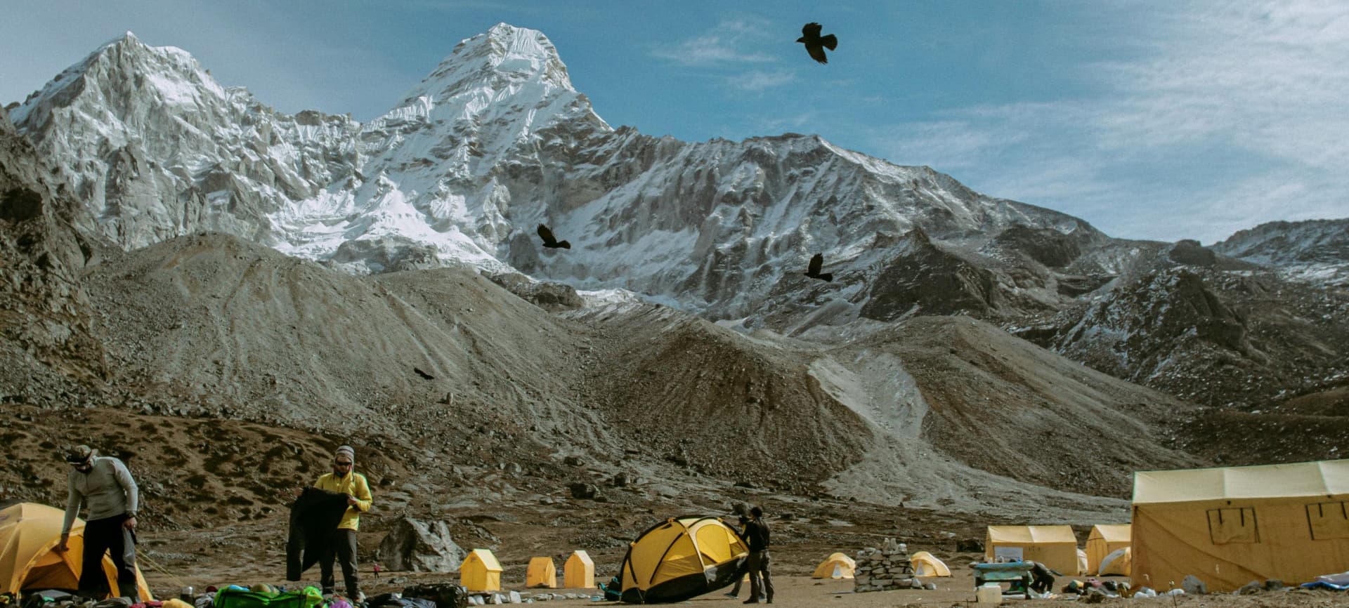
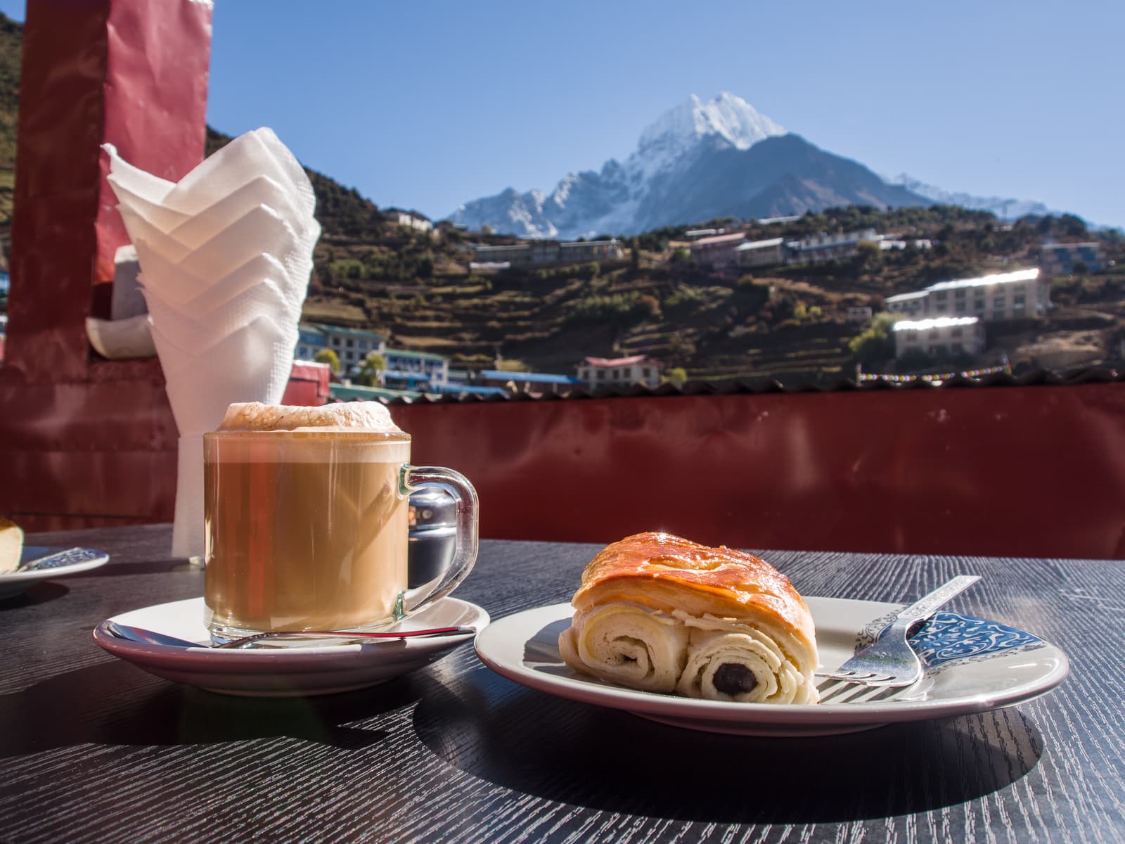
Teahouse accommodation is available throughout the entire Everest route. Rooms are basic: two beds, a blanket, shared bathrooms. The dining room is the center of life at each teahouse, with a central stove and communal tables. Food is filling and calorie-dense: dal bhat, noodles, porridge, fried rice, eggs. At higher altitudes, simple items cost significantly more because everything is carried up by porter or yak. Hot showers and device charging are available at most teahouses for a small additional fee.
What the Everest Region Trekking Experience Actually Looks Like
The Trail: Day by Day
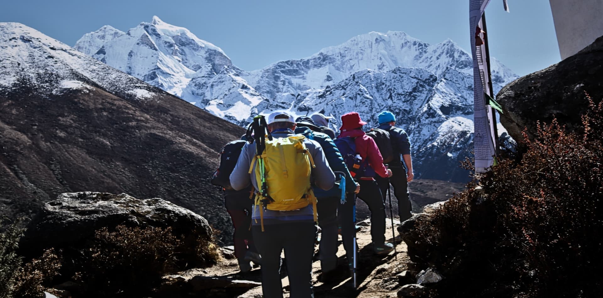
The trek starts at Lukla and descends slightly to Phakding before the real climbing begins. The stretch from Phakding to Namche Bazaar involves crossing suspension bridges over the Dudh Koshi River and a long uphill push through dense forest. Namche, at 3,440 m, is where most people feel altitude for the first time. The mandatory rest day here is non-negotiable.
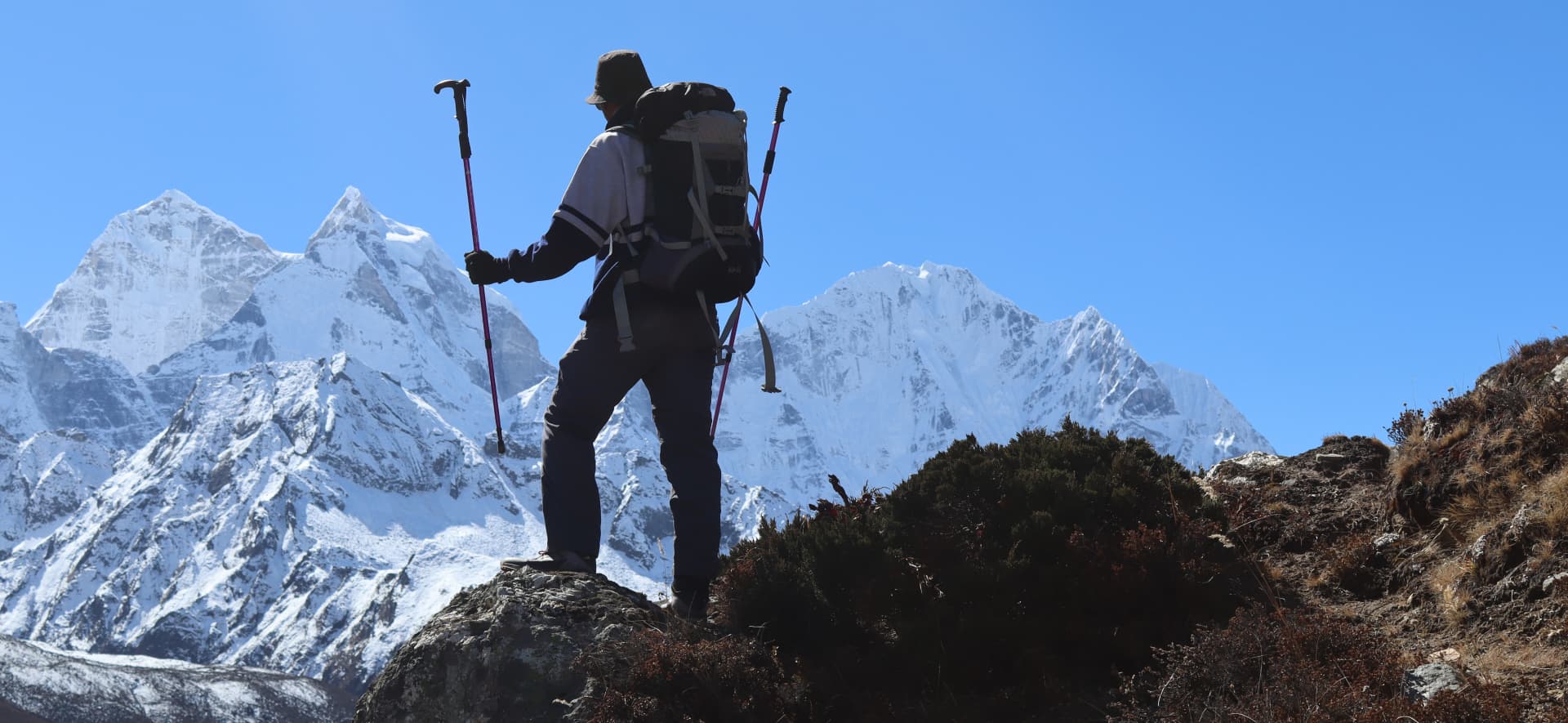
Above Namche, the trail opens up. The views of Ama Dablam appear suddenly and stay with you for the rest of the trek. Tengboche Monastery, perched on a ridge at 3,867 m, is a genuine highlight. The monastery itself dates to the early 20th century and the morning prayer sessions are open to trekkers. Past Tengboche, the landscape becomes more austere. Dingboche, Lobuche, Gorakshep: the villages get smaller, the air gets thinner, and the sense of exposure becomes very real.
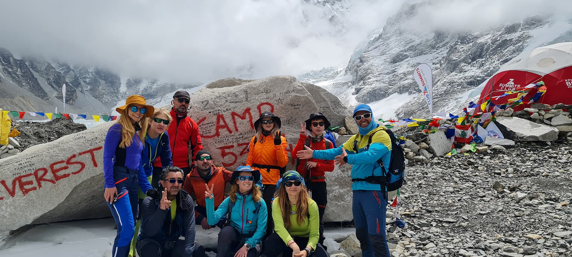
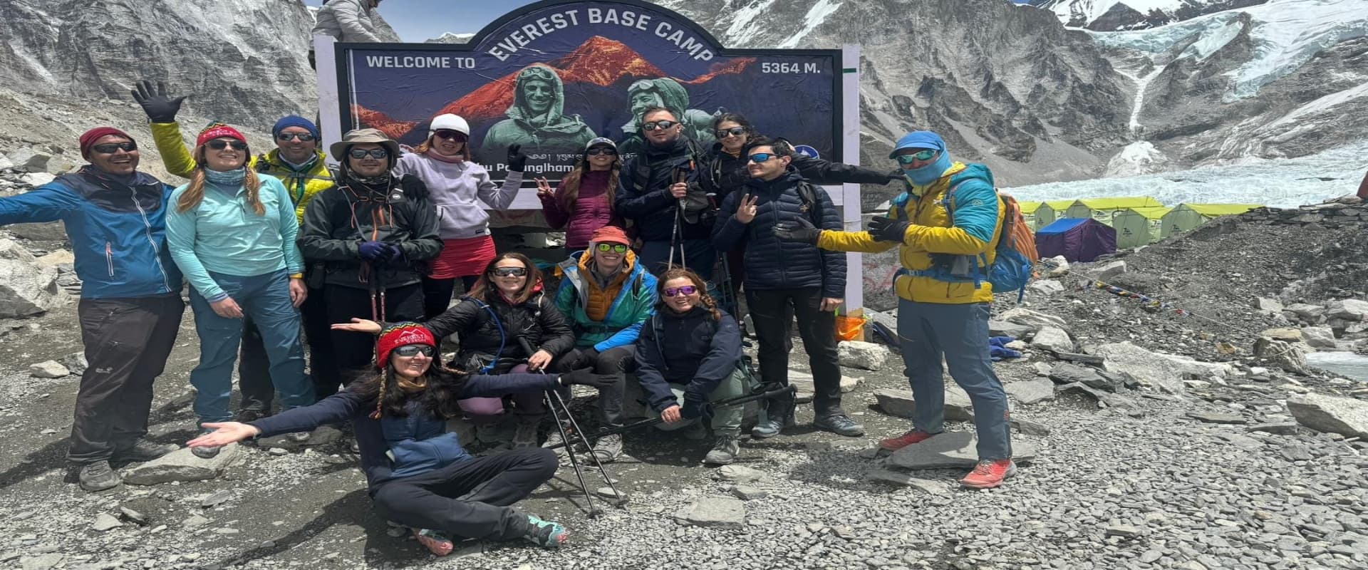
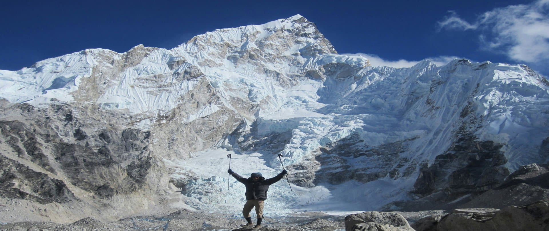
Everest Base Camp itself is a rocky glacial moraine at 5,364 m. There are no mountain views from the base camp itself because the surrounding terrain blocks the sight lines. What you do see is the Khumbu Icefall, the seracs, and the sheer scale of the glacier below the South Face. Most trekkers push on to Kala Patthar (5,545 m) the following morning for the sunrise view of Everest. That is the view that ends up in photographs.
Iconic Viewpoints and Highlights
Kala Patthar is the defining viewpoint of the trek. You start the climb before dawn, usually around 4:00 AM, to catch the sunrise on the South Face of Everest. The predawn temperatures are brutal, but the light that hits the summit at sunrise is worth it. You can see Everest, Lhotse, Nuptse, and the Khumbu Icefall all at once.
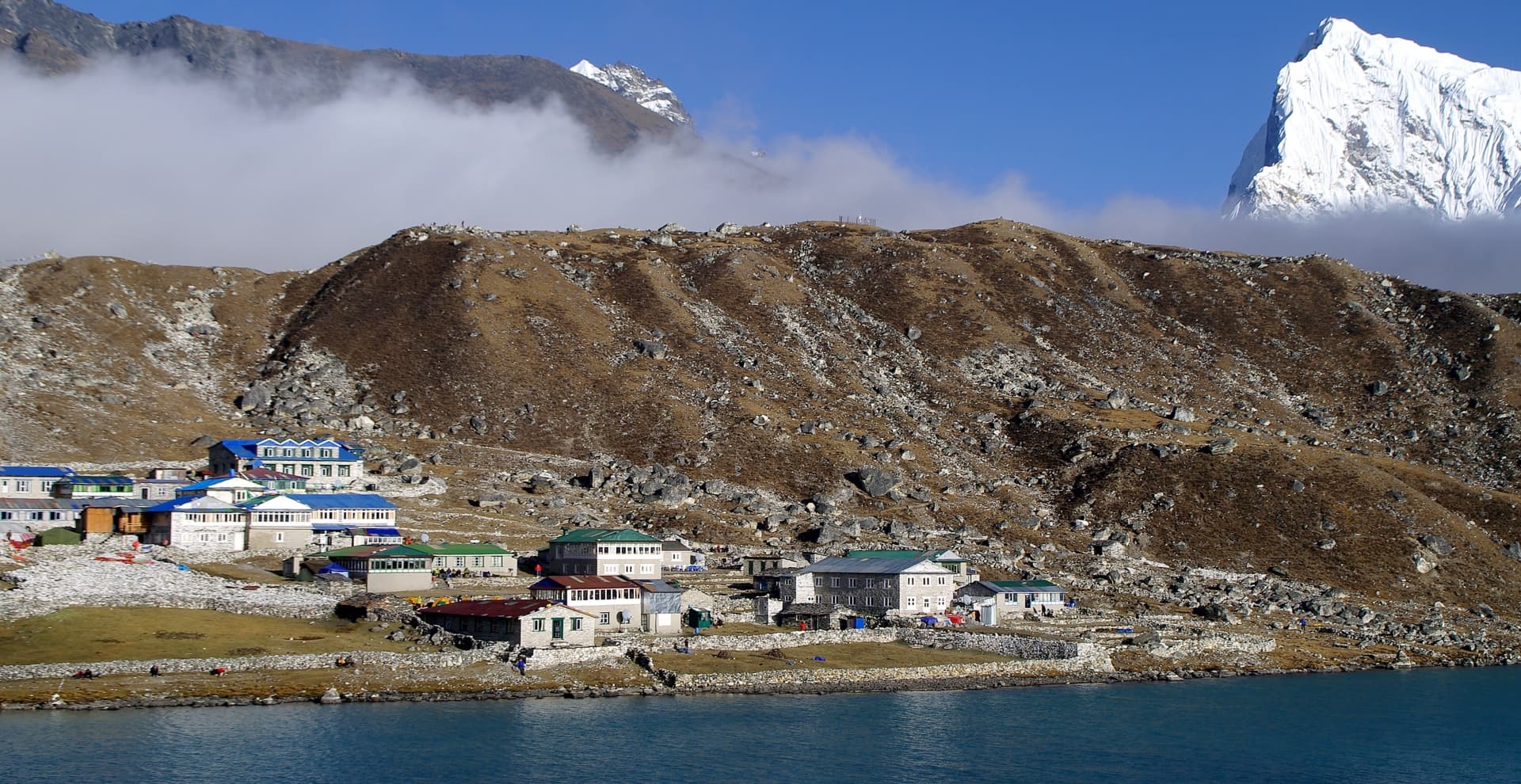
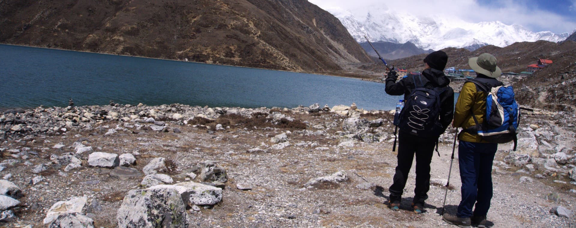
Gokyo Lakes and Gokyo Ri offer an alternative or extension route. Gokyo Ri (5,357 m) arguably gives a better panoramic view of the Everest massif than Kala Patthar, with the added bonus of the turquoise Gokyo Lakes in the valley below. The Three Passes trek combines the EBC route with Gokyo and three high passes (Kongma La, Cho La, Renjo La), all above 5,000 m. It's a serious undertaking that adds five to seven days to the standard itinerary.
Sherpa Hospitality and Local Culture
The teahouse experience is genuinely good on the Everest trail. Sherpa-run lodges dominate the route and the quality of service reflects generations of hosting trekkers. The food won't win any awards but it's honest, hot, and filling. Dal bhat is the fuel of choice. Unlimited refills are standard practice at most teahouses on the main route.
The villages along the trail, particularly Namche Bazaar and Khumjung, hold Buddhist festivals that occasionally overlap with peak trekking seasons. If you're on the trail in late October or November, there's a chance you'll pass through a village mid-celebration. Mani Rimdu at Tengboche Monastery is one of the most important, a three-day masked dance festival with deep religious significance to the Sherpa community.
Luxury and Customized Options
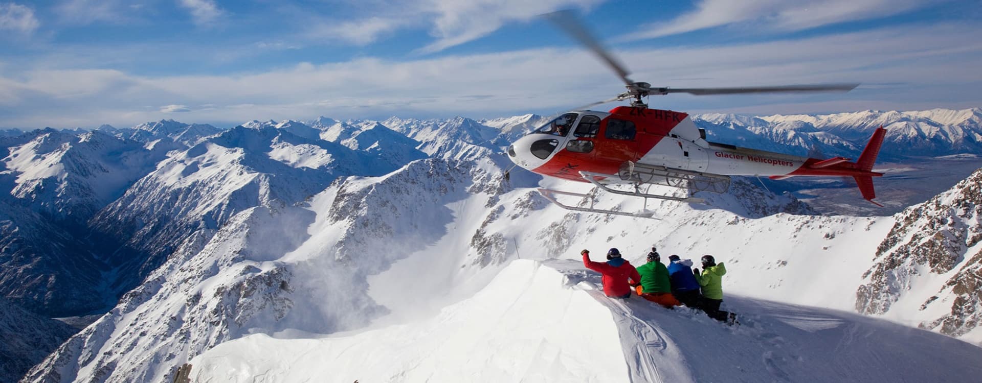
Luxury trekking is a growing segment in the Everest region. Several operators now offer high-end lodge experiences with better rooms, proper en-suite bathrooms, and more varied food at key stops like Namche and Phortse. Helicopter charters are another tier entirely. A helicopter return from Gorakshep to Lukla or Kathmandu costs USD 800 to 1,200 per person but saves four to five days of descent and gives you an aerial view of the Khumbu that is impossible to replicate on foot. Some trekkers choose a hybrid approach: walk up, fly back.
Costs: What to Budget for the Everest Trek in 2026
A realistic all-in budget for a standard guided 14-day EBC trek in 2026 runs USD 1,400 to 2,500. This typically includes the domestic Lukla flights, permits, guide and porter fees, and teahouse accommodation and meals along the route. Budget-conscious trekkers joining group departures can often come in closer to USD 1,000 to 1,400 for the essentials. Luxury options with helicopter return and premium lodges push the total to USD 3,500 and above.
The Lukla flight round-trip is one of the more significant individual costs, currently ranging from USD 350 to 420 depending on season. Teahouse accommodation runs USD 5 to 25 per night, with higher costs at elevation. Daily meals average USD 20 to 35 per day depending on where you are on the trail. Always verify current prices with your agency as costs at altitude fluctuate and are not always included in base package prices.
Final Thoughts
The Everest region is genuinely one of the best trekking destinations in the world, not because of the marketing around it, but because it delivers on multiple levels simultaneously. The mountain views are extraordinary. The culture is authentic. The teahouse infrastructure makes it accessible to a wide range of fitness levels. And the altitude keeps it honest.
Plan carefully. Train properly. Build a sensible acclimatization schedule and stick to it. Work with a registered trekking agency and a licensed guide who knows the route. The bureaucratic side of it is manageable once you understand the current permit system. Everything else tends to fall into place on the trail.
Start planning your Everest region trek today with a trusted local operator. Book through a TAAN-registered agency, confirm current permit requirements before you travel, and give yourself enough days to acclimatize properly. The mountain rewards patience.
People Also Ask
How difficult is Everest Region trekking in Nepal?
The difficulty is moderate to challenging, primarily because of altitude rather than technical terrain. Daily walking is five to seven hours on established trails. The challenge comes from sustained exertion above 4,000 m, where reduced oxygen affects everyone differently. Good aerobic fitness and a slow, patient ascent profile with proper rest days are the key variables.
Do I need prior trekking experience for the Everest region?
Prior experience at high altitude is helpful but not strictly required. What matters more is cardiovascular fitness and a realistic sense of how your body responds to exertion. First-timers with solid fitness and good preparation do complete the EBC trek regularly. Rushing the itinerary to save days is where most problems start.
How long does the Everest Base Camp trek take?
A standard EBC trek runs 12 to 14 days from Lukla, including acclimatization days. Adding Gokyo Lakes, the Three Passes route, or island peak climbing extends that to 17 to 22 days. Shorter Everest region treks exist, like the Everest View Trek at five to six days, but these don't reach base camp.
Is Everest region trekking safe?
Yes, when planned properly. The trail is well-established, the teahouse infrastructure is solid, and the mandatory guide requirement means trekkers have professional support throughout. The main risks are altitude-related: acute mountain sickness, high-altitude pulmonary edema (HAPE), and high-altitude cerebral edema (HACE). These risks are substantially reduced by not rushing the ascent and listening to your guide and your body. Comprehensive travel insurance that covers high-altitude trekking and helicopter evacuation is not optional.
What permits do I need for the Everest region?
Two permits are required: the Sagarmatha National Park Entry Permit (NPR 3,000 for foreigners) and the Khumbu Pasang Lhamu Rural Municipality Permit (NPR 2,000 to 3,000). The TIMS card is no longer required in the Everest region. Both permits can be obtained in Kathmandu or at entry points on the trail (Lukla and Monjo).
What is the best season to trek in the Everest region?
Autumn (September to November) and spring (March to May) are the two main windows. Autumn gives the clearest mountain views and most stable weather. Spring is warmer with rhododendrons in bloom at lower elevations but slightly more haze. October and April are the peak months in each season.