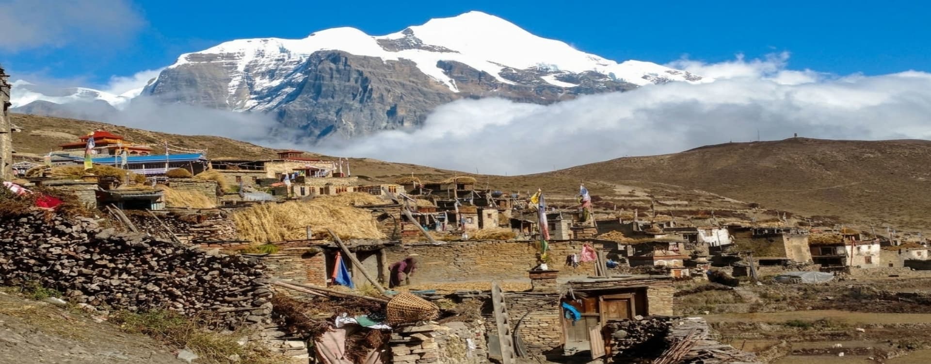
Why Choose Nar Phu Valley Trek?
Nepal's Most Isolated Valley, Connected to the
World's Greatest Mountain Circuit
Most trekkers who walk the Annapurna Circuit never know that a side valley branches off at Koto, heading north into a landscape that has barely changed in centuries. The Nar Phu Valley sits behind the main Annapurna range in a deep rain shadow that gives it the character of the Tibetan plateau rather than the lush Himalayan foothills visible from the main trail. The government restricts annual visitor numbers with a mandatory restricted area permit, and the result is one of the few genuinely remote valley experiences left in Nepal's most visited mountain region.
This 19-day route is a complete journey from the subtropical foothills near Kathmandu to two of Nepal's most significant high passes. The first week drives and walks through the Marshyangdi River corridor, enters the restricted valley at Koto, and pushes north through increasingly austere terrain to the ancient villages of Phu and Nar. The second week crosses the formidable Kang La Pass at 5,322 meters back onto the Annapurna Circuit, then continues the classic route over Thorong La at 5,416 meters. The final days descend through Muktinath and Jomsom before a short flight to Pokhara and the road home to Kathmandu.
What makes this route exceptional is the contrast between its two phases. Nar Phu is among the least visited trekking areas in the Annapurna Conservation Area. The villages of Phu and Nar are Tibetan-influenced settlements where Bon religious tradition and high-altitude agricultural life continue with minimal outside influence. The crossing of Kang La connects this isolated world to the mainstream Annapurna Circuit, and the subsequent Thorong La crossing closes the journey with one of the most celebrated pass days in Himalayan trekking. The whole experience costs fewer than three weeks and delivers a depth of mountain and cultural encounter that no single-valley route in this region can match.
What Sets the Nar Phu Valley Trek Apart
The Nar Phu Valley earns its restricted status from a combination of ecological sensitivity and cultural preservation. The valley sustains populations of snow leopard, Himalayan wolf, blue sheep, and Himalayan tahr in numbers that reflect the near-absence of human pressure from outside. The monasteries in Phu and Nar predate the Tibetan Buddhist transmission and carry art and manuscripts that have survived precisely because the valley has been difficult to reach. Walking through this landscape as one of a handful of permitted visitors in a given week produces a quality of experience that the busier circuit sections cannot replicate.
The cultural dimension of the Nar Phu section is as significant as the scenery. Phu village sits in a wide valley at 4,250 meters, its flat-roofed stone buildings clustered against the hillside in a layout unchanged for generations. Nar, reached on a separate day, is a walled settlement at 4,110 meters with an active monastery, juniper-smoke-scented lanes, and a community that measures the seasons by the monastic calendar rather than the trekking schedule. The acclimatization days built into both villages give time for genuine observation rather than a transit stop.
Highlights of the Nar Phu Valley Trek
-
Nar Phu Restricted Area: One of Nepal's least-visited trekking zones, accessible only with a special permit, preserving both the ecological character and the cultural integrity of a high-altitude Tibetan-influenced valley system.
-
Phu Village (4,250 m): An ancient Tibetan-style settlement in a wide plateau valley, with flat-roofed stone houses, active monasteries, and yak caravans operating on the same trade routes used for centuries.
-
Nar Village (4,110 m): A walled high-altitude community with active Bon and Buddhist religious practice, traditional architecture, and a monastery that holds centuries of continuous practice.
-
Kang La Pass (5,322 m): The high crossing that connects Nar Phu to the Annapurna Circuit, demanding early starts and sustained effort, rewarding with views across the entire central Himalayan arc.
-
Thorong La Pass (5,416 m): The highest point of the trek and one of the most celebrated passes in the Himalaya, reaching 5,416 meters between Thorong Phedi and Muktinath on the classic Annapurna Circuit route.
-
Muktinath Temple (3,800 m): One of the most sacred pilgrimage sites in Nepal and Tibet, sacred to both Hindus and Buddhists, with the 108 water spouts and the flame that burns on water considered among the most sacred phenomena in the Himalayan religious world.
-
Marshyangdi River Gorge: The approach corridor through the Annapurna Conservation Area, one of Nepal's most dramatic river gorges, with the river dropping nearly 4,000 meters from the Tibetan plateau to the subtropical lowlands.
-
Manang Valley (3,540 m): The upper Annapurna Circuit's main valley, with teahouses, the Himalayan Rescue Association medical post, and views of Annapurna III and Gangapurna across the glacial lake.
-
Wildlife of the Restricted Zone: The Nar Phu Valley is one of the strongholds of the snow leopard in Nepal, with blue sheep populations large enough to support a healthy predator count. Himalayan wolves and tahr are regularly observed.
-
Jomsom and the Mustang Gateway: The final overnight in the lower Mustang region, where the Kali Gandaki gorge, the world's deepest valley, frames the departure before the short flight to Pokhara.
Detailed Journey Breakdown
Kathmandu and the Long Drive to the Trailhead
Two days in Kathmandu cover the heritage sightseeing, permit processing, and pre-trek preparation before the eight to nine-hour drive to Jagat. The drive follows the Prithvi Highway out of the capital and then the Marshyangdi River corridor north through a sequence of mid-hill towns and increasingly dramatic gorge sections. Jagat at 1,100 meters is the standard trekking start point for the lower Marshyangdi approach, a functional village with basic teahouses positioned at the gateway to the main Annapurna Circuit gorge.
The Approach Through the Marshyangdi Valley
Days 4 and 5 follow the main Annapurna Circuit trail up the Marshyangdi gorge through Dharapani to Koto, covering the transition from subtropical river valley to the drier, open landscape of the mid-altitude Manang district. At Koto, a permit checkpoint marks the entry into the Nar Phu restricted zone, and the trail branches north away from the main circuit for the first time.
Into the Nar Phu Valley
Days 6 and 7 move deep into the restricted valley through Meta to Phu village, climbing from 2,610 meters at Koto to 4,250 meters at Phu over two days of sustained altitude gain through a landscape that shifts from mixed forest to high-altitude meadow to the dry Tibetan plateau character that defines the inner valley. The acclimatization day at Phu on Day 8 is essential before the altitude demands of the onward section.
Nar Village and the Kang La Preparation
Day 9 moves to Nar village, and Day 10 provides the second acclimatization and preparation day. The Kang La crossing on Day 11 is the most technically demanding day of the trek, climbing from Nar to the 5,322-meter pass and descending the far side to Ngwal before an overnight. The views from the pass summit span from the Nar Phu peaks to the main Annapurna range, a panorama that rewards the effort of the approach completely.
The Annapurna Circuit Exit and Thorong La
From Ngwal, the route joins the main Annapurna Circuit and follows the upper valley through Manang, Yak Kharka, and Thorong Phedi before the final high pass crossing on Day 15. Thorong La at 5,416 meters is reached in the pre-dawn hours from Thorong Phedi and descends to Muktinath, where the sacred pilgrimage site and the dramatic views of the Mustang plateau welcome the arrival.
Return via Jomsom, Pokhara, and Kathmandu
Days 16 through 18 descend through Muktinath to Jomsom along the Kali Gandaki valley, followed by a short flight to Pokhara and the road journey back to Kathmandu. The final day on Day 19 is the international departure.


