Why Choose Khopra Ridge and Mohare Hill Trek?
Last updated
Two of the Finest Annapurna Viewpoints, One Quiet Trail
The Annapurna region is the most visited trekking area in Nepal, and the standard circuits through it see tens of thousands of visitors each season. The Khopra Ridge and Mohare Hill Trek takes a different line through the same conservation area. It links two outstanding panoramic viewpoints, Khopra Danda and Mohare Danda, with a route that stays largely off the main trekking corridors and passes through villages the bigger circuits bypass entirely.
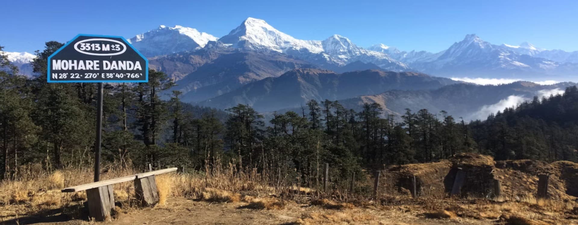
Khopra Danda sits at 3,660 meters on a long open ridge directly facing the south wall of Annapurna South and the full sweep of the Dhaulagiri range to the west. A day excursion from Khopra to Khayer Lake at 4,660 meters, a glacial lake sacred to both Hindu and Buddhist pilgrims, adds the trek's highest point and one of its most contemplative stops. Mohare Danda at 3,300 meters, reached later in the itinerary near Ghorepani, is a community-developed viewpoint offering a sunrise panorama over Annapurna and Dhaulagiri comparable to Poon Hill but with a fraction of the visitors.
The villages on this route are a significant part of its character. Swanta sees minimal trekking traffic, and its traditional Gurung and Magar architecture, terraced fields, and quiet daily life reflect an unhurried pace that the busier Annapurna routes have largely left behind. The route also supports a community tourism structure that channels trekking revenue directly into village development projects, giving the stay at these teahouses a dimension beyond simple transaction.
What Makes This Trek Distinct
Geographically, the route gives an unusually complete picture of the southern Annapurna massif. From Khopra, the view is dominated by Annapurna South and the Dhaulagiri range to the west. From Mohare Danda and Poon Hill, the perspective shifts to include Annapurna I, Machhapuchhre (Fishtail), and Nilgiri. Few single treks in the conservation area offer both angles within the same two-week window.
The rhododendron forests between Tadapani and Dobato are among the densest and best preserved in the region. In spring, the canopy bloom turns entire hillsides red and white. Outside bloom season, the forest retains a rich, atmospheric quality with moss-covered trunks and filtered light that the open ridgeline sections above cannot replicate. The trek moves through this forest progressively over Days 4 and 5, with the canopy thinning gradually as the trail climbs toward Khopra.
Highlights of the Khopra Ridge and Mohare Hill Trek
-
Khopra Danda Ridge (3,660 m): An open, largely undeveloped high ridge facing Annapurna South and the Dhaulagiri range, with minimal infrastructure and an expansive silence rare on Nepal's more established trekking routes.
-
Khayer Lake (4,660 m): A sacred glacial lake in a high alpine basin, visited by Hindu and Buddhist pilgrims, and the highest and most contemplative destination of the trek, reached on a dedicated full-day excursion from Khopra.
-
Poon Hill Sunrise (3,210 m): One of Nepal's most celebrated sunrise viewpoints, with a sweeping panorama across Dhaulagiri, Annapurna I, Annapurna South, Hiunchuli, Machhapuchhre, and Nilgiri.
-
Mohare Danda (3,300 m): A community-run viewpoint offering a comparable Annapurna and Dhaulagiri sunrise panorama to Poon Hill with significantly fewer visitors, directly supporting local village development.
-
Rhododendron Forest of Tadapani and Dobato: Among the richest and best preserved rhododendron forest in the Annapurna Conservation Area, spectacular in bloom season and atmospheric year-round.
-
Swanta Village: A quiet Gurung and Magar settlement with traditional stone architecture and terraced agriculture, seeing minimal trekking traffic relative to the established Annapurna hub villages.
-
Community Tourism Model: Teahouses along the Khopra and Mohare sections operate under a community-based structure that channels trekking revenue into local village development and conservation work.
-
Dhaulagiri and Annapurna South Panorama: Continuous close-range views of the southern Annapurna massif and Dhaulagiri throughout the Khopra section, among the most dramatic mountain backdrops in the conservation area.
-
Pokhara Lakeside: Two nights beside Phewa Lake in Nepal's adventure tourism capital, with the Annapurna range visible across the water on clear mornings.
-
Low Trail Traffic: A route that shares trailheads with busier Annapurna circuits but diverges onto quieter paths for the majority of its distance, delivering a markedly different trekking experience from the same mountain landscape.
Detailed Journey Breakdown
Kathmandu and the Road to Pokhara
Days 1 and 2 cover arrival and a sightseeing and preparation day in Kathmandu. Day 3 is the transfer to Pokhara, the lakeside city and gateway to the Annapurna region. Day 4 continues by vehicle to Kimche, with the first trekking section to Tadapani through forest and cultivated hillsides.
Into the Rhododendron Forest and Up to Khopra
Days 5 and 6 climb through dense rhododendron forest via Dobato, gaining altitude toward the open ridge of Khopra Danda. The forest sections here are among the richest in the conservation area, with the canopy thinning progressively as the trail approaches the treeline near Dobato.
Khopra Ridge and Khayer Lake
Day 7 is a full excursion day from Khopra to the sacred Khayer Lake at 4,660 meters, the highest point of the trek and a destination of both pilgrimage and scenic significance.
Descent Through Swanta and On to Mohare Danda
Days 8 and 9 descend from the ridge to the quiet village of Swanta and continue to Ghorepani. Day 10 adds Poon Hill for sunrise before the trail continues to Mohare Danda for the second viewpoint overnight.
Return Through Ulleri to Pokhara and Kathmandu
Days 11 and 12 descend through Ulleri's famous stone staircase to Nayapul and back to Pokhara. Day 13 returns to Kathmandu, and Day 14 is the international departure.