Why Choose Mera Peak Climbing via Lower Hinku Valley?
Last updated
Nepal's Highest Trekking Peak on the Route That Shows the Most
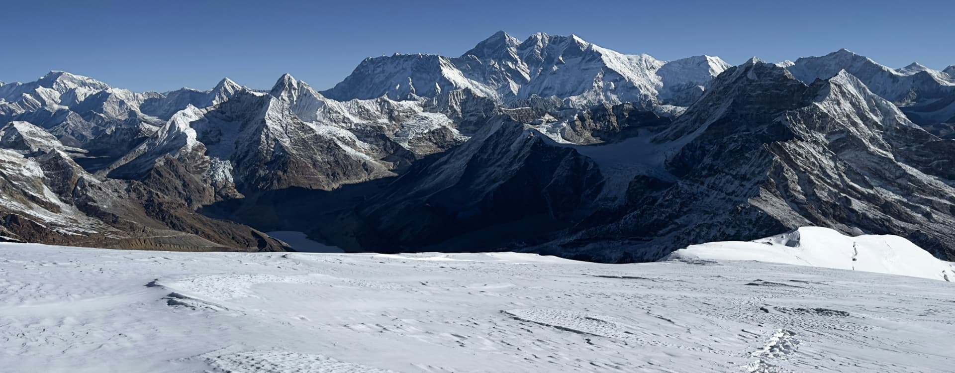
Mera Peak at 6,476 meters holds a specific status in Nepal's mountain landscape: it is the highest summit accessible to non-technical climbers in the country, and from its top, five of the world's fourteen 8,000-meter peaks are visible simultaneously. Everest, Kanchenjunga, Lhotse, Makalu, and Cho Oyu fill the horizon in every direction from the summit snowfield on a clear morning, a concentration of the world's highest mountains that no other trekking-accessible viewpoint in Nepal replicates.
The standard approach to Mera Peak from Lukla takes a high pass route over Zatrwa La and descends directly to Kothe in the Hinku Valley. The itinerary presented here follows a lower and longer approach through the village corridor of the Hinku drainage: Paiya, Panggom, Najing Dingma, Chalem Kharka, and Tashing Ongma before joining the main valley trail at Kothe. This lower route adds two to three days to the approach compared to the direct Zatrwa La crossing, but it passes through a sequence of Sherpa and Rai settlements that the high-pass route completely bypasses. The cultural texture of the approach is significantly richer. The altitude gain is more gradual. The villages of the lower Hinku have a daily life organized around agriculture and herding rather than expedition logistics, and the contrast between these communities and the high-altitude teahouses near Khare is one of the defining qualities of this specific itinerary.
The return route closes the circuit over Zatrwa La Pass at approximately 4,600 meters, descending from Thuli Kharka back to Lukla in a single energetic day. The circuit quality of the route, going in by the lower corridor and returning by the high pass, gives the 19-day itinerary a genuine geographic arc. This is not an out-and-back expedition. It is a complete loop through two distinct faces of the Hinku Valley.
Why Choose the Lower Hinku Valley Route to Mera Peak?
Most Mera Peak climbers who fly to Lukla and cross Zatrwa La on Day 1 of their trek arrive at Kothe having seen only the immediate descent from the pass. The lower route from Paiya through Panggom and Najing Dingma follows the actual Hinku River drainage through six days of progressively ascending terrain. The forest sections in the lower valley are dense and well-preserved. Rhododendron, oak, and fir dominate the mid-altitude sections. Wild orchids and various medicinal plants carpet the trail margins in spring. The villages are small but real: stone houses with carved wooden windows, water-powered grain mills beside the river, and Buddhist chortens and mani walls at every community threshold.
The altitude gain profile of the lower approach is also gentler than the Zatrwa La crossing. Rather than jumping immediately from Lukla at 2,860 meters over a 4,600-meter pass, the lower route climbs gradually through the valley, spending two nights below 3,000 meters before the sustained ascent toward Chalem Kharka and Tashing Ongma begins. By the time the team reaches Kothe, a more measured acclimatization has been established than the pass route typically provides.
Highlights of the Mera Peak Lower Hinku Valley Package
-
Mera Peak Summit (6,476 m): Nepal's highest trekking peak, with a summit panorama covering Everest, Kanchenjunga, Lhotse, Makalu, and Cho Oyu, five 8,000-meter peaks visible simultaneously from the broad summit snowfield.
-
Lower Hinku Village Corridor: Six days of approach through the lower Hinku Valley's Sherpa and Rai villages, including Paiya, Panggom, Najing Dingma, Chalem Kharka, and Tashing Ongma, all bypassed by the standard Zatrwa La crossing.
-
Circuit Route Structure: Ascending via the lower valley and returning via Zatrwa La Pass creates a complete geographic loop rather than an out-and-back corridor, covering two distinct faces of the Hinku drainage within a single expedition.
-
Zatrwa La Pass (4,600 m): The high pass crossed on the return from Thuli Kharka to Lukla, giving a final high-altitude perspective across the Hinku drainage and the surrounding Himalayan range before the valley descent to the airstrip.
-
Mera Glacier Approach: The glacier crossing from Khare to high camp at 5,750 meters provides a genuine high-altitude mountaineering experience with crampons and roped team travel across crevassed terrain.
-
Ice Climbing Practice at Khare: A structured training session on the Mera Glacier at Khare on the acclimatization day, covering crampon technique, ice axe use, and fixed rope ascending and descending in a controlled context before the summit push.
-
Five 8,000-Meter Peak Summit Panorama: Everest (8,849 m), Kanchenjunga (8,586 m), Lhotse (8,516 m), Makalu (8,481 m), and Cho Oyu (8,201 m) visible simultaneously from the summit, a view unmatched from any other non-technical summit in Nepal.
-
Hinku Valley Rhododendron Forest: The lower Hinku approach passes through some of the finest rhododendron forest in the Solu Khumbu, at its most visually spectacular during the March and April bloom season.
-
Contingency Summit Day: A dedicated spare day at Khare on Day 14 for a second summit attempt or weather recovery, giving the expedition a realistic second window without compromising the return schedule.
-
Kusum Kanguru Views: The striking rock and ice face of Kusum Kanguru (6,367 m) is visible throughout the Hinku Valley approach, one of the more dramatic peaks in the Solu Khumbu region.
Detailed Journey Breakdown
Kathmandu and the Lukla Flight
Days 1 and 2 in Kathmandu cover arrival, the heritage sightseeing circuit, and the pre-expedition permit processing and gear check. Day 3 brings the 35-minute mountain flight from Kathmandu to Lukla at 2,860 meters, followed by the first afternoon's walk to Paiya.
The Lower Hinku Village Approach
Days 3 through 8 follow the lower Hinku corridor from Paiya through Panggom, Najing Dingma, Chalem Kharka, and Tashing Ongma before the trail joins the main Hinku Valley at Kothe. Six days of village-based trekking through progressively higher terrain introduce the Sherpa and Rai cultural landscape of the lower valley.
The Upper Hinku Valley and Climbing Section
Days 9 and 10 continue from Kothe through Thangnak to Khare at 5,000 meters. The acclimatization and ice climbing practice day at Khare on Day 11 prepares the team technically and physiologically. Day 12 moves to high camp at 5,750 meters via the glacier. Day 13 is summit day, pushing to 6,476 meters before the return to Khare.
Return via Zatrwa La Pass
Day 14 is the contingency day at Khare. Days 15 and 16 descend through Kothe and up to Thuli Kharka. Day 17 crosses Zatrwa La Pass back to Lukla. Day 18 is the return flight to Kathmandu, with Day 19 as the international departure.


