No cancellation fees. No hassle. Book Now, stay relaxed.Cancellation Terms
Accessible Adventure
Outbound
Trekking in Nepal
Expeditions
Activities
Travel Guide
Company
Accessible Adventure Logo
About Us

As Accessible Adventure, we are a trusted adventure tour operator, crafting unforgettable journeys across Nepal, Tibet, and Bhutan that leave lasting memories for every traveler.

Explore More
  • Blog
  • Travel Guide
  • Our Commitments
  • Online Payment
Company
  • Our Team
  • Terms and Conditions
  • No-risk Booking Policy
  • Legal Documents
Have Questions?
  • Phalful Chwok, Nayabazar-16, Kathmandu, Bagmati, 44600, Nepal
  • +9779851352707
  • info@accessibleadventure.com
Contact Us
👥 Follow us:
FacebookX (Twitter)LinkedInInstagramYouTubePinterestTikTokWhatsAppViber

All content and photographs on this website are copyright © Accessible Adventure Pvt. Ltd. and may not be reproduced without prior written permission.

Developed byTuring Research And Development Private Limited ↗
Mera Peak and Amphu Lapcha Pass Traverse

Starting from

USD 3,295/ person
Book Now ↓
HomeExpeditionsPeak Climbing In NepalMera Peak and Amphu Lapcha Pass Traverse

Mera Peak and Amphu Lapcha Pass Traverse

Country

Nepal

Duration

19 Days

Difficulty

Demanding to Strenuous

Max Altitude

6476m

Style

Peak Climbing / Technical Traverse

Best Season

Apr-May & Oct-Nov

OverviewItineraryCost DetailsHighlightsBookingGuideAdditional InfoFAQs

Why Choose Mera Peak and Amphu Lapcha Pass Traverse?

Last updated August 21, 2026

One Summit, Two Technical Passes, Three Mountain Regions in Nineteen Days

This itinerary belongs to a specific category of Himalayan objective that very few guided expeditions offer: a complete mountain traverse that crosses multiple technical passes and moves through three entirely distinct regions of the high Himalaya within a single continuous journey. The standard Mera Peak expedition climbs to 6,476 meters and returns by the same route. This traverse climbs Mera Peak, continues eastward over Mera La at 5,415 meters into the remote Hongu Basin, crosses the Amphu Lapcha Pass at 5,845 meters into the upper Khumbu, and returns to Lukla via the classic Everest corridor through Chhukung, Tengboche, and Namche. It is a significantly more ambitious undertaking than a standard Mera expedition, and it delivers an experience that is proportionally richer.

Amphu Lapcha at 5,845 meters is the highest and most technically demanding element of the traverse. Unlike the walking passes of the standard trekking circuit, Amphu Lapcha involves fixed rope rappelling on the descent to the Chhukung Valley, glacier travel in the Hongu Basin on the approach, and a technical grade that puts it firmly in the mountaineering category rather than the trekking category. The pass connects the Hinku-Hongu drainage to the upper Khumbu, and the view from the col, with the entire Hongu Basin visible behind and the Ama Dablam and Makalu range opening ahead, is one of the finest high-altitude panoramas in Nepal.

The Hongu Basin, traversed between Mera La and the Amphu Lapcha base, is among the most remote and least visited high-altitude environments in Nepal accessible to guided expedition parties. The Seto Pokhari (White Lake) camp at 5,035 meters sits in a glacial basin with no teahouse infrastructure, no fixed trail markings, and no other expedition groups visible in most seasons. From Seto Pokhari, the world simplifies to ice, rock, sky, and the surrounding peaks of the Hongu range.

What Distinguishes This Traverse From Standard Mera Expeditions

The defining distinction is the Amphu Lapcha crossing. No standard Mera Peak itinerary includes this pass. The combination of Mera Peak and Amphu Lapcha was historically done by expedition mountaineers and adventurous trekkers with strong technical backgrounds. Our guided structure makes the traverse accessible to properly prepared climbers without requiring independent mountaineering credentials, while maintaining the full technical challenge that gives the route its character.

The Hongu Basin section between Mera La and Amphu Lapcha is the portion of this traverse that most dramatically separates it from anything achievable on the standard Mera or Khumbu routes. The basin is a high-altitude wilderness without the teahouse infrastructure that defines trekking in both the Hinku and Khumbu corridors. Moving through it with a complete expedition team, camping at Seto Pokhari with the surrounding peaks reflected in the still lake water, and then crossing Amphu Lapcha into the upper Khumbu gives the traverse a quality of genuine mountain exploration that its technically easier neighbors cannot replicate.

Mera Peak Compared With Island Peak and Lobuche East

Trekkers researching trekking peaks in Nepal often weigh Mera Peak against Island Peak (6,189 m) and Lobuche East (6,119 m), the other two NMA-listed peaks most commonly climbed in the Everest region. Of the three, Mera is the highest but is generally regarded as the least technical: the standard route is largely a sustained glacier walk, with altitude rather than technical difficulty as the main obstacle. Island Peak and Lobuche East both involve steeper ice sections, crevasse crossings, and more sustained fixed-rope climbing closer to their summits. What sets this particular Mera Peak itinerary apart from a simple peak-versus-peak comparison is the Amphu Lapcha addition: crossing that pass brings a technical demand, in the fixed-rope rappelling on the Chhukung side, that exceeds what a standard Mera ascent alone requires, placing this traverse in a different category from a straightforward Mera climb.

A Historic Route

Mera Peak was first climbed on 20 May 1953 by Colonel Jimmy Roberts, a British Army officer often credited as a founding figure of Nepal's trekking industry, together with the Sherpa climber Sen Tenzing, using what is still the standard route from Mera La. The ascent came just three days before the first ascent of Everest and used many of the same approach trails through the Hinku Valley. The Amphu Lapcha Pass has a longer working history as a link between the Hongu Basin and the Khumbu, used by local Sherpa travelers and early Himalayan expeditions moving between the two valleys long before it became a recognized trekking-peak add-on.


Trip Summary

Day 1

Arrival in Kathmandu

The expedition begins at Tribhuvan International Airport. Our team representative meets you at arrivals and transfers you by private vehicle to the hotel in Thamel. The rest of the day is free: most arriving climbers use it for a first walk through the neighborhood, currency exchange, and an early dinner before the permit briefing and preparation day tomorrow.

The guide makes a visit in the evening to introduce the team and run a brief overview of the 19-day itinerary. The overview pays specific attention to the traverse character of the second half of the expedition, the Hongu Basin section between Mera La and Amphu Lapcha, and the technical demands of the Amphu Lapcha crossing that distinguish this route from a standard Mera Peak expedition.

Daily Summary

DurationAirport transfer
Distance(airport transfer only)
AccommodationHotel
MealsB,L,D
Mountain Seen-
Day 2

Fly to Lukla (2,800 m) and Trek to Chutanga (3,475 m)

The pre-dawn transfer reaches the morning Lukla flight, departing from Kathmandu's domestic terminal outside peak season or from Manthali Airport in Ramechhap during the spring and autumn peak windows, when Lukla flights are scheduled from there as standard practice. The short flight drops into the Dudh Kosi valley and approaches Tenzing-Hillary Airport through a mountain corridor before landing on the 527-meter sloped runway. The specific approach angle and cliff-edge runway termination make the Lukla landing one of the more memorable aviation experiences available without actually being a pilot.

From Lukla, this itinerary takes the direct high approach rather than the lower valley route used by other Mera itineraries. The trail from Lukla climbs immediately and steeply toward Chutanga, gaining significant altitude in a short distance and arriving at 3,475 meters. This is the highest first-day overnight on any Mera Peak itinerary we cover, and the three to four hours of climbing from the Lukla airstrip represent a significant altitude challenge on a travel day.

Chutanga at 3,475 meters is a high-altitude teahouse stop positioned at the base of the Zatrwa La approach. The altitude tonight is noticeable for most arriving climbers, and the guide's recommendation of maximum hydration and early sleep reflects the altitude demands of the following day's pass crossing.

Daily Summary

Duration35 min flight + 3-4 hrs
Distance12 km
AccommodationTeahouse
MealsB,L,D
Mountain SeenDudh Kosi valley, first high ridgeline views
Day 3

Chutanga over Zatrwa La Pass (4,600 m) to Thuli Kharka (4,300 m)

Day 3 is the first major altitude commitment of the traverse. The ascent from Chutanga to the Zatrwa La gains approximately 1,125 meters over the morning section, climbing through high-altitude terrain with the Hinku Valley opening progressively to the east. The pass at 4,600 meters is marked by prayer flags and offers the first comprehensive view of the Hinku drainage: the Mera massif visible to the north, Kusum Kanguru's complex rock face to the northwest, and the valley floor far below.

The descent from Zatrwa La to Thuli Kharka at 4,300 meters is steep and rocky, requiring careful footing and trekking poles throughout. Thuli Kharka is a high-pasture teahouse settlement used primarily as a staging point for the Zatrwa La crossing in both directions. The overnight here, after a demanding day that crossed 4,600 meters while also starting from an already-high altitude at Chutanga, requires attentive hydration and SpO2 monitoring. Many climbers feel the altitude most acutely on this evening.

Daily Summary

Duration6-7 hrs
Distance15 km
AccommodationTeahouse
MealsB,L,D
Mountain SeenHinku Valley panorama, Kusum Kanguru, Mera peaks
Day 4

Thuli Kharka to Kothe (3,600 m)

The descent from Thuli Kharka to Kothe drops nearly 700 meters over four to five hours, following the Hinku Khola downstream through terrain that warms and greens progressively as the altitude decreases. The lower elevation at Kothe gives the body a partial recovery from the high altitude of the previous two days, and the SpO2 readings on this evening typically show measurable improvement from the Thuli Kharka numbers.

Kothe at 3,600 meters is the standard junction point of the Mera Peak approach routes, where the lower Hinku valley trail from Lukla via Paiya meets the Zatrwa La descent from Thuli Kharka. The teahouses here are well-equipped by expedition standards, with a broader menu than the higher stops and the welcome experience of dropping altitude after three demanding approach days.

Daily Summary

Duration4-5 hrs
Distance14 km
AccommodationTeahouse
MealsB,L,D
Mountain SeenHinku Valley descent, Kusum Kanguru west face
Day 5

Kothe to Thangnag (4,356 m)

A shorter day following the Hinku Khola upstream from Kothe to Thangnag, gaining approximately 756 meters over three to four hours. The trail passes through increasingly dramatic high-altitude scenery as the valley narrows and the glacier influence on the landscape intensifies. Kusum Kanguru's full western face, one of the more technically impressive walls visible from any standard Himalayan trekking route, dominates the western ridgeline throughout this day.

Thangnag at 4,356 meters sits below the moraine of the Hinku Glacier with the Mera massif visible in full detail to the northeast. The afternoon here is typically clear enough for the team's first unobstructed view of the summit that will be the Day 9 objective. The guide conducts the expedition briefing on the full traverse route over dinner, covering the post-summit section through the Hongu Basin and the Amphu Lapcha technical requirements in detail.

Daily Summary

Duration3-4 hrs
Distance10 km
AccommodationTeahouse
MealsB,L,D
Mountain SeenKusum Kanguru, Hinku Glacier, Mera massif approach
Day 6

Thangnag to Khare (5,000 m)

The final approach to the climbing base. Three to four hours from Thangnag climbs 644 meters to Khare at 5,000 meters, where the teahouse settlement and its expedition infrastructure represent the last conventional hospitality before the remote Hongu Basin section of the traverse.

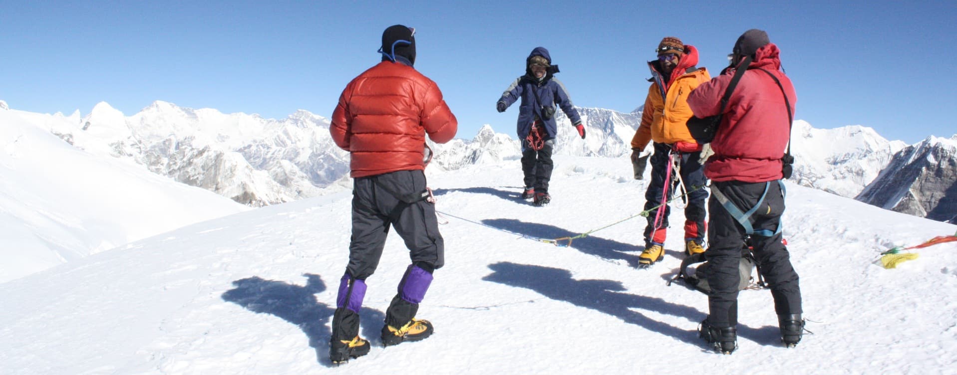
Khare's position at 5,000 meters marks the transition point between the trekking and climbing phases of the expedition. The guide runs an equipment check on arrival: crampons fitted and confirmed with the specific boots being worn, ice axe wrist leash attached, harness adjusted for the insulation layers worn at altitude. The briefing for Days 7 through 13 is comprehensive, covering the ice climbing session tomorrow, the glacier approaches on Days 8 and 12, the summit push structure, the Mera La crossing, the Hongu Basin camps, and the Amphu Lapcha technical requirements including the fixed rope rappelling on the Chhukung descent.

Daily Summary

Duration3-4 hrs
Distance8 km
AccommodationTeahouse
MealsB,L,D
Mountain SeenFull Mera massif, Mera La visible, glacier
Day 7

Acclimatization and Ice Climbing Practice at Khare (5,000 m)

The training day at Khare is among the most important preparation events of the entire traverse, because the skills practiced here apply not only to the Mera Glacier approach and summit but also to the Amphu Lapcha crossing on Day 13. The guide leads the team onto the Mera Glacier above camp, typically reaching 5,300 to 5,400 meters in a two to three-hour session before returning to the 5,000-meter overnight altitude.

The technical curriculum covers crampon technique on varying snow and ice gradients, ice axe balance and self-arrest, ascending a fixed rope with a jumar ascender, and descending a fixed rope section with a belay device. This last skill is the one with the most direct application to Amphu Lapcha, where the Chhukung-side descent involves rappelling on fixed ropes over steep rock and ice. Climbers who have practiced descending fixed lines before they reach the pass col manage the Amphu Lapcha descent with significantly more confidence and efficiency than those who encounter the technique for the first time at 5,845 meters.

The afternoon at Khare is for rest, complete hydration, and the summit day briefing. The guide confirms the Day 8 departure time for the high camp move, reviews weather forecast data, and runs the go/no-go evaluation criteria for both the summit push and the Amphu Lapcha crossing.

Daily Summary

Duration3-4 hrs training
AccommodationTeahouse
MealsB,L,D
Mountain SeenMera icecap, surrounding Hinku peaks
Day 8

Khare to Mera High Camp (5,800 m)

The move to high camp crosses the Mera Glacier and gains 800 meters over five to six hours. Crampons go on at the glacier transition, typically around 5,200 to 5,300 meters, and the team moves roped through the crevassed lower section with the guide setting the safe line. The snowfield above the lower crevasse zone opens onto the broad approach toward the high camp position.

High camp at 5,800 meters occupies an exposed snowfield with wide views south across the Hinku Valley and the surrounding peaks. The temperature at this altitude drops sharply after sunset, and the pre-summit preparation must be completed efficiently: summit packs organized, food and water consumed deliberately, and sleeping bags in use before 7:00 PM. The guide confirms the departure time at dinner, typically 3:00 AM.

Daily Summary

Duration5-6 hrs
Distance~4-5 km
AccommodationCamping
MealsB,L,D
Mountain SeenEverest, Lhotse, Makalu, Cho Oyu emerging above horizon
Day 9

Summit Mera Peak (6,476 m), descend to Khare (5,000 m)

Summit day. The 3:00 AM departure from high camp begins in full dark, headlamps illuminating the first sections of the northeast ridge climb. The gradient increases through the middle section before the broad summit snowfield becomes the final approach. At 6,476 meters, the effort of each step takes more out of the body than its sea-level equivalent, but the route itself is technically straightforward on the upper section.

From the summit of Mera Peak on a clear morning, five 8,000-meter peaks are visible simultaneously. Everest's familiar pyramid rises to the northwest. Kanchenjunga occupies the east. Lhotse and Makalu are visible in the northeast and east-southeast positions. Cho Oyu closes the northwestern arc. Baruntse, Chamlang, and the Hongu peaks, which will form the immediate landscape of Days 11 and 12, are visible to the south and southeast from this summit in a detail that gives the traverse its logical geographic logic: the country between Mera and Amphu Lapcha is visible from the top of one and from the approach of the other.

Summit time is kept to 20 to 30 minutes. The descent from 6,476 meters to Khare at 5,000 meters covers the full glacier on the same day. Arrival at Khare in the late afternoon closes the most physically demanding day of the expedition.

Daily Summary

Duration10-12 hrs
Distance9 km
AccommodationTeahouse
MealsB,L,D
Mountain SeenEverest, Kanchenjunga, Lhotse, Makalu, Cho Oyu, Baruntse
Day 10

Contingency Day at Khare (5,000 m)

The spare day at Khare serves different functions depending on the Day 9 outcome. A successful summit gives the team 24 hours of rest before the Mera La crossing on Day 11, which is the correct preparation for the technical and physically demanding Hongu Basin traverse that follows. The body benefits significantly from this recovery window before the demanding second half of the expedition.

If Day 9 produced a weather or conditions-related turnaround, Day 10 becomes the second summit window. The guide assesses weather, team condition, and high camp supply status before committing to a second attempt. A second summit attempt uses the same high camp and the same pre-dawn structure as Day 9. The return from a successful second attempt still leaves Days 11 through 16 for the Hongu traverse and Khumbu return, which the schedule can accommodate.

Daily Summary

DurationReserve day
AccommodationTeahouse
MealsB,L,D
Mountain SeenSummit panorama if second attempt used
Day 11

Khare over Mera La (5,415 m) to Seto Pokhari Camp (5,035

The traverse begins properly on Day 11. The climb from Khare to Mera La at 5,415 meters follows the upper Hinku glacier system and gains approximately 415 meters above the camp altitude. The col at Mera La is a wind-scoured saddle with the Hinku drainage visible behind and the Hongu Basin opening ahead: a sudden transition from the familiar Mera Peak approach terrain to a remote, glaciated landscape with no teahouse infrastructure and no established trail markers.

The descent from Mera La into the Hongu Basin traverses a high-altitude glacial environment where the guide navigates by knowledge of the terrain and current snow conditions rather than by following a marked path. Seto Pokhari, the White Lake, sits at approximately 5,035 meters in a glacial basin surrounded by the Hongu peaks, Chamlang at 7,321 meters to the southeast, and Baruntse's massive glaciated flanks to the northwest. The lake reflects the surrounding peaks on still mornings, and the camp here, with no other expedition group visible in most seasons, has a quality of genuine remoteness that the established teahouse circuit cannot provide.

The tents at Seto Pokhari are brought in by the porter team that has transported the full camp kit from Khare. No teahouse exists here. The dinner in the dining tent, the evening SpO2 readings, and the guide's briefing on the Amphu Lapcha approach for tomorrow all happen within the expedition camp structure.

Daily Summary

Duration6-7 hrs
Distance10-12 km
AccommodationCamping
MealsB,L,D
Mountain SeenHongu Basin, Hongu Peaks, Chamlang, Baruntse, remote wilderness
Day 12

Seto Pokhari Camp to Amphu Lapcha High Camp (5,650 m)

The approach to Amphu Lapcha Base Camp and then High Camp climbs through the upper Hongu Basin on glaciated terrain, gaining approximately 615 meters from Seto Pokhari. The route traverses below the Hongu peaks and approaches the Amphu Lapcha from the south, the final high camp positioned on a snowfield below the main col at 5,650 meters.

From the high camp position, the Amphu Lapcha col is visible above, the fixed ropes installed by the guide team on the Chhukung side visible in outline on the steep upper section of the descent. The Makalu massif fills the eastern horizon from this altitude. The Hongu Basin panorama, which will disappear after tomorrow's crossing, is visible in its full geographic scope: the entire remote drainage system that connects the eastern Nepal high country to the Khumbu.

The afternoon and evening at Amphu Lapcha High Camp follow the same deliberate preparation pattern as the Mera high camp night: full food and water consumption despite the altitude-suppressed appetite, summit gear organized and in the tent vestibule, and sleeping by 7:00 PM for the early Amphu Lapcha crossing morning.

Daily Summary

Duration4-5 hrs
Distance8-9 km
AccommodationCamping
MealsB,L,D
Mountain SeenFull Hongu Basin, Makalu, Amphu Lapcha approach
Day 13

Cross Amphu Lapcha Pass (5,845 m), descend to Chhukung (4,730 m)

The Amphu Lapcha crossing is the most technically demanding section of the entire traverse and the one that most clearly distinguishes this expedition from a standard Mera Peak package. The ascent from high camp to the 5,845-meter col involves glacier travel and scrambling on rocky terrain as the pass itself is predominantly rock rather than snow. The col at Amphu Lapcha is narrow and exposed, and the views from it are extraordinary: the full Hongu Basin visible to the south and the upper Khumbu opening to the north, with Ama Dablam's unmistakable profile appearing directly ahead on the Chhukung approach.

The descent from Amphu Lapcha on the Chhukung side is where the expedition's technical character is most explicit. The upper section of the descent involves steep rock and ice requiring rappelling on fixed ropes installed by the guide team. Climbers descend one at a time with the guide managing the rope from the station above. The technique practiced in the Day 7 training session, specifically descending a fixed line with a belay device, is applied here in full conditions at close to 5,800 meters. Below the technical sections, the descent eases to steep scrambling and finally to the trail leading down to the glacially fed valley below.

Chhukung at 4,730 meters arrives after seven to eight hours of the traverse's most committed technical effort. The teahouses here are the first conventional hospitality since Khare on Day 6. Ama Dablam's south face, Island Peak's northeast ridge, and the full upper Imja Khola drainage are visible from the settlement. The arrival at Chhukung marks the formal end of the remote traverse section: from here, the route follows the established Khumbu corridor back to Lukla.

Daily Summary

Duration7-8 hrs
Distance7-8 km
AccommodationTeahouse
MealsB,L,D
Mountain SeenAma Dablam, Lhotse, Island Peak, upper Khumbu entry
Day 14

Chhukung to Tengboche (3,867 m) via Dingboche and Pangboche

A long but rewarding descent day following the Imja Khola drainage south from Chhukung through the classic upper Khumbu landscape. The trail passes through Dingboche at 4,410 meters, a familiar Annapurna and Everest Base Camp circuit village, before dropping through the Khumbu Forest to Pangboche and the final climb to Tengboche Monastery.

Tengboche at 3,867 meters sits on a forested ridge with Ama Dablam rising directly behind the main gompa building in the eastern view and Everest visible to the north. The monastery was founded in 1916, destroyed by fire in 1989, and rebuilt in the early 1990s. The prayer hall contains thangkas, ritual instruments, and an active community of approximately 30 monks. The specific quality of the arrival at Tengboche after the remote Hongu Basin traverse is hard to describe: the monastery bells, the forest, and the organized human presence after days in the Hongu wilderness register with a particular clarity.

Daily Summary

Duration7-8 hrs
Distance16-18 km
AccommodationTeahouse
MealsB,L,D
Mountain SeenAma Dablam, Thamserku, Kantega, Tengboche Monastery
Day 15

Tengboche to Namche Bazaar (3,440 m)

The trail from Tengboche to Namche descends the forested ridge to the Dudh Kosi, then climbs the long approach to Namche's characteristic horseshoe amphitheater at 3,440 meters. The four to five-hour walk covers terrain that most Khumbu trekkers know from the EBC approach, but the direction of travel, coming down from the upper circuit rather than ascending from Lukla, gives familiar sections a different perspective.

Namche Bazaar's bakeries, gear shops, and wider accommodation variety are a genuine comfort after the expedition's remote middle section. The Sherpa Museum in the upper lane is worth an afternoon visit for the context it gives the mountains covered over the past two weeks. The Saturday market, if the day aligns, is the most vivid optional afternoon in the Khumbu.

Daily Summary

Duration4-5 hrs
Distance10-11 km
AccommodationTeahouse
MealsB,L,D
Mountain SeenEverest through ridgeline gap, Ama Dablam south face
Day 16

Namche Bazaar to Lukla (2,800 m)

The final trekking day retraces the lower Khumbu corridor from Namche to Lukla, covering 18 to 19 kilometers over six to seven hours. The trail passes through the national park, crosses the Hillary Suspension Bridge above the river gorge, and climbs the last section to Lukla through the birch and rhododendron forest that marks the lower limit of the high Khumbu.

Lukla in the evening closes the walking section of the expedition. The airstrip town's familiar one-lane atmosphere and the gear shops and lodges serving the expedition market provide the backdrop for the final crew dinner. Porter tips are distributed. Gear is sorted for the flight. The accumulated effort of 16 days of technical trekking and climbing settles into the specific relaxation of an expedition that is genuinely finished.

Daily Summary

Duration6-7 hrs
Distance18-19 km
AccommodationTeahouse
MealsB,L,D
Mountain SeenDudh Kosi gorge, birch forest, Kusum Kanguru
Day 17

Fly Lukla to Kathmandu (1,350 m) or via Manthali

The return flight from Lukla operates in the morning window before the valley weather closes. The short crossing of the mid-hills compresses the journey that took 15 days on foot into a single aerial transit, with the Khumbu valley system visible below in the clear morning air. During peak spring and autumn season, this flight lands at Manthali Airport in Ramechhap rather than Kathmandu, per current Civil Aviation Authority of Nepal scheduling, followed by the four to five hour road transfer back to Kathmandu; we confirm the current operating pattern with you before this leg of the trip.

Kathmandu arrival returns the team to warmth, low altitude, and the city's characteristic density. Hotel check-in, a long shower, and a proper restaurant meal are the practical priorities of the afternoon. The Day 18 leisure day provides a full recovery and processing window before the international departure on Day 19.

Daily Summary

Duration35 min flight (plus road transfer if via Manthali)
Distance138 km
AccommodationHotel
MealsB,L,D
Mountain SeenAerial Khumbu and Solu Khumbu region
Day 18

Leisure Day in Kathmandu (1,350 m)

Day 18 is an unstructured rest and exploration day in Kathmandu. For those who missed the city's heritage sites on the transit through, Boudhanath Stupa, Pashupatinath Temple, and Patan Durbar Square are all accessible from Thamel by taxi. The craft shops and textile markets of the Thamel district offer the widest range of Himalayan craft goods in Nepal, and a full morning of browsing closes the souvenir gaps left by the expedition's remote middle section.

Physiotherapy and massage are both widely available in Thamel and are particularly welcomed after 16 days of demanding mountain terrain. The altitude drop to 1,350 meters from the expedition's sustained high-altitude section typically produces a noticeable energy improvement and the Kathmandu day usually feels more comfortable and energetic than the days immediately following previous returns to lower altitude.

Daily Summary

DurationFree day
AccommodationHotel
MealsB,L,D
Mountain SeenCity sightseeing optional
Day 19

Final departure from Kathmandu

The package concludes with a private airport transfer to Tribhuvan International Airport at the appropriate time for the outbound flight. Nineteen days covering Kathmandu's heritage, the Zatrwa La approach to the Hinku Valley, the Mera Peak summit at 6,476 meters with its five 8,000-meter peak panorama, the remote Hongu Basin wilderness camp at Seto Pokhari, the technical Amphu Lapcha Pass crossing at 5,845 meters, and the classic Khumbu return through Tengboche and Namche produce an expedition that spans the full range of Himalayan experience: technical mountaineering, remote wilderness, and the cultural richness of the Sherpa heartland. Safe travels onward.

Daily Summary

AccommodationTeahouse
MealsB
Mountain Seen-

Cost Details

Price Includes

1. Kathmandu Accommodation and Transfers

•        2 nights hotel in Kathmandu (Day 1 arrival and Day 18 return), twin-sharing with breakfast

•        Private airport pickup on arrival and airport drop-off on departure day

•        All private vehicle transfers within Kathmandu for hotel, permit offices, and domestic terminal

•        Guided sightseeing tour on Day 2 covering Boudhanath, Pashupatinath, Swayambhunath, and Patan

2. Domestic Flights

•        Round-trip domestic flight or transfer: Kathmandu (or Manthali) to Lukla (Day 2) and Lukla to Kathmandu (or Manthali) (Day 17)

•        All domestic airport taxes and airline surcharges

•        Ground transfer to Manthali (Ramechhap) airport when Lukla flights operate from there during peak spring and autumn season, per current Civil Aviation Authority of Nepal scheduling

•        Rebooking support during weather-related Lukla flight delays

3. All Required Permits and Documentation

•        Mera Peak NMA Climbing Permit (Nepal Mountaineering Association)

•        Makalu-Barun National Park Entry Permit (Hinku Valley approach)

•        Sagarmatha National Park Entry Permit (Khumbu exit through Chhukung and Namche)

•        Khumbu Pasang Lhamu Rural Municipality entry fee

•        All government documentation fees and checkpoint registration

A TIMS card is not required for this route. NMA-listed trekking peak permits and the national park and rural municipality fees above supersede the TIMS requirement for peak climbing itineraries.

4. Accommodation Throughout

•        Best available teahouse accommodation at all overnight stops from Chutanga through Lukla on return

•        Expedition tents at Mera High Camp, Seto Pokhari, and Amphu Lapcha High Camp with foam sleeping mats

•        Twin-sharing rooms at all teahouse stops

5. Meals (Full Board)

•        Three meals per day (breakfast, lunch, dinner) from Day 2 to Day 18

•        Teahouse meals throughout the approach and return sections

•        Full expedition camp meals at the three wilderness camps

•        Safe drinking water at all teahouse stops

6. Professional Expedition Team

•        Government-licensed English-speaking lead guide with Mera Peak, Hongu Basin, and Amphu Lapcha experience

•        Assistant guide(s) on the glacier, summit, and Amphu Lapcha technical sections, maintained at a ratio of roughly one guide per two to four climbers on technical terrain

•        Porter service (one porter per two climbers, max 25 kg per load)

•        All staff wages, meals, accommodation, and comprehensive insurance

•        Ethical employment and fair wage standards for all team members

7. Technical Climbing Equipment and Training

•        Guided ice climbing practice session at Khare on Day 7 covering crampons, ice axe, and fixed rope technique

•        Fixed ropes, ice screws, and anchor equipment for Amphu Lapcha

•        Group crampons and ice axes available if personal equipment not carried

•        Route wands and glacier navigation equipment

8. Safety and Medical Equipment

•        Comprehensive expedition first aid kit including altitude medications (Diamox, Dexamethasone, Nifedipine)

•        Pulse oximeter for daily SpO2 monitoring from Chutanga through the return to Lukla

•        Emergency oxygen for severe AMS management

•        Satellite communication device for emergency contact

9. Summit Certificate and Taxes

•        Official Mera Peak summit certificate on successful ascent

•        All applicable government taxes and VAT

•        Agency service charges with no hidden fees applied post-booking

Price Excludes

1. International Flights and Visa

•        International airfare to and from Nepal

•        Nepal entry visa fee (obtainable on arrival at Tribhuvan International Airport for most nationalities)

2. Personal Climbing Equipment

•        Mountaineering boots (crampon-compatible, high-altitude rated)

•        Personal crampons, ice axe, climbing harness, helmet, belay device, and carabiners

•        Personal cold-weather clothing layering system

•        Personal sleeping bag rated to -30 degrees Celsius for wilderness camps

3. Personal Spending

•        Tea, coffee, soft drinks, alcohol, and snacks beyond included meals

•        Hot shower fees at teahouses

•        Device charging fees and Wi-Fi access fees

•        Personal laundry costs

4. Travel and Expedition Insurance (Mandatory)

•        Comprehensive mountaineering insurance covering helicopter evacuation from 6,500 m and technical pass crossing is mandatory

•        Coverage must explicitly include technical peak climbing and Amphu Lapcha grade

•        Medical treatment and trip interruption coverage

5. Tips and Gratuity

•        Tips for guides, assistant guides, and porters are customary

•        Standard: USD 12 to 20 per day for lead guide, USD 7 to 12 per day for porters

6. Optional and Unforeseen Costs

•        Helicopter rescue costs (covered by mandatory insurance)

•        Extra hotel nights due to Lukla flight delays

•        Any personal medical treatment during or after the expedition

•        Personal energy supplements and nutrition items

Scenic Highlights Along the Mera Peak and Amphu Lapcha Pass Traverse

•        Mera Peak Summit (6,476 m): Nepal's highest trekking peak with a simultaneous view of five 8,000-meter peaks from the summit snowfield.

•        Amphu Lapcha Pass (5,845 m): Technical high pass connecting Hongu Basin to Khumbu Valley with fixed rope rappelling.

•        Hongu Basin Wilderness: One of Nepal's most remote high-altitude environments, traversed with expedition camp at Seto Pokhari.

•        Seto Pokhari Camp (5,035 m): Glacial lake camp in the Hongu Basin with dramatic surrounding peaks.

•        Five 8,000-Meter Peak Panorama: Everest, Kanchenjunga, Lhotse, Makalu, and Cho Oyu visible simultaneously from Mera Peak summit.

•        Chhukung Valley Entry: Descent from Amphu Lapcha into the upper Khumbu with Ama Dablam and Island Peak views.

•        Classic Khumbu Return: Tengboche Monastery, Dingboche, and Namche Bazaar on the return to Lukla.

•        Zatrwa La Pass (4,600 m): High approach pass crossed early in the expedition.

•        Mera La (5,415 m): Transition col from Hinku Valley to the remote Hongu Basin.

•        Ice Climbing Practice: Structured training at Khare preparing for both Mera summit and Amphu Lapcha technical demands.

Mera Peak and Amphu Lapcha Pass Traverse Departures

Select Departure Date

Trip duration: 19 Days

Sep - Oct 2026

September 2026

Su
Mo
Tu
We
Th
Fr
Sa
1
2
3
4
5
6
7
8
9
10
11
12
13
14
15
16
17
18
19
20
21
22
23
24
25
26
27
28
29
30

October 2026

Su
Mo
Tu
We
Th
Fr
Sa
1
2
3
4
5
6
7
8
9
10
11
12
13
14
15
16
17
18
19
20
21
22
23
24
25
26
27
28
29
30
31
Your Trip
USD 3,295/ person

Best Price Guaranteed

2-5 People
USD 3,295/ Person
5-11 People
USD 3,195/ Person
12-19 People
USD 3,095/ Person
20-27 People
USD 3,035/ Person
28-38 People
USD 2,950/ Person
CUSTOMIZE TRIP

Speak to an Expert

Laxmi Malla
Hari Kumar Shrestha
Himal Shrestha
Shiva Kumar Shrestha
UR Ghale

Himal Shrestha

Director 🇳🇵

Chat on WhatsApp

Meet Our Expert Guides

Ongchhu Sherpa

Ongchhu Sherpa

Peak Climbing Guide

15 years of experience

Meet the Legendary Mr. Ongchu Sherpa, our expert peak climbing guide. He is an experienced climber with a passion for adventure and a wealth of knowledge in the Himalayas. Ongchu Sherpa is a professional climber who has accomplished many notable summits, especially Mera Peak, Island Peak, and Lobuche Peak. His deep familiarity with the mountains and his unwavering commitment to professionalism and safety make him a priceless colleague on our team.
Lakpa Sherpa

Lakpa Sherpa

Climbing Guide

16 years of experience

Lakpa Sherpa is a seasoned mountaineer with a remarkable history of climbing numerous mountain peaks with groups and climbers from all over the world. He has more than ten years of experience and is widely regarded as one of the most trustworthy hiking and climbing guides. Peaks such as Tukuche, Island Peak, Mera Peak, Everest, Kanchenjunga, Makalu, and Lobuche are among those he has successfully ascended.
Kipa Sherpa

Kipa Sherpa

Climbing Guide

17 years of experience

Kipa is an experienced climber working as a climbing guide and has been active in this sector since 2006. He evaluates your capability for climbing and mountaineering and guides you to snowy summits accordingly. With an extensive background in climbing and mountaineering, he has successfully completed the ascent of 7000-meter massifs on multiple occasions.
Rengi Lakpa Sherpa

Rengi Lakpa Sherpa

Climbing Guide

18 years of experience

Rengi Lakpa Sherpa was born in the Makalu region and has completed the ascent of Mount Everest twice, along with summiting a number of other notable mountains. He has climbed a significant number of peaks in Nepal and Tibet and leads expeditions as a professional trek and climbing leader.

Additional Information

A Typical Day on This Expedition

The expedition's daily rhythm evolves through distinct phases: the Zatrwa La approach, the Mera Peak climbing section, the remote Hongu Basin traverse, and the classic Khumbu return.

On the approach days from Chutanga through Khare, the schedule follows the established high-altitude trekking pattern with early breakfasts and steady walking days. From Khare upward, the altitude and technical demands take over as the primary daily variables. The three wilderness camp nights in the Hongu Basin represent the most committed phase of the expedition.

Summit day on Mera Peak and the Amphu Lapcha crossing day operate on entirely different schedules from the standard trekking days. Both require pre-dawn starts, sustained technical effort at altitude, and deliberate energy management throughout.

Accommodation on This Expedition

Two nights in a comfortable Kathmandu hotel bookend the expedition. The trekking nights span teahouses on the Zatrwa La approach and Khumbu return, plus three expedition tents at the wilderness camps: Mera High Camp, Seto Pokhari, and Amphu Lapcha High Camp.

The wilderness camps in the Hongu Basin are full expedition setups with tents and cook team. No permanent infrastructure exists in this section. The Seto Pokhari camp at the White Lake is one of the most remote overnight positions available on guided Nepal expeditions.

High camp nights at Mera High Camp and Amphu Lapcha High Camp require the strongest sleeping bag rating. The combination of altitude, exposure, and cold makes these nights among the more demanding of any guided Himalayan traverse.

Wi-Fi and mobile connectivity are available in Lukla and at most teahouses up to Kothe or Thangnag, but become unreliable or nonexistent from Khare through the Amphu Lapcha crossing until Chhukung or Namche Bazaar is reached. Charging is available for a small fee at teahouses up to Khare, but is very limited during the tented sections, so we recommend carrying a power bank of at least 20,000 mAh.

Food and Drink on the Route

Meals combine Nepali staples such as dal bhat, noodle and rice dishes, and soups with simple Western options like pasta, eggs, and pancakes, with variety narrowing as altitude increases and the route moves from teahouses to expedition tents above Khare. Vegetarian, vegan, gluten-free, and other common dietary needs can be accommodated with advance notice, though choices become more limited at the higher camps.

Bottled water is available for purchase at lower teahouses but becomes scarce and expensive at altitude, so we recommend purification tablets, a filter, or a UV purifier as a backup to the boiled water our camp crew provides. Alcohol is available at teahouses up to around Khare but is strongly discouraged above 3,500 meters because of its effect on acclimatization.

Best Time for the Traverse

April and October are the optimal months. April provides warmer conditions at the wilderness camps and the rhododendron bloom on the Khumbu return. October offers the clearest summit and pass views after the monsoon and consolidated snow conditions.

The traverse requires stable weather windows for both the Mera summit and the Amphu Lapcha crossing. The contingency day at Khare and the weather buffer in the Hongu Basin provide flexibility for the most weather-dependent sections.

Lukla Flights and the Manthali Alternative

During the spring (mid-March to mid-May) and autumn (late September to late November) peak seasons, flights between Kathmandu and Lukla are scheduled to operate from Manthali Airport in Ramechhap district rather than from Kathmandu's domestic terminal, a Civil Aviation Authority of Nepal measure intended to reduce congestion and improve on-time performance during the busiest months. This means an early departure from the Kathmandu hotel, typically around 1:00 to 2:00 AM, for the four to five hour drive to Manthali ahead of the short Lukla flight. We include this transfer in the package at no additional cost whenever it applies, and confirm the current operating pattern with you before departure. Outside peak season, flights typically operate directly between Kathmandu and Lukla.

If a flight is cancelled outright because of weather, we rebook the next available departure and can arrange a helicopter transfer at additional cost if the schedule is at risk. Building buffer days around the Lukla legs, rather than scheduling international connections tightly against them, is the most effective way to absorb a delay without disrupting the trip.

Difficulty Level

This is a technical traverse combining high-altitude trekking, glacier travel, and fixed-rope technical sections. It is significantly more demanding than a standard Mera Peak expedition, primarily due to the Amphu Lapcha crossing and the remote Hongu Basin wilderness section.

Altitude and Acclimatization

The itinerary builds acclimatization progressively through the Zatrwa La crossing and Mera Peak section before entering the sustained high-altitude Hongu Basin traverse. Daily SpO2 monitoring supports the guide's clinical assessment at every decision point.

Essential Equipment

Technical Climbing Gear

•        Mountaineering boots: crampon-compatible, rated to -30 to -40 degrees Celsius.

•        12-point technical crampons fitted to boots.

•        Ice axe with wrist leash.

•        Climbing harness, helmet, three locking carabiners, and belay/rappel device for Amphu Lapcha.

Clothing and Sleeping

•        Heavy down jacket and trousers rated for extreme cold, full layering system.

•        Sleeping bag rated to -30 degrees Celsius: non-negotiable for wilderness camps.

Practical Items

•        Headlamp with spare batteries, trekking poles, power bank (20,000 mAh), sunscreen, glacier glasses.

•        Most technical gear, including crampons, ice axes, harnesses, and mountaineering boots, can be rented in Kathmandu or Namche Bazaar for those who prefer not to buy specialized equipment for a single trip.

Safety on the Expedition

Daily SpO2 monitoring, guide assessment at every technical decision point, and comprehensive expedition medical kit support the safety protocols. The Amphu Lapcha fixed rope setup and rappel management are the primary technical safety preparations.

Guides carry a first aid kit, pulse oximeter, satellite communication device, and, where warranted, a portable altitude chamber (Gamow bag) for emergency AMS treatment. Helicopter evacuation from Khare, Mera High Camp, or Amphu Lapcha High Camp is the primary emergency option from the higher sections of the route, which is why comprehensive high-altitude insurance is mandatory.

Travel Insurance

Comprehensive mountaineering insurance covering technical peak climbing, pass crossing, and helicopter evacuation from 6,500 meters is mandatory. Policy details must be provided to the guide before the Day 2 Lukla departure.

Frequently Asked Questions About Mera Peak and Amphu Lapcha Pass Traverse

General InformationPreparation and FitnessPermitsInsurance and VisaGuides and Support StaffAccommodation and FacilitiesFood and DrinksWeather and SeasonsHealth and SafetyPacking and GearBooking and PaymentsTransportation and Flights

General Information

9 Qs
What is the Mera Peak and Amphu Lapcha Pass Traverse?

It is a 19-day trekking and climbing expedition in Nepal's Everest region that combines a summit of Mera Peak (6,476 m), Nepal's highest trekking peak, with a crossing of the technical Amphu Lapcha Pass (5,845 m) into the Khumbu Valley.

How long is the itinerary?

The standard itinerary runs 19 days from arrival in Kathmandu to final international departure, including acclimatization days, the Mera Peak summit push, and the Amphu Lapcha Pass crossing.

Where is Mera Peak located?

Mera Peak sits in the Hinku Valley of eastern Nepal, in the Makalu-Barun region, roughly a 35-minute flight from Kathmandu to Lukla followed by several days of trekking to reach the base of the climb.

Is Mera Peak a trekking peak or a full mountaineering expedition?

The Nepal Mountaineering Association classifies Mera as a trekking peak, but the standard route involves glacier travel, fixed ropes, crampons, and an ice axe, which makes it more technical than an ordinary trek even before the Amphu Lapcha add-on.

What makes this itinerary different from a standard Mera Peak climb?

A standard Mera Peak trip returns to Lukla the way it came. This traverse instead continues over Mera La into the Hongu Basin, crosses Amphu Lapcha into the upper Khumbu, and returns through Chhukung, Tengboche, and Namche Bazaar, adding a genuine technical pass and a remote wilderness section that a standard itinerary never touches.

Can beginners join this traverse?

Trekkers with no prior mountaineering experience but strong fitness can attempt the Mera Peak summit itself. The Amphu Lapcha crossing, however, involves rope work and rappelling on exposed terrain, so this particular traverse suits climbers with at least some prior exposure to technical mountain travel better than complete beginners.

What is the highest point reached?

The Mera Peak summit at 6,476 meters is the high point of the trip, with the Amphu Lapcha Pass at 5,845 meters crossed later in the itinerary.

What views are visible from the Mera Peak summit?

On a clear day, climbers see five of the world's eight-thousand-meter peaks from the summit: Everest, Lhotse, Makalu, Cho Oyu, and Kanchenjunga, along with Baruntse and the wider Hongu and Khumbu ranges.

Where does the trek finish?

After crossing Amphu Lapcha, the route descends through Chhukung, Dingboche, Pangboche, Tengboche, and Namche Bazaar before flying out of Lukla back to Kathmandu.

Preparation and Fitness

7 Qs
How fit do I need to be?

You should be comfortable hiking 6 to 8 hours a day on consecutive days at altitude while carrying a daypack. A solid base of cardiovascular fitness and leg strength, built over at least 8 to 12 weeks of training, is strongly recommended.

How should I train before departure?

A combined plan of hiking with a weighted pack, stair climbing, cardio work such as running or cycling, and strength training for the legs and core, sustained consistently for around three months, is the standard preparation most guiding operators recommend.

Do I need prior mountaineering experience?

Prior mountaineering experience is not mandatory for Mera Peak itself, but familiarity with crampons, an ice axe, and rope-assisted movement is a real advantage given the technical demands of the Amphu Lapcha crossing.

Will I receive climbing training during the trek?

Yes. Day 7 is a dedicated acclimatization and ice climbing practice day at Khare, where our guides teach crampon technique, fixed-rope ascending and descending, and basic ice axe self-arrest before the summit push.

How many acclimatization days are built in?

Beyond the gradual multi-day ascent through the Hinku Valley, the itinerary includes a dedicated acclimatization and training day at Khare plus a built-in contingency day after the summit attempt.

What age range suits this trek?

Most operators accept climbers roughly between 16 and 65 years old, provided fitness requirements are met and there are no underlying health conditions affected by altitude. A doctor's clearance is often recommended for older participants.

Should I do a practice trek first?

A shorter acclimatization trek such as Everest Base Camp or Annapurna Base Camp in the year before can be a useful way to see how your body responds to altitude before committing to a technical 6,476-meter peak.

Permits

6 Qs
What permits are required for this traverse?

Climbers need an NMA climbing permit for Mera Peak, a Makalu-Barun National Park entry permit for the Hinku Valley approach, a Sagarmatha National Park entry permit for the Khumbu exit, and a Khumbu Pasang Lhamu Rural Municipality entry fee. All four are arranged as part of this package.

Who issues the Mera Peak climbing permit?

The Nepal Mountaineering Association issues the climbing permit, since Mera Peak falls under the NMA's list of designated trekking peaks rather than the Department of Tourism's expedition peaks.

Do I need a separate permit for the Amphu Lapcha Pass crossing?

No standalone permit is required for the pass itself. It is covered by the national park and rural municipality permits that already apply to the Hongu Basin and Khumbu areas it connects.

Do I need permits for both Makalu-Barun and Sagarmatha National Parks?

Yes. Because this traverse starts in the Makalu-Barun region near the Hinku Valley and exits through Sagarmatha National Park in the Khumbu, both park permits are required, and both are included in the package price.

Is a TIMS card required?

No. TIMS is not required for this route. The NMA peak permit and the national park and rural municipality fees supersede it for climbing itineraries of this kind.

Can I arrange permits myself?

We arrange all required permits, including the NMA climbing permit, both national park fees, and the rural municipality fee, as part of the package. You will need to provide a passport copy, passport photos, and travel insurance details for processing.

Insurance and Visa

3 Qs
What travel insurance do I need?

You need insurance that specifically covers high-altitude trekking and climbing to at least 6,500 meters, includes emergency helicopter evacuation, and covers medical treatment for altitude-related illness. Standard travel insurance policies typically exclude mountaineering above 4,000 to 5,000 meters, so a specialized policy or an added adventure rider is usually necessary.

Is helicopter evacuation coverage mandatory?

In practice, yes. Helicopter evacuation is the only realistic rescue option from high points like Khare, Mera High Camp, or Amphu Lapcha High Camp, so coverage that includes it is a requirement of joining this trip.

Do I need a visa to trek in Nepal?

Most nationalities can obtain a Nepal tourist visa on arrival at Tribhuvan International Airport for a fee, though it is worth checking current requirements for your specific nationality before travel. A 30-day visa is generally sufficient for this 19-day itinerary.

Guides and Support Staff

4 Qs
Are the guides licensed?

Yes. Guides leading this route are government-licensed climbing guides with specific training in glacier travel, rope-fixing, and high-altitude rescue.

What is the guide-to-client ratio?

We maintain a ratio of roughly one climbing guide per two to four clients on technical sections such as the summit push and the Amphu Lapcha crossing, so supervision is closer during the most demanding parts of the route.

Who handles the technical rope work at Amphu Lapcha?

Our experienced climbing guides and Sherpa support handle the fixed-rope setup, anchor placement, and rappel systems at Amphu Lapcha, guiding each climber across individually on fixed lines.

What happens if I need to descend early?

A guide or assistant guide accompanies any climber who needs to descend early for medical reasons. Nobody descends alone from the high-altitude sections of the route.

Accommodation and Facilities

4 Qs
What accommodation is used on this trek?

Accommodation shifts from teahouses, from Chutanga through Khare and again on the Khumbu return, to expedition tents at the three wilderness camps: Mera High Camp, Seto Pokhari, and Amphu Lapcha High Camp.

Are hot showers available?

Hot or bucket showers are generally available at lower teahouses such as Lukla, Chutanga, and Kothe, but become unavailable or very limited from Khare upward and through the tented camping section.

Is Wi-Fi or mobile connectivity available?

Connectivity is reasonably reliable in Lukla and at teahouses up to Kothe or Thangnag, but becomes unreliable or nonexistent from Khare through the Amphu Lapcha crossing until Chhukung or Namche Bazaar.

Is electricity available to charge devices?

Charging is available for a small fee at most teahouses up to Khare, but is very limited or unavailable during the tented high-altitude sections, so a power bank is strongly recommended.

Food and Drinks

4 Qs
What kind of food is served?

Meals mix Nepali staples like dal bhat, noodle and rice dishes, and soups with simple Western options such as pasta, eggs, and pancakes, with variety narrowing as altitude increases and the route moves into expedition camping above Khare.

Can dietary restrictions be accommodated?

Yes, vegetarian, vegan, gluten-free, and other common dietary needs can generally be accommodated with advance notice, though options narrow at the higher, more remote camps.

Is bottled water available, or should I purify my own?

Bottled water can be purchased at lower teahouses but becomes expensive and scarce at altitude. We recommend purification tablets, a filter, or a UV purifier as a backup to the boiled water our expedition crew provides above Khare.

Is alcohol available on the route?

Beer and local spirits are available at teahouses up to around Khare, but alcohol is strongly discouraged above 3,500 meters because of its effect on acclimatization and increased risk of altitude sickness.

Weather and Seasons

4 Qs
What is the best season for this traverse?

Spring (March to May) and autumn (late September to November) both offer relatively stable weather and the safest conditions for the summit push and the Amphu Lapcha crossing. This package targets April and October departures specifically.

Can this route be done in winter or monsoon?

Winter climbing is technically possible but brings extreme cold, higher avalanche risk, and shorter daylight hours. Monsoon season, June to early September, is not recommended because of heavy rainfall, poor visibility, and frequent Lukla flight cancellations.

How does weather affect the Amphu Lapcha crossing?

The crossing is highly weather-dependent, since snow, wind, or poor visibility on the exposed rock and ice sections significantly increases risk. Guides build flexible timing into the itinerary around this crossing for exactly this reason.

How does weather affect Lukla flights?

Lukla flights are sensitive to cloud cover and wind, and delays are common, particularly during shoulder seasons. See the Lukla Flights and the Manthali Alternative section above for how we manage this.

Health and Safety

4 Qs
What is the risk of altitude sickness on this trek?

Given the 6,476-meter summit and multiple nights above 5,000 meters, the risk of Acute Mountain Sickness is significant, which is why the itinerary includes dedicated acclimatization days and a gradual ascent profile.

What symptoms should I watch for?

Early symptoms include headache, nausea, dizziness, and fatigue. More severe warning signs, such as confusion, loss of coordination, or shortness of breath at rest, require immediate descent and medical attention.

Is Diamox recommended?

Many climbers use Diamox (acetazolamide) as a preventive measure, but it should only be taken after consulting a doctor familiar with your medical history.

What should I do if I feel unwell at altitude?

Tell your guide immediately, no matter how minor the symptom seems. Early reporting allows the team to intervene with descent or treatment before a condition becomes dangerous.

Packing and Gear

3 Qs
What technical climbing gear is required?

Required gear includes crampons, an ice axe, a climbing harness, a belay or rappel device, carabiners, a helmet, and mountaineering boots rated for extreme cold and glacier travel.

Can I rent gear in Kathmandu?

Yes, most technical gear, including crampons, ice axes, harnesses, and mountaineering boots, can be rented in Kathmandu or Namche Bazaar, a popular option for climbers who do not want to buy specialized equipment for a single trip.

What sleeping bag rating do I need?

A four-season bag rated to at least -30 degrees Celsius is required, since nighttime temperatures at the high camps and during the Amphu Lapcha crossing regularly drop well below freezing.

Booking and Payments

5 Qs
How do I book this traverse?

Booking involves selecting a departure date, submitting a booking form with passport and health details, and paying a deposit to confirm your place.

What deposit is required?

A deposit of around 20 to 30 percent of the total package cost is typically required at booking, with the balance due before departure or on arrival in Kathmandu.

Can I book a private departure?

Yes, private departures with a custom start date and dedicated guide team are available for individuals, couples, or groups who prefer not to join a fixed group departure.

How far in advance should I book?

Booking 2 to 4 months in advance is recommended, especially for the peak spring and autumn seasons, to secure Lukla or Manthali flight availability, permits, and preferred guide teams.

What is the cancellation policy?

See the Group Discounts and Booking Information section above for the full cancellation schedule.

Transportation and Flights

4 Qs
How do I get from Kathmandu to the start of the trek?

The trek begins with a short domestic flight, roughly 35 minutes, from Kathmandu to Lukla, the standard gateway airport for the Hinku Valley and Everest region.

What if Lukla flights are disrupted by weather?

We rebook the next available departure and build buffer days into the itinerary to absorb typical delays. See the Lukla Flights and the Manthali Alternative section above for how the seasonal Manthali routing works.

Is there transportation during the Amphu Lapcha crossing?

No. The entire route from Khare through Chhukung is covered on foot, with fixed ropes used at the pass itself. No motorized transport is possible in the Hongu Basin or on the crossing.

How much luggage can I bring on the Lukla or Manthali flight?

Domestic flights to Lukla typically enforce a baggage limit of around 15 kg total, often split between checked and hand luggage, so packing efficiently matters.

Now Offering 100% Private Treks

Explore Nepal's breathtaking trails at your own pace with our exclusive private treks. No strangers, no rushed schedules—just you, your adventure, and complete flexibility. Enjoy personalized itineraries, expert guides, and a safety-first approach designed for unforgettable experiences.

Tailor-Made Itineraries

Plan your trek exactly how you want it. Choose destinations, duration, and activities that suit you.

Dedicated Guide & Porter

Enjoy expert guidance and personal assistance every step of the way.

Safety & Health Focus

We ensure proper acclimatization, medical support, and emergency readiness.

Flexible Scheduling

Pick your own travel dates and move at a pace that suits your adventure style.

Privacy & Comfort

Ideal for couples, families, and friends who want a fully private experience.

Discover Your Private Trek