No cancellation fees. No hassle. Book Now, stay relaxed.Cancellation Terms
Accessible Adventure
Outbound
Trekking in Nepal
Expeditions
Activities
Travel Guide
Company
Accessible Adventure Logo
About Us

As Accessible Adventure, we are a trusted adventure tour operator, crafting unforgettable journeys across Nepal, Tibet, and Bhutan that leave lasting memories for every traveler.

Explore More
  • Blog
  • Travel Guide
  • Our Commitments
  • Online Payment
Company
  • Our Team
  • Terms and Conditions
  • No-risk Booking Policy
  • Legal Documents
Have Questions?
  • Phalful Chwok, Nayabazar-16, Kathmandu, Bagmati, 44600, Nepal
  • +9779851352707
  • info@accessibleadventure.com
Contact Us
👥 Follow us:
FacebookX (Twitter)LinkedInInstagramYouTubePinterestTikTokWhatsAppViber

All content and photographs on this website are copyright © Accessible Adventure Pvt. Ltd. and may not be reproduced without prior written permission.

Developed byTuring Research And Development Private Limited ↗
Chulu East Peak Climbing and the Annapurna Circuit Trek

Starting from

$2,689$2,530/ person
Book Now ↓

Chulu East Peak Climbing and the Annapurna Circuit Trek

Chulu East Peak Climbing and the Annapurna Circuit Trek costs USD 2,530 per person, reduced from USD 2,689.

Country

Nepal

Duration

22 Days

Difficulty

Strenuous to Challenging

Max Altitude

6,584m / 21,601ft

Style

Peak Climbing | High-Altitude Trekking | Himalayan Expedition

Best Season

March-June & Sept-November

Why Choose Chulu East Peak Climbing and the Annapurna Circuit Trek?

A Himalayan Summit Embedded in One of the World's Great Trekking Routes

The Annapurna Circuit has been called the finest long-distance trek in the world, and while road construction has altered some of its original character over the past two decades, the core journey still delivers something that few trekking routes anywhere can match. It circles the entire Annapurna massif, one of the broadest and most dramatic mountain ranges on earth, passing through subtropical river gorges, terraced agricultural valleys, rhododendron forests, high alpine terrain, and finally the arid, wind-scoured plateau of Mustang, all in a single continuous journey. The crossing of Thorong La Pass at 5,416 meters is the physical and psychological centerpiece of the circuit and one of the great physical achievements available to a non-technical trekker.

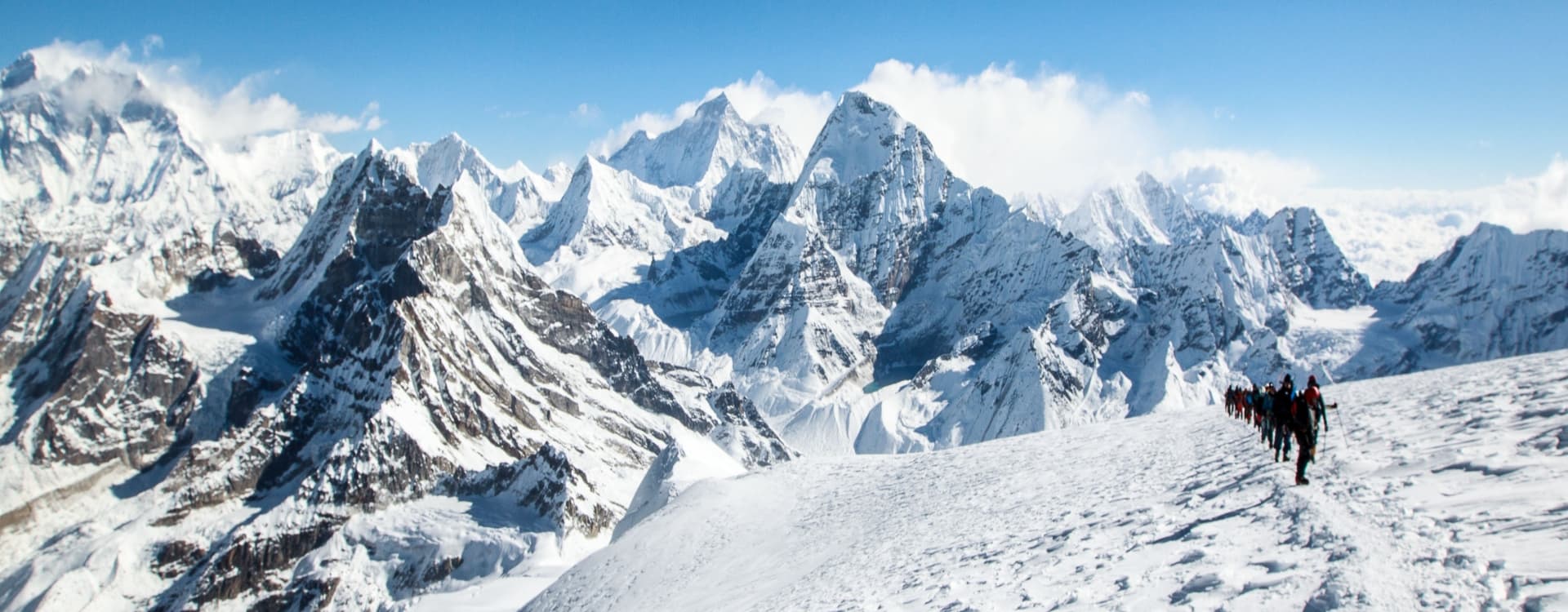
Now place a 6,584-meter technical summit in the middle of that circuit. The Chulu East peak sits just north of the main Annapurna circuit trail, above the Manang Valley, accessed via the quiet Julu Khola tributary. Its summit is visible for several days of approach trekking, a distinctive snow pyramid that draws the eye from as far back as Pisang. The climb via the northeast ridge involves glacier crossing, fixed rope sections, and a long pre-dawn summit push, and the reward is a 360-degree panorama that takes in Annapurna II, III, and IV, Gangapurna, Glacier Dome, Tilicho Peak, Manaslu, and Dhaulagiri. It is a rare summit view, higher and more expansive than almost anything available to a non-specialist climber without a fully technical expedition.


What Makes This Expedition Different

Two things set this itinerary apart from most Nepal climbing packages. First, the cultural and landscape diversity of the 22 days is extraordinary. The journey begins in Kathmandu's heritage temples, moves through Hindu market towns in the lower Marsyangdi Valley, climbs into the Tibetan Buddhist highlands of Manang district, reaches a genuine Himalayan summit above 6,500 meters, crosses a 5,400-meter mountain pass, and descends into the ancient kingdom of Mustang before returning through Pokhara to the capital. No two consecutive days feel the same. Second, the combination of trekking infrastructure and real mountaineering means the expedition is accessible to fit, experienced trekkers without requiring the logistical complexity of a standalone high-altitude expedition.


Highlights of the Expedition

  • A 6,584-meter summit on Chulu East, one of the most technically interesting permitted climbing peaks in the Annapurna region.

  • The full Annapurna Circuit, one of the world's great trekking routes, is completed as an integral part of the same itinerary.

  • Crossing Thorong La Pass at 5,416 meters, the iconic high point of the Annapurna Circuit, with panoramic views of Dhaulagiri and the Annapurna range.

  • Muktinath Temple, a sacred pilgrimage site for both Hindus and Buddhists, where a natural flame burns perpetually alongside a spring.

  • The Manang Valley and its ancient Tibetan Buddhist culture, including monasteries, mani walls, and communities with centuries-old trading traditions.

  • Summit views from Chulu East encompassing Annapurna II, III, and IV, Gangapurna, Glacier Dome, Tilicho Peak, Dhaulagiri, and Manaslu.

  • The Kali Gandaki Gorge, one of the deepest river gorges in the world by relative elevation difference, descending from Muktinath toward Jomsom.

  • Pisang, Manang, and Kagbeni, three of the most atmospherically distinct villages in Nepal, each carrying a centuries-deep cultural identity.


Journey Breakdown

Starting in Kathmandu

After arrival and a heritage sightseeing day in the capital, the journey begins with a long but rewarding drive west into the Marsyangdi Valley, where the trekking trail proper begins at Syange.

Through the Marsyangdi Valley

Four days of valley trekking through Dharapani, Chame, and Pisang progressively gain altitude while passing through a landscape that shifts from subtropical forest to alpine terrain. Each village encountered along the way carries a distinct cultural identity.

The Chulu East Climb

From Pisang, the route departs the main circuit to follow the Julu Khola valley toward the Chulu massif. An acclimatization day at the meadow camp, a demanding push to Base Camp, and then the ascent to High Camp and the summit form the centerpiece of the expedition.

Thorong La and the Descent into Mustang

After returning from the summit, the route re-joins the Annapurna Circuit at Manang and continues to the Thorong La crossing and the spectacular descent into Muktinath and the Kali Gandaki Valley.

Jomsom, Pokhara, and the Return

The final days descend to Jomsom, fly or drive to Pokhara, and return by road to Kathmandu, completing a full geographic circuit of one of the Himalaya's most iconic mountain ranges.

Trip Summary

DayDestination & ActivitiesDistanceTimeMountain Seen
1

Arrival in Kathmandu

10 km30 minsOn a clear day: Langtang Lirung, Ganesh Himal
2

Kathmandu Sightseeing & Trek Preparation

-5-6 hrs sightseeingHimalayan views from Swayambhunath (weather permitting)
3

Drive Kathmandu - Besisahar - Syange

235 km8-9 hrsLamjung Himal
4

Syange - Jagat - Chamje - Tal - Karte - Dharapani

16 km7-8 hrsLamjung Himal, Manaslu (distant)
5

Dharapani - Bagarchhap - Danaque - Timang - Koto - Chame

15 km6–7 hrsLamjung Himal, Annapurna II, Manaslu
6

Chame - Bhratang - Dhukur Pokhari - Lower Pisang

14 km5–6 hrsAnnapurna II, Pisang Peak, Lamjung Himal
7

Lower Pisang - Upper Pisang

4 km2–3 hrsAnnapurna II, Annapurna IV, Pisang Peak, Chulu Peaks
8

Upper Pisang - Julu Khola Meadow

10 km5-6 hrsChulu East, Chulu West, Annapurna II, Gangapurna
9

Acclimatization at Julu Khola Meadow

5 km3-4 hrsChulu East, Gangapurna, Annapurna II
10

Julu Khola Meadow - Chulu East Base Camp

7 km4-5 hrsChulu East, Chulu Far East
11

Base Camp - Chulu East High Camp

4 km5-6 hrsChulu East Summit Ridge
12

Summit Chulu East (6,584m) - Return to Base Camp

10 km10-12 hrsAnnapurna II, Annapurna III, Annapurna IV, Gangapurna, Tilicho Peak, Dhaulagiri, Manaslu
13

Contingency Day

-FlexibleChulu Peaks
14

Base Camp - Julu Khola Meadow

7 km4-5 hrsChulu Peaks
15

Julu Khola Meadow - Manang

12 km5-6 hrsGangapurna, Annapurna III, Tilicho Peak
16

Manang - Gunsang - Yak Kharka

10 km4–5 hrsGangapurna, Chulu Peaks
17

Yak Kharka - Ledar - Thorong Phedi

7 km4-5 hrsThorong Peak, Chulu West
18

Thorong Phedi - Thorong La Pass - Muktinath

15 km8-10 hrsDhaulagiri, Nilgiri, Annapurna Range, Thorong Peak
19

Muktinath - Kagbeni - Jomsom

15 km5-6 hrsDhaulagiri, Nilgiri, Tukuche Peak
20

Jomsom - Pokhara

155 km1 hrsDhaulagiri, Nilgiri (morning)
21

Pokhara - Kathmandu

200 km6-7 hrsGanesh Himal (clear weather)
22

Departure from Kathmandu

---

Detailed Chulu East Peak Climbing and the Annapurna Circuit Trek Itinerary

Cost Details

Price Includes

Airport Transfers

  • All airport pick-up and drop-off services by private tourist vehicle.
  • Assistance from our representative upon arrival and departure.

Accommodation

  • 4 nights hotel accommodation in Kathmandu on a twin-sharing basis with breakfast.
  • 1 night hotel accommodation in Pokhara on a twin-sharing basis with breakfast.
  • Tea house/lodge accommodation during the Annapurna Circuit trek on a twin-sharing basis.
  • Fully serviced camping accommodation during the Chulu East Peak climbing section (Base Camp and High Camp), including expedition tents, dining tent, kitchen tent, toilet tent, tables, chairs, and sleeping tents.

Meals

  • Daily breakfast in Kathmandu and Pokhara.
  • Three meals a day (Breakfast, Lunch, and Dinner) during the trek and climbing expedition.
  • Fresh seasonal fruits served after dinner whenever available.
  • Tea and coffee served during meals at the campsite.

Transportation

  • Private tourist vehicle from Kathmandu to Syange.
  • Tourist bus or private vehicle from Pokhara to Kathmandu (as per itinerary).
  • Jomsom to Pokhara by domestic flight or private vehicle (as specified in the package).
  • All required ground transportation for staff and expedition logistics.


Trekking & Climbing Permits

  • Annapurna Conservation Area Permit (ACAP).
  • Trekkers' Information Management System (TIMS) Card (if applicable).
  • Chulu East Peak Climbing Permit issued by the Nepal Mountaineering Association (NMA).
  • Local municipality and conservation area entry fees where applicable.
  •  

Climbing Guide & Trekking Staff

  • Experienced, government-licensed English-speaking trekking guide.
  • Professional NMA-licensed climbing guide for the peak expedition.
  • Required assistant climbing guides according to group size.
  • One porter for every two trekkers (maximum luggage limit: 20kg per porter).
  • Wages, meals, accommodation, insurance, transportation, equipment, and allowances for all guides, porters, and climbing staff.

Climbing Equipment

  • Group climbing equipment including:
  • Fixed ropes
  • Dynamic ropes
  • Ice screws
  • Snow bars
  • Ice axes (group use)
  • Carabiners
  • Ascenders and descenders
  • Safety anchors
  • Climbing hardware
  • Kitchen and camping equipment for Base Camp and High Camp.
  • Oxygen meter for daily health monitoring.

Personal Trekking Equipment

  • Down sleeping bag (to be returned after the trip).
  • Down jacket (to be returned after the trip).
  • Duffel bag for trekking.
  • Trekking map.
  • Company T-shirt.
  • Peak climbing completion certificate.

Safety & Emergency Support

  • A comprehensive first aid medical kit carried by the guide.
  • Daily health monitoring during the expedition.
  • Weather forecast updates during the climbing period.
  • Assistance in arranging emergency helicopter evacuation and rescue logistics, with evacuation costs covered by the traveler's comprehensive travel insurance.

Government Taxes & Service Charges

  • All applicable government taxes.
  • Company service charges.
  • Official VAT where applicable.

Price Excludes

International Travel

  • International airfare to and from Nepal.
  • Nepal entry visa fees.

Meals in Cities

  • Lunch and dinner in Kathmandu and Pokhara (except farewell dinner if provided).
  • Extra meals due to early return or itinerary changes.

Personal Climbing Equipment

The following personal climbing gear is not included and can be rented or brought by participants:

  • Mountaineering boots (double boots)
  • Crampons
  • Climbing harness
  • Helmet
  • Ice axe (personal)
  • Jumar/ascender
  • Figure-8 or ATC descender
  • Safety cow's tail
  • Locking and non-locking carabiners
  • Mountaineering gloves
  • Gaiters
  • Trekking poles
  • Headlamp and spare batteries
  • Personal clothing and thermal layers
  • Beverages & Personal Expenses
  • Soft drinks, bottled water, alcoholic beverages, and energy drinks.
  • Hot showers, Wi-Fi, battery charging, laundry services, and personal phone calls.
  • Snacks, chocolates, and other personal purchases.
  • Tea or coffee during the trek is not included (except at the expedition campsite where meals are served).

Insurance

  • Comprehensive travel insurance covering:
  • High-altitude trekking and peak climbing (up to 6,584m)
    Emergency helicopter evacuation
  • Medical treatment
  • Trip cancellation
  • Personal accident
  • Loss or damage of baggage

Additional Expenses

  • Costs arising from flight cancellations, weather delays, natural disasters, political disturbances, strikes, pandemics, or any circumstances beyond the company's control.
  • Extra accommodation and meals due to itinerary changes.
  • Additional climbing days beyond the scheduled itinerary.

Tips

  • Tips and gratuities for guides, climbing guides, porters, drivers, and expedition staff.

Miscellaneous

  • Personal medical expenses.
  • Personal trekking or climbing equipment not listed in the inclusions.
  • Any services not specifically mentioned under the "Cost Includes" section.
Altitude in:
Scroll to view full route

Scenic Highlights Along the Chulu East Peak Climbing and the Annapurna Circuit Trek

  • Chulu East summit at 6,584 meters: views of Annapurna II, III, and IV, Gangapurna, Glacier Dome, Tilicho Peak, Dhaulagiri, and Manaslu from a single vantage point.

  • Thorong La Pass at 5,416 meters: the classic Annapurna Circuit high point, marked by prayer flags and surrounded by an alpine panorama spanning Dhaulagiri, Annapurna, and Nilgiri.

  • Manang Valley and Gangapurna: one of the most dramatically situated high-altitude valleys in Nepal, ringed by glaciated peaks with the turquoise Gangapurna Lake visible below the glacier snout.

  • Paungda Danda Rock Face near Pisang: a near-vertical curved rock wall rising 1,500 meters from the Marsyangdi River, one of the most striking geological features on the circuit.

  • Muktinath Temple: a sacred complex at 3,800 meters where an eternal flame burns alongside a spring, revered by both Hindus and Tibetan Buddhists.

  • The Kali Gandaki Gorge: one of the world's deepest river gorges by relative elevation, descending between Dhaulagiri and Annapurna in a wide, wind-scoured valley that carries traders, pilgrims, and yak caravans.

  • Pisang and Upper Pisang: villages perched above the Marsyangdi Valley with ancient monasteries and the first close views of the Chulu massif and Annapurna range.

  • The Marsyangdi Valley approach: a multi-day river gorge walk through subtropical forest, waterfalls, suspension bridges, and culturally diverse mountain villages.


Additional Information

Expected Oxygen Saturation (SpOâ‚‚) by Elevation During the Chulu East Expedition

Day

Place

Altitude (m)

Oxygen (% sea level)

Est. SpO2

Notes

1

Kathmandu

1,338

~84%

95-98%

Arrival; baseline at low altitude

2

Kathmandu

1,338

~84%

95-98%

Sightseeing; no altitude concern

3

Syange

1,100

~87%

96-98%

Road journey; comfortable oxygen level

4

Dharapani

1,960

~80%

93-96%

First trekking day; easy adjustment

5

Chame

2,630

~74%

90-94%

Altitude begins to register mildly

6

Lower Pisang

3,200

~68%

87-91%

Good hydration increasingly important

7

Upper Pisang

3,300

~67%

86-90%

First notable thinning of air

8

Julu Khola Meadow

3,900

~62%

83-87%

AMS awareness starts here

9

Julu Khola (Acclimatization)

3,900

~62%

84-88%

Rest improves oxygen efficiency

10

Chulu East Base Camp

5,000

~53%

78-83%

High altitude; monitor carefully

11

Chulu East High Camp

5,500

~48%

73-80%

Very thin air; full climb prep day

12

Chulu East Summit

6,584

~42%

68-76%

Critical zone on summit day

13

Contingency Camp

5,000-5,500

~48-53%

73-83%

Rest or second summit attempt

14

Julu Khola

3,900

~62%

83-87%

Strong recovery on descent

15

Manang

3,540

~65%

86-90%

Good recovery; lodge comfort

16

Yak Kharka

4,110

~60%

83-87%

Re-entering high altitude zone

17

Thorong Phedi

4,600

~56%

80-84%

Final pre-pass acclimatization

18

Thorong La / Muktinath

5,416 / 3,800

~47% / ~63%

70-76% / 84-90%

Most demanding day; rapid descent rewarding

19

Jomsom

2,700

~75%

92-95%

Near-full oxygen recovery

20

Pokhara

820

~90%

95-98%

Back to comfortable altitude

21

Kathmandu

1,338

~84%

95-98%

Full recovery

22

Departure

-

-

-

End of expedition


What a Typical Day Looks Like on the Chulu East Peak Climbing Expedition

The Chulu East and Annapurna Circuit expedition has three very different daily rhythms depending on which phase you are in: a main-circuit trekking day, a high-altitude camping day, or a summit push. Understanding what each looks like in practice helps you prepare mentally as much as physically.

Trekking Days on the Annapurna Circuit (Days 3 to 7 and Days 15 to 21)

The alarm on a standard circuit trekking day goes off around 6:00 AM. The cold in the upper valley is noticeable immediately; the sleeping bag resists letting you leave. By 6:30 the dining room is warm and breakfast is underway. The kitchen runs on a predictable schedule, and the guide has usually already checked the weather and assessed the day before anyone else is awake.

Breakfast is the most important meal of a trekking day. A standard teahouse menu includes porridge with honey, eggs cooked to order, toast or chapati with jam or peanut butter, and a pot of tea or instant coffee. Most trekkers eat more than they expect to, which is exactly right. The body is burning considerably more than its urban baseline at altitude.

Walking begins between 7:30 and 8:30 AM. The guide sets a pace that prioritizes breathing rhythm over speed. On a good day, you move steadily for two to three hours before a natural rest or teahouse stop. Midday is lunch, typically taken at a teahouse where the guide already knows the kitchen. Dal bhat, the Nepali staple of rice with lentil soup and vegetable curry, is always the best performance choice on a long walking day. The carbohydrate density carries you through the afternoon. The guide does not rush lunch. The hour spent sitting, eating, and rehydrating is as important as the walking.

The afternoon section is usually shorter than the morning, three to four hours at most. Altitude gain slows as the valley climbs. Villages become more Tibetan in character. The prayer flags get denser. Arrival at the overnight teahouse is typically between 3:00 and 5:00 PM, which leaves two to three hours before dinner for a rest, a short exploration of the village, gear checks, and the altitude monitoring check the guide runs every evening above 3,500 meters.

Dinner at 6:30 or 7:00 PM is the social moment of the day. The dining room fills with trekkers from multiple routes. The guide debriefs on what was covered and briefs on tomorrow. Lights out at 8:30 to 9:00 PM is standard, and early to bed is genuinely the right call at altitude where the body is doing significant physiological work through the night.


Camping Days at Julu Khola and the High Camps (Days 8 to 14)

From the moment the team branches off the main Annapurna Circuit at Upper Pisang and follows the Julu Khola north, the daily rhythm changes completely. The teahouse comforts disappear. The kitchen crew arrives at each camp before the climbing team and has the dining tent set up and water boiling by the time the main party arrives.

Days at Julu Khola Meadow camp begin with the cook bringing tea to the tent door at around 6:00 AM. This is more appreciated than it sounds. The tent temperature at 3,900 meters before sunrise is well below zero, and lying in a warm sleeping bag with a hot mug while the morning light works across the Chulu peaks is one of the finer moments of the expedition. Breakfast in the dining tent follows within 30 minutes: porridge, eggs, bread, and hot drinks. The menu is more limited than the teahouse circuit but the preparation is often more attentive, because the cook is focused entirely on this group rather than a full dining room of strangers.

At base camp and high camp, the altitude fundamentally changes how everything feels. Eating at 5,000 meters requires conscious effort because appetite decreases significantly above 4,500 meters. The guide monitors food and fluid intake closely and encourages eating even when it does not feel necessary. The caloric demand at altitude is higher than at sea level, and under-eating is one of the most common causes of energy failure on summit day.

Evening camp routines are structured and deliberate. The guide checks blood oxygen saturation for every team member after dinner, noting any individual whose numbers are not matching the expected pattern for that altitude. Gear for the following day is organized before sleep. Summit packs are prepared the night before the push. No one stays up late in the high camp. 8:00 PM in the tent, sleeping by 8:30, is the target.


Summit Day (Day 12)

Summit day operates on a different schedule from every other day of the expedition. The guide wakes the team between 1:00 and 3:00 AM depending on conditions and the intended pace. The pre-dawn hours at 5,500 meters are intensely cold. Getting dressed inside a sleeping bag, then stepping out of the tent into darkness with crampons and harness to fit by headlamp, tests patience and dexterity simultaneously.

A minimal but essential breakfast happens before departure: hot tea or soup, a small amount of solid food, and energy gels or bars loaded into accessible pockets. Eating properly before the push matters more than most first-time high-altitude climbers expect. The body will not absorb much above 6,000 meters, so the reserves built before departure are what carry the summit effort.

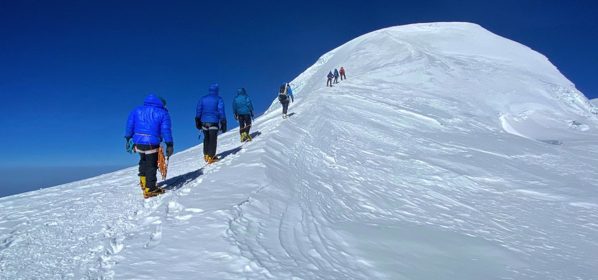
The summit push itself runs for 8 to 12 hours round trip. The guide sets an exaggeratedly slow pace for the first hour to prevent the early altitude mistakes that cause most high-mountain turnarounds. Movement is deliberate, regular, and conserving. The team clips onto fixed ropes on the technical sections and moves methodically. Communication between team members and the guide is constant. The descent begins as soon as the summit is reached and photographs are taken: the mountain has to be left with enough daylight and energy to descend the steepest sections safely.

Accommodation During the Chulu East Peak Climb: Hotels, Teahouses & Camping

This expedition uses four distinct types of accommodation across 22 days, and the shift between them is one of the more striking experiential transitions of the journey. Understanding what to expect at each stage removes surprise and allows proper preparation.


Kathmandu: Hotel Accommodation (Days 1 to 2 and Day 21)

The first two nights and the final night are spent in a comfortable tourist-standard hotel in the Thamel district of Kathmandu. Rooms are en-suite with hot water, Wi-Fi, air conditioning, and breakfast included. The hotel's proximity to the main permit offices and trekking outfitters on Thamel's main lanes is deliberate. Everything needed for the final preparation days is within a 10-minute walk. The standard here is comfortable but not luxurious, designed to provide a proper rest before and after the physical demands of the expedition without encouraging the sedentary hotel lifestyle that is counterproductive to the mindset needed for 22 days in the mountains.


Annapurna Circuit Teahouses (Days 3 to 7 and Days 15 to 21)

The main circuit teahouses range considerably in quality depending on location. In the lower valley settlements like Syange and Dharapani, rooms are basic: a wooden bed with a foam mattress and blankets, a shared bathroom down the hall, cold water only, and a communal dining area heated by a wood or yak-dung stove. By Chame, the administrative capital of Manang district at 2,630 meters, teahouses expand to include private rooms with attached bathrooms and hot showers powered by solar or electric heating.

Manang itself, at 3,540 meters, represents the high point of teahouse quality on the circuit. Several lodge-restaurants in Manang have private rooms with good beds, reliable hot water, charging points, and kitchens producing a wide-ranging menu. The Himalayan Rescue Association clinic operates from Manang during trekking season and is referenced in the acclimatization section below.

Above Manang toward Thorong Phedi, the teahouses simplify again. Yak Kharka and Thorong Phedi operate at altitude with limited infrastructure. Rooms are basic and bathrooms shared. The trade-off is the dramatic open landscape and the absence of the commercial bustle of lower-altitude hub villages.

On the Mustang side after Thorong La, Muktinath and Jomsom both have comfortable lodge options with private rooms, reliable kitchens, and, in Jomsom, functioning ATMs and a small hospital. Kagbeni, passed on the way between the two, is one of the most atmospherically interesting villages on the entire route despite its simple accommodation.

For all teahouse nights, a sleeping bag liner is useful for hygiene, and a personal sleeping bag rated to at least minus 10 degrees Celsius is recommended for the nights above 3,500 meters where teahouse blankets may be insufficient.


Expedition Tenting: Julu Khola to High Camp (Days 8 to 14)

From Julu Khola Meadow camp through the climbing section, all accommodation is by high-altitude camping. The agency provides a complete camp infrastructure: two-person dome tents for sleeping, a separate dining tent large enough for the full team with folding table and chairs, a cook tent, and a toilet tent positioned away from the main camp.

The sleeping tents are high-quality four-season expedition models chosen for wind resistance and thermal retention. At Julu Khola meadow at 3,900 meters, they are comfortably warm by evening with a down sleeping bag. At base camp at 5,000 meters, the temperature inside the tent can approach minus 15 degrees Celsius before dawn. At high camp at 5,500 meters, it will be colder. A sleeping bag rated to minus 20 degrees Celsius is not optional for the high camp nights.

The dining tent is the social and operational center of the camp during the climbing section. This is where the guide briefs the team each evening, where SpO2 readings are recorded, where gear checklists are reviewed, and where the cook produces three meals a day from a portable gas kitchen set up just outside. The quality and variety of camp cooking surprises most first-time expedition clients, who expect field rations and often receive proper hot meals with multiple courses.

Foam sleeping mats are provided at all tent camps. Climbers should bring their own personal sleeping bag, sleeping bag liner, and any comfort items that help them sleep better at altitude, including earplugs against wind noise and a small personal pillow.

Best Time to Climb Chulu East Peak and Trek the Annapurna Circuit

The combination of a 6,584-meter technical summit and a 5,416-meter pass crossing means this expedition has tighter viable seasonal windows than a pure trekking route. Both the Chulu East climb and the Thorong La require stable high-altitude weather conditions. The two primary seasons are spring and autumn, with specific month-by-month notes below.


Spring: March through May

Spring is the single strongest season for this expedition. March through May delivers the combination of stable weather patterns, predictable summit windows, and increasingly warm temperatures that the climbing section demands. April is the peak month.

March is viable from mid-month onward. The lower Marsyangdi valley is cold at night but daytime trekking temperatures are comfortable. The rhododendron forests between Syange and Dharapani are in early bloom, adding exceptional visual richness to the lower trekking days. At altitude, March still carries residual winter snowpack on the Chulu East approach and on the Thorong La, which requires the guide to make current conditions assessments before the high-altitude sections. Crampons are more likely to be needed from the glacier transition upward than in April.

April is optimal across almost every dimension. The jet stream has typically shifted northward enough by mid-April to allow summit windows on peaks above 6,000 meters. The Thorong La is clear of the winter snowpack. Temperature ranges are manageable at all altitudes: cold nights at the high camps but not the extreme minus 25 to minus 30 conditions of February. The lower circuit is warm and the rhododendrons are at their peak bloom. Trail traffic is at its annual high but the Chulu East branch via the Julu Khola is quiet regardless of season, since almost all circuit trekkers continue toward Manang on the main trail.

May is viable through approximately the third week. Pre-monsoon moisture begins building from the Bay of Bengal from around mid-May, generating afternoon cloud and increasing the frequency of brief afternoon precipitation events at altitude. The summit windows on Chulu East become less predictable in the second half of May. The lower circuit is warm, sometimes uncomfortably so at the lower elevations. Expeditions departing in early May can still complete the full itinerary successfully if pacing is managed carefully.


Autumn: September through November

Post-monsoon autumn brings the clearest skies of the year across the Himalaya. The exceptional long-range visibility that follows the monsoon makes the views from the Chulu East summit and from Thorong La more dramatic than at any other time of year. October is the peak autumn month.

September is possible from the last week onward. The monsoon typically withdraws from the Annapurna region in mid-September, but significant residual moisture can affect the upper circuit into early October. Fresh snow on the Chulu East approach and on the Thorong La can be unpredictable in September, requiring current conditions assessment. The lower circuit is lush and green from the monsoon rains, providing a visually rich trekking environment even if the high-altitude conditions are slightly more variable than in October.

October is the strongest autumn month and arguably the single best month of the year for this specific expedition. Stable post-monsoon high pressure delivers clear skies, reliable visibility, and settled conditions on both the climbing route and the pass. Night temperatures at the high camps run from minus 10 to minus 20 degrees Celsius, which is demanding but within the range of properly equipped high-altitude camping. The circuit is at its busiest in October, particularly between Besisahar and Manang, but the Chulu East branch via Julu Khola remains quiet.

November is viable through the first half of the month. By mid-November, the first hints of winter jet stream positioning begin to affect high-altitude conditions, and summit windows on peaks above 6,000 meters become less reliable. The Thorong La can experience early winter snowfall in November. A November expedition requires flexibility in scheduling the summit day and the pass crossing and is best suited to teams with prior high-altitude experience who can make weather-based go/no-go decisions confidently.


Seasons to Avoid

December through February is winter. Sustained jet stream winds above 6,000 meters can reach 80 to 100 kilometers per hour and make the Chulu East summit and the Thorong La extremely hazardous or impassable. The lower circuit is cold but functional. The high-altitude sections are not viable for commercial expeditions.

June through August is monsoon season. The lower Marsyangdi Valley receives sustained heavy rainfall and is subject to landslides that make the road approach and the early trekking days genuinely dangerous. While the Manang district above Chame benefits from a rain shadow effect and receives less precipitation, the approach trail and the Thorong La area remain affected. The climbing route on Chulu East accumulates fresh snow on unstable monsoon bases, significantly increasing avalanche and serac risk. No reputable agency operates commercial expeditions to Chulu East during the monsoon.

Food and Meals on the Chulu East Peak Climbing Route

Food management across 22 days spanning a full-service circuit and a self-contained camping expedition requires significant planning. The agency handles all meal provision, but understanding what to expect at each phase helps trekkers and climbers prepare appropriately and avoid the common mistake of under-eating at altitude.


Teahouse Meals on the Annapurna Circuit

The Annapurna Circuit is one of the best-provisioned trekking routes in Nepal, and the teahouse menus reflect decades of adaptation to international trekker preferences. Dal bhat, the fundamental Nepali meal of rice, lentil soup, vegetable curry, and pickled accompaniments, is the nutritional backbone of the circuit. Most teahouses offer an unlimited refill policy on dal bhat, and the guides encourage using it. The complex carbohydrates support sustained energy at altitude better than most alternatives on the menu.

Beyond dal bhat, the standard Annapurna teahouse menu includes noodle and pasta dishes, momos, potato-based preparations, eggs in multiple styles, soup, and pizza at the more developed establishments in Chame and Manang. The quality narrows toward the higher altitude stops: at Yak Kharka and Thorong Phedi, the kitchen is simpler and the menu reverts to the reliable staples. This narrowing is not a deficiency; it reflects the supply logistics of a small settlement at 4,100 meters, and the reliable options are good.

Breakfast across the circuit covers porridge, eggs, toast, chapati, pancakes, and muesli. The local honey at many Manang district teahouses, collected from hives in the lower valleys, is excellent and worth ordering with any bread dish. Masala tea, black tea, lemon tea, and ginger tea are the hot drink standards. Coffee drinkers will find instant coffee on most menus and espresso at some of the more developed lodges in Chame and Manang.

Caloric intake awareness matters from the moment the trekking begins. The body burns significantly more than its resting baseline when walking six to eight hours at altitude with a daypack. Trekkers who eat conservatively at the start of multi-day mountain trips frequently report energy depletion by the midpoint. Eating the full range of available food at each stop is not indulgence at altitude; it is performance management.


Camp Meals on the Climbing Section

From Julu Khola Meadow through the return to Manang, all meals are prepared by the expedition cook from a fully equipped camp kitchen. The supply chain is planned in Kathmandu and replenished at Chame and Manang before the team branches north. The kitchen carries a combination of fresh ingredients for the first days and longer-duration provisions for the higher camps.

Breakfasts at Julu Khola and Base Camp are the most substantial meals of the camping section: porridge with dried fruit, eggs, Tibetan bread, hot drinks, and fresh or reconstituted fruit. The cook tailors the morning meal to the day ahead. On days before the base camp push or the high camp move, the breakfast is deliberately large and heavy on protein. On rest days, it is lighter and more varied.

Lunches at camp or en route alternate between cooked camp meals and trail food depending on the day's schedule. Soups, dumplings, pasta, and rice dishes appear regularly. The cook carries a reliable portable gas system that functions at altitude with appropriate high-altitude fuel canisters, and hot lunches at 5,000 meters are both possible and planned.

Dinners in the dining tent are three-course where possible: a soup starter, a main of rice or pasta with protein and vegetables, and a sweet finish. The quality of camp cooking by an experienced Himalayan expedition cook consistently surprises new clients. The cook's motivation is not simply contractual; there is genuine professional pride in producing good food at 5,000 meters, and the results reflect it.

At high camp, meals simplify significantly. At 5,500 meters, the appetite suppression caused by altitude is substantial, and the body's ability to digest complex food is reduced. The focus shifts from nutritional variety to caloric density and ease of preparation. Hot soup, instant noodles, energy bars, and hot drinks provide the fuel for the summit push. Climbers should bring personal energy gels, bars, and electrolyte sachets from Kathmandu to supplement the high-camp rations, particularly for carrying on the summit day itself.

Water management throughout the camping section requires attention. At altitude, the body dehydrates faster than at sea level due to increased respiratory rate and the dryness of high-altitude air. The target intake is three to four liters per day from Julu Khola upward. The cook purifies or boils all water used in food preparation. Each climber should carry a personal 1.5-liter water bottle and a purification option (tablets or filter) for trail use.


How Difficult Is Chulu East Peak? Complete Difficulty, Fitness & Experience Guide

This expedition combines two distinct challenge categories with very different physical and technical demands. Anyone considering this package should understand both dimensions before committing, because the combination is significantly more demanding than either component would be alone.


The Annapurna Circuit Trekking Component

The main circuit trekking days rate as moderate to strenuous for experienced hikers. The Thorong La crossing at 5,416 meters is the hardest single day, involving a pre-dawn departure, an 800 to 900-meter altitude gain over six kilometers on a sustained uphill with no rest point until the pass summit, and then a 1,700-meter descent to Muktinath over approximately 10 kilometers of trail that varies from steep snow and ice near the top to rocky scree and sandy desert terrain below. This day is long, cold, and physically comprehensive.

The preceding circuit days, while individually less demanding than Thorong La, accumulate fatigue over multiple weeks. Daily distances range from 10 to 22 kilometers, with elevation gains of 500 to 900 meters per trekking day in the ascending sections. The terrain is non-technical throughout: stone-flagged paths, river-crossing suspension bridges, forested gorge trails, and open high-altitude plateau walking. No ropes, crampons, or climbing hardware are used on the main circuit.

The Thorong La crossing, despite its altitude, is achievable by well-prepared trekkers who have acclimatized properly on the ascent. The key preparation factors are: three to four months of cardiovascular fitness training before departure, including long loaded hiking days; proper acclimatization at each altitude step on the approach; adequate hydration; and a pre-dawn departure that clears the pass before afternoon winds develop.


The Chulu East Climbing Component

Chulu East at 6,584 meters adds a genuinely technical mountaineering component that has no parallel on the main circuit. The peak is consistently graded as requiring moderate technical ability in the Himalayan climbing context, which in practice means the following specific demands.

  • Glacier travel:The approach from base camp crosses the Chulu glacier system. Crampons are worn from the transition onto consolidated snow or ice and remain on through the high camp move and the summit push. Crevasses on the lower glacier are well-defined and the guide marks a safe line, but awareness and footwork appropriate for glaciated terrain are required throughout.

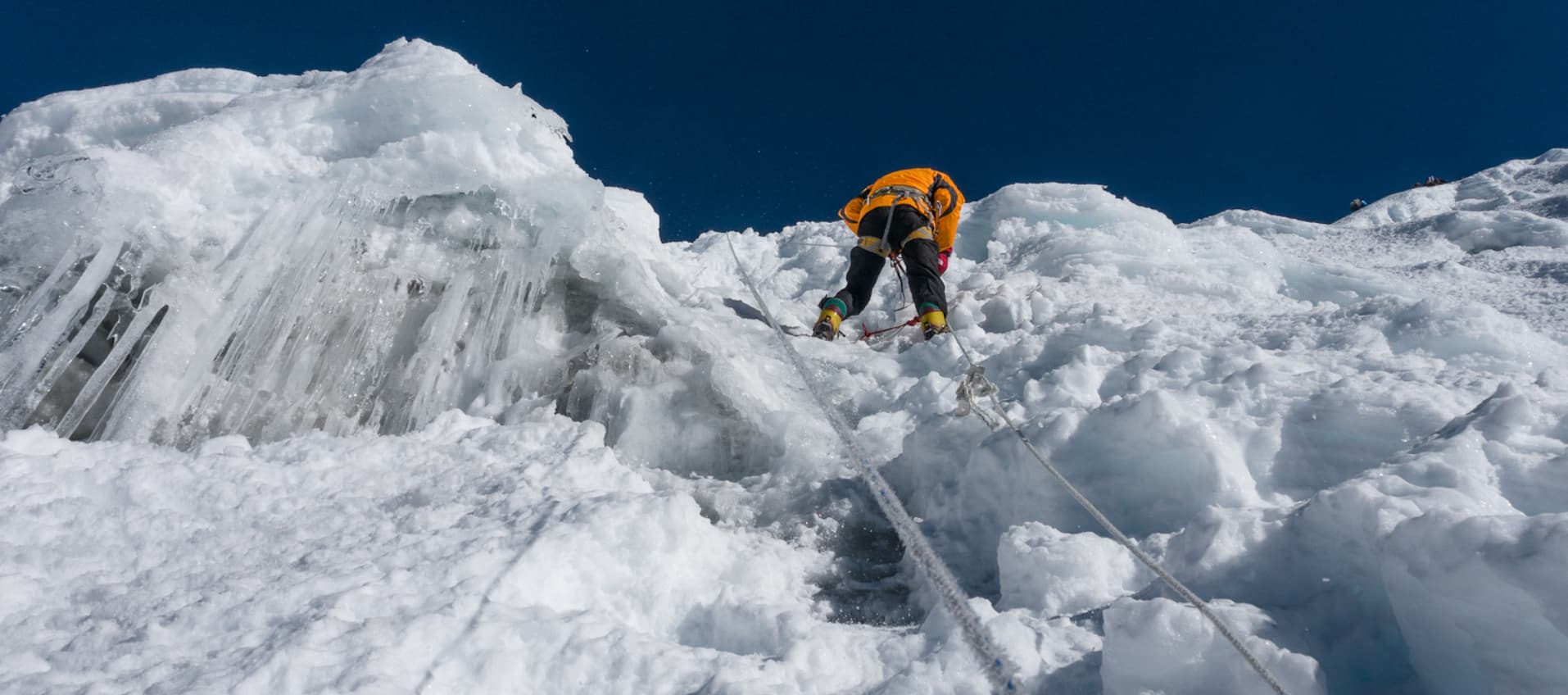
  • Fixed rope technique:The steepest sections of the northeast ridge between base camp and high camp, and from high camp to the summit, are protected with fixed rope installed by the guide team. Climbers ascend these sections clipped in with an ascender device, managing the transitions between rope sections without stopping the team. This technique requires prior practice to execute smoothly at altitude with a loaded pack.

  • Ice axe use:The ice axe is used for balance and as a self-arrest tool throughout the climb. The self-arrest technique, which stops an accidental fall on steep snow or ice, is practiced at Julu Khola but must be understood before departure. An untrained ice axe self-arrest at 45 degrees and 5,800 meters is not a learning environment.

  • High-altitude endurance:The summit push from high camp gains approximately 1,080 meters over a return distance of eight kilometers and takes 10 to 12 hours. At altitudes between 5,500 and 6,584 meters, every physical action requires more oxygen than the body can access efficiently. The ability to sustain deliberate, measured effort over this duration at this altitude is the single hardest physical demand of the expedition.

  • Decision-making under hypoxia:Above 6,000 meters, cognitive performance is measurably affected by reduced oxygen. The ability to assess personal condition honestly, communicate with the guide clearly, and accept a turnaround decision without ego investment is a mental skill that matters as much as any technical ability on summit day.


Prior Experience Requirements

A minimum of one prior Himalayan trekking or climbing peak experience is strongly recommended. Ideal preparation includes a summit of an NMA trekking peak in the 5,500 to 6,200-meter range, such as Island Peak (6,189 m), Lobuche East (6,119 m), or Mera Peak (6,476 m). Any of these provides meaningful preparation in crampon technique at altitude, fixed rope use, high camp living, and the physiological reality of sleeping and climbing above 5,000 meters. A mountaineering skills course, including glacier travel and self-arrest training, is mandatory for anyone without prior technical climbing experience.


Essential Packing List for Chulu East Peak Climbing and the Annapurna Circuit

The equipment list for this expedition divides into two distinct categories: standard trekking gear for the circuit days, and technical mountaineering gear for the Chulu East climbing section. The circuit and climbing gear overlap in some areas (base layers, warm insulation) but diverge significantly in the technical hardware and footwear requirements. Everything on this list is necessary. Nothing on this list is optional.


Clothing System (Circuit and Camp)

  • Moisture-wicking thermal base layers, top and bottom, minimum two full sets. Merino wool performs better than synthetic at altitude for both warmth and odor management over multi-day use without laundry.

  • Mid-weight fleece jacket or softshell: for active use in cooler conditions. This is the layer added and removed most frequently during the trekking days.

  • Heavy insulated down jacket rated to at least minus 15 degrees Celsius: for teahouse evenings, base camp use, and as a layering piece under the down suit on summit day.

  • Waterproof and windproof hardshell jacket with hood: essential for the Thorong La crossing and for storm management at altitude.

  • Waterproof and windproof hardshell trousers: for the Thorong La, the glacier sections, and any wet-weather days on the lower circuit.

  • Down suit (one-piece or two-piece) rated to minus 30 to minus 40 degrees Celsius: for high camp nights and the summit push. This is the single most important cold-weather item on the list and should not be substituted with a down jacket and insulated trousers if the combination does not reach the same warmth rating.

  • Trekking trousers, two to three pairs: for the main circuit days. Quick-drying synthetic is preferred.

  • Thermal hat and balaclava: both, not one. The hat covers standard cold-morning trekking. The balaclava is for the high camp mornings and the summit push when wind chill adds significantly to the cold.

  • Liner gloves, insulated trekking gloves, and expedition mitts: three glove levels for the three distinct temperature environments. Liner gloves for the lower circuit, insulated gloves for the high trekking days and base camp, expedition mitts rated to minus 30 degrees for high camp and summit.

  • Thermal socks, four to five pairs minimum, plus liner socks for the climbing boot section: the blister-prevention combination of a thin liner sock inside the climbing boot is important for the high-altitude days.


Footwear

  • High-altitude double boots or single-boot system rated to minus 30 to minus 40 degrees Celsius and compatible with step-in crampons: this is the most important single equipment item and the one that causes the most problems when not properly fitted. Boots must be broken in before departure, fitted with the socks that will actually be worn on the climb, and tested with the specific crampons being used. A boot that creates a pressure point at sea level will create a significant injury at 6,000 meters.

  • Waterproof trekking boots for the circuit days: different from the mountaineering boots. These cover Days 3 through 7 and the return from Manang through Jomsom and Pokhara. Well broken-in and waterproof with ankle support.

  • Camp sandals or light shoes for teahouse and base camp evenings when the boots come off.

  • Gaiters for snow sections on the Thorong La and the upper climbing route.


Technical Climbing Hardware

  • Crampons compatible with the mountaineering boots: 12-point technical crampons with front points. Must be fitted and tested with the boots before departure. Bring a crampon tool and spare bail wires.

  • Ice axe, 55 to 65 centimeters: a standard technical alpine ice axe. Bring a wrist leash. This item can be rented in Kathmandu at reasonable daily rates from reputable outfitters.

  • Climbing harness: a full-strength mountaineering harness that fits over a down suit. Test this specifically, because a harness fitted for normal clothing may be uncomfortably tight or dangerously loose over bulky high-altitude insulation.

  • Locking carabiners, minimum four: HMS and D-shaped lockers for clipping into fixed ropes, building belay anchors, and managing the harness connection.

  • Ascender device (jumar): for ascending fixed ropes. Right or left-handed to preference. Practice using it before the expedition.

  • Belay and rappel device: for descending fixed ropes on the steeper sections. An ATC-style device or equivalent.

  • Prusik cord, two lengths: as a backup for fixed rope management and emergency use.

  • Climbing helmet: mandatory above base camp. Non-negotiable. Rockfall and ice fall hazards on the northeast ridge make helmet use essential, not optional.


Sleeping and Camp

  • Personal sleeping bag rated to minus 20 degrees Celsius minimum for base camp, and minus 30 degrees for high camp: the agency provides sleeping mats at all camps. Sleeping bags are personal. Rental bags are available in Kathmandu but should be tested and verified to their stated ratings, which is difficult to do for a rental item. Bringing a personal bag with a verified rating is always preferable.

  • Sleeping bag liner: adds warmth and maintains hygiene across both teahouse and tent sections of the expedition.


Navigation, Safety, and Health

  • Headlamp with a minimum of four sets of spare batteries: the pre-dawn summit start and the Thorong La morning departure both require reliable headlamp use for the first one to two hours. Cold at altitude drains batteries significantly faster than at sea level.

  • Trekking poles, both poles: essential on descent sections throughout the circuit. The long downhill from Thorong La to Muktinath places significant load on the knees. Poles distribute that load and protect the joints.

  • High-SPF sunscreen rated 50 or above: UV intensity at altitude and on snow and glacier surfaces is dramatically higher than at sea level. Reapplication every two to three hours on high-altitude days is necessary. Burns occur even on overcast days when snow reflection is present.

  • Glacier sunglasses or goggles with category 4 UV protection: standard sunglasses are insufficient for the glacier and high snowfield sections where 80 to 90 percent of UV radiation reflects upward from the snow surface. Snow blindness is a preventable and genuinely debilitating condition.

  • Lip balm with SPF: the combination of altitude, dry air, wind, and UV reflection causes rapid and severe lip damage on the high-altitude sections. Apply repeatedly throughout each high-altitude day.

  • Personal first aid kit: tailored to the expedition context. Minimum contents: moleskin and blister treatment materials, ibuprofen and paracetamol for altitude headache, anti-diarrhea medication, antihistamine, a compression bandage, antiseptic, and adhesive dressings. The agency carries a comprehensive expedition first aid kit, but personal items for common issues are valuable.

  • Altitude sickness medication: Acetazolamide (Diamox) and Dexamethasone should be discussed with a travel medicine physician before departure. Both are prescription medications in most countries. Diamox is used prophylactically or therapeutically for AMS; Dexamethasone is a treatment for severe AMS or HACE. Having both available for the high-altitude section is responsible preparation.

  • Water purification tablets or a lightweight filter: as a backup to the agency-provided purified water supply. Useful on the independent trekking sections between teahouses.


Electronics and Accessories

  • High-capacity power bank, minimum 20,000 mAh: charging is unavailable for the camping section of the expedition from Julu Khola through the return to Manang. A large power bank covers camera batteries, phone, and GPS device for the six to seven days without grid power.

  • Camera with sufficient battery capacity and memory: the summit of Chulu East and the Thorong La crossing are among the most photographed moments in Himalayan trekking. Cold at altitude drains camera batteries quickly; carry spare batteries in an inside jacket pocket to keep them warm.

  • Personal GPS device or offline mapping app with downloaded Annapurna maps: useful but not mandatory since the guide navigates throughout. Valuable in the Julu Khola section where the trail is marked only by cairns and occasional bootprints.

Safety, Acclimatization & Summit Success on Chulu East Peak

Safety management on this expedition operates across three parallel dimensions: altitude physiology, technical climbing risk, and emergency response capability. The guide team manages all three systematically throughout the 22 days. Understanding the framework is useful for every team member, not just the guide.


The Acclimatization Strategy

The itinerary has been designed around one governing principle: the body cannot be rushed at altitude. Every significant altitude gain is followed by a period that allows physiological adaptation before the next gain. The specific mechanisms are: increased red blood cell production, cardiovascular adjustments, and respiratory pattern changes that collectively improve oxygen delivery to the muscles and brain. These processes require time, typically 24 to 48 hours at each new altitude band before significant further gain is safe.

The ascent through the Marsyangdi Valley from 1,100 meters at Syange to 3,300 meters at Upper Pisang covers approximately 2,200 meters of net altitude gain over five trekking days, an average gain of 440 meters per day. This is within the broadly accepted acclimatization guideline of no more than 500 meters of sleeping altitude gain per day above 3,000 meters.

The acclimatization day at Julu Khola Meadow at 3,900 meters (Day 9) is the most important structured rest day of the expedition. It combines a practical altitude stimulus via the morning hike with genuine recovery time in the afternoon. The technical skills session on this day also serves a secondary acclimatization function by encouraging low-intensity movement at the camp altitude.

The high camp move from 5,000 meters to 5,500 meters (Day 11) is preceded by the acclimatization carry day (Day 10) that takes the team to 5,600 meters and returns them to 5,000 meters for sleep. This is the classic mountaineering acclimatization principle applied at its most effective: reaching a higher altitude during the day drives adaptation, while sleeping at the lower altitude allows the body to consolidate that adaptation during rest.


Daily Monitoring Protocol

The guide uses a calibrated pulse oximeter to measure blood oxygen saturation (SpO2) and heart rate for every team member every evening from Day 7 onward, and additionally in the morning before any altitude gain day from Day 8 upward. The readings are recorded and compared against each individual's baseline and against expected values for the altitude.

Normal SpO2 values decrease predictably with altitude. At 3,900 meters, a well-acclimatized trekker will typically read between 83 and 88 percent. At 5,000 meters at base camp, readings between 78 and 83 percent are expected. At 5,500 meters, 73 to 80 percent. At the summit of 6,584 meters, values between 68 and 76 percent are within the expected range for an acclimatized climber in motion. Any reading that falls significantly below these ranges, or that fails to improve after rest and hydration, is an immediate trigger for protocol review.

No team member ascends to a higher altitude while experiencing worsening altitude sickness symptoms. The cardinal rule of high-altitude medicine is: if in doubt, go down. The guide's safety assessment overrides any individual preference to push higher, and this is communicated clearly to all team members in the Day 2 Kathmandu briefing.


Recognizing Altitude Sickness

Acute Mountain Sickness (AMS) produces symptoms including persistent headache, nausea, reduced appetite, disturbed sleep, and general fatigue. Mild AMS is extremely common above 3,500 meters and usually resolves with rest and hydration at the same altitude without further ascent. The guide monitors for AMS symptoms individually and adjusts pace accordingly.

High Altitude Pulmonary Edema (HAPE) and High Altitude Cerebral Edema (HACE) are the serious, potentially fatal progressions of altitude sickness. HAPE presents as progressively worsening breathlessness, a wet cough, and reduced ability to function at rest. HACE presents as loss of coordination, confusion, inability to walk a straight line, and altered consciousness. Both require immediate descent and emergency medical treatment. These conditions are rare when acclimatization protocols are followed, but the guide is trained in their recognition and response.

Every team member should know the symptoms of AMS, HAPE, and HACE before departure and should self-report any concerning symptoms to the guide immediately rather than waiting to see if they resolve. Early intervention is always preferable to delayed response.


Technical Safety on the Climb

Above base camp, the guide manages a set of fixed technical safety protocols that do not vary based on conditions or team preference. No climber moves on glaciated terrain without crampons when the guide is wearing crampons. Every team member clips onto fixed rope before beginning an ascent on a secured section. Transitions between rope sections are handled one at a time on exposed terrain, with the guide calling each transition. Summit day turnaround time is set the evening before the push and is respected regardless of position on the mountain. The time limit exists because of the energy cost of the descent and the afternoon conditions on the route.

The Himalayan Rescue Association clinic in Manang, which the team passes through on Day 15, provides free altitude sickness consultations and is an excellent resource for the Thorong La section of the expedition. The clinic is staffed by doctors with specific high-altitude medicine training during the trekking season. Stopping for a consultation if any team member has any unresolved questions about their condition is strongly recommended.


Emergency Response

The agency maintains helicopter rescue coordination contact capability through the guide's satellite phone throughout the expedition. This includes the base camp section, where commercial mobile networks are absent. Emergency helicopter evacuation from the Manang and Chulu area is logistically feasible in good weather conditions and typically has a response time of two to four hours from contact to landing.

Helicopter evacuation costs from the Annapurna region can reach USD 5,000 to 8,000 for a single rescue. Travel insurance covering helicopter rescue to the expedition's maximum altitude is mandatory. The policy details, including the 24-hour emergency assistance number, must be shared with the guide before the expedition departs from Kathmandu.

Insurance Requirements for Chulu East Peak Climbing in Nepal

Travel insurance for this expedition is not optional and cannot be organized after arrival in Nepal. The combination of a 6,584-meter technical summit, a 5,416-meter pass crossing, remote camping terrain in an area without road access, and 22 days in the high Himalaya creates a risk exposure that no standard travel insurance policy covers without specific mountaineering extensions. The guide team verifies insurance coverage for every team member before the expedition departs Kathmandu.


Mandatory Coverage Requirements

  • Altitude coverage:The policy must explicitly cover mountaineering or peak climbing to at least 6,600 meters. Many standard travel insurance policies designed for trekkers or adventure travelers cap coverage at 4,000 or 5,000 meters. A policy that caps at 5,000 meters does not cover the Chulu East summit at 6,584 meters or the Thorong La crossing at 5,416 meters and is therefore inadequate for this expedition. Read the altitude clause explicitly before purchasing.

  • Emergency helicopter evacuation:Coverage must include emergency helicopter rescue from the trekking and climbing area with no upper cost cap, or a limit that is adequate for actual Nepal rescue costs. A single helicopter evacuation from the Manang district can cost USD 5,000 to 8,000. Some policies set limits below this threshold. Confirm the evacuation coverage ceiling before purchasing.

  • Medical treatment and hospitalization:In-country medical treatment costs, including hospitalization at Kathmandu hospitals if evacuation is required, should be covered. Kathmandu has several internationally accredited hospitals but treatment costs are significant without insurance.

  • Trip cancellation and interruption:Coverage for trip cancellation due to medical emergencies before departure, and trip interruption due to evacuation during the expedition, protects the financial investment in the package.

  • Delayed and lost baggage:Equipment loss or damage affecting the climbing section can be significant. Mountaineering equipment has high replacement costs.


Policy Exclusions to Check

Insurance exclusion clauses are where most coverage gaps occur. The following specific exclusions should be checked before purchasing any policy for this expedition.

  • Pre-existing medical conditions: most policies exclude coverage for conditions that were diagnosed or treated within a specified period before purchase. Declare all relevant conditions at the time of purchase to avoid claim rejection.

  • Altitude definition: some policies define mountaineering differently from trekking and apply different coverage rules. Confirm that technical climbing with crampons and ice axe above 6,000 meters is explicitly covered, not simply assumed.

  • Guide requirement: some adventure sports policies require that climbing above a certain altitude be conducted with a licensed guide. This expedition meets that requirement, but the policy language should be confirmed.

  • Time limits: some rescue policies require that evacuation occur within a specified time window from the onset of the emergency. In remote mountain terrain, this window may not always be achievable. Confirm the policy does not contain unreasonable time restrictions.


How to Use the Insurance on the Expedition

Before the expedition departs Kathmandu, every team member provides the guide with the following in writing: the insurance company name, the policy number, the 24-hour emergency assistance phone number, and the coverage amount for helicopter evacuation. This information is stored in the guide's satellite phone and in the agency's Kathmandu office records. In the event of an emergency requiring evacuation, the guide contacts the insurance company's emergency line directly to initiate the rescue coordination process.

Team members should also carry printed copies of their insurance policy summary and the emergency contact number in their daypack at all times above base camp. Mobile phone access to digital copies is insufficient in the no-signal zones of the Chulu approach and the high camps.

Reputable providers with established Himalayan expedition coverage include Global Rescue, IMG Global, World Nomads (with mountaineering extension), Austrian Alpine Club insurance (for European residents), and Battleface. Premium costs for 22 days of coverage at the required altitude with full evacuation benefits typically run USD 250 to 500 depending on nationality, age, and the specific coverage levels selected.

Book Your Chulu East Peak Climbing and Annapurna Circuit Adventure Today

The combination of Chulu East Peak Climbing and the full Annapurna Circuit is one of the most complete mountain expeditions available anywhere in Nepal. In 22 days, the journey covers a genuine high-altitude summit at 6,584 meters, the crossing of a 5,416-meter mountain pass, five distinct ecological zones, four Nepali districts, and some of the most culturally and geographically diverse terrain on the planet.

It demands real preparation and real commitment. But for those who arrive fit, with their gear in order and their expectations well aligned with what high-altitude climbing genuinely involves, this expedition delivers an experience that ranks among the most complete adventures available in the Himalaya without entering the domain of fully technical, specialist mountaineering.

Reach out to discuss available departure windows, ask questions about gear and preparation, or begin planning a departure date. A team of experienced guides, climbing Sherpas, and logistics professionals stands ready to help make this expedition a safe and genuinely unforgettable one.


Everything you need to know

Frequently Asked Questions About The Chulu East Peak Climbing and the Annapurna Circuit Trek

Swipe to see more FAQ topics→
→
General
3 Qs

The combination of Chulu East Peak Climbing and the full Annapurna Circuit creates one of the most complete high-altitude adventure itineraries available in Nepal. On its own, the Annapurna Circuit is widely considered one of the finest long-distance trekking routes in the world, passing through five distinct ecological zones, encountering diverse ethnic communities, and culminating in the crossing of the 5,416-meter Thorong La Pass. Add a 6,584-meter technical summit to the middle of that circuit, and the result is a 22-day expedition that combines genuine mountaineering challenge with cultural depth, landscape variety, and two of the Himalayas' most celebrated high points. Very few other itineraries deliver this balance of climbing and trekking in a single, logically structured journey.

No. The Chulu massif contains three separate permitted peaks with distinct characteristics. Chulu East, at 6,584 meters, is the highest and most technical of the three. Chulu West sits at approximately 6,419 meters and is considered somewhat less demanding in technical terms. Chulu Far East, at 6,059 meters, is the lowest and most straightforward of the three peaks. All three permit separate climbing permits issued by the Nepal Mountaineering Association. The route described in this package targets Chulu East, approaching via the Julu Khola valley and ascending via the northeast ridge, the same line taken on the first ascent in 1979.

The Annapurna Circuit passes through four distinct Nepali districts (Lamjung, Manang, Mustang, and Myagdi) and encounters a wide spectrum of ethnic communities. In the lower Marsyangdi Valley, Gurung and Magar communities maintain traditions rooted in the middle hills. As the trail climbs, Tibetan Buddhist culture grows progressively stronger, with Managi people in Manang district maintaining ancient trading rights and cultural practices that date back centuries. After crossing Thorong La, the trail enters Mustang, a culturally Tibetan region that was a separate kingdom until 1795 and retains an almost completely distinct identity. Ancient monasteries, mani walls, butter lamp-lit shrines, and the sound of religious festivals mark the higher sections of the route, giving trekkers and climbers a cultural journey that is as rich as the physical one.

Weather and Temperature
2 Qs

The Annapurna region's weather follows the same general pattern as most of Nepal: spring (March to May) and autumn (September to November) are the prime trekking and climbing seasons, offering the most stable conditions, the clearest mountain views, and the most reliable pass-crossing windows. In spring, daytime temperatures in the lower valleys can reach 15 to 20 degrees Celsius, while nights at altitude drop to minus 5 to minus 15. Autumn brings crisp, post-monsoon clarity and similar temperature ranges. At Chulu East High Camp and on the summit, temperatures in either season can drop to minus 20 degrees or colder with wind chill. On Thorong La Pass, wind and cold are the main concerns regardless of season, and an early-morning crossing (before 10 AM) dramatically reduces the risk of encountering the strong afternoon winds that push up the valley from the Mustang side.

Thorong La Pass becomes significantly more dangerous in winter (December to February) when deep snow and ice accumulate and wind speeds increase. The pass has been the site of serious accidents and fatalities during winter crossings. The monsoon (June to August) brings heavy rainfall to the lower Marsyangdi Valley, making trails slippery, rivers high, and landslides a genuine risk on some sections. However, the upper Manang district and Mustang region lie in the rain shadow of the Annapurna range and receive far less monsoon precipitation than the south-facing valleys. Some experienced trekkers complete the circuit in summer and find the solitude appealing. Chulu East itself should only be attempted in spring or autumn when glacier conditions are at their most stable and predictable.

Arrival and Visas
2 Qs

Nepal visas are available on arrival at Tribhuvan International Airport in Kathmandu, making the process straightforward for most nationalities. The visa-on-arrival desk is located before the immigration counters and accepts cash payments in major currencies including US dollars, euros, and British pounds. A 15-day visa costs USD 30, a 30-day visa costs USD 50, and a 90-day multiple-entry visa costs USD 125. For a 22-day itinerary, the 30-day visa is the appropriate choice. It is advisable to bring passport-sized photos from home, though a photo machine is available at the airport. Indian nationals do not require a visa. Check current entry requirements with the relevant Nepali consulate or embassy before departure, as regulations occasionally change.

After clearing immigration and customs at Tribhuvan International Airport, a team representative will be waiting in the arrivals hall with a name board. The transfer to the hotel in the Thamel area of central Kathmandu typically takes 30 to 45 minutes depending on traffic. The remainder of Day 1 is left free for rest and adjustment. An evening briefing with the guide covers the itinerary, permit documents, gear requirements, and practical logistics for the drive to Syange the following morning. Any final gear items or personal equipment can be purchased or rented from the many trekking shops in Thamel, which are a short walk from most Thamel-area hotels.

Trek Cost
3 Qs

A complete Chulu East Peak Climbing and Annapurna Circuit package covers airport transfers in Kathmandu, hotel accommodation in the city with breakfast, all transportation to and from the trekking start point, three meals per day throughout the trek and climb, teahouse accommodation along the Annapurna Circuit sections, camping equipment and tents for the climbing section from Julu Khola to High Camp, all required permits (Annapurna Conservation Area Permit, TIMS card, and Chulu East NMA climbing permit), group climbing equipment such as fixed ropes and hardware, the services of a licensed trekking guide and climbing guide, and porter support for the duration. Government taxes and service charges are included.

Several expenses fall outside a standard package. International flights to and from Kathmandu, Nepal visa fees, and comprehensive travel insurance are universally excluded. Personal trekking and climbing gear including mountaineering boots, crampons, harness, ice axe, and helmet must be brought or rented separately. Personal expenses along the route, including hot showers, battery charging, Wi-Fi, bottled drinks, and alcoholic beverages, add up to USD 10 to 20 per day depending on usage. Emergency evacuation is covered by personal insurance rather than the package. Tips for the guide and porter team are customary and typically amount to USD 8 to 15 per day for the lead guide and USD 5 to 10 per day for porters. A realistic additional personal budget of USD 400 to 600 beyond the package price covers most eventualities for the majority of trekkers.

Three permits apply to this combined itinerary. The Annapurna Conservation Area Permit (ACAP) costs NPR 3,000 per person (approximately USD 25 to 30) and is required for the full Annapurna Circuit section. The TIMS (Trekkers' Information Management System) card costs NPR 2,000 per person (around USD 20) and applies to trekkers in most controlled trekking areas of Nepal. The Chulu East NMA climbing permit, issued by the Nepal Mountaineering Association, is the most significant permit cost and varies by season: spring season (March to May) costs approximately USD 350 per person, autumn (September to November) approximately USD 175, and winter/summer rates are lower still. All permits are arranged through the trekking agency before departure; individual climbers cannot apply independently.

Who Can Trek?
2 Qs

The combined Chulu East Peak Climbing and Annapurna Circuit is suitable for trekkers and climbers who have prior high-altitude trekking experience and a solid level of fitness, but it does not require advanced technical mountaineering credentials. The Annapurna Circuit sections are non-technical trail walking, though some days are long and the Thorong La crossing demands real stamina. For the Chulu East climb itself, prior familiarity with the use of crampons, an ice axe, and a basic harness is strongly recommended. Climbers who have previously trekked to 4,000 meters or above, or who have attempted or completed other trekking peaks in Nepal, will be better prepared for the demands of this itinerary than complete beginners. The guide team provides on-site training at the Julu Khola acclimatization camp, but technical skills cannot be taught from scratch during the expedition itself.

There is no fixed universal minimum age for trekking in Nepal, but most experienced operators recommend at least 16 years of age for the Chulu East climbing component, given the glacier travel, pre-dawn summit conditions, and the extended altitude exposure involved. Fit adults of all ages have successfully completed both the Annapurna Circuit and the climb, though older trekkers should be aware that acclimatization responses tend to be somewhat slower with age. Anyone with pre-existing cardiovascular or respiratory health conditions should consult a doctor before booking and should be fully transparent with the guide team about those conditions before the expedition begins.

Physical Fitness
2 Qs

Physical fitness for this expedition should be taken seriously. The itinerary involves 22 days of consecutive activity, with daily walking times ranging from three to eight hours and two extremely demanding days on the summit push and the Thorong La crossing. The most effective training for this kind of sustained trekking and climbing is consistent aerobic exercise over several months before the trip, not a sudden burst of exercise in the weeks before departure. Long hikes with a loaded daypack on consecutive days are the most directly transferable training possible. Stair climbing, cycling, swimming, and running all contribute to the cardiovascular base needed. Strength in the legs and core supports the long descent days. Beginning a structured training programme at least three to four months before departure, gradually increasing weekly load, gives the body adequate time to adapt and reduces the risk of injury.

Three days stand out as the most physically demanding of the 22. Summit day on Chulu East (Day 12) begins in the pre-dawn cold and involves ten to twelve hours of climbing at extreme altitude, with sustained effort above 6,000 meters where oxygen is less than half of sea-level concentration. The crossing of Thorong La Pass (Day 18) involves an early start and seven to eight hours of demanding trekking with 800 meters of ascent followed by over 1,500 meters of descent, all at high altitude. The approach to Chulu East Base Camp (Day 10), gaining nearly 1,100 meters in a single day at high altitude, is also notably taxing. All three of these days come after significant prior altitude exposure, which helps, but they nonetheless demand real reserves of fitness and mental determination.

Trek Preparation and Packing
2 Qs

The climbing section from Julu Khola to the summit requires a separate packing strategy from the main trekking portion. A sleeping bag rated to at least minus 20 degrees Celsius is essential for High Camp. Mountaineering boots capable of accepting crampons (not standard hiking boots) are mandatory. Crampons, a climbing harness, an ice axe, a helmet, and a locking carabiner form the core personal climbing hardware. Layering for extreme cold is critical: thermal base layers, a warm mid-layer fleece, an insulated down jacket, and a windproof shell should all be in the pack before leaving Base Camp. Heavy insulated gloves or mittens are needed for the summit push, and goggles rather than sunglasses are advisable in windy summit conditions. Headlamp with spare batteries is essential for the pre-dawn start. All personal climbing gear can be rented from reputable shops in Thamel if bringing items from home is impractical.

For the trekking sections of the circuit, standard high-altitude trekking gear applies. Good quality waterproof hiking boots that are well broken in before the trip are the most important single item. A daypack of 25 to 35 liters carries daily essentials while porters handle the main bags. A rain jacket and rain cover for the pack are important in the lower valley sections and during any unexpected weather. Sun protection (high-SPF sunscreen, UV-blocking sunglasses, and a wide-brimmed hat) becomes increasingly important as altitude rises. Trekking poles make a meaningful difference on the steep descents. A lightweight sleeping bag liner adds warmth in teahouses at higher elevations. Bring sufficient layers for temperatures ranging from warm subtropical afternoons in the lower Marsyangdi Valley to genuinely cold nights above 4,000 meters.

Trek Accommodation
2 Qs

The Annapurna Circuit is one of the best-served trekking routes in Nepal for teahouse infrastructure. From Syange all the way through to Jomsom and beyond, comfortable family-run lodges with twin-sharing rooms, attached or shared bathrooms, and dining areas with wood-burning stoves operate throughout the main trekking season. Room quality improves significantly in larger settlements like Chame, Manang, and Jomsom, where higher-end lodges with en-suite bathrooms, hot water, and even satellite Wi-Fi are available. Smaller villages like Dharapani and Yak Kharka have basic but clean accommodation. Hot showers are available almost everywhere for a small additional fee. The teahouses in Manang have become particularly well-developed, offering bakeries, well-stocked small stores, and dining rooms with a wide selection of food.

From Julu Khola Meadow onward through the climbing section, all accommodation is in tents provided and set up by the expedition team. The Julu Khola camp itself is a high mountain meadow, and the camps above it at Base Camp and High Camp are established on moraine and snow terrain. The climbing team provides dome tents, sleeping mats, a kitchen tent, and a dining tent. All meals during the camping section are prepared by the kitchen crew. Climbers need their own high-specification sleeping bag, as conditions at High Camp are extremely cold. The camping section covers approximately six to eight nights depending on the summit schedule and weather, after which the return to Manang brings everyone back into comfortable teahouse accommodation on the Annapurna Circuit route.

Health and Safety
3 Qs

Altitude sickness is a genuine and manageable risk on this expedition. The route spends multiple days above 4,000 meters, including the Chulu East summit at 6,584 meters and Thorong La at 5,416 meters, both of which are above the altitude at which Acute Mountain Sickness becomes a serious concern. The itinerary includes built-in acclimatization stages, including an acclimatization day at Julu Khola before the climb, a full two-day climbing period at Khare-equivalent levels, and a gradual ascent through the Marsyangdi Valley that allows progressive adaptation. Despite this, individual responses to altitude vary significantly, and no amount of careful planning guarantees that a specific person will not develop symptoms. The guide team carries a pulse oximeter to monitor oxygen saturation daily above 3,500 meters, and the Himalayan Rescue Association operates a clinic in Manang during trekking season. Immediately descending at the first sign of serious symptoms is always the correct response.

Comprehensive travel insurance with explicit coverage for high-altitude mountaineering to at least 6,600 meters is mandatory for this expedition. Standard travel insurance or basic trekking policies that cap coverage at 4,000 or 5,000 meters are not sufficient. The policy must cover emergency helicopter evacuation, since this is the only realistic rescue option from the Chulu East climbing section or the upper Annapurna Circuit. A helicopter evacuation from the Manang area or from near Thorong La can cost USD 4,000 to 8,000 without insurance. Policies from providers such as World Nomads, IMG Global, and Global Rescue commonly cover the required altitudes and rescue operations, but the policy documents should be read carefully for altitude exclusions before purchase. Printed and digital copies of the policy, including the emergency contact number, should be provided to the lead guide before the trek begins.

The guide team is trained to recognize the symptoms of Acute Mountain Sickness and to manage appropriate responses. Early symptoms include persistent headache, nausea, loss of appetite, disturbed sleep, and unusual fatigue. Communicating any of these symptoms to the guide immediately is essential: suppressing or hiding symptoms to avoid slowing the group down is one of the most common causes of preventable high-altitude fatalities. The standard response to early symptoms is to pause, rest, and hydrate without further ascent. If symptoms do not improve within a rest period, or if they worsen at all, descent to a lower altitude is the only reliable treatment. Medication such as Acetazolamide (Diamox) can help manage mild symptoms but is not a substitute for descent in serious cases. Consult a doctor before the trip about whether prophylactic Diamox is appropriate for you.

Practical Matters
2 Qs

Nepal's currency is the Nepali Rupee (NPR). US dollars, euros, and British pounds can be exchanged at banks and exchange counters in Kathmandu and Pokhara. ATMs are widely available in Kathmandu and Pokhara. Along the Annapurna Circuit trail, ATMs exist in Besisahar and Chame but are unreliable and often out of cash during peak season. It is essential to carry sufficient Nepali Rupees in cash before leaving the last major town on the trekking route. For personal expenses on the trail (hot showers, drinks, battery charging, Wi-Fi), a daily budget of approximately NPR 1,500 to 2,500 is reasonable for most trekkers. Bring a small amount of USD for the Nepal visa on arrival.

Mobile phone coverage in Nepal has expanded significantly and now reaches many points along the Annapurna Circuit, though it remains patchy in the more remote sections near Chulu East and in the high camps. Providers such as Ncell and NTC offer the best coverage on this route; a local SIM card purchased in Kathmandu for USD 5 to 10 is far more cost-effective than international roaming. Wi-Fi is available in most teahouses throughout the Annapurna Circuit for a small daily fee, though connection speeds slow considerably at higher altitudes and are unavailable entirely during the camping section of the climb. Power banks are useful for keeping devices charged during multi-day camping periods.

Transportation and Flights
2 Qs

The trek begins in Syange, in the Marsyangdi Valley of the Lamjung district. The most common approach is a private vehicle or tourist bus from Kathmandu, a journey of approximately seven to nine hours covering around 180 kilometers. The road follows the Prithvi Highway before turning north toward Besisahar and continuing up the Marsyangdi Valley. Road conditions in this area have improved over recent years but can still be rough in places, particularly after the monsoon season. All transport from Kathmandu to Syange and back is arranged by the trekking agency and included in the package. Individual climbers do not need to arrange their own transport.

From Jomsom, the fastest option is a short 20-minute domestic flight to Pokhara, from where a connecting bus or flight continues to Kathmandu. Jomsom has an active airstrip served by Twin Otter aircraft and small propeller planes, and flights to Pokhara operate most mornings in good weather. Mountain flights at Jomsom are subject to weather cancellation, particularly in the afternoon when winds in the Kali Gandaki valley become strong. The road from Jomsom to Pokhara via Beni is an alternative for those who prefer not to fly, taking approximately five to six hours. Whichever option is used for Day 20, the package includes the arrangement, though individual flight disruptions due to weather are covered by personal travel insurance rather than the package itself.

Chulu East Peak Climbing and the Annapurna Circuit Trek Departures

Select Departure Date

Trip duration: 22 Days

Aug - Sep 2026

August 2026

Su
Mo
Tu
We
Th
Fr
Sa
1
2
3
4
5
6
7
8
9
10
11
12
13
14
15
16
17
18
19
20
21
22
23
24
25
26
27
28
29
30
31

September 2026

Su
Mo
Tu
We
Th
Fr
Sa
1
2
3
4
5
6
7
8
9
10
11
12
13
14
15
16
17
18
19
20
21
22
23
24
25
26
27
28
29
30
Your Trip
USD 2,689SAVE $159
USD 2,530/ person

Best Price Guaranteed

2-3 People
USD 2,550/ Person
4-7 People
USD 2,530/ Person
8-13 People
USD 2,510/ Person
14-22 People
USD 2,495/ Person
23-28 People
USD 2,455/ Person
CUSTOMIZE TRIP

Speak to an Expert

Laxmi Malla
Hari Kumar Shrestha
Himal Shrestha
Shiva Kumar Shrestha
UR Ghale

Himal Shrestha

Director 🇳🇵

Chat on WhatsApp

Meet Our Expert Guides

Ongchhu Sherpa

Ongchhu Sherpa

Peak Climbing Guide

15 years of experience

Meet the Legendary Mr. Ongchu Sherpa, our expert peak climbing guide. He is an experienced climber with a passion for adventure and a wealth of knowledge in the Himalayas. Ongchu Sherpa is a professional climber who has accomplished many notable summits, especially Mera Peak, Island Peak, and Lobuche Peak. His deep familiarity with the mountains and his unwavering commitment to professionalism and safety make him a priceless colleague on our team.
Lakpa Sherpa

Lakpa Sherpa

Climbing Guide

16 years of experience

Lakpa Sherpa is a seasoned mountaineer with a remarkable history of climbing numerous mountain peaks with groups and climbers from all over the world. He has more than ten years of experience and is widely regarded as one of the most trustworthy hiking and climbing guides. Peaks such as Tukuche, Island Peak, Mera Peak, Everest, Kanchenjunga, Makalu, and Lobuche are among those he has successfully ascended.
Kipa Sherpa

Kipa Sherpa

Climbing Guide

17 years of experience

Kipa is an experienced climber working as a climbing guide and has been active in this sector since 2006. He evaluates your capability for climbing and mountaineering and guides you to snowy summits accordingly. With an extensive background in climbing and mountaineering, he has successfully completed the ascent of 7000-meter massifs on multiple occasions.
Rengi Lakpa Sherpa

Rengi Lakpa Sherpa

Climbing Guide

18 years of experience

Rengi Lakpa Sherpa was born in the Makalu region and has completed the ascent of Mount Everest twice, along with summiting a number of other notable mountains. He has climbed a significant number of peaks in Nepal and Tibet and leads expeditions as a professional trek and climbing leader.

Now Offering 100% Private Treks

Explore Nepal's breathtaking trails at your own pace with our exclusive private treks. No strangers, no rushed schedules—just you, your adventure, and complete flexibility. Enjoy personalized itineraries, expert guides, and a safety-first approach designed for unforgettable experiences.

Tailor-Made Itineraries

Plan your trek exactly how you want it. Choose destinations, duration, and activities that suit you.

Dedicated Guide & Porter

Enjoy expert guidance and personal assistance every step of the way.

Safety & Health Focus

We ensure proper acclimatization, medical support, and emergency readiness.

Flexible Scheduling

Pick your own travel dates and move at a pace that suits your adventure style.

Privacy & Comfort

Ideal for couples, families, and friends who want a fully private experience.

Discover Your Private Trek