Essential Info
Nepal Trekking: Essential Information for Every Traveler
Every person who has ever trekked seriously in Nepal will tell you that the planning matters as much as the walking. The routes themselves are well-established, the tea house system works, and the mountains are not going anywhere. What separates a frustrating trip from a genuinely transformative one is usually the quality of the preparation that happened months earlier: whether you understood the permit system before you arrived at the checkpoint, whether your boots were broken in before day one, whether you knew what altitude sickness actually feels like versus what it feels like to be tired, whether you budgeted realistically for a two-week absence from your normal life.
This guide brings together the practical information that applies to all trekking in Nepal regardless of which specific route you choose. The seasonal patterns, the trekking regulations, the costs, the gear requirements, the physiology of altitude, the guide regulations, and the communication realities are all covered here in the detail that the individual region guides do not repeat. Read this page first, then move into whichever regional guide covers your intended route: the Annapurna region, Langtang, Manaslu, or the peak climbing section. Together they give you the complete picture.
Trekking Seasons: A Complete Month-by-Month Reference
The single most important planning decision for any Nepal trek is timing. Get the season wrong and you are either fighting monsoon mud and leeches in the lower gorges, sitting in cloud that refuses to lift for a week at altitude, or managing frostbitten toes in a tea house that has run out of gas. Get it right and the conditions feel almost engineered for the purpose: dry trails, clear air, extraordinary mountain light, and nights cold enough to sleep properly without being dangerous.
Nepal's climate is governed by the monsoon, which arrives from the Bay of Bengal in early June, intensifies through July and August, and retreats by mid to late September. This monsoon cycle divides the year into two primary trekking windows and two shoulder or off-season periods. Within those broad categories, meaningful differences exist between months and between regions.
October is universally regarded as the finest trekking month in Nepal. The monsoon has fully cleared, the air carries the kind of transparency that makes distant peaks appear impossibly sharp, temperatures at mid-elevation are comfortable during walking hours, and the post-rain landscape is intensely green in the lower forest zones. October is also when Dashain falls, Nepal's most important Hindu festival, which adds cultural richness to any itinerary that passes through villages during the celebration period. The practical consequence of October's quality is that popular routes see their highest visitor numbers, and tea house bookings in peak locations should be secured in advance.
November extends the autumn window with colder nights and light snow beginning to accumulate on the higher passes by late in the month. The trail traffic is lower than October and the mountain views remain excellent. Trekkers who prioritize solitude over optimal temperatures find November the better choice, with the caveat that some high-elevation tea houses close as the season ends and pass crossings on routes like the Manaslu Circuit require monitoring for early snowfall.
March and April constitute the spring window. The rhododendron forests between roughly 2,000 and 3,500 meters bloom through April in a display that changes the character of the walk through the lower valleys completely. Mountain views are generally good in the mornings before afternoon cloud builds, which becomes more pronounced as April extends into May. The pre-monsoon haze of late May reduces visibility noticeably. April is the sweet spot for spring trekking, offering a combination of warm lower-valley temperatures, active birdlife, flowering forest, and adequate mountain clarity.
May is warm and increasingly humid in the lower sections, with afternoon clouds becoming a daily feature. It is trekable but not the first choice for photography-focused itineraries. December through February is cold throughout the trekking zones, with serious snowfall on the higher passes and some tea houses above 3,500 meters closing for the winter. The passes of the Annapurna Circuit (Thorong La, 5,416 meters) and Manaslu Circuit (Larkya La, 5,106 meters) are crossable in winter with appropriate gear, experienced guides, and flexibility around weather windows, but the margin for error is considerably smaller than in the main seasons.
June through mid-September is the monsoon. The popular trekking zones in the Khumbu, Annapurna, and Langtang regions receive heavy rain through this period. Trails in the lower forest zones become slippery and leech-infested. Mountain views are frequently obscured for entire days. The areas north of the main Himalayan ridge, including Upper Mustang and the Manaslu valley above Samdo, lie in the rain shadow and receive significantly less monsoon precipitation, making them a legitimate option for trekkers with flexible timing who accept the occasional overcast day. The monsoon is not a binary on-off event; it starts in the southeast and retreats in the same direction, so the far western and northern zones see it later and lose it earlier.
|
Month |
Season |
Annapurna |
Everest / Khumbu |
Langtang |
Manaslu |
|
Jan |
Winter |
Cold, Thorong La icy |
Cold, clear, quiet |
Cold, some lodges closed |
Very cold, limited lodges |
|
Feb |
Winter |
Warming, still cold high |
Good, less crowded |
Cold improving |
Cold improving |
|
Mar |
Spring |
Rhododendron bloom begins |
Good, pre-season |
Rhododendron bloom |
Good conditions |
|
Apr |
Spring |
Peak bloom, excellent |
Peak season, crowded |
Best spring month |
Excellent, less traffic |
|
May |
Pre-monsoon |
Hazy, cloud builds |
Expedition season, warm |
Cloud builds afternoon |
Pre-monsoon haze |
|
Jun |
Monsoon |
Rain, leeches, muddy |
Rain, poor views |
Heavy rain, leeches |
Upper valley OK, lower wet |
|
Jul-Aug |
Monsoon |
Not recommended |
Not recommended |
Not recommended |
Rain shadow areas viable |
|
Sep |
Late monsoon |
Clears mid-late Sep |
Clears mid-late Sep |
Clears mid-late Sep |
Clears mid-late Sep |
|
Oct |
Autumn |
Best month, crowded |
Best month, very crowded |
Best month |
Best month, peak fees |
|
Nov |
Autumn |
Excellent, cooling |
Excellent, fewer people |
Excellent, quiet |
Good, snow risk late Nov |
|
Dec |
Winter |
Cold, some lodges close |
Cold, quiet, beautiful |
Cold, limited lodges |
Very cold, difficult |
Physical Fitness: What Is Actually Required
The question of how fit you need to be for Nepal trekking produces more wishful thinking than honest assessment in most published material. The honest answer is that it depends entirely on which route you are planning, and that the required fitness level for any route above 4,000 meters is higher than most people who have not trekked at altitude before can accurately self-assess from the lowlands.
For the shorter, lower routes such as the Ghorepani Poon Hill circuit (maximum elevation around 3,200 meters, four to five days) and the lower sections of the Langtang Valley trek, a person who walks regularly and can manage three to four hours of moderate hiking with a daypack is a reasonable candidate. These routes do not involve glacier travel, high passes, or sustained days above 3,500 meters. Fitness here is about comfortable walking, not athletic performance.
For the Annapurna Base Camp trek (maximum elevation 4,130 meters, seven to twelve days), the Langtang Valley with acclimatization hikes to Tserko Ri (4,985 meters), and the Everest Base Camp route (5,364 meters, twelve to fourteen days), you need to be in genuinely good cardiovascular condition with the ability to walk uphill for five to seven hours with a daypack without significant distress. This is a meaningful threshold, and the preparation needed to reach it comfortably is at least eight to twelve weeks of consistent training beginning from a baseline of moderate fitness.
For the Manaslu Circuit (maximum elevation 5,106 meters at Larkya La, nine days in the rapid format), the Annapurna Circuit with Thorong La (5,416 meters), and peak climbing objectives like Island Peak (6,189 meters) and Mera Peak (6,476 meters), you need to be in the kind of physical shape that comes from sustained, deliberate training over several months. The summit days on these objectives involve eight to twelve hours of continuous physical output at elevations where each step costs significantly more effort than the equivalent at sea level. Cardiovascular fitness, load-bearing leg strength, and mental resilience under physical discomfort are all relevant.
A practical training framework for moderate to serious trekking should include the following components. The foundation is long aerobic sessions on hilly terrain with a loaded daypack, building progressively to at least one six to eight hour hike per week in the final six weeks before departure. Running, cycling, or swimming three to four times per week builds the cardiovascular base. Weighted stair climbing or step-ups specifically address the eccentric quad and hip flexor strength needed for long descents, which is where most trekking knee problems originate. Core stability training, two to three times per week, improves balance on uneven ground and reduces back fatigue under pack weight. If you have access to altitude or can arrange a preparatory trek to 3,500 to 4,500 meters before your main objective, do it. Knowing how your body responds to altitude before you commit to a high route is genuinely valuable information.
The Mandatory Guide Regulation: What It Means for You
Nepal introduced a mandatory guide regulation effective April 1, 2023, requiring all foreign trekkers to be accompanied by a licensed guide when walking in national parks, conservation areas, and restricted zones. The regulation was introduced primarily for safety reasons: Nepal's search and rescue infrastructure receives 40 to 50 reports of missing or overdue trekkers annually, and the government's position is that the presence of a licensed local guide reduces both the frequency of emergencies and the response time when they occur. The regulation also creates employment in local guiding communities.
The practical current situation as of 2026 is that the mandatory guide rule is enforced at checkpoints on all major regulated trekking routes, including the Annapurna Conservation Area, Langtang National Park, Sagarmatha National Park (Everest region), and the Manaslu Conservation Area. Trekkers found at checkpoints without a licensed guide face fines of NPR 12,000 or higher, immediate removal from the trail, and in some cases restrictions on future permit applications. The regulation applies to foreign nationals regardless of experience level.
One important exception: the Khumbu Pasang Lhamu Rural Municipality, which governs the lower Everest region trail through Lukla and Namche Bazaar, opted out of the mandatory guide regulation and permits solo trekking without a guide on this specific section. Once you enter Sagarmatha National Park above Monjo, the standard national park rules apply. This exception creates some ambiguity on the Everest Base Camp route that is worth clarifying with your agency before departure.
The case for hiring a licensed guide goes well beyond legal compliance. An experienced guide on the Manaslu Circuit or in the Langtang valley has walked the route dozens or hundreds of times, knows which tea houses are reliably clean and which sections of trail deteriorate in specific weather conditions, can read your physical state and make altitude safety decisions with genuine authority rather than optimism, speaks the local languages and dialects that enable real cultural engagement rather than transactional interactions, and carries both the equipment and the established rescue contacts to manage a serious emergency faster than any independent trekker could. The guide is not an optional extra to the experience. On a serious Himalayan route, the guide is part of the experience.
Realistic Cost Breakdown for Nepal Trekking
Nepal is frequently described as an affordable destination, which is true at the budget end but misleading as a general statement. The total cost of a serious trekking trip, including international flights, permits, guide and porter fees, accommodation, food, gear, and insurance, is not trivial. Understanding where the money actually goes allows for realistic planning rather than arriving with insufficient funds and having the options narrow at exactly the wrong moment.
The table below represents realistic 2025 to 2026 daily and trip-level costs for the primary expense categories. Figures are in US dollars unless otherwise noted and represent what a foreign national traveling on a standard organized package should expect. Budget-end figures assume shared rooms, Dal Bhat twice daily, and the minimum required services. Mid-range figures assume a private guide, one porter per two trekkers, private rooms where available, and a reasonable food variety. The figures exclude international flights and travel insurance, which are addressed separately.
|
Expense Category |
Budget |
Mid-Range |
Notes |
|
Tea house accommodation |
USD 5–10/night |
USD 10–25/night |
Higher prices above 3,500 m; private rooms cost more |
|
Food (3 meals per day, on trail) |
USD 15–20/day |
USD 25–35/day |
Prices increase with elevation; free Dal Bhat refills standard |
|
Licensed trekking guide |
USD 25–30/day |
USD 30–40/day |
Includes guide's food, accommodation, and insurance |
|
Porter (per 2 trekkers) |
USD 15–20/day |
USD 20–25/day |
One porter carries up to 20 kg for two clients |
|
TIMS card |
NPR 2,000 (~USD 15) |
NPR 2,000 (~USD 15) |
NPR 1,000 for registered group bookings |
|
National park / conservation permit |
USD 20–30 |
USD 20–30 |
Per permit; most routes require one or two permits |
|
Manaslu Restricted Area Permit |
USD 100 first 7 days (peak) |
USD 100 first 7 days (peak) |
USD 75 off-peak; USD 15/day thereafter |
|
Hot shower at tea house |
NPR 300–500 |
NPR 300–500 |
USD 2–5; often a bucket rather than pressurized shower above 3,500 m |
|
Device charging at tea house |
NPR 100–300 |
NPR 100–300 |
Per session; unavailable at some high elevations |
|
Bottled water (per liter) |
NPR 100–300 |
NPR 100–300 |
Increases with elevation; use purification to avoid cost and plastic |
|
Guide tip (customary) |
USD 10–15/day |
USD 10–15/day |
Standard expectation; not included in package fees |
|
Porter tip (customary) |
USD 7–10/day |
USD 7–10/day |
Per porter per day of trek; meaningful component of their income |
|
Kathmandu accommodation (per night) |
USD 20–40 |
USD 50–100 |
3-star equivalent in Thamel; rates vary by season |
|
Private jeep (Kathmandu to trailhead) |
USD 120–180 per vehicle |
USD 150–250 per vehicle |
Split across group; route-dependent |
|
Domestic flight (Kathmandu to Pokhara) |
USD 80–120 one way |
USD 80–120 one way |
Book in advance; prices rise with proximity to travel date |
|
Domestic flight (Kathmandu to Lukla) |
USD 180–220 one way |
USD 180–220 one way |
Weather-dependent; frequent delays |
|
Travel insurance (high altitude) |
USD 80–150 per trip |
USD 100–200 per trip |
Must cover helicopter evacuation to your summit elevation |
|
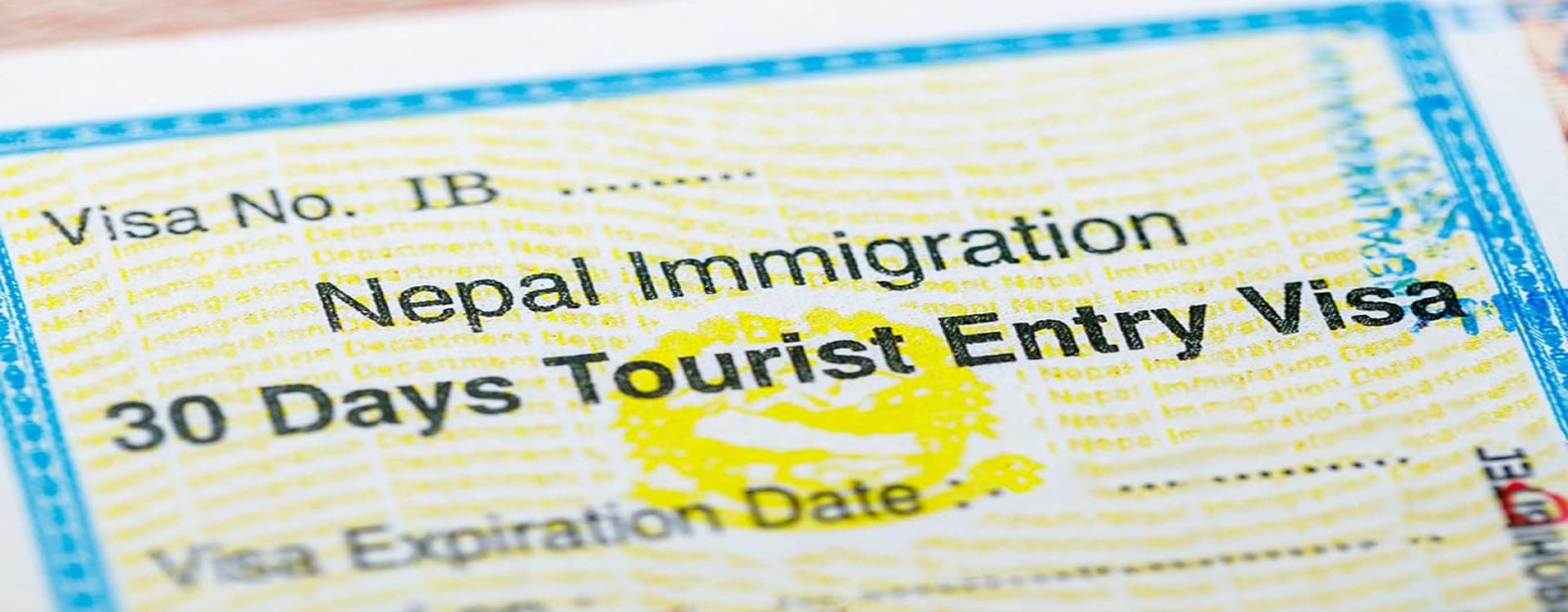
Nepal tourist visa (30 days) |
USD 50 |
USD 50 |
Payable in USD cash on arrival at TIA |
For a nine to fourteen-day organized trek at mid-range level, not including international flights, total in-Nepal costs typically run between USD 1,200 and USD 2,500 depending on route, season, and whether you include Kathmandu accommodation and domestic flights. Peak season surcharges of 20 to 30 percent on guide and porter fees are common in October. Tips are not included in any package fee and should be budgeted separately.
Altitude Sickness: A Complete Guide
Altitude sickness is caused by ascending too quickly for the body to compensate for reduced atmospheric oxygen. At sea level, each breath delivers oxygen at a partial pressure of approximately 159 mmHg. At 5,000 meters, that partial pressure is around 79 mmHg, roughly half. The body responds through a series of physiological adaptations: increased respiratory rate, increased heart rate, elevated production of erythropoietin (which stimulates red blood cell generation), and shifts in blood chemistry that allow more efficient oxygen delivery to tissues. These adaptations take days to weeks to develop. The problem occurs when the rate of ascent outpaces the rate of adaptation.
Acute Mountain Sickness (AMS) is the early form of altitude illness. Symptoms include a headache that worsens with exertion, fatigue beyond what the day's walking explains, nausea, poor appetite, dizziness, and disrupted sleep. AMS commonly appears in the first 12 to 24 hours after arriving at a new altitude. Mild AMS is extremely common above 3,000 meters and is not dangerous in itself; the danger lies in continuing to ascend while symptomatic rather than resting or descending until symptoms resolve.
High Altitude Pulmonary Edema (HAPE) is a potentially fatal accumulation of fluid in the lungs. It develops when the capillaries of the lung respond to altitude-induced hypoxia by leaking fluid into the alveolar spaces, progressively reducing the lung's ability to exchange oxygen. Symptoms include breathlessness at rest or with minimal exertion, a persistent cough that may produce frothy or pink-tinged sputum, and severe fatigue. Resting heart rate at altitude is elevated as a baseline, but a rate that seems disproportionately high combined with the above symptoms is a serious warning sign. HAPE can develop and progress to incapacitation within hours.
High Altitude Cerebral Edema (HACE) is a swelling of the brain caused by severe hypoxia. Symptoms include an intense headache that does not respond to analgesics, loss of coordination (the standard test is walking heel-to-toe in a straight line, called the Romberg test), confusion or altered consciousness, and in severe cases drowsiness leading to coma. HACE is the most immediately life-threatening form of altitude illness and requires descent and evacuation as an emergency.
The prevention framework is built on four principles. First, ascend gradually: above 3,000 meters, limit sleeping altitude gain to 300 to 500 meters per night and include a rest day for every 1,000 meters of altitude gained. Every properly designed trekking itinerary for serious routes includes acclimatization days built on this principle. Second, hydrate consistently: the dry, thin air at altitude increases respiratory water loss substantially, and the combination of exertion and cold air means most trekkers are chronically mildly dehydrated. The target is three to four liters of water daily during trekking hours. Third, avoid alcohol above 3,000 meters: alcohol suppresses the respiratory drive, accelerates dehydration, and can mask or mimic early AMS symptoms. Fourth, sleep at the altitude you have adjusted to rather than the altitude you reached that day where the route structure permits.
Acetazolamide (Diamox) is the standard pharmaceutical prophylactic for AMS. It works by inhibiting the carbonic anhydrase enzyme, which stimulates increased respiratory rate and shifts blood pH in a direction that accelerates altitude adaptation. The standard prophylactic dose is 125 mg twice daily, starting 24 to 48 hours before major altitude gain. Side effects include increased urination (which reinforces the hydration requirement), tingling in the fingers and toes, and altered taste of carbonated drinks. Diamox is contraindicated for people with sulfonamide antibiotic allergies, and anyone with sulfa drug sensitivity should not take it. Consult a physician before travel to confirm it is appropriate for you and to obtain a prescription.
Pulse oximeters are small, inexpensive clip-on devices that measure blood oxygen saturation. Our guides carry them on all treks and check client saturation at altitude daily. A reading above 90 percent SpO2 at altitudes up to 5,000 meters is generally acceptable; readings between 80 and 90 percent warrant monitoring and caution about further ascent; readings below 80 percent combined with symptoms are grounds for immediate descent. A personal pulse oximeter costs less than USD 20 and is worth carrying, not because the number alone determines decisions, but because it provides objective data to supplement subjective symptom assessment.
The non-negotiable rule is this: if symptoms of moderate AMS appear, stop ascending until they resolve. If symptoms of HAPE or HACE appear, descend immediately. No summit, no schedule, and no sunk cost justifies staying at altitude when the body is in distress. Our guides have a strict descend-on-symptoms policy and make the final call on altitude safety for every group they lead.
Gear and Packing: The Layered System
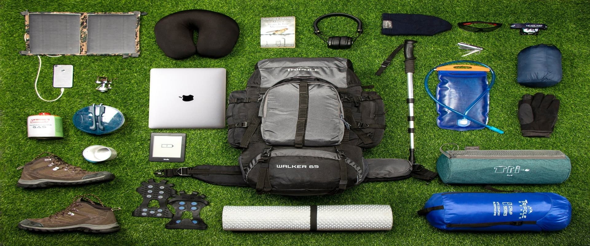
Gear for Nepal trekking follows a layered logic that manages the extraordinary temperature variation across a typical day: cool mornings at tea house departure, warming quickly as the sun rises and you begin moving, potentially very hot in sunny lower valleys by midday, cooling rapidly in the afternoon with elevation gain or cloud cover, and cold again at night in the tea house where the only heat source is a central stove in the communal room. The layered system allows you to add and remove insulation throughout the day without stopping the walk for a full kit change.
Base layer: Moisture-wicking synthetic or merino wool tops and bottoms. Merino wool has the advantage of resisting odor through multiple days of wear without washing, which matters considerably on a ten-day trek. Two sets allow rotation. Cotton in any layer is genuinely dangerous at altitude: it retains moisture, loses insulation value when wet, and dries slowly in cold conditions.
Mid layer: A fleece jacket or softshell top providing insulation during rest stops and cold mornings. At altitude, this is worn under the shell and over the base layer through most walking hours in autumn and spring. A lightweight fleece pairs with a heavier down or synthetic insulated jacket for camp use at elevation.
Insulation layer: A down or synthetic insulated jacket worn over fleece in cold conditions and at high camps or passes. A quality down jacket rated for temperatures below freezing is essential for anything above 4,000 meters. Synthetic insulation performs better than down in wet conditions; down is lighter and more compressible for the same warmth level.
Outer shell: A waterproof and windproof jacket and trousers. Mountain weather changes fast and the upper sections of all major treks are exposed to wind and precipitation. Gore-Tex or equivalent membrane fabrics provide both waterproofing and breathability; the breathability matters because a non-breathable shell soaks you from the inside with condensation during sustained exertion. Carrying a pack cover for your daypack is also worth doing.
Trekking boots: The single most important item in your kit. Waterproof, ankle-supporting, stiff-soled boots that have been thoroughly broken in before the trek. Broken in means worn on at least four to six full-day hikes, not worn to the office a few times. Blisters from unbroken boots account for more suffering and lost summit days than any other gear failure. For routes involving glacier travel or the higher passes, a boot compatible with crampon attachment is required; discuss requirements with your guide before purchase.
Trekking poles: Collapsible trekking poles reduce knee stress on long descents by 20 to 30 percent according to studies on pole use in mountain terrain, and improve balance on narrow or rocky sections. They are particularly valuable on routes with extended descents like the Larkya La day on the Manaslu Circuit or the descent from Thorong La. Rental poles are available in Kathmandu for approximately USD 2 per day.
Sleeping bag: Rated to at least -15 degrees Celsius for routes with high camps or high-elevation tea houses. The blankets provided by tea houses are insufficient at the highest elevations. A sleeping bag liner adds warmth and keeps the bag cleaner through a multi-week trip. Rental sleeping bags are available in Kathmandu; inspect them for loft compression and moisture damage before accepting.
Headlamp: Essential and non-negotiable. Summit days on pass-crossing routes and peak climbs begin before dawn; tea house corridors lack light; and power outages happen. Carry spare batteries or a USB-rechargeable model with a backup power bank. LED headlamps in cold conditions can dim quickly; keep the headlamp in your sleeping bag at high elevation to maintain battery performance.
Trekking socks: Wool or synthetic trekking socks in two to three pairs. Changing into dry socks at midday or at the end of each walking day significantly reduces blister development and keeps feet warmer at altitude. Sock liners reduce friction against the boot.
Sun protection: SPF 50 or higher sunscreen applied every two to three hours on exposed skin, UV-blocking sunglasses rated for high altitude (the UV intensity at 5,000 meters is roughly twice that at sea level), and a wide-brimmed hat or cap with neck coverage. Snow blindness from UV reflected off snow and glacier is a real and painful risk on routes above 4,500 meters; glacier glasses with side shields are the appropriate eyewear at elevation.
First aid kit: Blister treatment (Leukotape or moleskin, blister plasters), ibuprofen and paracetamol, oral rehydration salts, anti-diarrheal medication, antihistamine, medical tape, and any prescription medications including Diamox if you are carrying it. Guides carry group first aid kits; the personal kit supplements rather than replaces the group supply.
Internet, Power, and Communication on the Trail
The connectivity picture on Nepal's trekking routes is better than its reputation in popular imagination but significantly worse than most urban dwellers are accustomed to. Managing expectations before departure avoids frustration on the trail and allows you to make a plan for staying in contact with home.
Nepal Telecom's 4G network covers the main population centers and extends usefully along several of the major trekking corridors. Coverage reaches Namche Bazaar (3,440 meters) in the Khumbu, most villages along the lower Annapurna Circuit as far as Manang, the lower Langtang valley as far as Langtang village, and the lower sections of the Manaslu Circuit to approximately Deng. Above these points, coverage becomes intermittent and eventually disappears. A Nepal Telecom SIM card purchased at Tribhuvan Airport on arrival, loaded with a data package of NPR 1,000 to 1,500, provides adequate connectivity in the zones where it works. Ncell, the other major carrier, has less reach in the mountain zones and is generally less useful for trekkers.
Wi-Fi is advertised at tea houses in most settlements on the main routes up to about 3,500 meters. Quality ranges from barely functional to occasionally useful. Daily Wi-Fi charges of NPR 300 to 700 are standard, with no guarantee of a usable connection. At higher elevations, including Kyanjin Gompa in Langtang, Manang on the Annapurna Circuit, and Gorak Shep near Everest Base Camp, Wi-Fi may not be available or may work only intermittently. A local SIM with data is more reliable than tea house Wi-Fi for anything that requires consistent connectivity.
For routes in genuinely remote areas, including the upper Manaslu valley, the Dolpo region, and restricted area treks, satellite communication is the only reliable option. Our lead guides carry a satellite communication device on all departures, enabling contact with our Kathmandu operations office for logistical coordination and emergency response. Personal satellite messengers such as the Garmin inReach Mini allow two-way text communication and GPS tracking from anywhere on earth and are increasingly common among independent and safety-conscious trekkers. The device rents for approximately USD 35 to 50 per month for the hardware plus a service plan; it weighs 100 grams and provides genuine peace of mind for families at home following a multi-week itinerary.
Power for charging devices is available at most tea houses below 3,500 meters, with charging fees of NPR 100 to 300 per session. Above this elevation, solar power is the primary source and reliability varies by weather. A portable power bank with sufficient capacity to charge your phone and camera several times is a practical investment; 20,000 mAh capacity weighs around 350 grams and handles multiple device charges over several days between grid access. Cold temperatures at high altitude reduce battery capacity significantly; keep electronics and power banks inside your sleeping bag overnight to maintain charge.
Environmental Responsibility and Leave No Trace
Nepal's mountain regions face real environmental pressure from the combination of high visitor numbers, difficult waste management logistics in remote terrain, and the accumulated effects of decades of trekking infrastructure development. The response to this pressure is not to restrict access but to ensure that visitors who come understand their impact and make choices that reduce it.
Plastic waste is the most visible issue on the main trekking routes. Single-use plastic bottles accumulate in conservation areas faster than the removal systems can process them, particularly in the zones above the last road access where everything must be carried by hand. The practical alternative is a reusable water bottle combined with chemical purification tablets, a filter straw, or a UV pen. Any of these options costs less than USD 30, adds negligible weight, and eliminates the need to buy bottled water at every tea house. Boiled water is available at all lodges for a modest fee. The choice to use it rather than buying plastic is one of the most concrete environmental actions a trekker can take.
The garbage deposit system that applies to peak climbing permits, USD 500 per team refundable on evidence of waste removal, reflects the severity of the high-altitude litter problem. On organized treks, all non-biodegradable waste generated by the group should be carried out to the nearest roadhead rather than left at tea house rubbish points, where it frequently remains for months before removal or is burned in open fires. Our company's policy on all departures is to carry out all synthetic waste generated by the group, including food packaging, batteries, and personal care product containers.
Porter welfare is the human dimension of responsible trekking practice. The International Porter Protection Group's guidelines establish clear standards: porters should not carry more than 20 kilograms including their own equipment; they should receive appropriate clothing and footwear for the altitude and weather conditions they are working in; they should be insured against accident and illness; they should be accommodated at the same level as the clients they support rather than being housed separately in inferior conditions; and they should be paid wages that reflect the physical demands of the work. Booking through an agency that explicitly commits to these standards, as our company does on all departures, is the most direct way to ensure the people who make your trek possible are treated appropriately.
Respecting trail etiquette reduces the impact on both the environment and the communities you pass through. Stay on marked trails rather than cutting switchbacks, which accelerates erosion on steep slopes. Carry all rubbish until you reach a proper disposal point. Do not collect plants, rocks, or cultural objects from the trail environment. Keep noise at a level appropriate to the mountain setting, particularly in the early mornings and late evenings near tea houses. The Himalayan environment is not a backdrop for your visit; it is a functioning ecosystem and a cultural landscape that has sustained communities for centuries. Treat it with the same seriousness you would hope someone else would apply to your own home.
The information in this guide applies across all of Nepal's trekking regions and connects to the specific regional guides for the Annapurna area, the Langtang valley, the Manaslu Circuit, and peak climbing. Our team is available to answer questions that go beyond what is covered here, and we encourage reaching out before making final decisions on timing, route, and preparation. The treks work best when the planning that precedes them is honest and thorough, and we have the experience to help make that happen.