Why Choose Lower Dolpo Circuit Trek?
Step Into Nepal's Most Untouched Corner
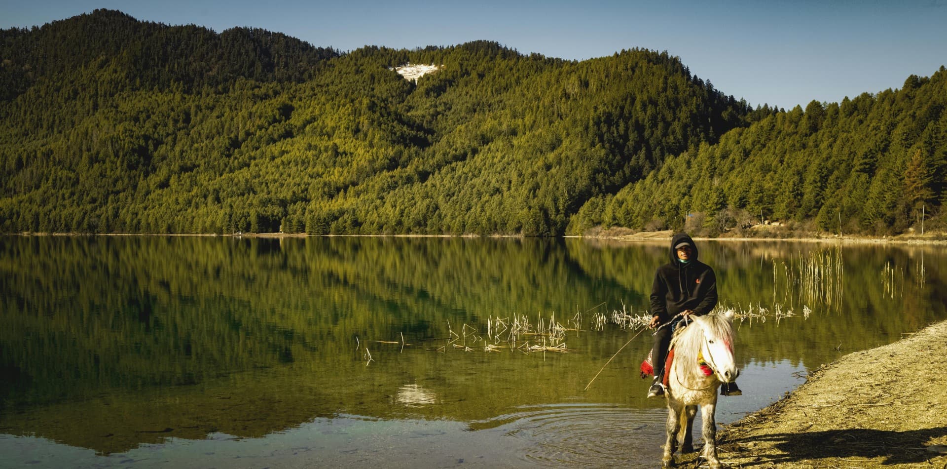
The Lower Dolpo Circuit Trek is the kind of journey that most people talk about but very few actually take. Tucked into the far northwest of Nepal, the Dolpo region sits in a high-altitude rain shadow that gets less annual rainfall than some deserts. The land here is brown, wind-carved, and immense. Above the treeline, prayer flags mark passes that connect isolated valleys to one another. Down in the gorges, rivers run cold and clear over flat stones. This is a place where modernity genuinely has not arrived.
A 19-day window of walking and flying gets you into the core of what makes Dolpo so unusual. You start from Nepalgunj, which sits near the Indian border at less than 200 meters above sea level. Two days later, you are crossing stone bridges above glacial tributaries and watching porters carry loads on trails cut into cliff faces. The contrast is difficult to explain but easy to feel.
Beyond the scenery, this trek goes through one of the world's last places where Bon religion is still practiced in its original community context. Bon predates Buddhism and differs from it in specific rituals, temple layouts, and the direction of kora walks around sacred structures. In Dho Tarap village and the monasteries nearby, you can observe and quietly learn about this tradition from people who have carried it for generations.
What Sets This Trek Apart
Most Nepal treks take you along known corridors, busy in peak season, with teahouse comforts and cell signal at most stops. The Lower Dolpo Circuit is not that kind of trek. The trail crosses two serious high passes: Numa La at 5,190 meters and Baga La at 5,070 meters. Between those passes, you drop into wide valleys and camp in meadows used by yak herders. The route then finishes at Phoksundo Lake, a still, turquoise body of water held against steep limestone cliffs that gave this region a moment of international attention after the 1999 film "Caravan" was nominated for the Academy Awards.
The logistics are deliberately limited. There are no roads in the core trekking area. Some stretches have no teahouses at all. The team carries camping equipment to the high sections, and the sleeping arrangements get simple. That simplicity is the point. You hear your own footsteps. You notice the altitude. You start to understand the terrain on its own terms rather than from behind a glass window.
Highlights of the Lower Dolpo Circuit Trek Package
-
Phoksundo Lake: Nepal's deepest lake, perched at 3,611 meters with water so clear it reads turquoise-blue against the surrounding brown cliffs and pine forest edges.
-
Numa La Pass (5,190 m): The highest crossing on this route, with sweeping views across Dhaulagiri, Churen Himal, Shey Shikhar, and the Kanjiroba range on a clear morning.
-
Baga La Pass (5,070 m): The second major pass, reached through a valley of scattered seasonal yak shelters, with sacred chortens at the top marking the descent toward Phoksundo.
-
Dho Tarap Village: A wide, flat-bottomed valley settlement at 4,080 meters, home to a culturally distinct Bon community and a cluster of monasteries including Ribo Bompa and Mekyem Gompa.
-
Shey Phoksundo National Park: Nepal's largest national park by area, with rare wildlife including snow leopards, blue sheep, grey wolves, Himalayan tahr, and the vibrantly plumed Himalayan Monal.
-
Ancient Monasteries: Pre-Buddhist Bon gompas alongside Tibetan-style Buddhist temples, decorated with thangkas, Maitreya statues, and collections of ceremonial weapons.
-
Rain Shadow Landscapes: Dry, ochre-colored plateaus that shift into pine-filled gorges below 3,000 meters, giving the trek a visual range not found on wetter Himalayan circuits.
-
Remote Culture: Villages like Ringmo and Tarakot where residents wear traditional garments, practice subsistence farming, and host pack animals rather than tourist infrastructure.
Detailed Journey Breakdown
Arriving in Kathmandu and Nepalgunj
The trek starts in Kathmandu, where you sort permits, meet the team, and check gear. A short flight drops you to Nepalgunj, Nepal's largest mid-western city, sitting at 154 meters. The warmth and flat horizon feel almost surreal after months of imagining high mountains. Another small aircraft carries you up to Juphal the following morning, landing on a sloped grass-and-gravel strip at 2,320 meters that many pilots consider one of Nepal's more demanding domestic approaches.
The Approach through the Bheri River Corridor
Early trek days follow the Thulo Bheri River through a mix of cultivated terraces, pine-covered slopes, and gorge sections where the trail narrows against cliff walls. Villages like Dunai, Tarakot, and Laini each have their own character. Dunai is the district headquarters, relatively functional, with small shops and a checkpoint. Tarakot sits at an old trade crossroads and carries a layered history. As you climb toward Nawarpani and Dho Tarap, the valley opens and the landscape gradually empties of agriculture.
Dho Tarap and Cultural Immersion
The wide valley of Dho Tarap is one of the more memorable campsites on this entire circuit. The village is organized around a central lane flanked by stone houses, dried-meat racks, and monastery walls. Children and dogs move through the lanes with equal confidence. An acclimatization day here gives you time to visit the gompas properly, watch community life, and give your body a needed rest before the high passes ahead.
Crossing the High Passes
The ascent to Numa La starts from a base camp at around 4,440 meters. The trail goes across loose scree, through snow-filled gullies in early season, and up a final rocky headwall to the pass cairn. From the top, the view extends across an enormous field of mountains with no visible road, no structure, nothing except ridgelines and sky. The descent takes you through a U-shaped valley to an overnight at Pelung Tang. The following day brings Baga La, which demands similar effort but ends with the lake beginning to appear through the valley floor below.
Phoksundo Lake and the Return
Ringmo village is the last settlement before Phoksundo Lake. From the village, a short uphill walk reaches the lake edge, where the water color genuinely stops you. The depth of the blue-green hue comes from the lake's 145-meter depth and the glacial minerals that filter in from above. A rest day here allows for a thorough exploration of the shoreline, the lake-edge monastery, and the waterfall fed by the outflow. The return to Juphal via Chhepka closes the circuit, retracing sections of the Bheri River valley before the flight back.
Returning to Kathmandu
The reverse flight from Juphal through Nepalgunj to Kathmandu is brief but striking. Looking down from the plane at the terrain you spent two weeks walking through is a good moment for reflection. Back in Kathmandu, the rest day exists for that purpose: going over the experience at your own pace before the international departure.


