No cancellation fees. No hassle. Book Now, stay relaxed.Cancellation Terms
Accessible Adventure
Outbound
Trekking in Nepal
Expeditions
Activities
Travel Guide
Company
Accessible Adventure Logo
About Us

As Accessible Adventure, we are a trusted adventure tour operator, crafting unforgettable journeys across Nepal, Tibet, and Bhutan that leave lasting memories for every traveler.

Explore More
  • Blog
  • Travel Guide
  • Our Commitments
  • Online Payment
Company
  • Our Team
  • Terms and Conditions
  • No-risk Booking Policy
  • Legal Documents
Have Questions?
  • Phalful Chwok, Nayabazar-16, Kathmandu, Bagmati, 44600, Nepal
  • +9779851352707
  • info@accessibleadventure.com
Contact Us
👥 Follow us:
FacebookX (Twitter)LinkedInInstagramYouTubePinterestTikTokWhatsAppViber

All content and photographs on this website are copyright © Accessible Adventure Pvt. Ltd. and may not be reproduced without prior written permission.

Developed byTuring Research And Development Private Limited ↗
Himlung Himal Expedition

Starting from

$7,500/ person
Book Now ↓
HomeExpeditionsNepal's 7000ersHimlung Himal Expedition

Himlung Himal Expedition

Country

Nepal

Duration

29 Days

Difficulty

Strenuous to Challenging

Max Altitude

7,126m / 23,379ft

Style

Expedition Climbing

Best Season

March-June & Sept-November

OverviewItineraryCost DetailsHighlightsBookingAdditional InfoFAQs

Why Choose Himlung Himal Expedition?

Last updated June 15, 2026

A 7,000-Meter Summit in One of Nepal's Least-Visited Valleys

Himlung Himal is not the kind of peak you stumble across by accident. At 7,126 meters, it sits deep inside the restricted Nar-Phu Valley, a region the Nepal government only opened to foreign climbers in 1992. Before that, Nar and Phu were closed to outsiders entirely. Even today, the number of expeditions that pass through each season is remarkably small. This remoteness is not a drawback; it is the point.
The mountain falls in the category experienced mountaineers call a 'gateway 7000er': high enough to demand genuine respect and full expedition protocol, but routed in a way that does not require extreme technical climbing. Most of the ascent sits at around 30 degrees, with only the section above Camp III pushing closer to 40 degrees. If you have solid experience from a 6,000-meter peak and you are ready to step into proper high-altitude mountaineering, Himlung makes a logical and rewarding next move.
The Himalayan Database records Himlung Himal as carrying one of the highest summit success rates among 7,000-meter peaks in Nepal. That is not because the mountain is easy. It is because the route is well-suited to structured, guided expeditions with proper acclimatization built into every stage. This 29-day itinerary gives every climber a realistic shot at the summit while keeping safety at the center of each decision.

What Makes This Expedition Different

The journey does not begin when crampons go on. It starts in Kathmandu, with equipment checks and permit briefings. It deepens during the drive through the Marsyangdi River valley, when the first Himalayan giants appear on the skyline. It shifts completely when you enter Koto and turn north into the Nar-Phu Valley, and the world around you becomes something very few travelers ever see: narrow gorges, juniper forests, stone villages built like fortresses against the altitude, and monasteries that have been chanting morning prayers at over 4,000 meters for centuries.
By the time you reach base camp, the summit already feels earned in some way. The climb is the final chapter, not the whole story.


Expedition Highlights

  1. Summit panorama at 7,126m: Annapurna I through IV, Manaslu, Dhaulagiri, Gangapurna, Tilicho Peak, and the Tibetan Plateau to the north
  2. Restricted Nar-Phu Valley approach: one of the few trekking routes in Nepal that still feels genuinely remote, requiring a special government permit
  3. Tibetan culture immersion: village visits to Nar and Phu, two ancient Tibetan-influenced settlements with centuries-old monasteries in active use
  4. Three-camp expedition system: Camp I at 5,450m, Camp II at 6,000m, Camp III at 6,350m, with rotation climbs before the summit push
  5. 1:1 climbing Sherpa ratio: dedicated Sherpa support for every climber during all high-altitude sections
  6. High summit success rate: among the highest recorded for a 7,000-meter peak in the Himalayan Database
  7. Full base camp infrastructure: individual 4-season tents, kitchen tent, dining tent, and dedicated toilet tent
  8. Low objective hazards: avalanche and rockfall risk is significantly lower on Himlung than on many comparable peaks at this altitude

Detailed Journey Breakdown

  1. Kathmandu: Preparation Before the Mountains
    Two days in Kathmandu set the expedition up for success. Gear is checked against a comprehensive list, permits are confirmed, and the expedition leader runs through the full itinerary, emergency protocols, and high-camp procedures in the pre-departure briefing. The city offers good food and a wide range of outdoor shops in Thamel for any last-minute purchases or rentals.
  2. The Drive to Koto
    The drive to Besishahar on Day 3 follows the Trisuli River and into the Marsyangdi valley, with early views of Annapurna II (7,937m) and Lamjung Himal appearing as you go deeper. On Day 4, a 4WD jeep continues to Koto at 2,600 meters, where the police checkpoint at the village verifies your restricted-area permits. Expect a rough ride; parts of the jeep track are unpaved and dusty.
  3. Trekking Into the Nar-Phu Valley
    The trail from Koto climbs into a landscape that feels genuinely apart from the rest of Nepal's well-known routes. Day 5 takes you to Mehta at 3,200 meters through a narrow canyon above the Phu Khola river. Day 6 continues up to Phu-Gaon at 4,400 meters, crossing terrain that shifts from scrub forest to open high-altitude plateau. Phu is one of the most culturally intact Tibetan-influenced villages in Nepal: flat-roofed stone houses, chorten-lined pathways, and the Tashi Lhakhang monastery standing watch over the settlement. The acclimatization day on Day 7 is well spent here.
  4. Base Camp and the Climbing Period
    Himlung Base Camp sits on a wide moraine at 4,850 meters, below the mountain's lower glaciers. Camp setup on Day 8 is a full day of work: kitchen tents go up, sleeping tents are arranged, and equipment is sorted and distributed by category.
  5. From Day 9 onward, the climbing period begins in earnest.
    The first rotations take the team to Camp I at 5,450 meters on rock and moraine, then back to base camp. A second rotation pushes to Camp II at 6,000 meters, where snow slopes begin. Camp III at 6,350 meters is established above that. The summit push departs Camp III in the early hours, ascending the final steepening ridge to 7,126 meters. From the top, the panorama on a clear spring morning stretches across the Annapurna chain, Manaslu, Dhaulagiri, and deep into the Tibetan plateau. The view is one of the finest available on any 7,000-meter peak in Nepal.
  6. Descent and Return
    Descent follows the approach in reverse: base camp to Phu-Gaon, Mehta, Koto, then the drive back through Besishahar to Kathmandu. A debrief and farewell dinner on Day 28 close the expedition before departure on Day 29.

Tips for a Successful Summit

  • Train specifically for altitude. Running and cycling build cardiovascular capacity, but uphill hiking with a loaded pack is the best direct preparation for trekking days above 4,000 meters.
  • Get your mountaineering boots fitted and broken in well before the trip. Boots that cause problems on summit day are the single most common avoidable discomfort on any high-altitude climb.
  • Take every acclimatization day seriously. Even if you feel strong at Phu-Gaon or base camp, your body is still working hard. The scheduled rest days are not optional extras.
  • Drink more water than you think is necessary. Dehydration at altitude accelerates fatigue, amplifies headaches, and increases the risk of altitude sickness.
  • Follow your climbing Sherpa's pace. They have seen every common mistake at high altitude, and their judgment on when to push and when to wait is based on genuine experience, not caution.
  • Log your SpO2 readings every morning at base camp and high camps. A drop of more than five points from your previous day's baseline is worth raising with the expedition leader.

Trip Summary

Day 1

Arrival in Kathmandu (1,400m)

The expedition begins at Tribhuvan International Airport, where a team representative meets you at arrivals and transfers you to the hotel in Thamel, Kathmandu's main hub for mountaineers and trekkers. The drive from the airport to Thamel takes 20 to 45 minutes, depending on traffic, which in Kathmandu can be substantial at any hour of the day.

April is a good month to arrive. The pre-monsoon haze has not yet set in fully, the city is warm but not oppressively hot at 1,400 meters, and the evenings are cool enough to be comfortable. If you arrive early enough in the day to do anything other than check in and rest, Thamel is worth an hour on foot. The streets are narrow and perpetually busy, and the outdoor gear shops, restaurants, and exchange counters are all within walking distance of each other. This is also where you will spend tomorrow's briefing day, so orienting yourself to the area now saves time.

The practical business of Day 1 is primarily rest. Long-haul flights from Europe or North America often land in the early morning after overnight travel, and the sleep deficit you carry into Kathmandu is worth taking seriously: the expedition ahead will place sustained demands on the body for 29 days, and arriving well-rested rather than already tired makes a genuine difference by the time the altitude section begins. If the timing works, a short evening walk and a meal at one of Thamel's better restaurants is a reasonable approach. The food is good and reasonably priced, the walk will help you sleep, and a first evening in Kathmandu sets the tone for what is coming.

Keep your passport and permit documentation accessible tonight. The Day 2 briefing requires these, and sorting them before bed means the morning starts efficiently rather than with a search through luggage. Overnight at the hotel.

Daily Summary

Duration30 mins
Distance10 km
Accommodation3* Hotel
MealsB,L,D
Mountain Seen-
Day 2

Kathmandu (1,400m)

This is the day everything that will keep you safe for the next four weeks gets verified, organized, and discussed. It is a full day and should be treated as one.

The morning starts with a gear check run by the expedition leader and lead guide. Every item on the pre-departure gear list is confirmed present and in working order. Mountaineering boots are inspected for compatibility with the crampons each climber has brought. Harnesses are checked. Ice axes, helmets, and ascenders are laid out and examined. Any gear that is absent, damaged, or incompatible with what the high-altitude sections require gets flagged and addressed now, not on the glacier. Thamel has a reliable gear market and most items can be sourced or rented the same day. The gear shops in the area stock everything from crampons and ice axes to expedition-weight sleeping bags, and the prices for rental equipment are generally reasonable. If you have any doubts about a piece of gear, raise them here. The cost of having the wrong equipment on the mountain is significantly higher than the cost of sorting it out in Kathmandu.

Permits are reviewed and confirmed in the afternoon. All four required documents, the Himlung Himal climbing royalty permit from the Nepal Mountaineering Association, the Nar-Phu Restricted Area Permit, the Annapurna Conservation Area Permit, and the TIMS card, are checked for accuracy and signed where required. The liaison officer assigned to the expedition by the government is introduced at this point. The liaison officer accompanies the team for the full duration and serves as the official government representative during all checkpoint inspections in the Nar-Phu corridor.

The full expedition briefing follows. The expedition leader covers the complete itinerary day by day, the acclimatization rationale behind the rotation structure, the communication protocols between base camp and high camps, the SpO2 monitoring system, emergency protocols including the helicopter evacuation procedures and the chain of contact from mountain to Kathmandu, and the specific safety rules that apply above base camp. Questions are encouraged and should be asked now rather than held for later.

This day is also when each climber's travel insurance policy is confirmed. The policy number and the insurer's 24-hour emergency contact number are recorded by the expedition leader before departure. This is not a formality.

The day typically ends early, because the drive to Besishahar begins tomorrow morning and the loading of vehicles with expedition equipment starts before breakfast. Overnight at hotel.

Daily Summary

Accommodation3* Hotel
MealsB,L,D
Mountain SeenSurrounding Hills
Day 3

Kathmandu → Besishahar (823m)

The first day of movement takes the team out of Kathmandu and into the foothills that eventually lead to the Himalaya. The vehicle departs in the early morning, typically around 7:00 AM, heading west on the Prithvi Highway.

The first hour of driving is through Kathmandu's western outskirts, past the temples and suburbs that thin into farmland as the city releases you. The road descends from the Kathmandu valley floor through the gorge section above the Trisuli River, a stretch of road that the river carved out over centuries and that the highway follows closely enough that the white water is visible below in several places. The Trisuli is jade-green in April, running high and fast with the pre-monsoon snowmelt from ranges further north, and the road above it is narrow, winding, and occasionally blocked by the trucks that use it as the primary freight route into the mountains.

At Mugling, roughly 110 kilometers from Kathmandu and around two and a half hours into the drive depending on traffic, the Trisuli and the Marsyangdi rivers meet. This is where the character of the journey changes. The Prithvi Highway continues south to Pokhara; the expedition vehicle turns north and follows the Marsyangdi valley upstream into Lamjung District. The road here runs above a river that is younger and more violent than the Trisuli, cutting a canyon through terrain that rises sharply on both sides toward the first serious foothills.

Thirty or forty minutes further north, the distant white wall of the Annapurna massif appears for the first time above the valley walls. Annapurna II at 7,937 meters is particularly prominent on a clear April morning, its northwest face catching the morning light, and Lamjung Himal at 6,983 meters anchors the eastern end of the chain. These are the first Himalayan giants of the expedition, and the sight of them from the vehicle window, still many miles distant but already vast, puts the scale of what is coming in useful perspective.

Besishahar sits at the head of the lower Marsyangdi valley and serves as the district headquarters of Lamjung. It is a functioning town rather than a trekking hub, with a market, government offices, and the kind of infrastructure that supplies the villages further up the valley. Drive time from Kathmandu is typically six to seven hours with a lunch stop. The afternoon can be used to walk the town streets, check gear loads, and get an early night before the 4WD section begins. Overnight at lodge.

Daily Summary

Duration 6–7 hrs drive
Distance175 km
AccommodationTeahouse
MealsB,D
Mountain SeenLamjung Himal
Day 4

Besishahar → Koto (2,600m)


From Besishahar, the vehicle switches from the main highway to the 4WD jeep track that runs north through the Marsyangdi valley and eventually reaches Koto at the entrance of the Nar-Phu restricted zone. Pack your daypack with whatever you need accessible during the drive: water, snacks, a layer for when the altitude rises, and your passport and permits. Everything else goes into the main luggage, which will not be reached again until the stop.

The track follows the Marsyangdi River upstream through a series of villages and gorge sections that together make up one of the more memorable overland journeys available in the Annapurna region. Below Dharapani, the road is partially paved and the going is straightforward. From Dharapani northward, the surface deteriorates: loose rock, dust, and the occasional river crossing over concrete causeways that in the dry season carry a trickle of water and in the monsoon carry enough to close the road entirely. April is a dry month and the crossings are passable without issue, but the track demands respect and the 4WD capability of the vehicle is not decorative.

The views along this stretch are exceptional. Annapurna II and Annapurna IV appear at close range above the northern end of the valley. Manaslu, at 8,163 meters the world's eighth-highest mountain, shows itself intermittently through the gorge walls as the track bends north and east. The juxtaposition of extreme altitude against the working villages and terraced fields in the valley floor is one of the things that strikes first-time visitors to this part of Nepal most forcefully: life at these elevations has been organized around enormous mountains for so long that the people living here treat them as ordinary background.

Koto sits at 2,600 meters where the Marsyangdi valley forks and the main Annapurna Circuit track continues northeast while the Nar-Phu approach heads due north. It is a small village of stone houses, a few lodges, a community tap, and the police checkpoint that controls access to the restricted zone. All permits are presented and checked here. The officer records each permit number and each climber's passport details in a physical register. This process is thorough and takes some time; patience is appropriate. The checkpoint exists because the Nepalese government takes the restricted area designation seriously, and it is enforced consistently rather than selectively.

The lodge at Koto is basic and clean. The shared dining room is heated in the evenings and the food is simple but genuinely nourishing: dal bhat, noodle soup, eggs, and hot tea. Drive time from Besishahar to Koto is typically four to five hours. Overnight at lodge.

Daily Summary

Duration7–8 hrs drive
Distance95 km
AccommodationTeahouse
MealsB,L,D
Mountain SeenAnnapurna II, Lamjung Himal, Manaslu views
Day 5

Koto (2,600m) → Meta / Mehta (3,200m)

This is the first full day on foot, and the Nar-Phu Valley makes an immediate and lasting impression.

The trail leaves Koto heading north and within the first ten minutes crosses the Marsyangdi River on a suspension bridge, the cables worn to a patina that suggests years of use by both trekkers and the local yak traffic. On the far side, the path follows the river upstream briefly before turning into the gorge of the Nar Khola, the river that drains the valley ahead. From this point the Annapurna Circuit, with its teahouses and trekking crowds, belongs to a different world. The Nar-Phu restricted zone has a different quality from the first kilometre inside it: quieter, more serious, with no infrastructure beyond the trail itself and the occasional stone shelter.
The gorge section between Koto and the first major river crossing is the most dramatic terrain of the approach. The cliff walls on both sides rise two hundred to three hundred meters above the trail in places, the river audible below and occasionally visible through gaps in the rock. The path is carved directly into the cliff face in several sections, wide enough for one person, with the drop to the river on the exposed side. Loaded yaks navigate this terrain with practiced indifference. Some sections have been reinforced with stone retaining walls that the local communities maintain; others are simply the original rock, worn smooth by decades of foot traffic.

After roughly 90 minutes of walking, the trail arrives at the Nar Khola campsite at approximately 2,900 meters, where a wooden bridge crosses to the river's east bank. This is the first of several bridge crossings on the approach section. Past the bridge, the terrain opens slightly and the valley walls pull back enough to allow views north toward the higher ground ahead. The path continues upstream, crossing and recrossing the river on a series of smaller wooden bridges as the valley narrows and widens in alternating sections.

Roughly four hours into the walk, the trail passes the Chhongche Cave, a large natural overhang in the cliff face that has been used as a shelter by travellers and traders for centuries. The interior is blackened from generations of cooking fires and contains some faded religious paintings on the rock face. It is worth pausing here, both for the rest and for the atmosphere of the place: this gorge has been a trade route between the Tibetan plateau and the lower valleys for hundreds of years, and the cave was a waypoint for people moving goods long before any trekking permit system existed.

The large waterfall that marks the approach to Mehta is audible before it becomes visible, a consistent roar above the river sound that grows for several minutes as the trail climbs toward it. The water comes off the cliff face to the west in a single curtain that falls eighty or ninety meters into the river below, catching the afternoon light in a way that makes it worth a proper stop rather than just a glance. Mehta sits about twenty minutes beyond the waterfall, on a small elevated platform above the valley floor. The settlement is modest: a handful of stone buildings, a basic lodge, and the beginning of the high-altitude landscape character that becomes the dominant aesthetic of everything above. At 3,200 meters, Mehta is the first place on the approach where altitude becomes noticeable for most trekkers, appearing as slight breathlessness on the uphill sections and a mild background pressure behind the eyes by evening.

Trekking time from Koto to Mehta: five to seven hours with stops. The climb totals approximately 600 meters of ascent. Overnight at lodge.

Daily Summary

Duration6–7 hrs walk
Distance12 km
AccommodationTeahouse
MealsB,L,D
Mountain SeenAnnapurna Range
Day 6

Meta (3,200m) → Phu-Gaon (4,400m)

The trail out of Mehta enters a different world within the first hour. The gorge character of the previous day gives way progressively to the open, dry, high-altitude plateau landscape that defines the inner Nar-Phu Valley: wide expanses of grey-brown rock, sparse vegetation, the wind coming off the higher ground in steady gusts, and the complete absence of the tropical and subtropical forest zones that define most of Nepal's lower elevations. The Tibetan plateau begins here in all but name.

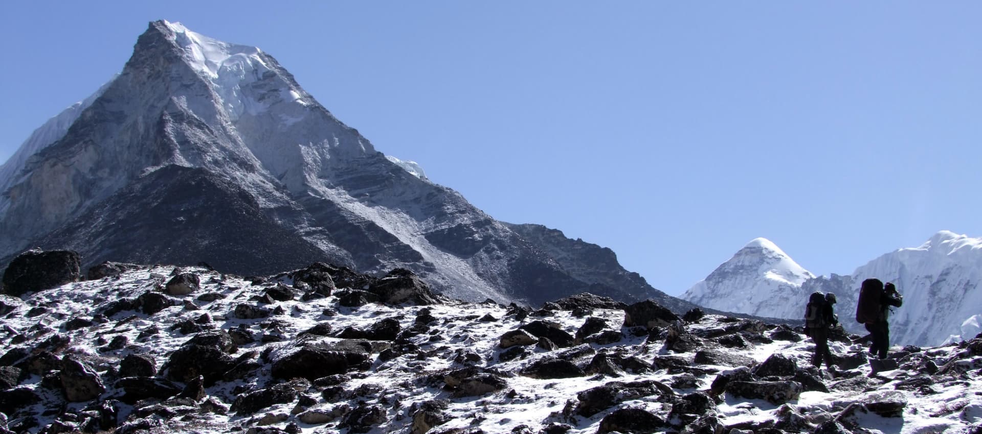
The path climbs gradually above Mehta through eroded gullies and across open hillside terrain, with the valley floor dropping away to the left and the upper ridgelines of Kang Guru at 6,981 meters appearing to the northwest. Kang Guru is not one of Nepal's most-visited peaks, but from this approach angle it presents a striking profile: a broad, heavily glaciated massif whose lower slopes send meltwater into the river draining below. On a clear April morning, the mountain catches the early light well before the valley floor does, and the glowing upper ice fields visible from the trail above Mehta give a first sense of the scale of terrain that the expedition is moving into.

Between Mehta and Phu-Gaon, the trail passes through a natural gate formed by two large rock outcrops, locally referred to as the entrance to Phu territory. Beyond these rocks, the landscape opens into the broad upper valley that Phu-Gaon occupies, and the village becomes visible at distance as a cluster of flat-roofed stone buildings stacked against the hillside on the valley's eastern side. At 4,400 meters, Phu-Gaon is high enough that the approach to it takes the better part of the morning and early afternoon, with the buildings visible for the last two to three hours of the walk in a way that simultaneously motivates and tests patience.

The village itself is one of the genuinely remarkable places in Nepal. The flat-roofed construction style, the stone walls darkened by centuries of weather, the yak corrals on the settlement's southern edge, and the mani walls carved with Om Mani Padme Hum that line the main path through the village all belong to a tradition that has more in common with the villages of the Tibetan plateau fifty kilometers north than with anything in the Nepal lowlands. The settlement has been here for centuries and shows it: the paths between buildings are polished smooth by generations of foot traffic, and the stone of the older structures has a permanence that the newer corrugated iron roofing additions do not.

Above the village on the hillside, the Tashi Lhakhang Monastery is visible as a cluster of white-walled buildings with a red roof section, catching the afternoon sun. This monastery, believed to be over 700 years old and associated with the Kagyu and Nyingma lineages of Tibetan Buddhism, is the spiritual anchor of Phu-Gaon and will be visited properly on the acclimatization day tomorrow. Today, the priority is reaching the lodge, eating a proper meal, drinking adequate fluids, and allowing the body to begin its adjustment to 4,400 meters. The altitude gain from Mehta to Phu-Gaon is 1,200 meters and most trekkers feel the elevation in some form by evening: a mild headache, reduced appetite, or the particular weariness of altitude that is different from ordinary tiredness. None of these are concerning at this point; they are normal responses to a significant elevation gain and rest, hydration, and acclimatization time resolve them.

Trekking time from Mehta to Phu-Gaon: five to six hours. Overnight at lodge.

Daily Summary

Duration7–8 hrs walk
Distance18 km
AccommodationTeahouse
MealsB,L,D
Mountain SeenHimlung Himal, Kang Guru
Day 7

Acclimatization at Phu-Gaon (4,400m)

The rest day at Phu-Gaon is not a luxury. It is one of the most important physiological investments of the entire expedition. The human body requires time to begin producing additional red blood cells in response to altitude, and this process starts in earnest during rest periods rather than during movement. Spending 36 hours at 4,400 meters before moving to base camp at 4,850 meters provides a foundation that the rotation climbs above base camp build on. Teams that skip the Phu-Gaon acclimatization day and push directly to base camp after a single night consistently show poorer SpO2 readings at Camp I and Camp II and higher incidence of altitude symptoms during the first rotation. The day is in the itinerary because it matters.
The morning is a good time for a short hike above the village to a viewpoint northwest of the settlement. The trail climbs 150 to 200 meters above Phu-Gaon on a path used by yak herders moving animals to higher pastures and takes less than an hour. The reward is a view that encompasses Kang Guru's full western flank, the distant snowfields of Himlung Himal to the northeast, and the full expanse of the upper valley floor below. Spending 30 to 60 minutes at a slightly higher elevation than the sleeping altitude before descending follows the climb-high-sleep-low principle even on a rest day and provides a mild but useful acclimatisation stimulus.

The Tashi Lhakhang Monastery is the other essential stop. The approach from the village involves a 15-to-20-minute walk up a flagged path past several chortens and a long mani wall running along the hill's lower slope. The monastery compound contains a main prayer hall, several smaller shrines, and monk's quarters built into the hillside. The building's age is visible in the thickness of the walls, the texture of the plaster, and the worn stone flags of the courtyard. The prayer hall interior contains butter lamps, thangka paintings in various states of preservation, and a number of statues whose iconography reflects the dual Kagyu and Nyingma heritage of the local practice. The monks here are generally welcoming to respectful visitors. The guide will brief the group on protocol before entry: shoes off at the threshold, proceed clockwise within the building, do not photograph without permission, do not touch religious objects. These are not abstract conventions. This is an active place of worship.

Back in the village, the afternoon can be spent exploring the lanes between buildings, watching the yak herders bring animals down from the upper pastures in the late afternoon, and eating properly. Appetite at altitude often suppresses before sleep quality deteriorates, and the evening meal at Phu-Gaon should be treated as an obligation rather than an option. Forcing a full meal when altitude has blunted appetite is the correct approach and matters for what comes next. SpO2 readings are taken that evening by the expedition leader and compared against individual baselines established in Kathmandu. Overnight at lodge.

Daily Summary

Duration2–3 hrs
Distance3–4 km hike
AccommodationTeahouse
MealsB,L,D
Mountain Seen-
Day 8

Phu-Gaon (4,400m) → Himlung Base Camp (4,850m)


The trail from Phu-Gaon to Himlung Base Camp is short in distance but marks the decisive transition from trekking into expedition territory. Below the village, the route and the infrastructure exist. Above it, only the mountain.

The path heads northeast out of the settlement across the open yak pastures that occupy the valley floor above Phu-Gaon. These flat, grassy areas are green and alive in April, with the first wildflowers beginning to show color along the water channels that run from the glacier melt above. Yaks graze here throughout the spring season and are sometimes encountered on the trail, moving with unhurried authority and requiring patient negotiation on the narrower sections. The path crosses several small streams on stone and log bridges, gains elevation steadily through the moraine fields that mark the lower edge of Himlung's glacial system, and arrives at base camp after a three-to-four-hour walk from the village.

Base camp sits on a wide, relatively flat section of lateral moraine at 4,850 meters, surrounded by peaks on three sides. The ground is a mixture of rock and compacted glacial debris, the kind of surface that holds tent pegs well and drains quickly. To the north and northeast, the lower slopes of Himlung Himal are visible in clear profile, the route of the upper mountain sketched against the sky in rock and ice. The summit ridge, still distant and very high, is the point toward which everything from here is oriented.
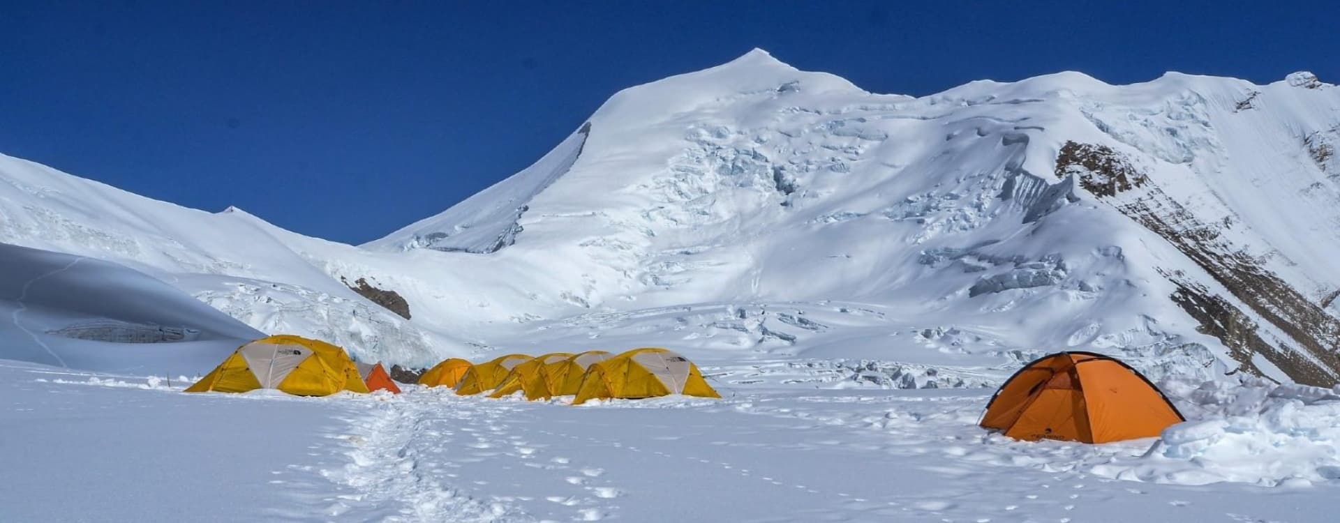
Setup day at base camp is a full day of work. The expedition's porter and cook teams arrive ahead of the climbing group and begin the camp layout as the climbers walk in. Individual sleeping tents are staked and guyed into the moraine, positioned to provide shelter from the prevailing wind direction while maximizing sun exposure for the afternoon hours. The kitchen tent, anchored separately from the sleeping area, is equipped with the cooking stoves, pots, and food stores that have been carried from Phu-Gaon by porter and yak team. The dining tent goes up alongside it with folding tables, chairs, and the small stove that will heat the social space during evening briefings and morning tea calls. The toilet tent is positioned downslope and well away from the cooking and sleeping areas. Water supply is established from the nearest clean melt stream, which is assessed and marked before the first meal.

Once tents are pitched, gear is sorted and laid out by category: personal sleeping equipment in each tent, climbing hardware staged near the team leader's tent for the pre-rotation check, group equipment in labeled dry bags in a separate location. The cook serves the first base camp meal in the late afternoon, usually a hot soup followed by a substantial main course, and the expedition leader runs a base camp briefing covering camp protocols, the morning SpO2 monitoring procedure, the rotation schedule, and the specific terrain each climber should expect on the first acclimatization movement. The team settles into the rhythm that will define the next two weeks.

Temperatures at base camp in late April drop to minus 15 degrees Celsius or lower by late evening. Get the sleeping bag and down layers accessible before dark. Camping at base camp.


Daily Summary

Duration3–4 hrs walk
Distance8 km
AccommodationTeahouse
MealsB,L,D
Mountain SeenHimlung Himal, Kang Guru
Day 9

Rest & Puja Ceremony at Base Camp (4,850m)

The 14-day climbing period is the expedition's core. The schedule within this block is not fixed to specific calendar dates because weather, individual acclimatization rates, and the timing of viable summit windows determine how the days are actually distributed. What follows is the proven structural pattern that every properly organized Himlung expedition runs, with the understanding that the expedition leader makes real-time adjustments based on conditions.

The first full day at base camp begins with morning tea at 5:30 AM and the first formal SpO2 check of the climbing period. Readings at 4,850 meters typically fall between 81 and 87 percent for most team members, down from the 96 to 99 percent baseline in Kathmandu. This drop is expected and does not indicate a problem. The expedition leader records each reading and will track the pattern over successive mornings to identify any individual whose adaptation is slower than the group.

The puja ceremony takes place in the morning of this first full day. A puja is a Tibetan Buddhist blessing ritual conducted by the climbing Sherpa team, essential in the expedition tradition before any ascent begins. A small altar is built near the kitchen tent using stones from the moraine, prayer flags are strung from the altar to tent poles and ice axes in a fan shape above the camp, and offerings of flour, rice, juniper incense, and food are arranged on the altar surface. The lead Sherpa leads the ceremony, which involves the chanting of prayers over the course of an hour, with each expedition member and staff present. Each climber's ice axe, crampons, and helmet are placed near the altar to receive the blessing. The puja is not optional and is not decoration. It is a sincere religious practice that the Sherpa team takes seriously and that every expedition member participates in respectfully, regardless of their own beliefs. Once the ceremony concludes, the ascent may begin.

The afternoon of Day 9 is for camp organization, gear check, and the pre-rotation briefing. The lead guide covers the route to Camp I: the terrain from base camp across the moraine, the transition to rock and steeper ground, the expected time to reach Camp I, and the protocol for returning to base camp the same day rather than sleeping at altitude. Understanding the route before stepping onto it reduces uncertainty and allows more mental energy to go toward the physical task of the climb.

Daily Summary

AccommodationTeahouse
MealsB,L,D
Mountain SeenHimlung Himal
Day 10

Rotation: Base Camp → Camp I (5,450m) → Base Camp

Departure from base camp is typically at 6:00 to 7:00 AM. The route heads north-northeast from camp across the lower moraine, gaining height gradually on loose rock and glacial debris before reaching the base of the first sustained slope. The trail picks its way through the moraine field on a line that the climbing Sherpas have marked in previous seasons, connecting sections of solid ground across the unstable rock and ice debris that characterizes lateral moraine terrain everywhere.

Above the moraine, the route transitions to consolidated rock with sections of fixed rope where the angle requires it. Camp I at 5,450 meters sits on a rocky platform with views back down the valley to Phu-Gaon far below and north toward the upper mountain. The air at this altitude is noticeably thinner than base camp: a climb that would take under 90 minutes at sea level takes three to four hours here with full rest-step pacing. Guides set and maintain the tempo throughout the ascent, and the instruction to not move faster than the slowest person in the group is enforced on this first rotation more firmly than anywhere else on the expedition, because the tendency to push on fresh legs with the energy of early excitement is exactly what produces altitude illness on Day 11 rather than the productive rest-day recovery the itinerary requires.

The team rests at Camp I for 30 to 60 minutes, taking in the view, recording SpO2 readings, eating and drinking, and allowing the body to register the altitude before the descent begins. Returning to base camp to sleep is the physiological point of the exercise. The body adapts to altitude most effectively when it is exposed to a higher elevation during the day and then allowed to recover at a lower elevation overnight. The first rotation to Camp I and back, combined with the base camp rest that follows, is the most important single acclimatization step of the entire expedition.

Return to base camp: two to three hours. Total outing: six to eight hours. SpO2 readings on return are compared against morning baseline.

Daily Summary

Duration6–8 hrs
Distance8 km
AccommodationTeahouse
MealsB,L,D
Mountain SeenHimlung Himal
Day 11

Rest at Base Camp

Rest, hydration, calorie intake, and SpO2 monitoring. The cook prepares three full meals. The afternoon is quiet. Some climbers sleep; others read, write, or sit outside watching the mountain change light through the afternoon hours. Base camp at 4,850 meters on a sunny April afternoon is genuinely pleasant: the air is thin but the sun is strong and the windward side of the dining tent is warm enough to sit without a down jacket. The cold returns sharply after sunset.
Any climber whose SpO2 has not recovered to within two to three points of their Day 9 baseline by the end of the rest day should raise this with the expedition leader. A slow recovery reading is not a crisis but it is information, and adjusting the subsequent rotation schedule based on individual physiological response is standard practice.

Daily Summary

AccommodationTeahouse
MealsB,L,D
Mountain SeenHimlung Himal
Day 12

Rotation: Base Camp → Camp II (6,000m) → Base Camp

The second rotation uses the route established to Camp I on Day 10 and extends above it to Camp II at 6,000 meters. The terrain between the two camps moves north-eastward, following a line of rocky ground with occasional short fixed-rope sections before reaching a ridge section that avoids the crevassed glacier below. The character of the ground changes significantly between Camp I and Camp II: above 5,600 meters, snow and ice begin to dominate the surface, crampons go on, and the route becomes the high-altitude glacier travel that defines all further movement on the mountain.

Camp II at 6,000 meters marks a threshold. The SpO2 readings here fall to the 72-to-78 percent range for most team members, a level at which basic physical tasks require measurably more effort than they did at base camp and concentration during technical movements demands conscious maintenance. The route-fixing team will have been above by this point, installing ropes on the technical sections between Camp I and Camp II. The second rotation is the first time most climbers use these ropes, and the practice of clipping in, moving on the fixed line, and unclipping smoothly while maintaining balance at altitude is worth deliberate attention on this day rather than trying to master it during the summit push.

Return to base camp the same day follows the same route in descent. The total elevation gain and loss for the day is approximately 1,150 meters each way. By the time the team arrives back at base camp in the late afternoon, the physical toll of the second rotation is apparent in how people eat, move, and talk. This is normal and productive. Rest and calories are the correct response.

Daily Summary

Duration8–10 hrs
Distance12 km
AccommodationTeahouse
MealsB,L,D
Mountain SeenHimlung Himal
Day 13

Rest at Base Camp

The second rest day consolidates the acclimatization work done in the two rotations. The SpO2 readings on this morning typically show a measurable improvement over the Day 9 and Day 11 figures for most climbers, reflecting the red blood cell production that the altitude exposure has triggered. Appetite sometimes improves on this day as the body stabilizes at 4,850 meters and ceases treating it as an emergency.

The expedition leader reviews each climber's rotation performance, SpO2 trend, and physical condition on this day and makes any adjustments needed before the summit push sequence begins. This is also the moment to sort and pack the high-camp personal kit: the items that will be carried to Camp I, II, and III in the days ahead rather than left at base camp. Down jackets, sleeping bags, high-energy snacks, and technical equipment are consolidated into summit loads here rather than assembled in haste at Camp I.

Daily Summary

Distance
AccommodationTeahouse
MealsB,L,D
Mountain SeenHimlung Himal
Day 14

Base Camp (4,850m) → Camp I (5,450m)

The summit push sequence begins. Today is not a rotation: the team does not return to base camp. The camp at 5,450 meters is tonight's sleeping altitude, and arriving there in the mid-afternoon allows time to settle in, eat, melt snow for water, and rest before the climb to Camp II tomorrow.

The route is now familiar from the first rotation. Without the requirement to descend the same day, the pace can be slightly more relaxed. Attention goes to conserving energy rather than maximizing speed. The Sherpa cook team accompanies the group and manages food preparation at Camp I from this point forward. Dinner at Camp I is hot, calorie-dense, and eaten early: lights out by 7:00 PM is the standard, because Camp II tomorrow is a long day and the next night will be even longer. High camp sleeping.

Daily Summary

Duration3–4 hrs
Distance4 km
AccommodationTeahouse
MealsB,L,D
Mountain SeenHimlung Himal
Day 15

Camp I (5,450m) → Camp II (6,000m)

The move from Camp I to Camp II follows the route climbed in the second rotation, now with personal loads rather than just daypacks. Crampons go on at the snowline, the rope team forms up, and the movement above 5,600 meters proceeds under fixed-line management. The terrain between the camps includes a rocky ridge section and a glacier traverse that requires crevasse awareness and steady footwork.

Camp II at 6,000 meters is on a snow shelf on the glacier. The tent platforms here were prepared by the Sherpa team in advance and the expedition tents are already in place. The afternoon at Camp II is spent recovering from the morning's effort, melting snow for the evening and tomorrow's needs, and eating the hot meal the cook team prepares in the separate kitchen tent. The view from Camp II at this altitude on a clear April afternoon, south across the Nar-Phu Valley toward the Annapurna massif and east toward the distant snowfields, is one of the visual rewards of the altitude work that has preceded this point. High camp sleeping.

Daily Summary

Duration4–6 hrs
Distance5 km
AccommodationTeahouse
MealsB,L,D
Mountain SeenAnnapurna Range
Day 16

Camp II (6,000m) → Camp III (6,350m)

Camp III at 6,350 meters is the launching point for the summit. The route from Camp II follows the western side of the glacier, angling upward through steepening snow terrain toward the protected platform where the high camp sits. This is a shorter day in terms of total time, typically three to four hours, but it takes place entirely at altitude where every 100 meters of gain is felt. Crampons, fixed lines, and the rest-step rhythm are essential throughout.

Camp III is exposed compared to the lower camps. The wind comes off the upper ridge with more force here and the tents are staked and anchored accordingly by the Sherpa team. Temperatures overnight fall to minus 20 degrees Celsius or below with wind chill. This is where sleeping bag quality, down pants, and layering discipline are directly relevant to how the following day begins: a cold night at Camp III produces a slow and miserable summit morning; a warm one produces a team that gets moving efficiently in the dark
.
The afternoon at Camp III is for rest and preparation only. Gear is laid out in the order it will be needed in the pre-dawn hours. Headlamps, boot liners, crampons, ice axe, harness, and summit mitts are arranged so they can be found in darkness without searching. The cook prepares a substantial hot dinner: soup, noodles, and a main course, with as many calories as each climber can manage to eat. The alarm is set for 1:00 AM or 1:30 AM. Sleep comes or it does not; altitude at this level affects sleep quality for most climbers, and the pre-summit night at Camp III involves more rest than actual deep sleep. This is expected and does not prevent a productive summit day. High camp sleeping.

Daily Summary

Duration 3–4 hrs
Distance3 km
AccommodationTeahouse
MealsB,L,D
Mountain SeenHimlung Summit Ridge
Day 17

Camp III (6,350m) → Himlung Summit (7,126m) → Base Camp (4,850m)

The alarm at 1:00 AM sounds into cold and darkness. Temperature inside the tent may be minus 10 degrees Celsius or lower. The process of getting dressed, layering correctly, and preparing gear for departure takes 30 to 40 minutes and requires patience and deliberate movement: rushed preparation at altitude in cold produces mistakes. Every item of clothing goes on in the correct order. Boot liners are warmed before going in. Crampons are fitted outside and checked for security. Headlamps are switched on and checked. The team assembles at the tent area and the guide conducts a final gear check before the first steps.
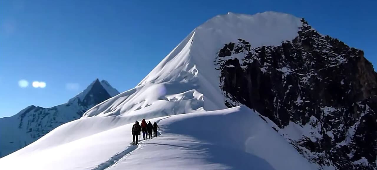
The first two hours of the summit day take place in complete darkness. The route above Camp III ascends the slope below the summit ridge on a line the Sherpa team fixed during the previous day. The angle is moderate initially, around 30 to 35 degrees, rising to 40 to 50 degrees as the ridge approaches. The surface is compacted snow and ice, firm in the early morning cold and providing good crampon purchase. The pace is set by the lead guide and held deliberately: rest step, deliberate breathing, no rushing on the flatter sections. The temptation to move faster when the ground briefly eases is resisted consciously, because the final meters to the summit arrive much faster when the reserve energy is intact.

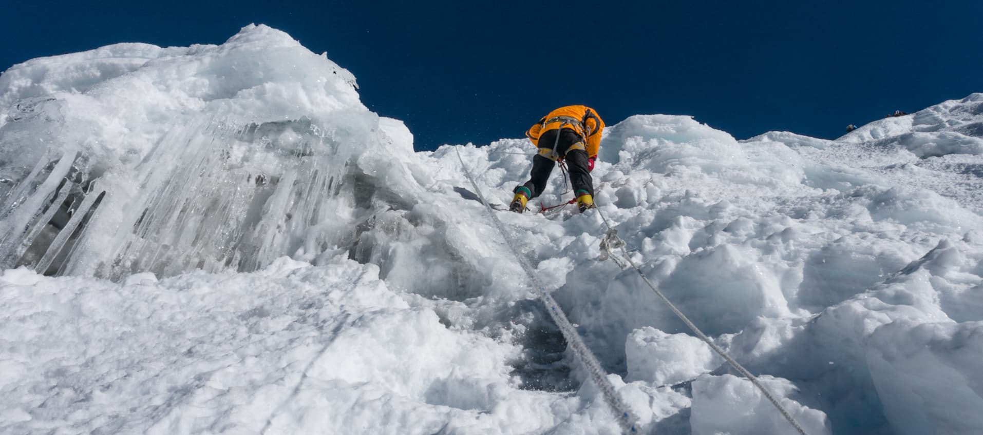
Above 6,800 meters, the ridge steepens to its maximum angle on a section of approximately 400 to 500 meters of sustained steep ground where the fixed ropes are in continuous use. The jumar ascends the rope in the same rhythm that was practiced at the training day in Kathmandu and on the rotations below: one slide up, weight transfer, one step, breathe. At this altitude, the effort required for each movement is substantially greater than the mechanical difficulty of the movement itself. The objective is to keep moving, maintain the rest step, follow the guide's pace, and trust the preparation.

Light comes up somewhere between 5:30 and 6:00 AM depending on the season and cloud cover. The transformation from headlamp tunnel vision to the full Himalayan panorama appearing over the ridgeline to the east is one of the defining experiences of the expedition for most climbers who reach the upper mountain. The Annapurna chain becomes visible first, its massive west face lit from below by the rising sun. Manaslu appears to the east, its characteristic pyramid profile unmistakable at this distance. As height increases, the northern horizon opens toward the Tibetan plateau, a vast brown tableland beyond the range that marks the Nepal-Tibet border, stretching away without feature toward a horizon that seems improbably distant.

The summit of Himlung Himal at 7,126 meters is reached in the early to mid-morning on a typical summit day, between 7:00 AM and 10:00 AM depending on conditions and group pace. The summit area is a broad, moderately flat snowfield on the upper ridge, wide enough for the team to stand together without crowding. The panorama from this point encompasses the full Annapurna massif from Annapurna I at 8,091 meters through Annapurna II, III, and IV, with Gangapurna and Tilicho Peak visible in the eastern section of the chain. Manaslu at 8,163 meters is to the northeast, rising above its own glaciated approaches in clean profile. Dhaulagiri at 8,167 meters anchors the western horizon. The Tibetan plateau extends north from the border ridge without interruption. It is one of the finest summit views on any 7,000-meter peak in Nepal.

Time at the summit is typically 20 to 30 minutes. Photographs are taken, GPS readings are confirmed, and the guides assess the descent conditions and team status before initiating the return. Descent follows the ascent route back to Camp III, then directly to base camp without an overnight stop at the high camps. The total summit day, from the 1:00 AM departure to arrival at base camp in the early evening, runs 14 to 16 hours. Descending from 7,126 meters to 4,850 meters on the same day is exhausting and requires sustained attention on the technical sections. The relief and emotional weight of the descent together are something that does not fully register until the base camp tent is visible and the last of the fixed ropes is behind you.

Daily Summary

Duration12–14 hrs climb
AccommodationTeahouse
MealsB,L,D
Mountain SeenAnnapurna I-IV, Manaslu, Dhaulagiri, Tibetan Plateau
Day 18

Rest & Recovery at Base Camp

Four buffer days are built into the climbing period to absorb weather delays, provide a second summit window for any team member who did not reach the top on the first attempt, and allow for additional rest and recovery above what a compressed itinerary would permit. These days are not wasted time: they are the structural margin that distinguishes a realistic expedition from an optimistic one.

If the summit window on Day 17 was good and all team members summited, the buffer days are used for extended recovery at base camp and some can be converted to earlier descent movement. If weather prevented the summit attempt or the attempt fell short, the buffer days provide the time needed to attempt again once conditions improve. The expedition leader monitors satellite weather forecasts daily during this period and makes the decision on second-attempt timing based on the available window data and the team's physical state.

Daily Summary

AccommodationTeahouse
MealsB,L,D
Mountain SeenHimlung Himal
Day 19

Buffer Day

Four buffer days are built into the climbing period to absorb weather delays, provide a second summit window for any team member who did not reach the top on the first attempt, and allow for additional rest and recovery above what a compressed itinerary would permit. These days are not wasted time: they are the structural margin that distinguishes a realistic expedition from an optimistic one.

If the summit window on Day 17 was good and all team members summited, the buffer days are used for extended recovery at base camp and some can be converted to earlier descent movement. If weather prevented the summit attempt or the attempt fell short, the buffer days provide the time needed to attempt again once conditions improve. The expedition leader monitors satellite weather forecasts daily during this period and makes the decision on second-attempt timing based on the available window data and the team's physical state.

Daily Summary

AccommodationTeahouse
MealsB,L,D
Mountain SeenHimlung Himal
Day 20

Buffer Day

The climbing period closes on this day. The mountain is behind the team and the practical business of closing the camp takes over. Personal sleeping tents come down first, with all interior contents sorted before the tent is struck: what goes in the main duffel, what stays accessible in the daypack, what is included in the general expedition equipment load. The kitchen tent is dismantled after the morning meal. The dining tent follows. All tent hardware, guy lines, and pegs are counted and packed against the manifest brought in at the start of the expedition.

Waste management at base camp is a permit condition and a Leave No Trace obligation taken seriously on this expedition. All non-biodegradable waste, from food packaging to fuel canisters to any abandoned equipment, is bagged and weighed. The waste is carried out by the porter team on the descent to Phu-Gaon and onward. The moraine platform that served as base camp for two weeks should look, on departure, as close to what it looked like on arrival as the team can make it.

The afternoon is for final personal organization and a quiet closing to the section of the expedition that the past weeks have built toward. Many climbers find this day has an unexpected reflective quality: the summit is done, the camp is coming apart, and the mountain sits above as it did on Day 8 but now carries the specific memory of every step taken on it. Worth noting, and then worth leaving. Overnight at base camp.

Daily Summary

AccommodationTeahouse
MealsB,L,D
Mountain Seen-
Day 21

Buffer Day

Daily Summary

AccommodationTeahouse
MealsB,L,D
Mountain Seen-
Day 22

Buffer Day

Daily Summary

AccommodationTeahouse
MealsB,L,D
Mountain Seen-
Day 23

Base Camp (4,850m)

The climbing period closes on this day. The mountain is behind the team and the practical business of closing the camp takes over. Personal sleeping tents come down first, with all interior contents sorted before the tent is struck: what goes in the main duffel, what stays accessible in the daypack, what is included in the general expedition equipment load. The kitchen tent is dismantled after the morning meal. The dining tent follows. All tent hardware, guy lines, and pegs are counted and packed against the manifest brought in at the start of the expedition.

Waste management at base camp is a permit condition and a Leave No Trace obligation taken seriously on this expedition. All non-biodegradable waste, from food packaging to fuel canisters to any abandoned equipment, is bagged and weighed. The waste is carried out by the porter team on the descent to Phu-Gaon and onward. The moraine platform that served as base camp for two weeks should look, on departure, as close to what it looked like on arrival as the team can make it.

The afternoon is for final personal organization and a quiet closing to the section of the expedition that the past weeks have built toward. Many climbers find this day has an unexpected reflective quality: the summit is done, the camp is coming apart, and the mountain sits above as it did on Day 8 but now carries the specific memory of every step taken on it. Worth noting, and then worth leaving. Overnight at base camp.

Daily Summary

AccommodationTeahouse
MealsB,L,D
Mountain SeenHimlung Himal
Day 24

Base Camp (4,850m) → Phu-Gaon (4,400m)

The return trail to Phu-Gaon covers the same ground as the approach in the opposite direction. The moraine and yak pasture terrain below base camp descends easily, and the 450-meter drop from camp to village is felt immediately in how the air improves. Most climbers notice the change in oxygen partial pressure within the first 30 minutes of descent in a way that the gradual ascent on Day 8 never quite produced: breathing is suddenly easier, the background cognitive load of altitude retreats, and the general weight of the high-altitude environment lightens.

Phu-Gaon from above, on the descent, has a different quality from the approach view. Having spent the past weeks looking up at snow and glacier terrain, the sight of the flat-roofed stone buildings and the chorten-lined paths below feels like another country. The monastery on the hillside above the village, seen in profile from the descent trail, is more visible than it was during the upward approach, and arriving in the village with the summit behind you gives the place a different significance from the one it had as a stopping point on the way in.

The lodge at Phu-Gaon serves a better meal than any of the high camp food of the past two weeks, and altitude suppression of appetite has largely reversed by this point. Eat well, rest, and mark the first real descent of the expedition. Camping at Phu-Gaon or overnight at the lodge depending on availability.

Daily Summary

Duration3–4 hrs walk
Distance8 km
AccommodationTeahouse
MealsB,L,D
Mountain SeenHimlung Himal, Kang Guru
Day 25

Phu-Gaon (4,400m) → Mehta (3,200m)

The descent through the Nar-Phu Valley reverses the approach trail. From Phu-Gaon, the path heads south and west, dropping through the open upper valley terrain and re-entering the gorge section above Mehta after roughly two hours. The trail is now fully familiar: the bridges, the cliff-face sections, the waterfall above Mehta, and the progressive loss of altitude that brings the vegetation back and the air density up.

At 3,200 meters, Mehta sits in noticeably richer air than the past three weeks have provided. The background cognitive and physical load of sustained altitude exposure does not disappear immediately, but the directional change is clear by the time the lodges at Mehta come into view. SpO2 readings on arrival at Mehta typically approach 90 to 93 percent, moving back toward the comfortable range for most team members.

Trekking time from Phu-Gaon to Mehta: five to six hours. Overnight at the lodge.

Daily Summary

Duration5-6 hrs walk
Distance14 km
AccommodationTeahouse
MealsB,L,D
Mountain SeenKang Guru
Day 26

Mehta (3,200m) → Koto (2,600m)

The final trekking day follows the gorge trail downstream from Mehta to Koto, retracing the approach corridor in the opposite direction. The suspended bridges, the river noise, the cliff-cut sections, and the Chhongche Cave are all passed in reverse sequence, and the gorge that felt dramatic and impressive on Day 5, heading in, feels different heading out: smaller somehow, and more manageable, though the objective terrain has not changed.

The tree line appears progressively as the descent continues, first as scrub growth on the canyon walls and then as proper forest on the lower slopes as Koto approaches. By the time the expedition reaches Koto at 2,600 meters and the police checkpoint records the departure from the restricted zone, the air is rich enough that breathing without awareness of it has returned. After weeks above 4,500 meters, this is not trivial.
The vehicle that will carry the team to Besishahar and Kathmandu meets at Koto. Luggage is loaded for the drive that begins tomorrow. Trekking time: four to five hours. Overnight at lodge.

Daily Summary

Duration4-5 hrs walk
Distance12 km
AccommodationTeahouse
MealsB,L,D
Mountain SeenAnnapurna II
Day 27

Koto → Besishahar → Kathmandu (1,400m)

The return drive retraces the jeep track from Koto through Dharapani and Chame to Besishahar, then the main highway from Besishahar through Dumre, Mugling, and along the Trisuli River back to Kathmandu. The total drive time is nine to eleven hours with a lunch stop.

The drop in altitude over this single day is dramatic: from Koto at 2,600 meters to Kathmandu at 1,400 meters, passing through Besishahar at around 800 meters in the middle section. Most climbers describe the air in the Marsyangdi valley below Besishahar as almost shocking after weeks above 4,000 meters. The oxygen at 800 meters is not appreciably different from sea level in any physiological sense, and the body's response to it after extended altitude exposure is immediate: breathing deepens, the background effort associated with every movement at altitude disappears, and the sheer richness of low-altitude air becomes briefly conspicuous before the body simply adjusts and moves on. It is a good feeling.

The drive is long and the road is still rough between Koto and Besishahar. Rest, watch the Annapurna chain recede to the south as the vehicle heads east, and allow the transition from expedition mode to city mode to begin at whatever pace it needs. The hotel in Kathmandu, with its hot shower, reliable electricity, and absence of a 1:00 AM summit alarm, will still be there when the vehicle arrives in the evening. Transfer to hotel in Kathmandu.

Daily Summary

Duration9-11 hrs drive
Accommodation3* Hotel
MealsB
Mountain SeenAnnapurna Range
Day 28

Debriefing, Leisure Day, and Farewell Dinner (1,400m)

The final full day. A formal debrief in the morning covers the full expedition from the Kathmandu briefing through to the summit outcome, including safety observations, route conditions, equipment performance, and any feedback the team wants to share for future expeditions. This session takes one to two hours and is the professional close of the climbing period.

The expedition operator presents summit certificates to climbers who reached the top. These are official certificates issued under the Nepal Mountaineering Association and Ministry of Culture, Tourism and Civil Aviation frameworks and carry the expedition's permit details, the climber's name, and the summit date. For climbers who did not reach the summit, the certificate reflects the highest verified elevation reached and acknowledges the full expedition participation.

The afternoon belongs to the team: Thamel for shopping, the Kathmandu valley temples if the legs are willing, or simply a long meal at a restaurant that is not serving dal bhat or instant noodles. The city in May is warm, busy, and cheerfully indifferent to anyone's high-altitude ambitions.

The farewell dinner in the evening brings the full team together one final time. The guides, the climbing Sherpas, the cook crew, and the liaison officer join the expedition members at a restaurant in Kathmandu. Tips are distributed at this dinner, and the expression of thanks between team and clients is genuine on both sides. The people who guided this expedition up and down a 7,000-meter mountain over the past weeks are not service providers in any ordinary sense of the term, and the farewell dinner acknowledges that. Overnight at hotel.

Daily Summary

Accommodation3* Hotel
MealsB
Mountain Seen-
Day 29

International Departure

Transfer to Tribhuvan International Airport for your onward flight. Departure times vary by destination; the team representative handles airport transfers and confirms timing the previous evening. The expedition is complete.

Daily Summary

AccommodationTeahouse
MealsB,L,D
Mountain Seen-

Cost Details

Price Includes

1. Kathmandu Accommodation and City Logistics

  • 4 nights at a 3-star hotel in Kathmandu (twin sharing, breakfast included)

  • Airport transfers in private vehicles on arrival and final departure

  • Welcome meeting with the expedition team in Kathmandu

  • All ground transportation required for expedition logistics


2. All Overland Transportation

  • Private vehicle transfer from Kathmandu to Besishahar (Day 3)

  • 4WD jeep transport from Besishahar to Koto and return journey (Days 4 and 27)

  • All fuel, driver costs, and vehicle expenses during the expedition


3. Permits and Legal Documentation

  • Himlung Himal climbing royalty permit (Nepal Mountaineering Association)

  • Nar-Phu Restricted Area Permit for the full expedition duration

  • Annapurna Conservation Area Permit (ACAP)

  • TIMS card (Trekkers' Information Management System)

  • Liaison officer fee, salary, equipment, food, and accommodation throughout

  • Official Himlung Himal climbing certificate from Nepal's Ministry of Culture, Tourism and Civil Aviation upon successful summit

  • All government taxes and official paperwork


4. Accommodation During Trek and Expedition

  • Best available teahouse and lodge accommodation during trek days (twin sharing)

  • Individual 4-season sleeping tent at base camp for each expedition member

  • Full camp infrastructure: kitchen tent, dining tent, toilet tent

  • Foam sleeping pads at base camp and high camps


5. All Meals (High-Calorie Expedition Nutrition)

  • 3 meals per day (Breakfast, Lunch, Dinner) throughout all trekking and climbing days

  • High-calorie expedition meals prepared by the kitchen crew at base camp and high camps

  • Energy snacks, seasonal fruits, and hot drinks available throughout the expedition

  • High-altitude camp food: instant meals, soups, energy-dense provisions for Camp I through Camp III


6. Professional Expedition Team

  • Licensed, NMA-certified expedition leader and guide

  • 1:1 ratio of climbing Sherpa per climber during all high-altitude sections above base camp

  • Kitchen crew (cook plus assistant) for base camp and high camp food preparation

  • Porter team during trekking sections (1 porter per 2 climbers, maximum 25kg per porter)

  • Full insurance, wages, equipment, food, and accommodation for all staff throughout


7. Technical Climbing Support

  • Fixed rope installation on technical sections above Camp II

  • Group climbing equipment: ropes, ice screws, snow stakes, and anchors

  • Route-fixing and ongoing maintenance by the Sherpa team during the climbing period

  • Pre-summit orientation session at base camp covering crampon use and jumar technique


8. Base Camp and High Camp Infrastructure

  • High-quality sleeping bags (down, -20C rating or better) on loan if required

  • Dining tent with tables, chairs, and solar or gas lighting

  • Kitchen equipment, cooking gas, and full utensil set

  • Toilet tent and waste management system at base camp


9. Health and Safety Equipment

  • Comprehensive first aid medical kit carried by the lead guide at all times

  • Pulse oximeter for daily SpO2 monitoring of all expedition members

  • Emergency supplemental oxygen cylinder for critical high-altitude use

  • Coordination support for emergency rescue operations (cost covered by the climber's travel insurance)


10. Government Taxes and Service Charges

  • All applicable government taxes and VAT

  • No hidden fees or surprise operational charges


Price Excludes

1. International Travel and Visa

  • International airfare to and from Kathmandu

  • Nepal entry visa fee (currently USD 30 for 15 days, USD 50 for 30 days, available on arrival)


2. Personal Expenses

  • Beverages beyond those included: soft drinks, bottled water purchased at teahouses, alcoholic drinks

  • Hot shower fees at lodges (USD 2-5 per shower)

  • Device charging fees at teahouses (USD 2-3 per session at higher elevations)

  • Wi-Fi access at lodges (USD 2-5 per session)

  • Laundry services

  • Personal shopping and souvenirs


3. Personal Climbing Equipment

  • Mountaineering boots, crampons, harness, helmet, ice axe, and ascender

  • Personal clothing, base layers, down jacket, and outer shell

  • Rental support can be arranged through the team in Kathmandu if needed


4. Travel Insurance (Mandatory)

  • Comprehensive high-altitude climbing insurance is required for every expedition member

  • Policy must cover: emergency helicopter evacuation up to 7,200m or above, medical treatment, and trip interruption

  • This must be arranged independently before arriving in Kathmandu


5. Tips

  • Tips for the expedition leader, climbing Sherpas, kitchen crew, and porters are not included

  • Tipping is a significant part of local expedition culture; see the Personal Expenses section for guidance


6. Force Majeure and Unforeseen Costs

  • Additional hotel nights from flight delays or weather-related itinerary extensions

  • Costs from early descent due to personal illness or injury

  • Helicopter evacuation charges beyond insurance coverage

  • Costs from natural events: landslides, political disruptions, weather emergencies


7. Optional Add-ons

  • Pokhara extension after the expedition

  • Extra Kathmandu hotel nights before or after the expedition dates

  • Satellite phone usage charges

  • Private guide or Sherpa upgrades

Scenic Highlights Along the Himlung Himal Expedition

  • Summit Panorama from 7,126m: Standing on top of Himlung on a clear morning, you can see Annapurna I through IV, Manaslu (8,163m), Dhaulagiri (8,167m), Gangapurna, Tilicho Peak, and the Tibetan Plateau stretching north without end.

  • Nar-Phu Valley Approach: The restricted approach through Koto, Mehta, and Phu-Gaon takes you through one of the few genuinely remote trekking corridors in Nepal, including a dramatic, narrow gorge above the Phu Khola river.

  • Phu-Gaon Village: One of the most culturally intact Tibetan-influenced villages in Nepal, sitting at 4,400 meters with centuries-old monasteries, prayer walls, and a way of life that has changed very little.

  • Tashi Lhakhang Monastery: An active monastery above Phu village, where monks continue daily prayer routines at an altitude. A rare opportunity to experience a living monastic community in a completely off-the-beaten-path setting.

  • Glacier and Moraine Terrain: Above base camp, the route crosses moraines, open glaciers, and compressed snowfields, with the Himlung summit ridge and high camps visible from many points on the approach.

  • Views of Kang Guru and Ratna Chuli: From the acclimatization hikes above Phu-Gaon and from base camp, views of Kang Guru (6,981m) and Ratna Chuli (7,035m) are among the most impressive in the region.

  • Marsyangdi Valley Drive: The overland journey from Kathmandu passes through the Marsyangdi valley with moving views of Annapurna II (7,937m) and Lamjung Himal appearing as you move deeper into the mountains.

  • Starfields at Base Camp: At 4,850 meters, with no light pollution and exceptionally clear spring skies, the night sky from Himlung Base Camp is among the finest you will see anywhere in the world.

Himlung Himal Expedition Departures

Select Departure Date

Trip duration: 29 Days

Sep - Oct 2026

September 2026

Su
Mo
Tu
We
Th
Fr
Sa
1
2
3
4
5
6
7
8
9
10
11
12
13
14
15
16
17
18
19
20
21
22
23
24
25
26
27
28
29
30

October 2026

Su
Mo
Tu
We
Th
Fr
Sa
1
2
3
4
5
6
7
8
9
10
11
12
13
14
15
16
17
18
19
20
21
22
23
24
25
26
27
28
29
30
31
Your Trip
USD 8,000SAVE $500
USD 7,500/ person

Best Price Guaranteed

2-3 People
USD 0/ Person
4-5 People
USD 0/ Person
6-11 People
USD 0/ Person
12-15 People
USD 0/ Person
16+ People
USD 0/ Person
CUSTOMIZE TRIP

Speak to an Expert

Laxmi Malla
Hari Kumar Shrestha
Himal Shrestha
Shiva Kumar Shrestha
UR Ghale

Himal Shrestha

Director 🇳🇵

Chat on WhatsApp

Additional Information

A Typical Day on the Expedition

Base camp days start early. By 5:30 or 6:00 AM, the kitchen crew has tea ready and the morning temperature sits somewhere between -5C and -10C. Breakfast follows: porridge, fried eggs, toast, jam, and hot drinks. At 7:00, the expedition leader runs a brief check-in, SpO2 readings are recorded, and the team sets off toward the day's objective.
Movement above base camp is deliberate. Slow and steady is the rule; conversations happen in shorter bursts because breathing demands it. Stops for water come every 45-60 minutes. Snacks are eaten on the move or during short rests. The pace can feel almost frustratingly slow to climbers used to lower altitudes. It is exactly right.
At high camp, afternoon rest matters as much as the climbing itself. The body repairs and adapts during horizontal rest, and every hour of sleep at altitude contributes directly to what is possible on summit day. Evenings at Camp II or III are spent eating warm food (soup, noodles, high-calorie expedition meals), checking gear, melting snow for water, and setting alarms for the early departure.
Summit day is a different experience entirely. Departure from Camp III in the very early morning, often under headlamp in temperatures of -20C to -25C or lower. The first few hours are cold, dark, and demanding. As the light comes up and you gain height, the view that opens below and around you is the reward the whole expedition has been building toward. Descent back to base camp after summiting takes the rest of the day. By evening, the hardest part of the expedition is done.

Accommodation Overview

Kathmandu
Four nights at a 3-star hotel in Kathmandu, with breakfast included each morning. These are comfortable, centrally located hotels with en-suite bathrooms, hot water, Wi-Fi, and easy access to Thamel for gear shopping and restaurants.
Trekking Section (Besishahar through Phu-Gaon and Return)
Accommodation during the trek is in teahouses and small lodges. Standards vary by elevation. At lower altitudes (Besishahar, Koto), rooms are basic but clean, with shared or private bathrooms. At Mehta and Phu-Gaon, rooms are simpler and more rustic, reflecting the remoteness of the Nar-Phu Valley. All teahouses have communal dining areas with central heating, which becomes very popular in the evenings.


Base Camp and High Camps
Each expedition member has an individual 4-season sleeping tent at base camp. The kitchen crew operates a separate fully equipped kitchen tent and a dining tent with tables, chairs, and lighting. A toilet tent is positioned away from the main camp. High camps use lighter, wind-resistant tents designed for conditions that base camp does not fully prepare you for. Sleeping at Camp III in a well-anchored high-altitude tent at -25C is an experience. It is also completely manageable with the right sleeping bag and layering system.

Best Time for the Himlung Himal Expedition

Spring (April to May) is the main climbing season. After winter, the weather stabilizes, and jet stream winds gradually lift from the summit zone, creating windows of calm days that experienced leaders can read and time well. Daytime temperatures at base camp range from -2C to +5C, with nights dropping to -15C to -20C. Above 6,000 meters, nighttime temperatures fall further. Late April through the first week of May typically offers the most reliable summit windows.


Autumn (October to November) is the second viable window. The post-monsoon atmosphere is clear and cold, and the mountain views on the approach are particularly sharp. Summit windows at altitude tend to be shorter in autumn than in spring, and temperatures at high camp are consistently lower. Both seasons produce successful expeditions; spring is simply more forgiving.


Winter (December to February) is not suitable for this expedition. Temperatures at high camp regularly fall below -40 °C with wind chill, and the jet stream sits directly on the summit zone for most of the season. Summer (June to September) coincides with the monsoon and brings heavy rainfall at lower elevations, snowfall above base camp, and poor visibility throughout.

Meals During the Expedition

All meals are included from Kathmandu throughout the full 29 days of the itinerary, with the exception of meals not covered by the package during free time in the city (see Price Excludes).

Kathmandu
Breakfasts at the hotel are full meals with local and continental options. Lunches and dinners in Kathmandu are at your own expense, with a wide range of restaurants in Thamel covering everything from Nepali dal bhat to Italian and Japanese cuisine.

Trekking Days
Three meals a day are served at teahouses along the route. Breakfasts typically include porridge, eggs (fried or boiled), bread, and hot drinks. Lunch on the trail often means dal bhat (rice and lentils), noodle soup, or pasta. Dinner is the main meal of the day: usually dal bhat or a noodle or rice dish with vegetables and protein. Options decrease as you move higher into the valley, but the food remains genuinely nourishing.


Base Camp and High Camps
At base camp, the kitchen crew prepares meals from fresh supplies brought in on the approach. Breakfasts are calorie-dense: oatmeal, fried eggs, bread, peanut butter, and hot drinks. Lunches lean on soup, pasta, and rice. Dinners are the main meal: dal bhat, noodle soup, a rice or potato dish with protein, and occasionally something resembling dessert. Seasonal fruit and snacks are available throughout the day.
At high camps, food shifts to what is portable and efficient: instant noodles, freeze-dried meals, energy gels, nuts, chocolate, and thermal flasks of hot soup or tea. The guiding principle above 5,500 meters is calorie density and digestibility, not variety.

Key Dietary Notes:

  • Dietary restrictions (vegetarian, vegan, gluten-free) can be accommodated at lower altitudes with advance notice; options become more limited above base camp
  • Drink at least 3-4 liters of fluid daily throughout the expedition; more on climbing days
  • Appetite decreases naturally at altitude; eating regularly even without hunger is important
  • Carry your own personal snack supply for high camp nights

Difficulty Level

Overall Rating: Strenuous to Challenging
Himlung Himal sits among the more accessible 7,000-meter peaks in Nepal, but accessible does not mean easy. This is a full mountaineering expedition that demands weeks of physical and mental effort at high altitude.


Physical Demands
Trekking days involve 5-6 hours of walking, often on uneven trail with significant elevation gain. Climbing days at high camp require 6-8 hours of sustained movement on steep mixed terrain, and summit day is a 10-14 hour effort from first crampons on to back in the sleeping bag at base camp.


Technical Climbing Skills
Crampons and ice axe use are mandatory throughout the high-altitude section. Rope work on fixed lines is required above Camp II. The route does not involve technical ice climbing or rock climbing, but crampon technique, self-arrest knowledge, and jumar use are expected of all participants before the expedition begins. Most of the route sits at 30 degrees; the final section above Camp III reaches approximately 40 degrees.


Mental Demands
Fourteen days at or above 4,850 meters is psychologically taxing even when the climbing is progressing well. Weather delays, poor sleep at altitude, the physical weight of the effort, and the sheer length of the expedition compound over time. Mental preparation is as important as physical fitness.


Who Should Attempt This Expedition

  • Climbers with at least one successful 6,000-meter summit (Mera Peak, Island Peak, or equivalent)
  • Individuals with experience using crampons, ice axe, and fixed ropes
  • Anyone physically capable of 5-7 hours of mountain movement per day over multiple consecutive days
  • Those who are mentally prepared for high-altitude conditions and the uncertainties of expedition climbing


Altitude and Acclimatization

The itinerary is built around a proven acclimatization logic: gradual ascent, rotation climbs that go higher before sleeping lower, and rest days at critical points. Every scheduled rest day has a physiological purpose.


The first major acclimatization step is Phu-Gaon at 4,400 meters, where Day 7 is reserved entirely for adjustment. The move to base camp at 4,850 meters on Day 8 is kept manageable. Above base camp, the rotation system is the most important part of the whole expedition: going to Camp I and returning to sleep at base camp, then going to Camp II and returning, triggers red blood cell production at each elevation before the body rests at a lower altitude. This is how capable climbers arrive at Camp III in a state where a summit attempt is realistic.


The signs of altitude sickness to watch for above 4,000 meters: a headache that does not respond to paracetamol or ibuprofen, persistent nausea, confusion, loss of coordination, or a drop in SpO2 of more than 5 points below the previous day's morning reading. Any of these is a reason to flag to the expedition leader immediately. Descent is always the correct response to worsening symptoms. The expedition team carries emergency oxygen and is trained in altitude-related emergencies, including recognition of HACE and HAPE.


Key acclimatization rules for this expedition:

  • Never gain more than 500 meters of sleeping altitude per day above 3,000 meters
  • Climb high, sleep low during rotation days
  • Drink a minimum of 3-4 liters of fluid per day
  • Eat regular meals even when your appetite is reduced
  • Report any worsening symptoms to the expedition leader immediately
  • Trust the acclimatization schedule; pushing ahead of the planned timetable increases risk without improving summit odds

Permits and Regulations


Himlung Himal Climbing Royalty
Issued by the Nepal Mountaineering Association (NMA). The fee for spring season (March to May) is USD 500 per climber. Autumn (September to November) is USD 250, and winter and summer are approximately USD 125.


Nar-Phu Restricted Area Permit
Required for the approach through Koto, Mehta, and Phu-Gaon. Current rate: USD 100 per person per week during September through November; USD 75 per person per week during all other months including spring. Additional days beyond the first week are charged on a pro-rated basis.


Annapurna Conservation Area Permit (ACAP)
Required for trekking through the Annapurna Conservation Area. Current fee: NPR 3,000 per person (approximately USD 22) plus 13% VAT.


TIMS Card
The Trekkers' Information Management System card is required for all trekkers and climbers in Nepal. Arranged as part of the permit package.


Liaison Officer
One government-appointed liaison officer must accompany all expeditions to restricted peaks. The officer's salary, equipment, food, accommodation, and transport are included in the expedition package.


Regulations to Follow

  • Leave No Trace: all expedition waste must be carried out or disposed of in designated areas
  • Permits and identification must be carried and available for checkpoint inspections throughout the expedition
  • Use only licensed and registered guides and climbing teams in the restricted area
  • Respect the culture and customs of Nar and Phu villages: ask before photographing locals, remove shoes before entering monasteries, follow the guide's cultural briefing

Transportation

All transportation from Kathmandu to base camp and back is included in the package. Nothing is left to you to organize independently.


Overland: Kathmandu to Koto
Day 3 uses a private vehicle (minibus or SUV) from Kathmandu to Besishahar, following the Prithvi Highway west. Day 4 uses a 4WD jeep from Besishahar to Koto through the Marsyangdi valley. The jeep track to Koto is rough in places; pack your daypack for easy access during the ride.


Trekking: Koto to Base Camp
In Koto, all movement is on foot. Porters carry the main equipment and supplies (1 porter per 2 climbers, up to 25kg per porter). You carry a daypack with the day's essentials: water, snacks, camera, and an extra layer. High-altitude porter or yak support from Phu-Gaon to base camp may be used for the heavy supply loads.


Return: Base Camp to Kathmandu
The descent retraces the approach: on foot from base camp to Koto, then by 4WD to Besishahar, then by vehicle to Kathmandu. All return transport is included.


Emergency Helicopter Evacuation
In the event of a medical emergency at base camp or on the trekking approach, helicopter evacuation is available. This is covered by travel insurance, not by the expedition package. The team coordinates the evacuation; the insurance covers the cost. There are no helicopter landings above base camp.

Extra Personal Expenses During the Expedition

Budget an additional USD 300 to USD 600 for personal expenses across the 29 days. Here is a realistic breakdown:

  • Meals in Kathmandu (lunches and dinners): USD 8-20 per meal at mid-range restaurants in Thamel
  • Beverages on trek: tea and coffee at teahouses (USD 1.50-4), bottled water when purification tablets are not used (USD 1-3 per liter)
  • Hot showers at lodges: USD 2-5 depending on elevation
  • Device charging: USD 2-3 per device at lower elevations, higher at altitude
  • Wi-Fi: USD 2-5 per session; availability decreases above 3,500 meters
  • Tips (expedition total): expedition leader USD 10-20 per day; climbing Sherpa USD 15-25 per day; cook USD 8-12 per day; kitchen assistant USD 5-8 per day; porters USD 5-8 per day
  • Personal gear rental in Kathmandu (if needed): crampons, ice axe, sleeping bag USD 3-6 per item per day
  • Souvenirs and shopping: Thamel has prayer flags, thangka paintings, pashmina, and local craft items ranging from USD 5 to USD 50

Essential Equipment for the Expedition

Clothing (Layering System)

  • Moisture-wicking thermal base layers: 2-3 sets, top and bottom
  • Mid-layer fleece or softshell jacket
  • Heavyweight hooded down jacket (rated for -20C or below)
  • Expedition-weight down pants for high camp use
  • Waterproof and windproof hard-shell jacket and pants (Gore-Tex or equivalent)
  • 2-3 pairs of quick-dry trekking pants
  • Long-sleeve moisture-wicking shirts
  • Warm beanie, sun hat, and balaclava
  • Neck gaiter or buff
  • Liner gloves, insulated trekking gloves, and expedition-grade mitts
  • Trekking socks: 4-5 pairs moisture-wicking; 2-3 pairs heavyweight thermal for high camps

Footwear

  • Double-layered mountaineering boots compatible with step-in crampons (for all climbing sections)
  • Sturdy waterproof trekking boots for the approach
  • Camp sandals or light shoes for base camp evenings
  • Gaiters (short for trekking, full-length for high camps)
  • Technical Climbing Gear
  • 12-point crampons compatible with mountaineering boots
  • Ice axe (60-70cm standard alpine; bring your own or rent in Kathmandu)

Climbing harness

  • Mountaineering helmet
  • Ascender / jumar (right or left hand, depending on preference)
  • Locking and non-locking carabiners (minimum 3 locking, 2 non-locking)
  • Prusik loops (2 x 6mm cord)
  • Descender or figure-8

Personal Items and Other Essentials

  • Headlamp with spare batteries (minimum 300 lumens; essential for summit day)
  • Adjustable trekking poles with interchangeable baskets
  • Glacier glasses or ski goggles for high camp (anti-UV, wraparound)
  • Sunglasses with UV protection for the approach
  • Sunscreen SPF 50+ and lip balm with SPF (snow reflection at altitude is severe)
  • Water bottles (2 x 1 liter) or hydration bladder; water purification tablets or filter
  • High-energy personal snack supply: protein bars, nuts, chocolate, electrolyte tablets
  • Personal first aid kit: blister care, pain relievers, stomach medication, altitude medication (discuss Diamox with your doctor before departure)
  • Sleeping bag rated -25C to -30C for high camps (loan bags available if required)
  • Sleeping bag liner for added warmth and hygiene
  • Power bank (high capacity; cold reduces battery life significantly)

Camera or phone for documentation

  • Passport, insurance details, and permit copies (digital and printed)

Preparation for the Himlung Himal Expedition

Physical and mental preparation should begin a minimum of three months before departure. Here is a realistic training framework:


Cardiovascular Fitness
Run, cycle, or swim 4-5 sessions per week. Prioritize long steady-state sessions (60-90 minutes) over short intense intervals. Endurance at altitude depends on aerobic base, not peak output. If you can comfortably run for 90 minutes or complete a 3-4 hour hike without distress, you have the right foundation.


Hiking with a Loaded Pack
Weekly long hikes carrying 12-15kg prepare your joints and core for real trekking days. Find hilly terrain if you can. Flat routes do not translate to mountain performance. Try to include at least two multi-day hikes in the months before departure.


Strength Training
Focus on legs, core, and back: squats, lunges, step-ups, deadlifts, and planks. The descent from 7,126 meters is often harder on the body than the ascent, and good quad and glute strength makes a real difference by the time you are descending from high camp on tired legs.


Technical Skills
If you have not used crampons and an ice axe before, take a one-day mountaineering course from a local guide service before your departure. Knowing how to self-arrest, move on crampon points, and clip into a fixed line before the briefing day in Kathmandu saves time and increases confidence at altitude.


Medical Preparation
Get a full physical check-up and discuss the expedition with your doctor. Talk specifically about Diamox (Acetazolamide) as an acclimatization aid; start it 24-48 hours before arriving at Koto. Ensure vaccinations are up to date for Nepal travel. Bring a personal medical kit covering your usual medications, altitude sickness medication, and common trekking ailments.

Safety and Acclimatization on the Expedition

Every member of the expedition team is trained in high-altitude emergency response. The lead guide carries a first aid kit and an emergency oxygen cylinder at all times above base camp. SpO2 readings are recorded each morning at base camp and high camps and compared against each climber's personal baseline.

Standard Safety Rules

  • No climber operates above base camp alone at any time
  • All climbers are roped on fixed lines above Camp I
  • Summit day departures are weather-conditional; the expedition leader makes the call
  • Any SpO2 reading 5 or more points below a climber's baseline triggers an immediate assessment
    Descent is always the correct response to worsening altitude sickness symptoms

Altitude Sickness Response
Mild symptoms (headache, mild nausea, slight fatigue) are normal and usually resolve with rest and hydration. Moderate symptoms (persistent headache, vomiting, confusion, loss of coordination) require immediate descent by at least 300-500 meters and notification of the expedition leader. Severe symptoms consistent with HAPE (fluid in the lungs, extreme breathlessness at rest) or HACE (severe confusion, inability to walk) require emergency descent and evacuation. The team has emergency oxygen available for these situations.

Travel Insurance

Travel insurance is not optional on this expedition. It is a requirement, and the full climbing period will not begin without confirmation that every team member has valid coverage.

Minimum Required Coverage

  • Emergency helicopter evacuation up to 7,200 meters or above
  • Medical treatment costs for injuries and altitude-related illness
  • Trip cancellation and interruption
  • Repatriation

Important Notes

Standard travel insurance packages from mainstream providers typically exclude climbing above 5,000 or 6,000 meters. Read the policy carefully and confirm coverage limits with the insurer before purchasing. Himalayan helicopter rescues cost between USD 3,000 and USD 10,000 or more, depending on the operation; without insurance, these costs fall entirely on the climber.


Providers that specialize in high-altitude mountaineering include World Nomads, Battleface, IMG Global, and Global Rescue. Estimated cost for a 30-day policy with the required coverage: USD 150-300 per person.


Carry both a printed and digital copy of your insurance policy. Share the policy number and insurer's emergency contact number with the expedition leader before departure from Kathmandu.

Weather Conditions on the Himlung Expedition Route (Month by Month)

March to May (Spring)
Spring is the prime season. Kathmandu is warm and clear. At base camp (4,850m), daytime temperatures reach -2C to +5C, with nights at -15C to -20C. Above 6,000 meters, nighttime temperatures fall further. The jet stream typically lifts above the summit zone in late April and into the first week of May, creating multi-day windows of stable weather that allow summit attempts. Late April and early May represent the most reliable window.


June to September (Monsoon)
Not suitable for this expedition. Heavy monsoon rainfall at lower elevations, snowfall at altitude, and persistently poor visibility across the entire Himalayan range. The few expeditions that attempt a monsoon ascent face extremely challenging conditions.


October to November (Autumn)
The second viable season. Post-monsoon, the atmosphere is clear and cold. Summit views are exceptional. Base camp nights average -10C to -15C, and high camp temperatures are consistently lower than in spring. Weather windows at summit altitude tend to be shorter, but the season produces consistent results. Autumn is the preferred season for climbers who cannot travel in spring.


December to February (Winter)
Not suitable. Temperatures at high camp regularly fall below -40C with wind chill, and the jet stream sits directly over the summit zone for most of the winter. Access through the Nar-Phu Valley is also severely limited by snow on the approach trails.

Why Choose the Nar-Phu Valley Route to Himlung Himal

Himlung Himal's greatest distinction is not the mountain itself. It is where the mountain sits. The Nar-Phu Valley is one of the last genuinely restricted trekking corridors in Nepal, closed to outsiders until 1992 and still requiring a special government permit to enter. The number of expeditions that pass through each spring is a fraction of what any popular trekking route sees in a single week. You will not encounter crowds here.


Phu-Gaon at 4,400 meters is arguably one of the most culturally striking high-altitude settlements in the country. The village layout, the monasteries, the yak herding culture, and the Tibetan influence in everything from architecture to daily ritual give the place a quality that most Himalayan trekkers never encounter because most Himalayan trekkers never come this way.
From a climbing perspective, the approach through Koto and Mehta is longer than what you would face on peaks accessed via Lukla, but it provides a gradual and effective acclimatization ladder. By the time you arrive at base camp, having walked through Mehta (3,200m) and spent a night at Phu-Gaon (4,400m), your body has had more time to adjust than it would on a faster altitude gain approach.


For climbers who have completed a 6,000-meter peak and are ready to commit to their first genuine 7,000-meter expedition, Himlung Himal makes a strong and specific case. It is remote enough to feel like a real adventure. It is organized enough to give you a genuine chance at the top. And it sits inside a valley that will stay with you long after the summit is behind you.

Oxygen Saturation (SpO2) Chart - Himlung Himal Expedition

The following table provides estimated SpO2 ranges based on altitude. Individual readings vary based on fitness, acclimatization rate, and baseline health. Daily monitoring is conducted by the expedition team at base camp and all high camps.

Day

Date

Place

Alt (m)

SpO2 (%)

Comment

1-2

Apr 15-16

Kathmandu

1,400

96-99%

Baseline: no altitude impact

3

Apr 17

Besishahar

823

96-99%

Below Kathmandu, full saturation

4

Apr 18

Koto

2,600

92-95%

Mild altitude exposure begins

5

Apr 19

Mehta

3,200

90-93%

Acclimatisation underway

6

Apr 20

Phu-Gaon

4,400

84-88%

Noticeable drop; hydration critical

7

Apr 21

Phu-Gaon (rest)

4,400

85-89%

Rest day aids adaptation

8

Apr 22

Base Camp

4,850

81-86%

High-altitude zone begins

9

Apr 23

Base Camp

4,850

82-87%

Stabilising; monitor daily

10

Apr 24

Rotation: Camp I

5,450

76-82%

AMS risk rises; slow pace essential

11

Apr 25

Base Camp

4,850

82-87%

Descent recovery

12

Apr 26

Rotation: Camp II

6,000

72-78%

Significant altitude; pace carefully

13

Apr 27

Base Camp

4,850

83-88%

Rest before push

14

Apr 28

Camp I

5,450

76-82%

Second exposure; body adapting

15

Apr 29

Camp II

6,000

72-78%

Pacing essential

16

Apr 30

Camp III

6,350

68-74%

Very thin air; summit prep

17

May 01

Summit / Base Camp

7,126 / 4,850

58-70% (summit)

Critical zone; descends promptly after

18

May 02

Base Camp

4,850

82-88%

Strong recovery begins

19-22

May 03-06

BC / High Camps

4,850-7,126

Varies

Buffer days; daily monitoring required

23-24

May 07-08

BC / Phu-Gaon

4,850-4,400

82-89%

Descending; recovery improving

25

May 09

Mehta

3,200

90-93%

Near-normal levels

26

May 10

Koto

2,600

92-95%

Good recovery

27-29

May 11-13

Kathmandu

1,400

96-99%

Full recovery zone


Frequently Asked Questions About Himlung Himal Expedition

GeneralWeather and TemperatureArrival and VisasTrek CostPhysical FitnessTrek Preparation and PackingTrek AccommodationHealth and SafetyPractical MattersTransportation and Flights

General

5 Qs
What is the Himlung Himal Expedition?

The Himlung Himal Expedition is a 29-day guided mountaineering expedition to the summit of Himlung Himal at 7,126 meters (23,379 feet) in the restricted Nar-Phu Valley of northwestern Nepal. The route runs from Kathmandu by road to Koto, then on foot through the gorge trail to Phu-Gaon and Himlung Base Camp at 4,850 meters. Above base camp, a three-camp rotation system, Camp I at 5,450 meters, Camp II at 6,000 meters, and Camp III at 6,350 meters, precedes the summit push. The itinerary runs from 15 April to 13 May 2026, timed for the spring climbing window.

How does Himlung Himal compare to other peaks in Nepal?

Himlung sits above the standard trekking peaks in both altitude and expedition complexity. Mera Peak (6,476 m) and Island Peak (6,189 m) are common preparation climbs for it. Among 7,000-meter peaks, Himlung carries one of the highest recorded summit success rates in the Himalayan Database and one of the lowest objective hazard profiles, with significantly less avalanche and rockfall risk than many comparable mountains at this altitude. It is widely used as a stepping-stone for climbers preparing for 8,000-meter objectives including Manaslu (8,163 m) and Cho Oyu (8,188 m). The Nar-Phu Valley approach is one of the few genuinely remote approach routes still operating in Nepal.

What is the summit success rate on this expedition?

Himlung Himal records one of the highest summit success rates among 7,000-meter peaks in Nepal according to the Himalayan Database. For well-prepared climbers on properly organized expeditions following structured acclimatization protocols, rates typically fall between 80 and 90 percent. The 14-day climbing period in this itinerary includes buffer days for weather delays and a possible second summit attempt, specifically to maximize each climber's window. Physical preparation, individual acclimatization response, and weather are the three factors that most influence the outcome.

What happens if weather prevents a summit attempt?

Weather delays are a standard part of any high-altitude expedition. The team monitors conditions daily using satellite forecasts and local mountain knowledge. The buffer days built into the 14-day climbing period exist precisely for this: if the first planned window closes, the team waits for the next one. If no viable weather window opens within the expedition timeline, the situation is handled directly with the expedition operator, who will discuss partial refund or next-season credit options. The 29-day structure of this itinerary is intentionally generous compared to shorter commercial expeditions specifically to address this contingency.

Can I extend the trip to include Pokhara or other destinations?

Yes. A Pokhara extension after the expedition is straightforward to arrange and is popular with returning climbers: at 820 meters, Pokhara's lakeside setting and low altitude make it an effective recovery stop after weeks above 4,500 meters. Pokhara is approximately five to six hours from Kathmandu by road or 30 minutes by air. Additional Kathmandu nights, a Chitwan jungle safari, or a mountain-view flight are also available. All extensions are arranged separately and can be discussed with the expedition team during the planning phase.

Weather and Temperature

4 Qs
What is the best time to climb Himlung Himal?

Spring (April to May) is the primary climbing season. The jet stream gradually lifts above the summit zone through late April and into early May, creating multi-day windows of calm, clear weather that experienced expedition leaders track and time carefully. Daytime temperatures at base camp (4,850 m) range from -2°C to +5°C, with nights dropping to -15°C to -20°C. The section of late April through the first week of May consistently produces the most reliable summit windows and is the basis for this expedition's timing. Autumn (October to November) is the viable alternative, with excellent post-monsoon visibility and stable conditions at lower altitudes, though high-camp temperature windows tend to be shorter than in spring.

What temperatures should I expect at different points on the expedition?

On the drive and lower trekking section (Kathmandu to Koto, 800 to 2,600 m), temperatures in April range from around 15°C to 25°C during the day with cool nights. In the Nar-Phu Valley at Mehta (3,200 m) and Phu-Gaon (4,400 m), daytime temperatures sit at 10°C to 15°C with nights dropping below -5°C. Base camp (4,850 m) in late April sees daytime highs of -2°C to +5°C and nighttime lows of -15°C to -20°C. At Camp II (6,000 m) and Camp III (6,350 m), nighttime temperatures fall to -20°C to -25°C or lower depending on conditions. Summit day temperatures above Camp III can reach -25°C or below with wind chill. Layering for the full range from warm approach days to summit-day cold is essential.

What are weather conditions like in the Nar-Phu Valley on the approach?

The Nar-Phu Valley sits in a rainshadow and has less precipitation than many Nepal trekking routes. In spring, the valley approach through Koto, Mehta, and Phu-Gaon sees clear mornings, moderate daytime warmth at lower elevations (10°C to 20°C), and cold nights above 3,500 meters. Occasional afternoon cloud builds at lower elevations in May but does not typically affect the high-altitude climbing section significantly. The gorge terrain between Koto and Mehta is dry and rocky. The route is technically open year-round above Koto, but the restricted-area permit system limits when expeditions can legally operate.

What is the weather like during the summit push from Camp III?

Summit day departs Camp III typically between 1:00 AM and 3:00 AM. Temperatures at this altitude in early May sit at -20°C to -25°C before wind chill is applied. Wind is the primary variable: the jet stream proximity determines whether a window is viable. Above Camp III, the route steepens to approximately 40 degrees on ice and compressed snow. The morning light that comes with gaining altitude rewards the early departure, and on a clear spring morning the panorama from 7,126 meters, Annapurna I through IV, Manaslu, Dhaulagiri, Gangapurna, and the Tibetan Plateau, is one of the finest summit views available in Nepal.

Arrival and Visas

3 Qs
Do I need a visa to enter Nepal for the expedition?

Yes. Most nationalities require a Nepal tourist visa, obtainable on arrival at Tribhuvan International Airport in Kathmandu or in advance through Nepal's online eVisa portal at nepaliport.immigration.gov.np. Indian nationals are exempt and may enter with a valid passport or government-issued identity document. Visa durations available are 15 days (USD 30), 30 days (USD 50), and 90 days (USD 125). For a 29-day expedition with buffer days, the 30-day visa is the appropriate choice. Your passport must be valid for at least six months beyond your return date, with at least one blank page. During the peak spring season (April and May), immigration queues at Tribhuvan can take 30 to 60 minutes; patience and pre-filling the online form before arrival speed up the process.

What permits are required for the Himlung Himal Expedition?

Four permits are required, and all are arranged by the expedition team on your behalf. The Himlung Himal climbing royalty, issued by the Nepal Mountaineering Association, costs USD 500 per climber in the spring season. The Nar-Phu Restricted Area Permit costs USD 75 to USD 100 per person per week and covers the approach through Koto, Mehta, and Phu-Gaon. The Annapurna Conservation Area Permit (ACAP) costs approximately NPR 3,000 (USD 22) plus 13 percent VAT. A TIMS card (Trekkers' Information Management System) is also required. One government-appointed liaison officer must accompany all restricted-peak expeditions; all liaison officer costs, including salary, equipment, food, accommodation, and transport, are included in the package.

What is the arrival procedure in Kathmandu?

A team representative meets you at Tribhuvan International Airport on Day 1 and transfers you to the hotel in Kathmandu. Day 1 is for rest and settling in after the journey. Day 2 is the full preparation day: gear is checked against the complete list, permits are confirmed, and the expedition leader runs through the itinerary, safety protocols, high-camp procedures, and team roles. Any outstanding equipment gaps can be addressed through Thamel's outdoor gear market, which has a wide selection of rental and retail mountaineering equipment at reasonable rates. The NMA requires a medical certificate for climbing permits; confirm your doctor has provided this before departure.

Trek Cost

7 Qs
What does the expedition package price include?

The package includes four nights of hotel accommodation in Kathmandu (3-star, twin-sharing, breakfast included), all overland transportation from Kathmandu to Koto and return by private vehicle and 4WD jeep, all permits and government fees, a government-appointed liaison officer, full-board accommodation throughout all trekking and climbing days, individual 4-season sleeping tents at base camp, full camp infrastructure (kitchen tent, dining tent, toilet tent), three daily high-calorie meals throughout the expedition, an NMA-certified expedition leader, a 1:1 climbing Sherpa ratio for all sections above base camp, a porter team during the trek (one porter per two climbers), emergency oxygen, a pulse oximeter, a comprehensive first aid kit, all staff wages and insurance, route-fixing equipment, and all applicable government taxes with no hidden charges.

What costs are not covered by the package?

The package does not include international airfare to and from Kathmandu, the Nepal entry visa fee (USD 50 for the 30-day visa recommended for this expedition), personal climbing equipment (mountaineering boots, crampons, harness, helmet, ice axe, ascender), comprehensive high-altitude travel insurance (mandatory), and tips for the expedition team. Personal expenses on the trek include hot shower fees at lodges (USD 2 to 5 per shower), device charging (USD 2 to 3 per session at higher elevations), Wi-Fi at teahouses (USD 2 to 5 per session), personal beverages beyond included meals, and Kathmandu lunches and dinners. Satellite phone usage, Pokhara extensions, and extra Kathmandu hotel nights are also separate.

How much should I budget for personal expenses across the 29 days?

Budget an additional USD 300 to USD 600 for personal expenses across the full expedition. In Kathmandu, mid-range restaurant meals run USD 8 to 20. On the trek, teahouse extras (showers, charging, Wi-Fi, drinks) add up gradually. Tips are the most significant personal cost: the standard for this type of expedition is USD 10 to 20 per day for the expedition leader, USD 15 to 25 per day for each climbing Sherpa, USD 8 to 12 for the cook, USD 5 to 8 for the kitchen assistant, and USD 5 to 8 for each porter. Gear rental in Kathmandu (crampons, ice axe, sleeping bag if not bringing your own) runs USD 3 to 6 per item per day. Personal snack supplies for high camps represent a smaller but real cost worth factoring in.

Can I rent mountaineering equipment in Kathmandu?

Yes. Thamel has a well-established equipment rental market for mountaineering gear. Crampons, ice axes, harnesses, and sleeping bags are all available for daily rental rates. Quality varies across shops, so inspect any rented technical item carefully before accepting it; the expedition team can advise on reliable rental sources during the Day 2 gear check. Rental sleeping bags rated to -25°C or -30°C for high camps are available and covered by a loan arrangement if required. Mountaineering boots compatible with step-in crampons are the single piece of gear that should ideally be brought from home: fit and break-in time matter too much to leave to a rental.

Who Can Trek?

What level of experience is required for the Himlung Himal Expedition?
A minimum of one successful 6,000-meter summit is strongly recommended before attempting Himlung. Mera Peak (6,476 m), Island Peak (6,189 m), and Pisang Peak (6,091 m) are the most commonly used preparation peaks. Beyond altitude experience, climbers must be comfortable with crampons, ice axe use, self-arrest technique, and ascending fixed ropes with a jumar before the expedition begins. These skills do not need to be advanced, but they must be in place before the high-altitude section starts. Climbers attempting Himlung as a first mountaineering objective, without prior 6,000-meter experience, are not well-positioned for a safe and successful ascent.

Is Himlung Himal technically difficult?

It is classed as semi-technical and graded AD+ (Alpine Difficulty). The majority of the ascent sits at around 30 degrees on rock, moraine, and glacier terrain. The section above Camp III steepens to approximately 40 to 50 degrees on ice and compressed snow. There is no vertical ice climbing, mixed climbing, or technical rock work anywhere on the standard route. The main technical tools required are crampons with front-pointing technique, an ice axe for balance and self-arrest, and a jumar for fixed-rope sections above Camp II. The summit push is a 10 to 14-hour effort from Camp III; physical endurance on that day is the primary demand, not technical complexity.

Is Himlung Himal suitable as a training peak for 8,000-meter objectives?

Yes, and it is widely used for exactly this purpose. Nepal's government has formally recognized 7,000-meter peak experience as a prerequisite for obtaining climbing permits for 8,000-meter peaks including Everest, and Himlung satisfies this requirement. The three-camp expedition structure, the fixed-rope environment above Camp II, the sustained glacier travel, the multi-week base camp period, and the 7,000-meter altitude exposure all provide preparation that is directly transferable to higher objectives. Climbers using Himlung as a stepping stone toward Manaslu, Cho Oyu, or Shishapangma are making a well-established and logical progression.

Physical Fitness

3 Qs
How fit do I need to be for the Himlung Himal Expedition?

This is a strenuous to challenging expedition. Trekking days to base camp involve five to six hours of walking on uneven, high-altitude terrain with significant elevation gain. Climbing days at high camp require six to eight hours of sustained movement on steep mixed terrain. Summit day is a 10 to 14-hour effort from first crampons on to return to base camp. The fitness baseline required is the ability to move continuously at altitude for this duration, loaded with a daypack, for multiple consecutive days. Climbers who cannot comfortably complete a three to four-hour hike with 700 to 800 meters of gain before departure are not at the required fitness level. Mental endurance over a 29-day expedition adds a psychological dimension that physical fitness alone does not cover.

What does a structured training programme for Himlung look like?

Begin a minimum of three months before departure. Cardiovascular endurance is the foundation: run, cycle, or swim four to five sessions per week, prioritizing long steady-state efforts of 60 to 90 minutes over short intervals. Weekly long hikes carrying 12 to 15 kg, ideally on hilly terrain with at least two multi-day hikes in the months before departure, build the joint and core endurance that trekking days demand. Strength training should target legs, core, and back specifically: squats, lunges, step-ups, deadlifts, and planks. Descent from high camps is often harder on the body than ascent; strong quad and glute strength makes a real difference on long descents from Camp III on tired legs. Technical skills, crampons, self-arrest, jumar technique, should be practiced on a one-day mountaineering course if not already in place.

What are the most common physical challenges climbers face on this expedition?

The primary physical demands are sustained aerobic output at altitude over a multi-week period, cold management on summit day and at high camps, and the cumulative fatigue of 14 consecutive days at or above 4,850 meters. Sleep quality deteriorates at altitude and is difficult to fully compensate for. Appetite suppresses above 5,000 meters and eating regularly without hunger is a discipline that matters. The descent from the summit is frequently cited as the most physically demanding section of the climb: legs that pushed for 10 hours on the way up must carry the body back down. Proper quad conditioning before departure is the most direct mitigation.

Trek Preparation and Packing

3 Qs
What clothing system do I need for the expedition?

The full layering system covers the range from warm approach days below 3,000 meters to summit day at -25°C or below. Base layers are two to three sets of moisture-wicking thermal tops and bottoms. A mid-layer fleece or softshell adds insulation for trekking in cold conditions. A heavyweight hooded down jacket rated to -20°C or below is required for base camp evenings and high-camp use. Expedition-weight down pants are needed for Camp II and above. A waterproof and windproof hardshell jacket and pants in Gore-Tex or equivalent complete the outer system. Expedition-grade mitts are the critical hand protection for summit day, worn over liner gloves and insulated trekking gloves. A balaclava, neck gaiter, warm beanie, and sun hat cover the head for both extreme cold and high-altitude sun exposure.

What technical climbing gear do I need to bring?

The personal technical kit covers 12-point crampons compatible with your mountaineering boots, a 60 to 70-centimeter alpine ice axe, a climbing harness, a mountaineering helmet, an ascender (jumar, right or left hand depending on preference), three locking and two non-locking carabiners, two prusik loops in 6-millimeter cord, and a descender or figure-8. Mountaineering boots must be double-layered and step-in crampon compatible; this is the piece of gear that should not be rented if avoidable. A headlamp of at least 300 lumens with spare batteries is essential for the summit night departure. Glacier glasses or ski goggles with anti-UV wraparound coverage are required from Camp I upward.

What personal supplies should I carry to high camps?

A high-energy personal snack supply is essential for the high-camp nights and summit push. Protein bars, nuts, chocolate, dried fruit, and electrolyte tablets travel well at altitude and provide calories when the appetite drops and the standard camp food is insufficient. A power bank is critical; cold dramatically reduces battery life, and the headlamp, camera, and communication device all need power. Two one-liter water bottles or a hydration bladder with water purification tablets or a filter eliminates dependence on bottled water. A personal first aid kit covering blister care, pain relievers, stomach medication, and personal prescriptions rounds out the essentials. Passport copies, insurance details, and permit documentation in both digital and printed form should be accessible throughout.

Trek Accommodation

3 Qs
What is accommodation like on the trekking approach to base camp?

The Kathmandu nights are at a 3-star hotel in Thamel with en-suite bathrooms, hot water, Wi-Fi, and breakfast. On the overland and trekking section from Besishahar through Koto, Mehta, and Phu-Gaon, accommodation is in teahouses and small lodges. Standards drop with elevation: lodges at lower altitudes (Besishahar, Koto) are basic but clean with shared or private bathrooms; lodges at Mehta and Phu-Gaon are simpler and more rustic, reflecting the remoteness of the Nar-Phu Valley. All teahouse dining rooms have central heating and become the social centre of the evening. Three meals a day are served at teahouses throughout the approach. Expect conditions that are genuinely comfortable by mountain standards, not by city standards.

What is base camp accommodation like?

Each expedition member has an individual 4-season sleeping tent at base camp, set up on the moraine at 4,850 meters. The kitchen crew operates a separate, fully equipped kitchen tent with cooking gas, utensils, and a full meal service. A dining tent with tables, chairs, and solar or gas lighting provides a communal space for meals and team briefings. A toilet tent is positioned away from the main camp area. Foam sleeping pads are provided at base camp. High-calorie expedition meals are prepared by the kitchen crew at base camp throughout the climbing period. The camp layout, safety briefing, and equipment distribution are all covered on the setup day.

What are high camp conditions like?

High camps use lighter, wind-resistant expedition tents designed for conditions that base camp does not fully replicate. Camp I at 5,450 meters is the first high camp on rock and moraine. Camp II at 6,000 meters sits where snow and glacier travel begins. Camp III at 6,350 meters is the summit push departure point, typically in the early hours of the morning. Sleeping at Camp III at -25°C in a well-anchored high-altitude tent is a fully manageable experience with the right sleeping bag (rated -25°C to -30°C) and layering system, but it is not comfortable in any conventional sense. Food at high camps shifts from the base camp full-meal service to portable, calorie-dense provisions: instant noodles, freeze-dried meals, energy gels, nuts, chocolate, and thermal flasks of hot soup or tea.

Health and Safety

4 Qs
What are the main altitude sickness risks at 7,126 meters?

The altitude profile of this expedition passes through every significant risk zone. Mild Acute Mountain Sickness (AMS), headache, nausea, reduced appetite, disturbed sleep, can begin above 3,000 meters and is common at Phu-Gaon (4,400 m) and base camp (4,850 m) on first arrival. Moderate to severe AMS, High-Altitude Pulmonary Edema (HAPE, fluid on the lungs), and High-Altitude Cerebral Edema (HACE, brain swelling) become possible risks above 5,000 meters and require immediate descent as the primary response. Any SpO2 reading five or more points below a climber's personal baseline, persistent headache unresponsive to ibuprofen or paracetamol, confusion, vomiting, or loss of coordination are reasons to notify the expedition leader immediately. The team carries emergency supplemental oxygen and is trained in recognition and response to HAPE and HACE.

How does the acclimatization system work on this expedition?

The itinerary is built around a proven acclimatization logic that treats every rest day as physiologically purposeful, not optional. The approach ascends gradually from Koto (2,600 m) through Mehta (3,200 m) to Phu-Gaon (4,400 m), where a full acclimatization day is built in before the move to base camp (4,850 m). Above base camp, the rotation system is the most important element: climbing to Camp I (5,450 m) and returning to sleep at base camp, then to Camp II (6,000 m) and back, triggers red blood cell production at each elevation before the body rests lower. This "climb high, sleep low" principle is not a preference; it is the physiological mechanism that makes the summit attempt realistic. No climber gains more than 500 meters of sleeping altitude per day above 3,000 meters.

What safety protocols are in place on the mountain?

No climber operates above base camp alone at any time. All climbers are on fixed ropes above Camp I. Summit day departures are weather-conditional; the expedition leader makes the go/no-go call. SpO2 readings are recorded each morning at base camp and high camps and compared against each climber's personal baseline. A comprehensive first aid kit and an emergency oxygen cylinder are carried by the lead guide above base camp at all times. The liaison officer and base camp team maintain emergency communication capability throughout the climbing period. Descent is the default response to any worsening altitude illness, there are no exceptions to this protocol.

Is supplemental oxygen used on Himlung Himal?

Himlung sits below the 8,000-meter threshold widely described as the death zone, and supplemental oxygen is not used as standard on the ascent. Emergency oxygen is carried by the lead guide above base camp for use in critical altitude sickness situations including HAPE and HACE response. Climbers with a documented susceptibility to altitude illness may discuss optional supplemental oxygen use with the expedition leader; additional cylinders add 8 to 10 kilograms per bottle to the carry and must be arranged in advance. The expedition's emergency oxygen supply is for medical use, not summit-day performance support.

Practical Matters

4 Qs
Is there mobile phone signal and internet access during the expedition?

Signal and connectivity decrease sharply once you leave Kathmandu. Nepal Telecom SIM cards provide basic data coverage in the Marsyangdi Valley lower sections and at the drive stops. In the Nar-Phu Valley from Koto onward, connectivity becomes unreliable and largely absent at Mehta, Phu-Gaon, and base camp. Wi-Fi is available at some teahouses at lower elevations (Besishahar, Koto) for USD 2 to 5 per session. Above Koto, plan for no reliable internet access. A satellite communicator for emergency messaging from base camp and high camps should be discussed with the expedition team. A high-capacity power bank is essential throughout; cold temperatures at altitude significantly reduce battery life.

Should I carry cash and in what currency?

Yes. The US dollar is the most universally accepted foreign currency in Nepal for expedition-related expenses. Bring sufficient USD cash from home: currency exchange in Thamel in Kathmandu offers competitive rates for major currencies, but exchange access ends completely once you leave the Marsyangdi valley towns. On the trekking section through the Nar-Phu Valley, there are no ATMs and no card payment facilities. Budget for hot showers, device charging, any extra teahouse beverages, and the Phu monastery entry fee. The most significant cash requirement is tips for the full expedition team, which are distributed at the farewell dinner in Kathmandu. Calculating and carrying this amount in USD or NPR before the approach begins saves a logistical problem at the end.

What cultural considerations apply in the Nar-Phu Valley villages?

The communities of Nar and Phu are among the most culturally intact Tibetan-influenced settlements in Nepal. Remove footwear before entering monastery buildings and follow the guide's cultural briefing for each village stop. Ask before photographing residents, particularly at ceremonial contexts. The Tashi Lhakhang Monastery above Phu-Gaon is an active monastic site; the monks here are generally welcoming, and the acclimatization day in Phu-Gaon is a genuine opportunity for a rare cultural encounter. Pass mani walls and chortens on the left following the direction of the carved prayers. The Leave No Trace ethic applies throughout: all expedition waste is carried out and the restricted-area permit system carries specific environmental compliance requirements.

What dietary requirements can be accommodated?

Dietary restrictions, vegetarian, vegan, and gluten-free, can be accommodated at lower altitudes and at base camp with advance notice to the expedition team. Options narrow above base camp, where the logistical constraints of high-altitude food supply prioritize calorie density and portability over variety. Below base camp, the teahouse menus in the Nar-Phu Valley are more limited than standard Nepal trekking routes due to the valley's remoteness; dal bhat, noodle dishes, and basic egg preparations are the core options. Communicate any dietary requirements clearly during the booking process, not on arrival in Kathmandu.

Transportation and Flights

4 Qs
How do I get from Kathmandu to the expedition start point?

All transportation from Kathmandu to base camp and return is included in the package. Day 3 uses a private vehicle (minibus or SUV) from Kathmandu to Besishahar following the Prithvi Highway west along the Trisuli River and into the Marsyangdi Valley; drive time is approximately six to seven hours. Day 4 uses a 4WD jeep from Besishahar through Chame and Dharapani to Koto at 2,600 meters; the track is rough and partially unpaved with occasional river crossings. Drive time is approximately four to five hours. Pack your daypack for easy access on both drive days: luggage in the main hold becomes inaccessible during the journey. From Koto, all movement to base camp is on foot.

What is the jeep track to Koto like and what should I expect?

The jeep track from Besishahar to Koto through the Marsyangdi Valley is one of the more challenging overland sections of any Nepal expedition approach. The road is unpaved in sections, dusty in dry conditions, and subject to occasional rockfall and river crossings at lower points. The 4WD vehicle is appropriate for the terrain. Views from this section include clean approach lines to Annapurna II (7,937 m) and the early sightlines into the Nar-Phu massif. At Koto, the police checkpoint verifies restricted-area permits. Budget time and physical preparation for a bumpy but scenically exceptional drive. The jeep and driver costs are fully included in the expedition package.

How does the return journey work?

The return from base camp to Kathmandu retraces the approach in reverse: on foot from base camp through Phu-Gaon, Mehta, and Koto over three trekking days, then by 4WD from Koto to Besishahar, then by private vehicle from Besishahar to Kathmandu. The full return is covered by the package. The altitude drop from base camp (4,850 m) to Kathmandu (1,400 m) over the course of Day 27 is one of the most noticeable sensory experiences of the entire expedition: most climbers describe the air in Kathmandu after weeks above 4,500 meters as strikingly rich. Day 28 is the debrief, certificate presentation, and farewell dinner. Day 29 is the international departure transfer.

Is helicopter evacuation available and how is it activated?

Helicopter evacuation is available from base camp (4,850 m) and from the trekking approach below it. There are no helicopter landings above base camp on this route. In the event of a medical emergency, altitude illness escalating to HAPE or HACE, injury, or sudden illness, the expedition leader initiates the evacuation request through established rescue channels. The team coordinates the rescue; the cost is covered by the climber's travel insurance, not by the expedition package. Himalayan helicopter evacuations cost USD 3,000 to USD 10,000 or more depending on location and complexity. Sharing your insurance policy number and the insurer's 24-hour emergency number with the expedition leader before leaving Kathmandu is a required pre-departure step, not a formality.

Now Offering 100% Private Treks

Explore Nepal's breathtaking trails at your own pace with our exclusive private treks. No strangers, no rushed schedules—just you, your adventure, and complete flexibility. Enjoy personalized itineraries, expert guides, and a safety-first approach designed for unforgettable experiences.

Tailor-Made Itineraries

Plan your trek exactly how you want it. Choose destinations, duration, and activities that suit you.

Dedicated Guide & Porter

Enjoy expert guidance and personal assistance every step of the way.

Safety & Health Focus

We ensure proper acclimatization, medical support, and emergency readiness.

Flexible Scheduling

Pick your own travel dates and move at a pace that suits your adventure style.

Privacy & Comfort

Ideal for couples, families, and friends who want a fully private experience.

Discover Your Private Trek