
Kanchenjunga Region
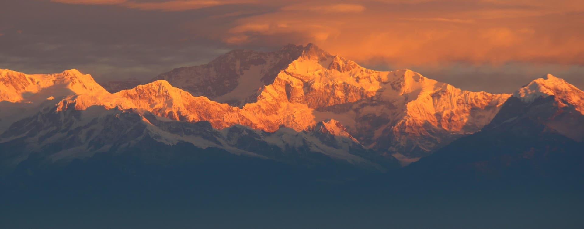
Trekking in the Kangchenjunga Region: Nepal's Last Great Wilderness
An Introduction to Eastern Nepal's Most Remote and Rewarding Trekking Region
Introduction
Most people who have trekked in Nepal carry one of two mental images of the country's mountains: the iconic south-facing pyramid of Everest rising above the Khumbu, or the Annapurna massif reflected in Phewa Lake on a calm Pokhara morning. Both images are earned, and both regions are extraordinary. But in the far east of the country, well past the Arun River valley and hard against the borders of Sikkim and Tibet, stands a mountain that is older in reputation, more complex in character, and, by most accounts, the least visited of Nepal's great Himalayan destinations. Kangchenjunga, at 8,586 metres, is the third-highest peak on earth. Its name translates from Tibetan as 'Five Treasures of the High Snow', a reference to the five summits that make up the massif and, according to local belief, the five repositories of sacred gifts held in trust for the people of the region: gold, silver, grain, precious stones, and holy scripture.
The region that carries this mountain's name is one of those rare places where the word 'remote' retains its original meaning. The Kangchenjunga Conservation Area was only opened to foreign trekkers in 1988, decades after Everest and Annapurna had already been developed into well-worn circuits. The trails here see a fraction of the foot traffic that passes through the Khumbu in any given season, and the communities along the route have had less exposure to the commercial pressures that have reshaped mountain culture in more accessible regions. What trekkers find in the Kangchenjunga region is something increasingly difficult to come by in Himalayan trekking: the unmediated experience of a landscape that has not yet been configured for tourism.
Overview of the Kangchenjunga Region
Geography and Landscape Diversity
The Kangchenjunga Conservation Area covers 2,035 square kilometres in Nepal's Taplejung District, Province No. 1, and spans an elevation range from roughly 1,200 metres in the subtropical river valleys of the south to 8,586 metres at the summit of Kangchenjunga itself. To the north, the conservation area borders the Qomolangma National Nature Preserve in Tibet. To the east, it meets Khangchendzonga National Park in Sikkim, India. To the west, it shares a boundary with Sankhuwasabha District, where the Makalu-Barun National Park occupies the adjacent drainage. The geographical result of this configuration is a protected corridor of extraordinary scale, one that links the Himalayan ecosystems of three different political territories into a single, largely undisturbed wilderness.
The landscape within this corridor is defined by dramatic vertical relief. A trekker ascending from the warm subtropical foothills around Taplejung through the Tamor River valley passes through more ecological zones than most mountain regions in the world contain from base to summit. The lower stretches are lush and densely forested, with cardamom plantations, banana groves, and the scent of the subtropical understory giving way to temperate oak and chestnut as the trail climbs. Above the temperate zone, rhododendron forest takes over, and the Kangchenjunga region is notable even by Himalayan standards for the density and diversity of its rhododendrons: 34 species have been recorded in the conservation area. Higher still, silver fir and alpine scrub give way to moraines, glacial lakes, and the stripped-back world of high rock and ice. The Yalung Glacier on the south side and the Kangchenjunga Glacier on the north are among the longest glacial systems in the eastern Himalaya, and both are accessible to trekkers, which is unusual among glaciers of their scale anywhere in the range.
The mountain itself is architecturally complex in a way that sets it apart from Everest or Annapurna. The massif has five distinct summits, the highest four of which all exceed 8,450 metres. Each presents a different face to the approaches below it, which is why the trekking routes to the North and South Base Camps deliver genuinely different visual experiences despite both looking at the same mountain. From the North Base Camp at Pangpema (5,143 m), the view is of the great north face, a wall of ice and rock that fills the entire horizon with a verticality that stops conversation. From the South Base Camp viewpoint at Oktang (4,730 m), the Yalung Glacier fills the valley floor below the southwest buttress, and the peaks of Rathong, Kabru, and Jannu frame the scene on either side.
Cultural Significance and Local Communities
The Kangchenjunga region is home to three distinct ethnic communities whose cultural identities are as layered and worth understanding as the mountain itself. The lower valleys and the approach from the south are predominantly Limbu territory. The Limbu are one of the Kirant peoples of eastern Nepal, with their own script (Sirijanga script), their own animist-shamanist religious tradition called Yumaism, and a clan structure that organises social life from birth to death. The Chasok Tangnam festival, held annually to mark the harvest and to give thanks to the mountain gods, is among the most important ceremonial events in the Limbu calendar and takes place in the villages that trail up toward the base camp approach. Trekkers who time their visit to coincide with it are given access to a dimension of highland culture that has nothing to do with the trekking economy.
As the trail climbs toward the upper valleys, particularly into the Ghunsa area on the north side, the communities shift toward the Sherpa and Tibetan Buddhist cultural world. Ghunsa itself, at 3,475 metres, is one of the largest permanently inhabited settlements in the upper Kangchenjunga valleys and one of the most historically intact Sherpa villages in Nepal. The gompas here date back several centuries, the mani walls along the trail are thick with carved prayer stones, and the flat-roofed architecture of the houses is more characteristic of the Tibetan plateau than of the Nepali hills below. Between these two cultural poles, Rai communities occupy the middle elevations, adding a third thread of indigenous eastern Nepali identity to the cultural fabric of the region. This layering of distinct communities along a single trekking route, without the homogenisation that high tourist volume tends to produce, is one of the most compelling reasons to choose Kangchenjunga over more established destinations.
Accessibility and Connectivity
The Kangchenjunga region is genuinely remote, and it is important to understand what that means in practical terms before planning a trip. The standard access route begins with a domestic flight from Kathmandu to Bhadrapur in the eastern Terai, a flight of approximately 45 minutes. From Bhadrapur, a jeep transfer to Taplejung takes between six and nine hours depending on road conditions, passing through Ilam, the hill town famous across Nepal for its tea gardens and the colonial-era tea estates that still line its ridges. The road to Taplejung is paved in stretches but deteriorates through the mountain sections and is prone to landslides during and after the monsoon. An alternative is to fly directly from Kathmandu to Suketar, the small airstrip above Taplejung, but this flight is infrequent and highly weather-dependent. The combined travel time from Kathmandu to the trailhead is typically one to two days, a logistical commitment that filters out casual visitors and contributes significantly to the region's low trekker numbers.
Mobile connectivity on the trail is limited and unreliable. Signal is intermittent in the lower valleys and largely absent above Ghunsa. This is not a flaw in the destination; it is one of its defining qualities. Trekking companies and guides carry satellite communication devices for emergencies, and our team maintains a direct communication channel with Kathmandu throughout all active treks. The teahouse infrastructure on the main route has improved considerably since the early 2000s, particularly following the development of the Great Himalayan Trail network, which passes through the region. Accommodation remains basic by the standards of the Khumbu, with simple twin rooms, shared facilities, and menus centred on dal bhat, noodle soup, and local produce. This simplicity is not a limitation; it is the texture of the place.
Why Choose the Kangchenjunga Region for Trekking in Nepal
Solitude and the Absence of Crowds
The Kangchenjunga region receives a fraction of the visitors that pass through the Everest or Annapurna corridors each year. During peak season in the Khumbu, the trails between Namche Bazaar and Gorak Shep see hundreds of trekkers daily. In the Kangchenjunga Conservation Area, you might walk for an entire day and encounter no other trekking group. This solitude is not manufactured or artificially maintained; it is simply the result of distance and access requirements. The trek demands commitment, and that commitment functions as a natural filter. For trekkers who have completed the standard routes and found themselves frustrated by the volume of traffic, or for those who want their first Himalayan experience to feel genuinely wild, the Kangchenjunga region offers something that is becoming progressively harder to find in Nepal's better-known areas.
A Dual Base Camp Experience Unique in the Himalaya
The classic Kangchenjunga circuit is one of only a handful of trekking routes in Nepal that provides access to two completely separate base camps of the same mountain, connected by a crossing of high passes between the northern and southern valleys. The North Base Camp at Pangpema and the South Base Camp viewpoint at Oktang present such different aspects of the mountain that they feel like encounters with two distinct peaks. Between them, the passes of Sele La (4,290 m), Mirgin La (4,633 m), and Sinion La (4,646 m) demand serious physical effort and reward that effort with panoramic views that extend to Makalu and Everest to the west and the peaks of Sikkim to the east. The complete circuit, linking both base camps, is arguably the most comprehensive high-altitude trekking experience available in eastern Nepal.
Biodiversity That Rivals Any Protected Area in the Himalaya
The Kangchenjunga Conservation Area is classified as a globally significant biodiversity hotspot, and the range of wildlife and plant life encountered on the trek reflects that classification. Snow leopards inhabit the upper alpine zones, and while sightings are rare, their presence is evidenced by tracks in the snow around Lhonak and the moraines above Pangpema. Red pandas are found in the rhododendron and bamboo forest at mid-elevation, a species whose global population is under considerable pressure and which is far more commonly seen here than in most parts of its range. Himalayan black bears, musk deer, and wild boar are present in the lower forest zones, and the bird diversity throughout the region is exceptional. The 34 recorded rhododendron species, spread across the temperate and alpine zones, give the spring trekking season a particular visual quality that rewards the walk independently of the mountain views.
Historical and Mountaineering Significance
Kangchenjunga has a longer and more complex relationship with Western mountaineering than almost any other Himalayan peak. It was the focus of early Himalayan exploration in the late nineteenth and early twentieth centuries, when it was widely believed to be the world's highest mountain before survey work established Everest's primacy. The 1955 British expedition led by Charles Evans made the first ascent, honouring the wishes of the Chogyal of Sikkim by stopping short of the absolute summit out of respect for the mountain's sacred character. That restraint, maintained by subsequent expeditions by convention, speaks to the relationship between the mountain and the communities who live beneath it. Trekking through the Kangchenjunga region is, in part, a walk through this history, through the same valleys and camps where the early expeditions staged their approaches, and along paths that connect a living culture to a peak that has been considered divine long before it was considered climbable.
Best Time and Climate Insights
The two established trekking seasons in Nepal broadly apply to the Kangchenjunga region: spring from March through May and autumn from late September through November. Within these windows, the character of the experience differs enough that the season should be chosen with the specific goals of the trip in mind.
Spring is the season of the rhododendron forests. From mid-March through April, the lower and mid-altitude sections of the trail are in full bloom, the 34 rhododendron species creating a sequence of colour that starts with the large-leafed tree rhododendrons at around 2,500 metres and progresses through smaller, more intensely coloured species as the trail climbs. Temperatures in the subtropical lower valleys are warm in spring, making the early days of the approach comfortable but requiring careful attention to hydration. The passes on the circuit are generally clear of winter snowpack by late April, though crossing them in March can require crampons and ice axes in heavy-snow years.
Autumn is the clearest season. The monsoon, which typically retreats from northeastern Nepal in late September, leaves the air washed clean of haze and the skies at high altitude a sharp, deep blue that is ideal for photography. October is the month during which visibility from the passes and base camp areas tends to be most reliable. Temperatures in the upper valleys begin dropping rapidly from November, and nights at Ghunsa and above are cold from mid-October, requiring a sleeping bag rated for serious cold and full down insulation for evenings. The autumn festival season adds a cultural dimension to village stays that the spring visit does not; Dashain and Tihar fall in October and November, and the celebrations in the Limbu and Rai villages of the lower trail are genuine community events, not staged displays.
The monsoon months from June through August are generally avoided, though the eastern Himalaya receives the monsoon's heaviest rainfall in the country and the trails in the lower Kangchenjunga region become slippery, leech-heavy, and cloud-covered during this period. The upper valleys above the snowline receive less monsoon precipitation due to their position in the partial rain shadow of the massif itself, but the access routes below are sufficiently challenging to make most operators suspend operations. Winter trekking from December through February is possible for experienced cold-weather parties but should only be planned with expert guidance, as snowfall on the passes can be substantial and the high camps are genuinely hostile in extreme cold.
The Main Treks in the Kangchenjunga Region
Kangchenjunga Circuit Trek (North and South Base Camps)
The full circuit is the definitive trekking experience in the region and one of the most complete long-distance mountain treks available anywhere in Nepal. Starting from Taplejung, the standard itinerary takes 20 to 26 days and visits both the North Base Camp at Pangpema (5,143 m) and the South Base Camp viewpoint at Oktang (4,730 m), connecting them by crossing the Sele La, Mirgin La, and Sinion La passes. The northern approach follows the Tamor River valley through Limbu villages and up through increasingly remote terrain to the Tibetan Buddhist village of Ghunsa (3,475 m), which serves as the main acclimatisation base before the push to Lhonak (4,792 m) and the day trip to Pangpema. The view from Pangpema is the singular moment of the trek for most people who complete it: the north wall of Kangchenjunga rising from the glacier in a near-vertical sheet of ice and rock, the summit pyramid set against sky so blue it registers more as a colour of space than of atmosphere.
From Pangpema the route returns to Ghunsa and then crosses the passes to the southern valley, descending through Tseram and Ramche to the Oktang viewpoint above the Yalung Glacier. The southern valley has a warmer, greener character than the stark northern basin, and the cultural mix shifts back toward the Limbu communities of the lower trail as the descent progresses. The circuit ends at Taplejung or, more commonly, at the roadhead near Yamphudin, from which a jeep connects back to Bhadrapur and the return flight to Kathmandu. The full circuit is classified as strenuous and requires prior trekking experience at high altitude, strong physical preparation, and strict adherence to the acclimatisation schedule.
Kangchenjunga North Base Camp Trek
For trekkers who have a firm preference for the northern approach or whose schedule does not accommodate the full circuit, the North Base Camp trek as a standalone route offers the higher-altitude experience and the Pangpema viewpoint without the additional week required to cross the passes and visit the southern side. This version of the trek is typically completed in 17 to 20 days from Kathmandu and follows the same approach through the Tamor valley to Ghunsa before ascending to Lhonak and the day trip to Pangpema. A notable side trip from Khambachen on the approach to Lhonak leads to the Jannu Viewpoint at approximately 4,420 metres, with a direct and unobstructed sight of Jannu (7,710 m), one of the most technically demanding mountains in the Himalaya and one whose sheer south face is considered among the most dramatic in the entire range.
Kangchenjunga South Base Camp Trek
The southern approach, beginning from Yamphudin and ascending through the Limbu heartland to Tseram and Ramche before reaching the Oktang viewpoint, is considered slightly less demanding than the northern approach due to its lower maximum elevation and more gradual altitude gain profile. It is the more culturally immersive of the two standalone options, passing through a greater density of Limbu villages and spending more trail time at the middle elevations where the forest character and the agricultural landscape are most engaging. The Yalung Glacier visible from Oktang is one of the most accessible large glaciers in the eastern Himalaya, and the surrounding peaks of Rathong (6,678 m), Kabru, and Kokthang (6,148 m) frame the view in a way that makes the destination feel enclosed and intimate despite the scale. This route takes 15 to 18 days from Kathmandu and is recommended as a first engagement with the region for trekkers who plan to return for the full circuit.
The Kanchenjunga Tea House Trek and Great Himalayan Trail Segment
The Kangchenjunga section of the Great Himalayan Trail (GHT), the long-distance route that crosses Nepal from east to west, passes through the heart of the conservation area and connects the Kangchenjunga approaches to the Makalu-Barun region to the west. Trekkers undertaking segments of the GHT often combine the Kangchenjunga circuit with a continuation toward the Arun Valley, linking two of Nepal's most remote trekking regions into a single extended journey. This combination route is among the most ambitious trekking itineraries available in Nepal and is suited to experienced parties with strong logistical support. The teahouse infrastructure on the more frequented sections of the Kangchenjunga trail has improved through community development initiatives associated with the GHT project, and while accommodation standards remain modest, the network of lodges is now sufficiently developed to support fully teahouse-based trekking without camping on the main circuit routes.
Planning Kangchenjunga Region Trekking in Nepal
The Kangchenjunga region is a restricted area, meaning that all foreign trekkers must be accompanied by a licensed guide and must obtain two separate permits before entering the conservation area. The Kangchenjunga Conservation Area Permit (KCAP) and the Restricted Area Permit (RAP) are both handled by a registered trekking agency on behalf of trekkers; they are not available for independent purchase at the trailhead. The minimum group size for the restricted area permit is two trekkers travelling together, though this requirement can be navigated through a ghost permit arrangement in consultation with the agency. Both permits are processed in Kathmandu before departure; trekkers should carry passport photographs and copies of their passport for this purpose.
Physically, the Kangchenjunga circuit is the most demanding of the main long-distance treks in Nepal. The combination of sustained duration, high passes, significant daily elevation gain and loss, and the genuinely remote nature of the upper sections requires a level of physical preparation that goes beyond what is needed for the Annapurna Circuit or the standard Everest Base Camp route. A minimum of three months of structured training including weighted uphill hiking, cardiovascular exercise, and multi-day endurance preparation is strongly recommended. Prior high-altitude trekking experience, ideally above 4,000 metres, is considered a prerequisite rather than a recommendation for the full circuit. Trekkers without this background should discuss their specific situation with us before booking; in many cases a modified itinerary or a standalone south base camp trek provides an appropriate first engagement with the region.
Comprehensive travel insurance covering helicopter evacuation to a minimum of 6,000 metres is mandatory for all participants. Medical facilities in the Kangchenjunga region are extremely limited; the nearest hospital is in Taplejung, and evacuation from the upper sections of the trail requires helicopter rescue. Our guides carry pulse oximeters and first aid kits including altitude medications, and the acclimatisation schedule built into all our Kangchenjunga itineraries is constructed to the conservative standards required by the terrain. As with all high-altitude trekking in Nepal, the decision to descend in response to altitude sickness symptoms is always made on the basis of the trekker's health and is never compromised by schedule pressure.
Conclusion
The Kangchenjunga region offers something that the numbers alone cannot fully capture. Yes, it has the third-highest mountain in the world. Yes, it has two accessible base camps connected by high passes with views of the eastern Himalaya that rank among the finest in Nepal. Yes, it has 34 species of rhododendron, snow leopards, red pandas, Tibetan Buddhist monasteries, and Limbu festivals conducted by firelight in villages that have not changed fundamentally in generations. All of that is true, and all of it can be looked up. What the numbers cannot tell you is what it feels like to walk for a week toward a mountain and have the entire valley essentially to yourself. What it is like to arrive at Pangpema and stand at the foot of the north wall of Kangchenjunga with no other sound but wind and the distant crack of the glacier. What it means to share a meal in Ghunsa with a family who has lived at 3,475 metres for generations and to understand, by the end of the evening, that the mountain behind the village is not a backdrop to their lives but a presence in it.
Nepal has extraordinary trekking in every direction. But the Kangchenjunga region is, for the trekker willing to make the effort to reach it, a place apart. It asks more than the standard routes in terms of time, preparation, and physical commitment. What it gives back, in proportion to what it asks, may be the most complete version of Himalayan trekking that Nepal currently has to offer.
Frequently Asked Questions
Is the Kangchenjunga trek suitable for first-time trekkers in Nepal?
The full Kangchenjunga circuit is not recommended as a first trekking experience in Nepal. It is a strenuous, multi-week route at serious altitude, crossing high passes and covering remote terrain where medical support is extremely limited. First-time trekkers with strong fitness and a willingness to prepare thoroughly can consider the South Base Camp standalone route as an entry point to the region; this version is more gradual in its altitude gain and offers an excellent introduction to the Kangchenjunga landscape. For those new to Himalayan trekking, we generally recommend starting with the Annapurna or Everest region to build the altitude experience and mountain sense that the Kangchenjunga circuit rewards.
How many days does the Kangchenjunga circuit take?
The standard full circuit visiting both the North Base Camp at Pangpema and the South Base Camp viewpoint at Oktang takes 20 to 26 days from Kathmandu, depending on pace, acclimatisation needs, and whether side trips such as the Jannu Viewpoint from Khambachen are included. Standalone treks to the North Base Camp take 17 to 20 days and standalone treks to the South Base Camp take 15 to 18 days. All these durations include the travel days to and from the trailhead in Taplejung.
What permits are required for the Kangchenjunga region?
Two permits are mandatory: the Kangchenjunga Conservation Area Permit (KCAP) and the Restricted Area Permit (RAP). Both are arranged through a registered trekking agency and cannot be purchased independently at the trailhead. The restricted area designation also requires that all foreign trekkers be accompanied by a licensed guide and that the trekking group consist of at least two persons. Our company handles all permit logistics on behalf of clients; permit fees are included in the package price.
How does the Kangchenjunga trek compare to Everest Base Camp in difficulty?
The Kangchenjunga circuit is generally considered more demanding than the standard Everest Base Camp route via Lukla. The main factors are duration (20 to 26 days versus 12 to 16 for standard EBC), the crossing of multiple high passes above 4,500 metres, the greater remoteness and corresponding lack of emergency support infrastructure, and the more variable trail conditions in the lower sections. The maximum altitude on the Kangchenjunga circuit is comparable to EBC, with Pangpema at 5,143 metres slightly lower than Kala Patthar at 5,550 metres, but the sustained physical demands of the longer route and the pass crossings make the overall challenge greater.
What is the best season to trek in the Kangchenjunga region?
Spring (March to May) and autumn (late September to November) are both excellent. Spring offers the spectacular rhododendron bloom across the mid-altitude zones and is the preferred season for those with a strong interest in the landscape and flora. Autumn delivers the clearest skies and best mountain views, particularly in October, and the festival season in the Limbu villages adds a cultural dimension that spring does not provide in the same way. Most experienced guides rate October as the single best month for the circuit in terms of combined weather, visibility, and cultural interest.
Is there teahouse accommodation throughout the route, or is camping required?
Teahouse accommodation is available along the main circuit route, including at Ghunsa, Khambachen, Lhonak, Tseram, and Ramche. The infrastructure has improved steadily over the past decade, partly through development associated with the Great Himalayan Trail project. That said, the teahouses in the Kangchenjunga region are basic by comparison with those in the Khumbu: simple twin rooms with shared facilities, no consistent electricity, and menus limited primarily to dal bhat, noodle soup, and tea. A sleeping bag rated to minus 15 degrees Celsius and a warm down jacket are essential from the Ghunsa elevation upward. For the pass sections between the northern and southern valleys, some operators use small camps; confirm the specific arrangements with your trekking company when booking.
What wildlife might I see on the Kangchenjunga trek?
The Kangchenjunga Conservation Area is one of the best places in Nepal to see red pandas, and sightings are relatively common in the rhododendron and bamboo forest between roughly 2,500 and 3,500 metres, particularly in the morning and evening. Snow leopards are present in the upper alpine zones but rarely seen; tracks in snow around Lhonak are a more likely indication of their presence than direct sightings. Himalayan black bears inhabit the lower forest zones. Musk deer are occasionally spotted on the approaches through the mid-elevation forest. The bird life throughout the region is rich, with the Himalayan monal pheasant, various pheasant species, eagles, and a wide range of forest birds present at different elevations.
Can the Kangchenjunga trek be combined with the Arun Valley or Makalu region?
Yes. The Kangchenjunga section of the Great Himalayan Trail connects to the Makalu-Barun region to the west, and experienced trekking parties with sufficient time, typically 35 to 45 days total, have completed a combined route linking Kangchenjunga, the Arun Valley, and in some cases the Everest region in a single continuous journey. This is among the most ambitious trekking itineraries available in Nepal and requires strong logistical support, prior high-altitude experience, and careful advance planning. Contact our team to discuss the specific requirements and current trail conditions before committing to a combined itinerary.
Do I need a guide, and how experienced should my guide be?
A licensed guide is legally required for the Kangchenjunga Restricted Area and is not optional. Beyond the legal requirement, the practical case for an experienced guide on this route is stronger than on almost any other trek in Nepal. The trail in the upper sections is less clearly marked than in the Khumbu, weather can change rapidly on the passes, and the distance from medical support means that the guide's ability to recognise and respond to altitude sickness symptoms is a genuine safety factor rather than a convenience. Our guides on the Kangchenjunga circuit hold government-issued trekking licences, altitude medicine training certifications, and have a minimum of several full circuit transits before leading groups. Choosing a guide with direct Kangchenjunga experience, rather than simply any licensed guide, is strongly recommended.
What is the cost of the Kangchenjunga circuit trek?
Package costs for the Kangchenjunga circuit vary depending on duration, group size, and inclusions, but as a general reference, a fully inclusive package covering permits, guide, porter, domestic flights, teahouse accommodation, and all meals typically starts from approximately USD 2,000 to USD 2,800 per person for a group of two to four trekkers, and can be higher for solo or custom arrangements. This is consistent with the additional logistical complexity of the region compared to standard Annapurna or Everest packages. Permit costs alone (KCAP and RAP) add to the overall cost beyond what other trekking regions require. Contact our team for a current detailed quote based on your specific dates and group size.