Langtang Region Guide
Langtang Region Travel Guide: Everything You Need to Know Before You Go
There is a persistent tendency in Nepal trekking circles to describe the Langtang region as the underrated option, the quieter alternative to Everest and Annapurna. That framing undersells it considerably. The Langtang valley was, for several decades before 2015, considered Nepal's third great trekking destination, ranking behind only the Khumbu and the Annapurna Conservation Area, and the reasons for its reputation have not changed. What has changed is the valley itself, reshaped by one of the deadliest natural disasters in Nepal's recent history, and rebuilt by a community that has demonstrated a degree of resilience that most visitors find deeply affecting.
The region sits directly north of Kathmandu, straddling the Nepal-Tibet border, and it is this proximity to the capital that gives it a practical appeal no other major trekking area can match. From Kathmandu, you can reach the trailhead at Syabrubesi in a single seven-to-eight-hour drive, which means the full valley experience is accessible within a ten-to-fourteen-day window from international arrival. For trekkers with limited time who want a serious Himalayan experience rather than a day hike from Pokhara, the Langtang region solves the equation neatly.
This guide covers the region's main routes, the practical details of permits and regulations, the cultural communities you will encounter, the food and accommodation realities, and the seasonal patterns that should inform when you go. The aim is to give you an honest picture of what the Langtang region actually involves so you can prepare for it properly.

The 2015 Earthquake and What It Means for Trekkers Today
On April 25, 2015, a 7.8-magnitude earthquake struck Nepal with its epicenter in Gorkha district. The effects were felt throughout the country, but the Langtang valley absorbed some of the most concentrated destruction of any single location. The main Langtang village, sitting at 3,430 meters below the ice face of Langtang Lirung, was obliterated within seconds when the earthquake triggered a massive avalanche from the mountain's flanks. A wall of ice, rock, and compressed air traveling at enormous speed buried the settlement. Of approximately 668 residents, 176 died. Another 200 or so visitors, guides, and porters who happened to be in the village that day were also killed, many of whose remains were never recovered. Both of the village's gompas were destroyed, removing the community's sacred spaces at the moment they needed them most.
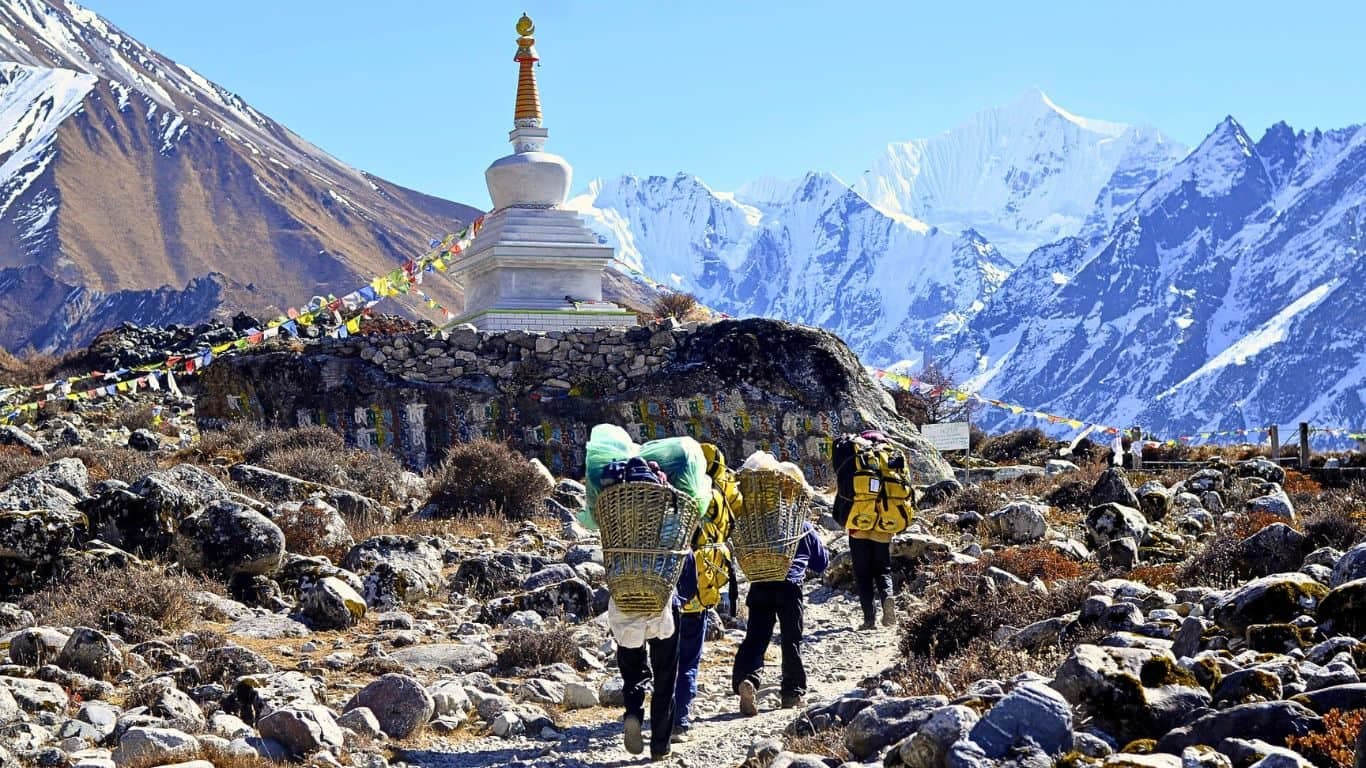
The practical question for anyone planning a trek is straightforward: what is the situation now? The answer, as of the current trekking seasons, is that the Langtang Valley trek is fully operational. The new Langtang village was rebuilt on a site roughly 100 meters above the ruins of the original, using stronger construction methods and wider spacing between buildings. The trekking trail from Syabrubesi to Kyanjin Gompa has been fully restored, with sections rerouted where the 2015 event changed the terrain. The Kyanjin Gompa monastery was rebuilt with support from the Japanese government and reopened in 2018. The famous yak cheese factory at Kyanjin, originally established in 1952 with Swiss technical assistance, resumed production and remains one of the region's most distinctive local industries.
Tea houses along the full route are operating again. During peak seasons, the valley sees meaningful visitor traffic, and the community is once more earning income from the tourism that many households depend on. The ruins of the old village are visible and are not hidden; they serve as a permanent memorial, and local guides handle questions about them with both candor and obvious emotional weight. Visiting the Langtang valley today means carrying some awareness of what happened there. Most trekkers who go find that awareness adds rather than detracts from the experience.

The Main Trekking Routes
The Langtang region contains several distinct routes that suit different durations and interests. They are not interchangeable: the valley trek, the Gosaikunda route, and the Helambu circuit each offer substantially different terrain and cultural environments.
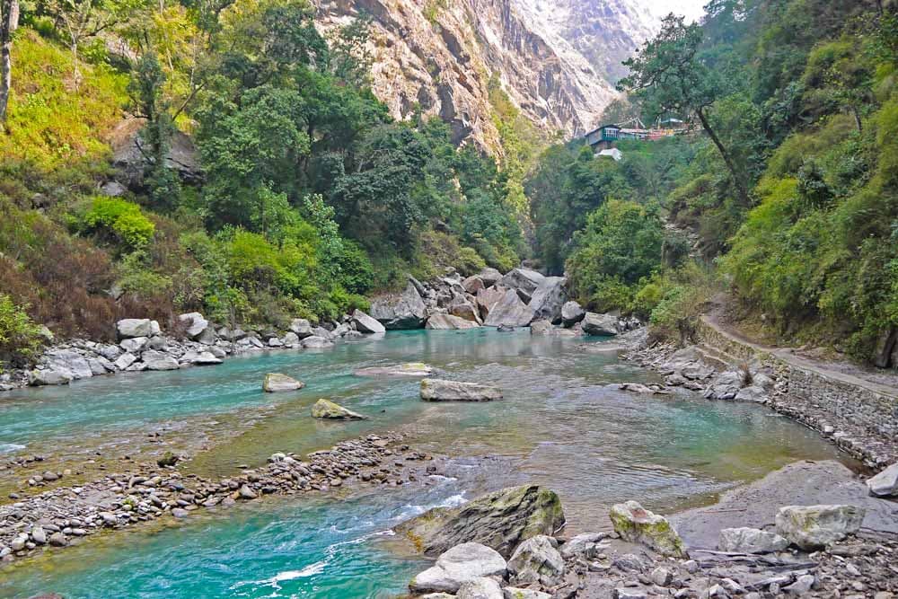
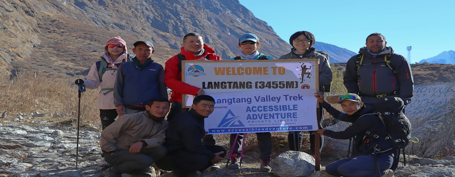
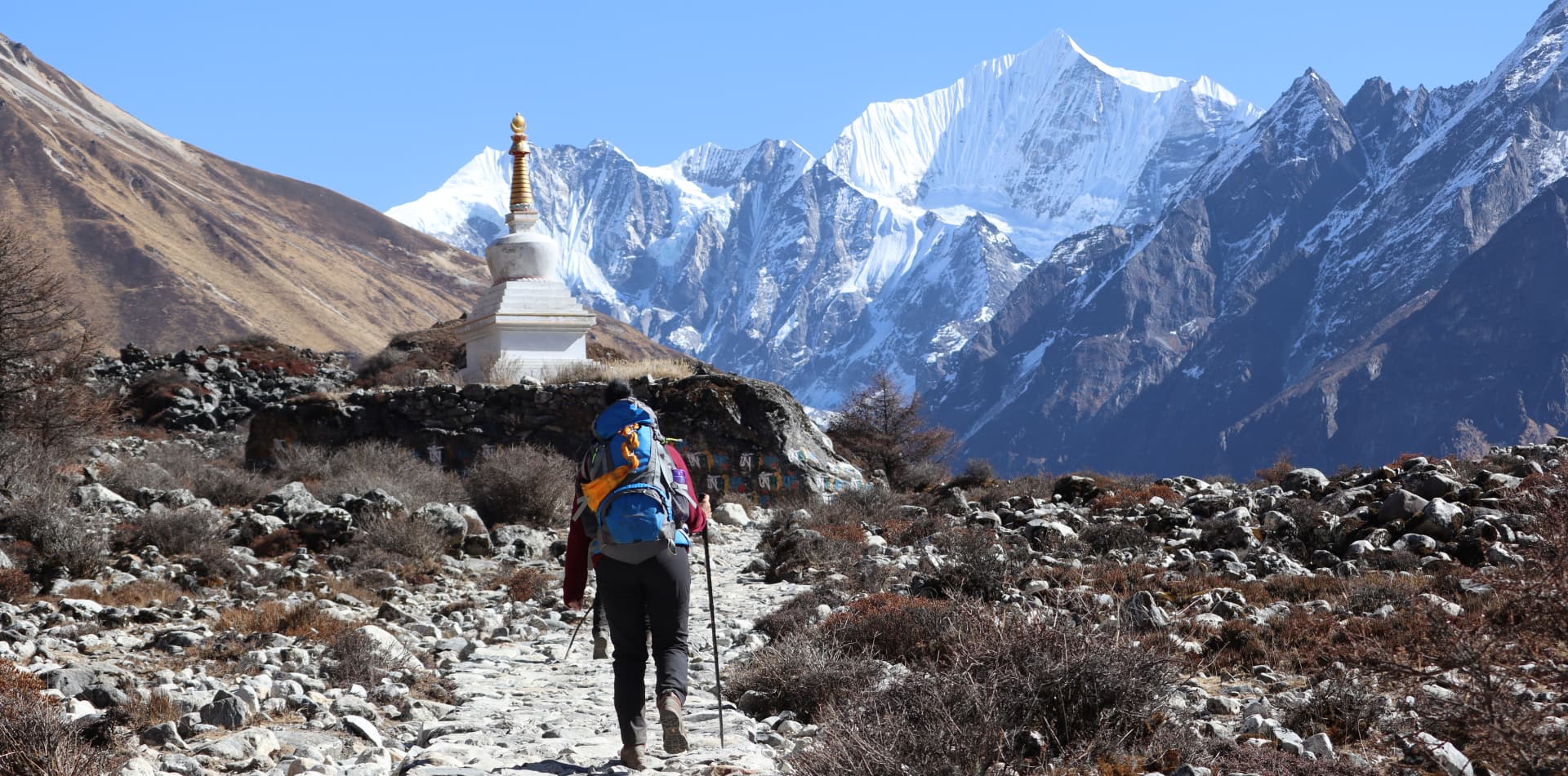
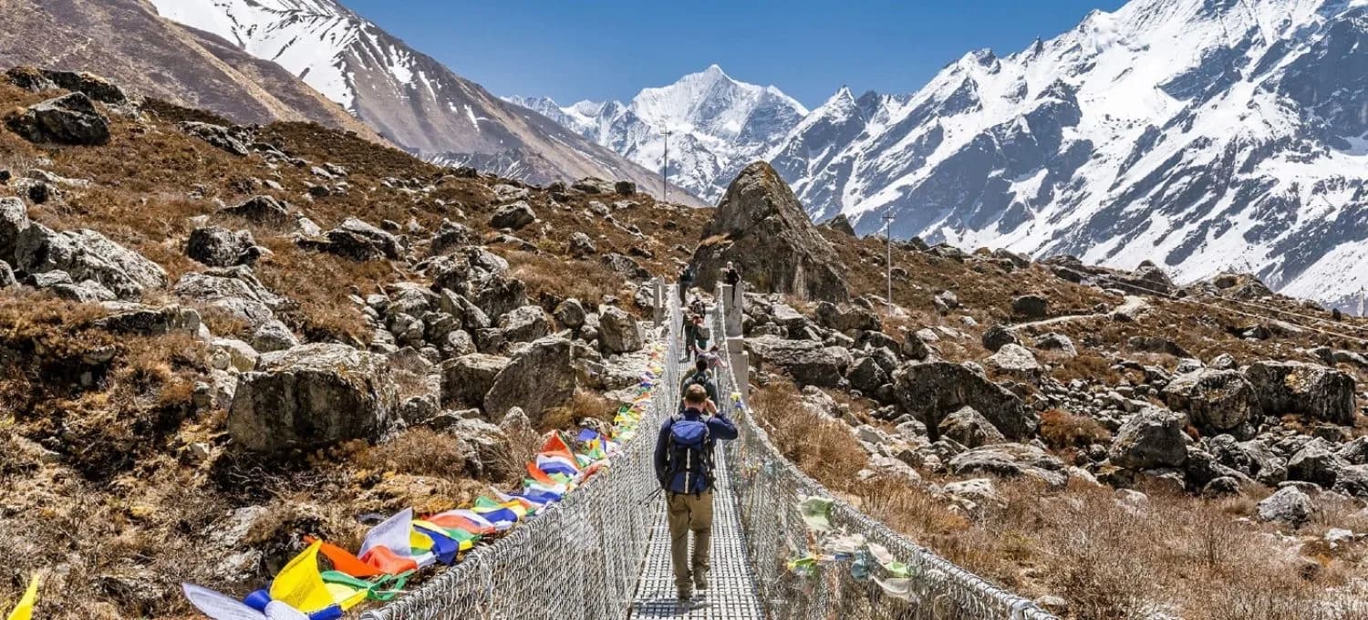
The Langtang Valley Trek is the principal route and the reason most people come to the region. It begins at Syabrubesi at roughly 1,460 meters and follows the Langtang River upstream through a gorge that narrows dramatically in places before opening into the broad glacial valley above. The trail passes through Lama Hotel (2,470 meters), a loose collection of tea houses in the forest that serves as the standard first-night stop, then continues through the meadow village of Ghodatabela before reaching the rebuilt Langtang village at 3,430 meters. From there, the path climbs the remaining five kilometers to Kyanjin Gompa at 3,860 meters, the cultural and geographical endpoint of the standard valley trek. Most itineraries allow a rest and acclimatization day at Kyanjin, from which trekkers climb the surrounding viewpoints of Kyanjin Ri at 4,773 meters or Tserko Ri at 4,985 meters for panoramic views of Langtang Lirung (7,227 meters), Langshisha Ri, Dorje Lakpa, and on a clear day, Shishapangma across the Tibetan border. The round trip from Syabrubesi takes seven to ten days depending on pace and side trips.
The Gosaikunda Trek follows a separate corridor south of the main valley, climbing from Syabrubesi through the Tamang village of Thulo Syabru and ascending through rhododendron and pine forest to Sing Gompa at 3,330 meters, where a small monastery and another yak cheese factory sit on a ridge with wide views. Above Sing Gompa, the trail continues through Cholangpati to the sacred Gosaikunda Lake at 4,380 meters. Gosaikunda is a glacially fed high-altitude lake of extraordinary beauty surrounded by ridges and snowfields, and it carries profound religious significance for both Hindus and Buddhists across Nepal. The lake is one of the sacred sites connected to Shiva in Hindu tradition; legend holds that Shiva struck the ground with his trident to create the lake's waters, and the Trisuli River is said to originate from its outflow. Every year during the full moon festival of Janai Purnima, which falls in July or August, thousands of Hindu pilgrims make the journey to Gosaikunda to bathe in its waters and perform puja. It is one of the largest pilgrimage gatherings in the Himalayan region.
The Helambu region lies further south and east of Gosaikunda, accessible by crossing the Lauribina La pass at 4,610 meters after the lake. The Helambu circuit passes through villages inhabited primarily by the Hyolmo people, a Tibetan Buddhist community related to the Sherpas, and the landscape has a softer, more pastoral character than the dramatic glacier country of the main valley. Communities like Tarkeghyang, Melamchi Gaon, and Sermathang have old monasteries, apple orchards, and a gentle ridge-walking trail that eventually descends to Kathmandu's northern fringe. The Helambu section is often combined with the Gosaikunda trek to create a longer circuit of twelve to fifteen days, making it one of the few routes in Nepal that loops back toward Kathmandu rather than requiring a return to the trailhead by road.
The Tamang Heritage Trail is a newer route that has attracted serious interest among culturally minded trekkers. It winds through Tamang villages in the western section of the Langtang region, including Gatlang, Tatopani, Thuman, Nagthali, and Briddim, passing a monastery in Gatlang that is over a hundred years old and offering homestay options in traditional stone houses. The trail eventually connects to the main Langtang Valley route and can be combined with the valley trek for a comprehensive circuit of ten to fourteen days. Because it receives significantly fewer visitors than the main valley path, the Tamang Heritage Trail has a quality of genuine encounter with local community life that the busier routes cannot fully replicate.

Permits and Current Regulations
Trekking in the Langtang region requires two permits: the Langtang National Park Entry Permit and the TIMS card. Both must be obtained before you reach the trailhead, ideally in Kathmandu, though the national park permit can also be purchased at the checkpoint in Dhunche if necessary.
The Langtang National Park Entry Permit costs NPR 3,000 (approximately USD 25) for foreign nationals, inclusive of the 13% VAT that brings the actual total to NPR 3,390. SAARC nationals pay NPR 1,695 with VAT. The permit covers entry to the national park, which encompasses the full Langtang Valley Trek, the Gosaikunda route, and parts of the Helambu section. Children under ten years old enter without a permit fee, though they still require documentation. The park was established in 1976, making it Nepal's first Himalayan national park, and the permit revenue funds conservation programs that protect the area's biodiversity.
The TIMS card (Trekkers' Information Management System) costs NPR 2,000 for individual trekkers and NPR 1,000 for those trekking as part of an organized group through a registered agency. The card records your identity and intended route, enabling rescue and emergency response teams to locate trekkers if something goes wrong. Unlike the Annapurna region where TIMS enforcement has been inconsistently applied in recent years, the Langtang checkpoints have generally continued to require both documents. Carry printed copies of both permits; digital versions are not reliably accepted at all checkpoints given the connectivity limitations of the area.
Effective February 15, 2025, the Nepalese government formally implemented the requirement that all foreign trekkers in the Langtang region must be accompanied by a licensed guide. Solo independent trekking without a guide is no longer permitted. This regulation brings Langtang into line with the broader national policy that has applied to the Manaslu region and other restricted areas for several years. Practically speaking, trekking with a licensed guide from a registered agency is the straightforward way to ensure all permit requirements are met simultaneously, since agencies handle the documentation process as part of their standard service.
|
Permit |
Foreign Nationals |
SAARC Nationals |
Notes |
|
Langtang National Park Entry Permit |
NPR 3,390 incl. VAT (~USD 25) |
NPR 1,695 incl. VAT |
Available at Dhunche checkpoint if not obtained in Kathmandu |
|
TIMS Card |
NPR 2,000 (individual) |
NPR 1,000 |
Obtain at Nepal Tourism Board office in Kathmandu or Pokhara |
There are three main permit checkpoints along the standard Langtang Valley route: at Dhunche, at Syabrubesi (for those taking the upper route), and at the army post in Ghodatabela between Lama Hotel and Langtang village. At each point, the original permit documents are inspected and your details recorded. Keep both permits accessible in your daypack rather than buried in your main bag.
The People and Culture of the Langtang Region
The dominant ethnic community throughout the Langtang region is the Tamang, one of the largest indigenous groups in Nepal with a total population across the country of over 1.6 million according to the 2021 census. The Tamang people who inhabit the Langtang valley and surrounding hills are Tibetan Buddhist in religion, Sino-Tibetan in language, and deeply connected to the mountain environment in their agricultural and herding practices. The word 'Tamang' translates roughly from Tibetan as 'horse traders,' a reference to a historical role in the trans-Himalayan trade networks that once moved goods between the Kathmandu Valley and Tibet.
In the Langtang valley specifically, the residents refer to themselves as Langtangpa, a term that reflects their particular identity within the broader Tamang community. Oral tradition holds that the Langtangpa's ancestors migrated from the Kyirong area of southern Tibet approximately 600 years ago, which explains the close similarity between the Langtangpa dialect and the Tibetan spoken in Kyirong. This Tibetan heritage is visible in every aspect of village life: the architecture of stone houses with flat roofs and whitewashed walls, the omnipresent prayer flags and mani walls along the trail, the layout of the monastery compounds, and the ritual calendar that governs the community's festivals and agricultural cycles.
Langtang Lirung, the 7,227-meter peak that dominates the northern skyline of the valley, is not simply a mountain to the Langtangpa community. It is a yul-lha, a protector deity, the presiding spiritual guardian of the valley. The community makes ritual offerings to the mountain and understands the relationship between human welfare and the mountain's disposition in terms that are entirely consistent with a worldview shaped by centuries of Tibetan Buddhist practice and older animist traditions that predate it. When the earthquake struck in 2015 and an avalanche from Langtang Lirung destroyed the village, many community members interpreted the disaster through this theological framework. It did not diminish the mountain's sacred status; it deepened the community's sense of responsibility to maintain the ritual relationships that govern their connection to it.
The Kyanjin Gompa at the head of the valley is the spiritual center of the Langtangpa community. The monastery has existed on this site for several centuries, though the current structure is the one rebuilt after 2015. A small resident monk population maintains the religious calendar throughout the year, and the monastery is an active place of worship rather than a preserved historical exhibit. Trekkers are welcome to enter, remove their shoes at the threshold, and observe the interior, which contains wall paintings, butter lamps, and religious statues. Offerings of small monetary donations are appropriate and appreciated.
The Hyolmo people of the Helambu region are culturally and linguistically related to the Sherpa community rather than the Tamang, and their Buddhist practice has some distinct characteristics reflecting that heritage. The Hyolmo villages of Tarkeghyang, Melamchi Gaon, and Sermathang have old monasteries and a tradition of religious art that includes carved wooden panels and thangka paintings. The communities here have had somewhat more exposure to outside contact than the upper Langtang valley, and the tourism economy of Helambu is correspondingly more developed, though it remains modest compared to the Everest or Annapurna circuits.
Culturally speaking, a few things are worth understanding before you go. Walking clockwise around all religious structures is the correct protocol throughout the Buddhist sections of the region. This applies to mani walls (the long stone structures covered in carved prayer mantras), chortens, stupas, and the main buildings of monasteries. Removing footwear before entering a monastery is mandatory. Photography inside monastery interiors should be done with explicit permission, not assumed. The 'namaste' greeting with hands pressed together at chest height works throughout Nepal and is universally appreciated; in the higher Tibetan-influenced villages, 'tashi delek' is the appropriate Tibetan greeting and will produce a noticeably warmer response than the Nepali alternative.
Food Along the Trail
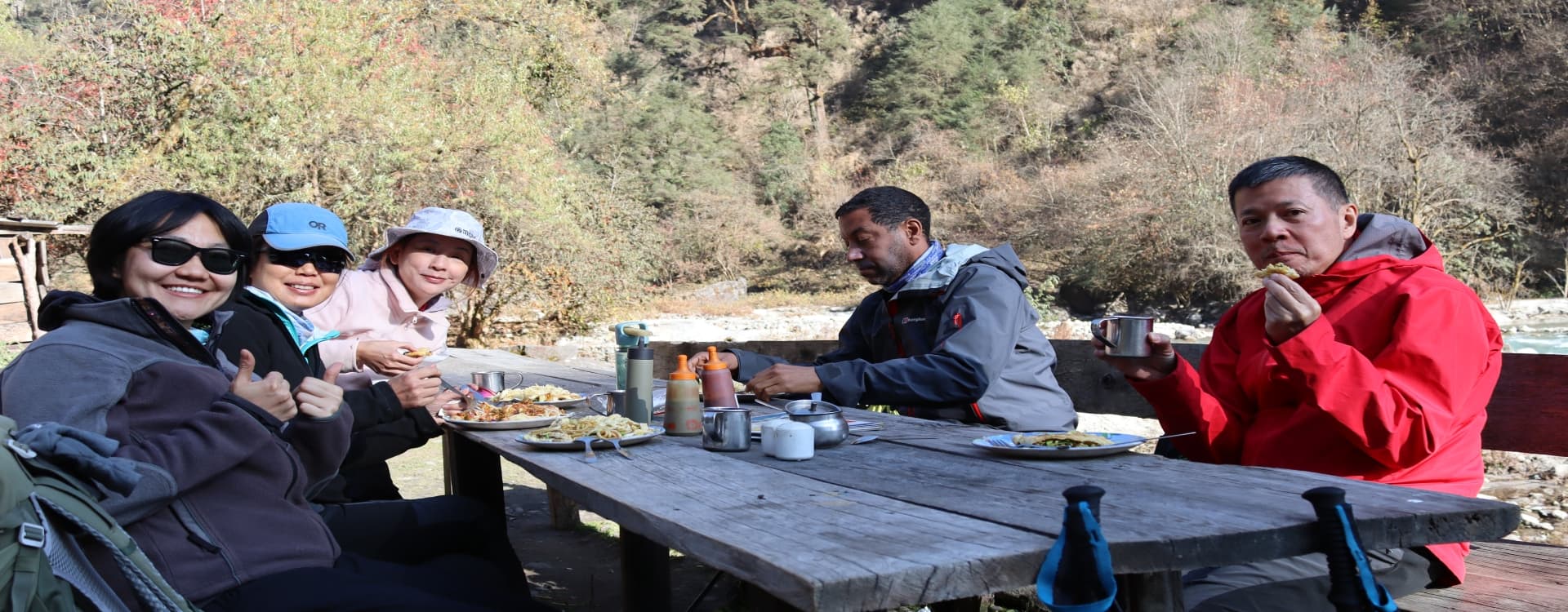
The food available on the Langtang circuit is good, honest mountain cooking shaped by the same logic as elsewhere in the Nepal trekking world: everything arrives by porter or pack animal, which limits variety at altitude and increases prices as you climb. The fundamental meal is Dal Bhat, the national staple of Nepal, available at every tea house on every day of the trek. The Langtang version is generally similar to what you find elsewhere, consisting of steamed rice, lentil soup, one or two vegetable curries, and pickled vegetables, with free refills as standard practice. Eating Dal Bhat twice a day is not a hardship; it is nutritionally excellent for sustained physical effort and deeply satisfying in the cold evenings of the upper valley.
One food experience specific to the Langtang region deserves particular attention: yak cheese. Nepal's first cheese factory was established at Kyanjin Gompa in 1952 with Swiss technical assistance, and yak cheese production has been part of the valley's economy ever since. The factory reopened after the earthquake and continues to produce a firm, salty cheese with a flavor that sits somewhere between a young parmesan and a traditional Swiss mountain cheese. You can visit the factory, watch the production process, and buy cheese to eat on the trail or carry back to Kathmandu. A second cheese operation at Sing Gompa on the Gosaikunda route offers a similar experience lower down the mountain. Eating yak cheese with bread at Kyanjin after a long climb to Tserko Ri is one of those specific Langtang pleasures that trekkers consistently mention.
Other food items worth seeking out include tsampa porridge, made from roasted barley flour and eaten with butter or salt, which is the traditional staple of Tibetan-influenced households and provides sustained warmth and energy at altitude. Tibetan bread, a thick pan-fried flatbread, is the standard breakfast accompaniment in the upper valley. Butter tea, which is churned with salt rather than sweetened, is an acquired taste that most visitors try once and evaluate in strongly divergent directions. It is genuinely warming at altitude and has been sustaining people in cold mountain environments for centuries; the calorific logic of salted fat in a cold climate is not complicated. Potato dishes are widely available and popular throughout the region, from simple boiled potatoes to potato curry and the ubiquitous potato soup that appears on nearly every menu above 3,000 meters.
Water management on the Langtang trek follows the same principles as any high-altitude Nepal route. Running water is plentiful, but none of it should be consumed without treatment. Boiled water is available at all tea houses, and carrying water purification tablets or a UV pen such as a SteriPen allows you to fill from any stream safely. The environmental argument for treating your own water rather than buying single-use plastic bottles is significant on a route that sees meaningful visitor traffic through a protected national park.
Wildlife and the Natural Environment
Langtang National Park covers 1,710 square kilometers of terrain spanning several distinct ecological zones, from subtropical forest at around 1,000 meters near the park boundary to the permanent snow and glacier country above 5,000 meters. This vertical range supports an extraordinary diversity of plant and animal life, and the park's protected status means that wildlife encounters are more likely here than on equivalent terrain outside park boundaries.
The red panda is the flagship species of Langtang National Park and one of the rarest animals in the Himalayan region. This distinctive russet-colored mammal, related neither to the giant panda nor to bears but occupying its own taxonomic family, lives in the temperate bamboo and mixed forest between roughly 2,200 and 4,800 meters. Sightings are most likely in the forested sections between Syabrubesi and Lama Hotel, particularly at dawn and dusk when the animals are most active. They are shy and well-camouflaged, and most trekkers pass through without seeing one; those who do encounter a red panda at close range on the trail tend to describe it as one of the highlights of the entire trip.
Other wildlife present in the park includes the Himalayan tahr, a large mountain goat commonly seen on the open slopes above the treeline; musk deer, which are smaller and more elusive but occasionally spotted in the forest zones; ghoral, a smaller goat-antelope found on rocky ridges; Himalayan black bear; and langur monkeys, which are frequently visible in the forest canopy between the lower trailhead and Lama Hotel. Snow leopards are present in the upper valley but extremely rarely seen; their territory overlaps with the areas frequented by blue sheep, which are occasionally visible on the high slopes near Kyanjin. The bird life is varied and rewarding for ornithologists, with over 250 recorded species in the park including the Impeyan pheasant (Nepal's national bird, called the Danphe), blood pheasant, Himalayan monal, and several species of woodpecker and sunbird in the lower forest zones.
The rhododendron forest between approximately 2,000 and 3,500 meters is one of the region's visual highlights. Nepal has more rhododendron species than any other country, and the Langtang forests contain several of them. In April and May, the hillsides between Syabrubesi and Lama Hotel are covered in blooms ranging from deep crimson through pale pink to white, an effect that the photographs reliably fail to capture adequately. The combination of flowering forest, glaciated peaks above, and the sound of the Langtang River below makes the spring approach to the valley genuinely beautiful.
Getting to the Langtang Region
The trailhead for the standard Langtang Valley Trek is Syabrubesi, a small town at roughly 1,460 meters in the Rasuwa district. It is reached by road from Kathmandu via Trishuli Bazaar and Dhunche, a journey of approximately 117 kilometers that takes seven to eight hours by local bus or five to six hours by private jeep depending on road conditions. The route follows the Trishuli River for a significant portion before climbing steeply into the Langtang National Park boundary. The road quality in the upper section has improved in recent years but remains rough in places, and landslides during the monsoon season can cause delays or temporary closures.
The sensible approach is to take a tourist bus from Kathmandu's Machhapokhari bus stop or arrange a private vehicle through your trekking agency. Private jeep transport from Kathmandu to Syabrubesi costs considerably more than the bus but saves several hours and offers significantly more comfort on the winding mountain road. For groups of four or more, the private vehicle cost per person becomes more reasonable. There is no domestic flight option to the Langtang area, which makes it different from the Everest and Annapurna regions where air access to Lukla and Pokhara is available. This road-only access contributes to the region's lower visitor numbers compared to those other areas.
Kathmandu is the staging point for all Langtang treks, and spending at least one full day there before departure is advisable for permit processing, gear rental or purchase, guide arrangements if not pre-organized, and acclimatization to a higher altitude than most international visitors arrive from. Kathmandu itself sits at roughly 1,400 meters, which provides a mild altitude adjustment before you begin climbing to 3,000 meters and above on the trail.

When to Go: Seasonal Patterns
The Langtang region follows the same broad seasonal pattern as the rest of the Nepal Himalaya, with two primary trekking windows separated by the monsoon season. Understanding the specifics of each season helps you choose the timing that matches your priorities.
Spring, covering March through May, is one of the two recommended windows. Temperatures in the lower valley and at mid-elevation are comfortable during walking hours, the rhododendron forests are in bloom through April, and mountain visibility is generally good in the mornings before afternoon cloud builds. May is warmer at lower elevations and the pre-monsoon atmospheric haze begins to accumulate, reducing the sharp clarity of the views that October offers, but the trail conditions are dry and the wildlife activity is at its peak following winter. March can still hold some snow on the upper trails near Kyanjin, which adds to the atmosphere without significantly affecting trekking conditions.
Autumn, covering September through November, is the single most popular window and by most measures the best for mountain photography and overall conditions. The monsoon clears in late September, leaving the air scrubbed to a transparency that makes the peaks look impossibly crisp. October is the premium month: stable weather, clear mornings, cold but manageable nights, and the surrounding peaks at their most photographically dramatic. November extends the window with increasingly cold conditions; by late November the upper trail is accumulating serious cold and some tea houses in the higher sections begin to close for the winter season.
The monsoon, running from June through mid-September, brings heavy rain to the Langtang region and makes the lower forest sections extremely muddy, with leeches active throughout the wet zones below 2,500 meters. The upper valley and areas near the Tibetan border receive somewhat less precipitation than the southern-facing slopes, and some trekkers complete the route during the monsoon with appropriate gear and reduced expectations for mountain views. It is not the recommended window for first-time visitors.
Winter, from December through February, is cold throughout the region and serious at altitude. Night temperatures at Kyanjin Gompa can drop to -15 or -20 degrees Celsius, and the trails in the upper sections carry snow. Some tea houses close for the winter, which affects logistics in the higher sections. Trekkers who go in winter have the trail largely to themselves and can experience the valley in its most austere and silent form, but the preparation requirements are substantially higher than in the main seasons.
|
Season |
Months |
Day Temp (Low Elev) |
Night Temp (Kyanjin) |
Conditions |
|
Spring |
Mar to May |
10 to 20°C |
-2 to -8°C |
Rhododendron bloom, good visibility |
|
Monsoon |
Jun to Aug |
18 to 25°C |
5 to 10°C |
Rain, leeches, muddy trails, poor views |
|
Autumn |
Sep to Nov |
8 to 18°C |
-5 to -15°C |
Best visibility, dry trails, peak season |
|
Winter |
Dec to Feb |
2 to 10°C |
-15 to -20°C |
Snow, some tea houses closed, solitude |
Accommodation Along the Route
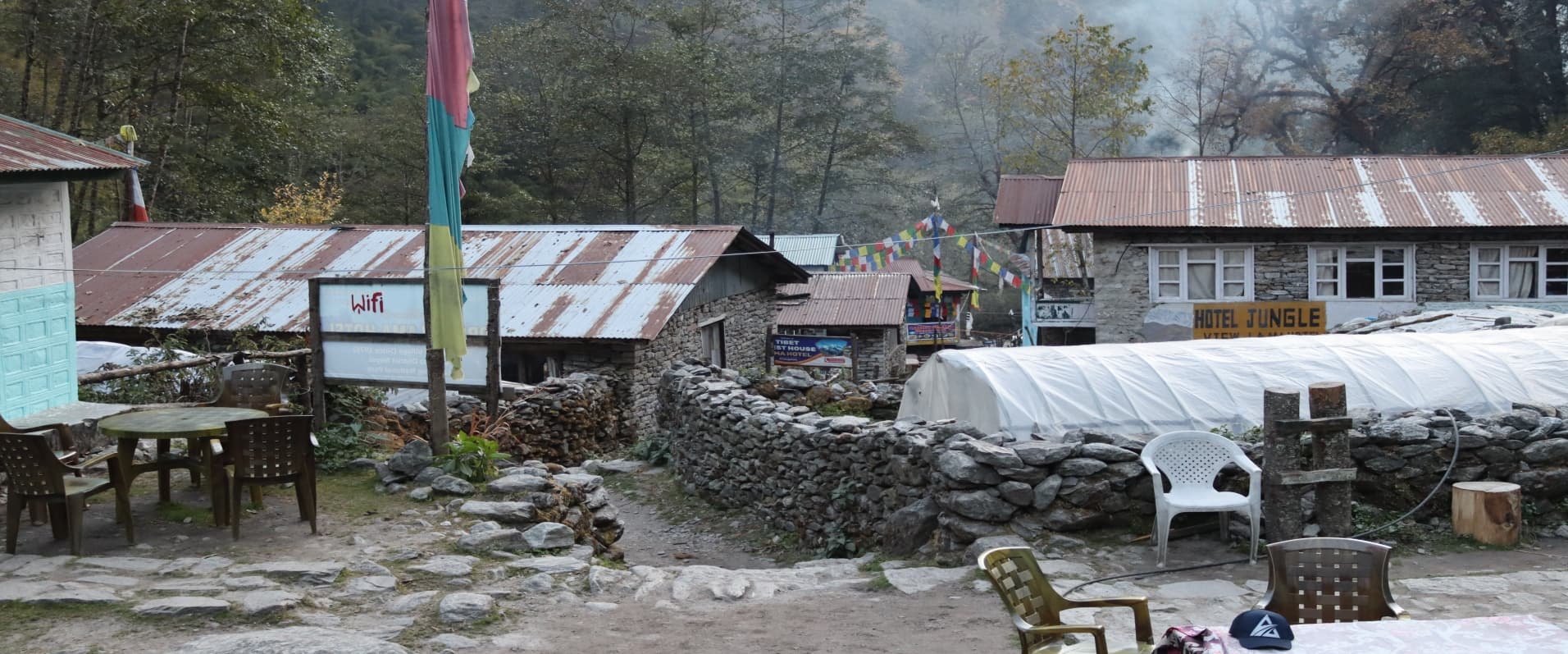
Tea houses are the standard accommodation throughout the Langtang region, and their quality follows the expected pattern: more comfortable and varied in the lower and larger settlements, more basic as you gain altitude and move into smaller communities. Syabrubesi at the trailhead has the widest range of options, including some lodges with attached bathrooms and consistent hot water, which makes it a good place to spend the first night before beginning the walk. The standard drops somewhat at Lama Hotel, which is a loose scattering of family tea houses in the forest, each offering simple twin rooms with shared bathrooms and a communal dining room built around a central wood stove.
At Kyanjin Gompa, the accommodation situation has improved significantly since the post-earthquake reconstruction. Several well-built tea houses offer clean rooms, and a few have solar-heated shower facilities available at a small additional charge, typically around NPR 300 to 500 per shower. Electricity for charging devices is available at most tea houses along the main route up to and including Kyanjin, though reliability varies and charging fees of NPR 100 to 300 per session are standard. Wi-Fi is advertised at some lodges in Syabrubesi and occasionally at Lama Hotel, but above that point, mobile coverage from Nepal Telecom is the practical alternative, and even that becomes patchy above Langtang village.
The tea houses on the Gosaikunda route at Sing Gompa and Cholangpati are more basic than those in the main valley, reflecting the lower traffic volumes on that section of trail. Gosaikunda itself has a handful of simple lodges that exist specifically to accommodate the trekker and pilgrim traffic at the lake, though during the Janai Purnima festival in August the demand vastly exceeds the capacity of the permanent structures and large numbers of pilgrims camp on the surrounding slopes. If you are planning to visit Gosaikunda during the festival period, flexibility and early arrival are essential.
Practical Notes for the Journey
Cash is the only payment method available throughout the Langtang region once you leave Syabrubesi, and even there the ATM situation is limited. The last reliable ATMs are in Kathmandu. Bring enough Nepalese rupees from the capital to cover the full cost of your trek including accommodation, food, permit fees if not already arranged, tips for your guide and porter, charging fees, and a reasonable contingency buffer. Tea house prices increase as you gain elevation, and a daily budget for accommodation and three meals at Kyanjin runs between NPR 2,500 and NPR 4,000 per person excluding tips and extras. Budget more than you think you will need.
Mobile coverage from Nepal Telecom's network is functional through most of the lower valley up to and including Langtang village, and some connectivity extends intermittently to Kyanjin. A Nepal Telecom SIM card, available at Tribhuvan International Airport in Kathmandu for a modest fee, gives you access to this network and is worth obtaining before departure. The Ncell network has less reach in the Langtang area than in some other trekking regions. Above Kyanjin and on the Gosaikunda route, plan for complete digital disconnection.
Altitude sickness is the primary health risk on the Langtang trek. The route gains significant elevation over a relatively short number of days, and the final push to Kyanjin at 3,860 meters followed by acclimatization hikes to nearly 5,000 meters on Tserko Ri puts meaningful demands on the body's adaptation systems. The standard protocols apply: ascend gradually, drink three to four liters of water daily, avoid alcohol above 3,000 meters, eat even when appetite is reduced, and report any headache, nausea, or loss of coordination to your guide immediately rather than hoping it passes. The acclimatization day built into most standard itineraries at Kyanjin Gompa is not optional padding; it is a clinically sensible measure that should be respected.
Travel insurance covering emergency helicopter evacuation to at least 4,500 meters and comprehensive medical treatment is required for all trekkers working with our company, and it is simply good judgment for anyone going above 3,000 meters in a remote area without road access. Helicopter rescue from the Langtang valley costs between USD 3,000 and USD 5,000 depending on location and conditions, a cost that falls entirely on the individual without appropriate insurance coverage. Adventure-specific insurers including World Nomads, Battleface, and Campbell Irvine offer policies designed for high-altitude trekking; read the policy language carefully and confirm that your specific altitude range is explicitly covered.
The Langtang region rewards a certain quality of attention that the more crowded trekking areas sometimes make harder to sustain. Because the trail carries fewer visitors than Everest or Annapurna, the interactions with local communities feel less transactional. The tea house dinners are quieter and more conversational. The valley above Langtang village has a wild, open character that the gorge below does not prepare you for. The rebuilt village carries a weight of history that a sensitive traveler will feel without needing it spelled out. These are not trivial things. They are the reasons that people who have trekked in all three of Nepal's great regions consistently describe Langtang as the one that stayed with them longest.
Frequently Asked Questions: Langtang Region
1. How difficult is the Langtang Valley trek compared to Everest or Annapurna?
The Langtang Valley trek is generally considered moderate and is less physically demanding than the Everest Base Camp trek or the full Annapurna Circuit. While it lacks the extreme altitudes of the Khumbu, it still requires a serious climb from the trailhead at 1,460 meters to Kyanjin Gompa at 3,860 meters. The trails are well-maintained, but the rapid elevation gain over a few days means that fitness and proper acclimatization are essential for a comfortable experience.
What sets Langtang apart is its accessibility; you can experience high-alpine glacial scenery and 7,000-meter peaks much faster than in other regions. For those seeking a Himalayan experience without the logistical complexity of domestic flights or twenty-day itineraries, Langtang offers a more concentrated but equally rewarding challenge.
2. Is it safe to trek in Langtang after the 2015 earthquake?
Yes, the region is fully operational and safe for trekkers. The trekking infrastructure, including trails and tea houses, has been completely restored or rerouted where necessary to ensure stability. The new Langtang village was rebuilt on a safer site 100 meters above the ruins of the original settlement, using modern, earthquake-resistant construction methods with wider spacing between buildings.
While the physical scars of the 2015 avalanche are still visible and serve as a poignant memorial, the community has shown incredible resilience in welcoming visitors back. Modern safety protocols, such as the 2025 requirement for all foreign trekkers to be accompanied by a licensed guide, further enhance safety by ensuring professionals handle navigation and emergency response.
3. What is the new guide requirement for 2025?
As of February 15, 2025, the Nepalese government requires all foreign nationals trekking in the Langtang region to be accompanied by a licensed guide. Solo independent trekking is no longer permitted. This policy aligns Langtang with other restricted trekking zones in Nepal and aims to improve trekker safety, provide local employment, and ensure that environmental regulations are respected within the national park.
Hiring a guide through a registered agency simplifies the logistics of your trip, as they typically handle the procurement of both the Langtang National Park Entry Permit and the TIMS card. Beyond the legal requirement, guides provide invaluable cultural context and bridge the communication gap with the Tamang and Langtangpa communities.
4. What kind of wildlife might I see in Langtang National Park?
Langtang National Park is a biodiversity hotspot, and you are more likely to see wildlife here than in many other trekking regions. The park's flagship species is the elusive red panda, which inhabits the bamboo forests between Syabrubesi and Lama Hotel. While they are shy, lucky trekkers often spot them at dawn or dusk.
In the higher elevations above the treeline, you are likely to encounter Himalayan tahr (mountain goats) and blue sheep. Langur monkeys are a common sight in the lower forest canopies, and bird enthusiasts can look for over 250 species, including the vibrant Impeyan pheasant, which is Nepal’s national bird.
5. How much cash should I carry for the trek?
Cash is the only reliable currency once you leave the trailhead at Syabrubesi, as there are no ATMs on the trail. You should carry enough Nepalese rupees from Kathmandu to cover your entire journey, including food, accommodation, charging fees, and tips for your guide and porter. A safe daily budget for a trekker at higher elevations like Kyanjin Gompa ranges between NPR 2,500 and NPR 4,000.
It is always advisable to budget a contingency buffer of 15-20% above your estimated costs. Prices for meals and services increase as you gain altitude because all supplies must be transported by porters or pack animals.
6. What is the accommodation like in the Langtang Valley?
The region utilizes a "tea house" system, which consists of small, family-run lodges. At lower elevations like Syabrubesi, you can find more comfortable lodges with attached bathrooms and consistent hot water. As you climb higher, the facilities become more basic; places like Lama Hotel offer simple twin rooms with shared bathrooms and a communal dining area heated by a central wood stove.
At Kyanjin Gompa, the heart of the upper valley, reconstruction has led to significantly improved facilities. Many tea houses there now offer clean rooms and solar-heated showers for a small fee. Electricity for charging devices is generally available along the main route, though you should expect to pay a small session fee for its use.
7. Can I get a mobile signal or Wi-Fi on the trail?
Connectivity in the Langtang region is functional but inconsistent. Nepal Telecom (NTC) offers the most reliable mobile coverage in the lower valley and up to Langtang village, with patchy service extending to Kyanjin Gompa. Ncell typically has much less reach in this specific area.
While some lodges in Syabrubesi or Lama Hotel may advertise Wi-Fi, it is often slow or unreliable due to the terrain. For those heading toward Gosaikunda or the high ridges above Kyanjin, you should prepare for a complete digital fast, as these areas often have no signal at all.
8. What makes the food in Langtang unique?
While the staple meal is the ubiquitous Dal Bhat, the Langtang region is famous for its local yak cheese. The region hosts Nepal’s first cheese factory, established in 1952 at Kyanjin Gompa with Swiss assistance. Trekkers can visit the factory to see the production of this firm, salty cheese, which is a highlight of the local culinary experience.
Other local specialties include tsampa (roasted barley flour) and Tibetan bread, which are staples of the high-altitude Buddhist communities. You may also be offered butter tea—a salty, fatty drink that is an acquired taste but provides essential warmth and calories in the cold mountain air.
9. When is the best time for photography in Langtang?
The autumn season, specifically October and November, is the gold standard for photography. After the monsoon rains, the atmosphere is "scrubbed" clean, resulting in razor-sharp visibility and deep blue skies that make the snow-capped peaks of Langtang Lirung look incredibly crisp.
Spring (March to May) offers a different but equally stunning palette. During this time, the lower forests are ablaze with blooming rhododendrons in shades of crimson and pink. While the air may be slightly hazier in the afternoons, the combination of flowering forests and white peaks creates a softer, more colorful landscape for photographers.
10. What are the essential permits required?
Every trekker in the region must hold two documents: the Langtang National Park Entry Permit and the TIMS (Trekkers' Information Management System) card. The National Park permit costs NPR 3,390 for foreign nationals and funds conservation efforts within the park. The TIMS card costs NPR 2,000 for individual trekkers and serves as a vital registration for safety and rescue operations.
It is highly recommended to obtain these in Kathmandu before you depart, although the National Park permit can be purchased at the Dhunche checkpoint if necessary. You must carry physical copies of these permits, as digital versions are rarely accepted at the military and park checkpoints along the trail.