Annapurna Region Guide
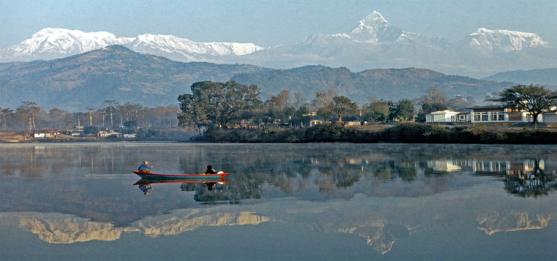
The Annapurna Region: A Complete Travel Guide to Nepal's Most Celebrated Himalayan Landscape
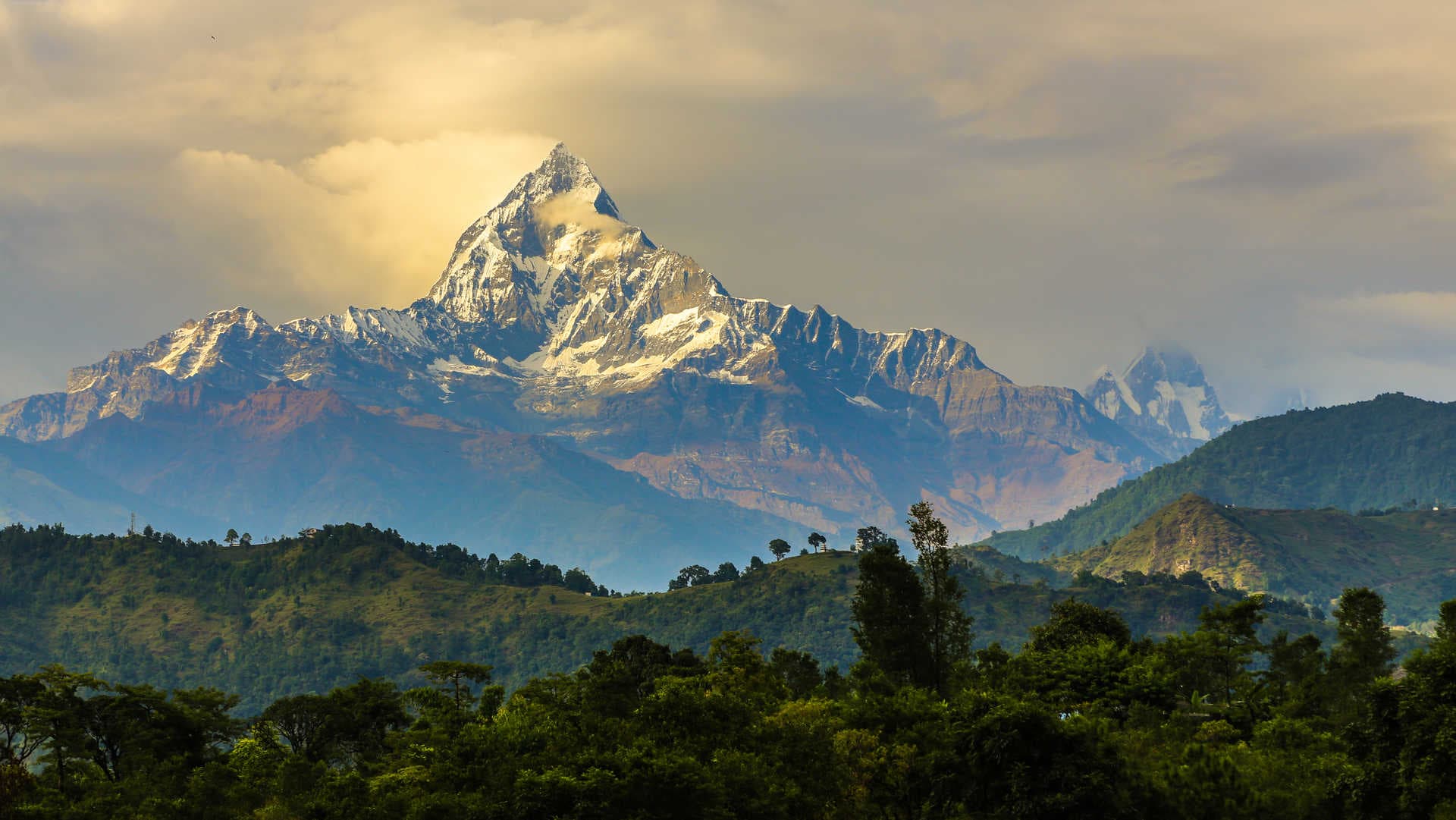
There are mountain regions in the world that reward a quick visit, and then there are places that seem to resist any relationship with hurry. The Annapurna region of north-central Nepal belongs firmly to the second category. Spread across Gandaki Province in the middle of the country, the area surrounds the Annapurna massif, a collection of peaks that includes Annapurna I at 8,091 meters, the tenth-highest mountain on earth, along with Annapurna II, III, IV, South, and a series of surrounding giants including Dhaulagiri (8,167 meters), Manaslu (8,163 meters), Machhapuchhre (6,993 meters), and Nilgiri (7,061 meters). The region contains some of the most dramatic elevation transitions on the planet: within a horizontal distance of roughly 40 kilometers, the land rises from subtropical river valleys at around 800 meters to permanent snowfields above 8,000 meters.
What draws close to 130,000 registered trekkers to the Annapurna Conservation Area every year is not just altitude records. The infrastructure here is among the best-developed in Nepal, the cultural variety along the trail corridors spans Hindu farming villages, Gurung and Magar highland communities, and Tibetan Buddhist settlements near the Mustang border, and the landscape shifts so dramatically over short distances that a single day of walking can take a trekker from rhododendron forest to high desert. For first-time visitors to Nepal, the Annapurna region offers an accessible and well-supported introduction to Himalayan travel. For returning visitors, it continues to reveal layers that shorter and faster visits miss entirely.
This guide covers the practical and cultural dimensions of traveling in the Annapurna region: the permits and regulations, the people and their traditions, the food, the seasons, the health and safety considerations, and the treks worth knowing about. It is written for people who want to understand the place they are traveling through, not just move through it.
Understanding the Annapurna Region: Geography and Scope
The Annapurna Conservation Area (ACA) was established in 1986 and covers approximately 7,629 square kilometers, making it the largest protected area in Nepal by land mass. It was also the first conservation area in Nepal to be managed not as a conventional national park with strict exclusion zones, but as a multiple-use area where human habitation, agriculture, and tourism coexist with wildlife conservation. This design decision shapes the entire character of the region: unlike parks where visitors move through a preserved wilderness, the Annapurna circuit moves through living communities whose members have farmed, herded, traded, and worshipped in this landscape for centuries.
The region is drained by two major river systems. The Kali Gandaki River, one of the deepest river gorges on earth by some measurements, flows south between the Annapurna massif to the east and Dhaulagiri to the west, cutting a corridor that has served as a trans-Himalayan trade route between the Terai lowlands and Tibet for at least 2,000 years. The Modi Khola River drains the southern flanks of the Annapurna range and provides the approach corridor for the Annapurna Base Camp trek. These two river valleys define the primary trekking routes and also explain much of the cultural geography: the Kali Gandaki valley has been a commercial artery for generations of traders, and the religious and ethnic complexity of the communities along it reflects that history of movement and exchange.
The topography creates extraordinary ecological diversity. The southern slopes of the Annapurna range receive some of the highest monsoon rainfall in the Himalayan region, producing dense subtropical and temperate forests. The north-facing slopes and the trans-Himalayan valleys beyond the main range sit in the rain shadow and receive dramatically less precipitation, producing a high-altitude semi-arid landscape that closely resembles the Tibetan Plateau. The ecological transition between these two worlds, most dramatically experienced on the Annapurna Circuit when crossing the Thorong La pass at 5,416 meters, is one of the most striking features of the entire trek.
The Major Treks of the Annapurna Region
The Annapurna region accommodates several distinct trekking routes, ranging from multi-week circuits to short day treks accessible from Pokhara. Each corridor has its own character, difficulty profile, and cultural emphasis. Below are the routes that most trekkers consider when planning a visit.
The Annapurna Circuit Trek
The Annapurna Circuit is the defining long-distance trek of the region and, for much of the 1980s and 1990s, was ranked among the finest walks in the world. The classic full circuit covers between 160 and 230 kilometers depending on the starting point and variant routes taken, and crosses the Thorong La pass at 5,416 meters, which remains the high point of the journey and the single most logistically significant challenge for most trekkers. The circuit begins either at Besisahar in Lamjung district or, for those who bypass the roadside sections by jeep, at Chame or Dharapani, and continues clockwise around the Annapurna massif, finishing at Tatopani or Nayapul after descending the Kali Gandaki valley.
The route was partially altered in the 2000s and 2010s by road construction along the Marsyangdi valley, which replaced a section of the traditional trail with a vehicle track. Many trekkers now choose to bypass the lower Marsyangdi sections by jeep and begin walking from Chame or Pisang, preserving the mountain trail experience. Despite the road development, the upper sections of the circuit, from Manang to Muktinath and the Kali Gandaki descent, remain spectacularly intact. The full circuit at a reasonable pace takes 16 to 21 days.
The Annapurna Base Camp Trek
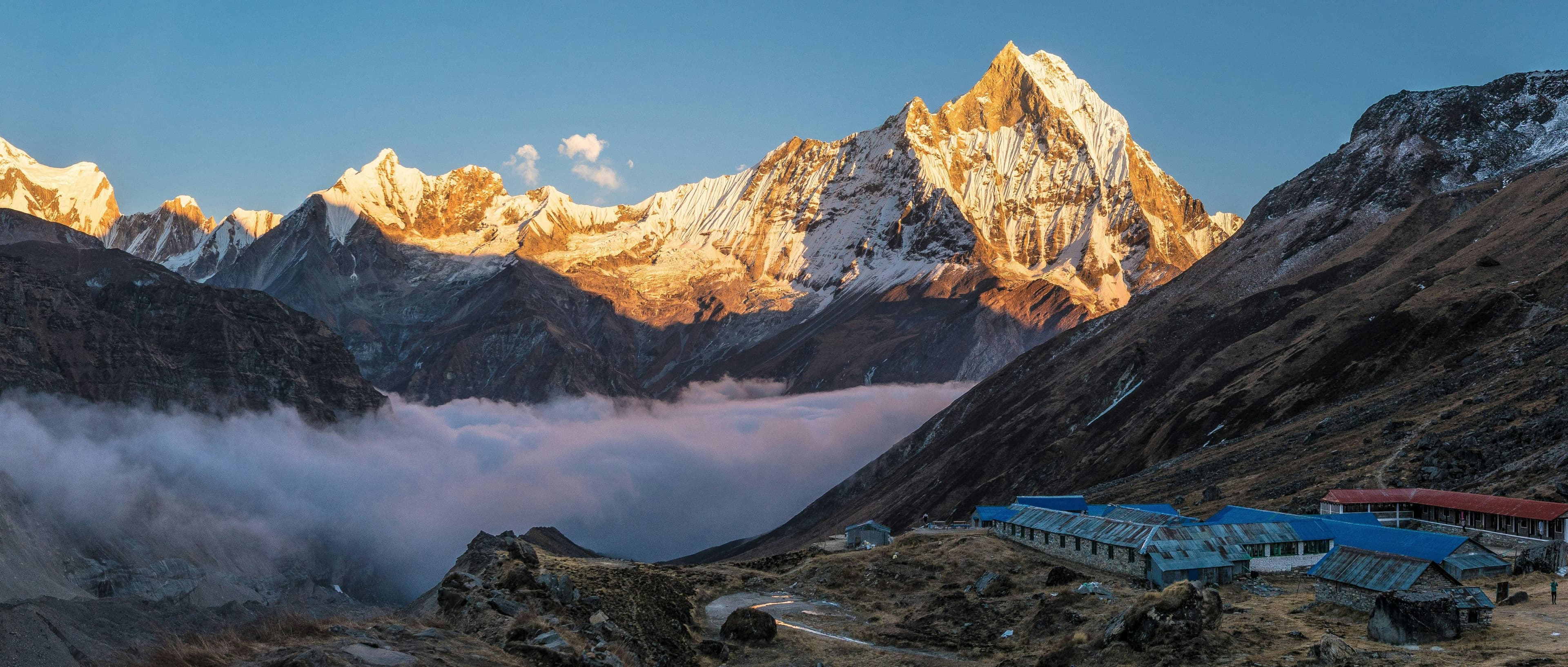
The Annapurna Base Camp (ABC) trek follows the Modi Khola valley north from Nayapul or Phedi into the Annapurna Sanctuary, a glacially carved natural amphitheater surrounded on three sides by a wall of peaks including Annapurna I, Annapurna South, Hiunchuli, Machhapuchhre, Gangapurna, and Glacier Dome. The base camp sits at 4,130 meters. The round trip from Nayapul takes 10 to 13 days at a comfortable pace, with the standard approach passing through the Gurung village of Chhomrong, the rhododendron forests of the middle elevation corridor, and the bamboo and rhododendron sanctuary approach.
The ABC trek is the most popular route in the region for trekkers on shorter schedules or those new to Himalayan walking. The maximum elevation of 4,130 meters is achievable without the extreme acclimatization demands of the Thorong La crossing, and the trail is exceptionally well-marked and serviced with teahouses throughout. The visual drama of arriving at the base camp, surrounded by a complete 360-degree ring of peaks above 6,000 meters, is one of the most reliably stunning moments in Himalayan trekking.
The Poon Hill and Ghorepani Trek
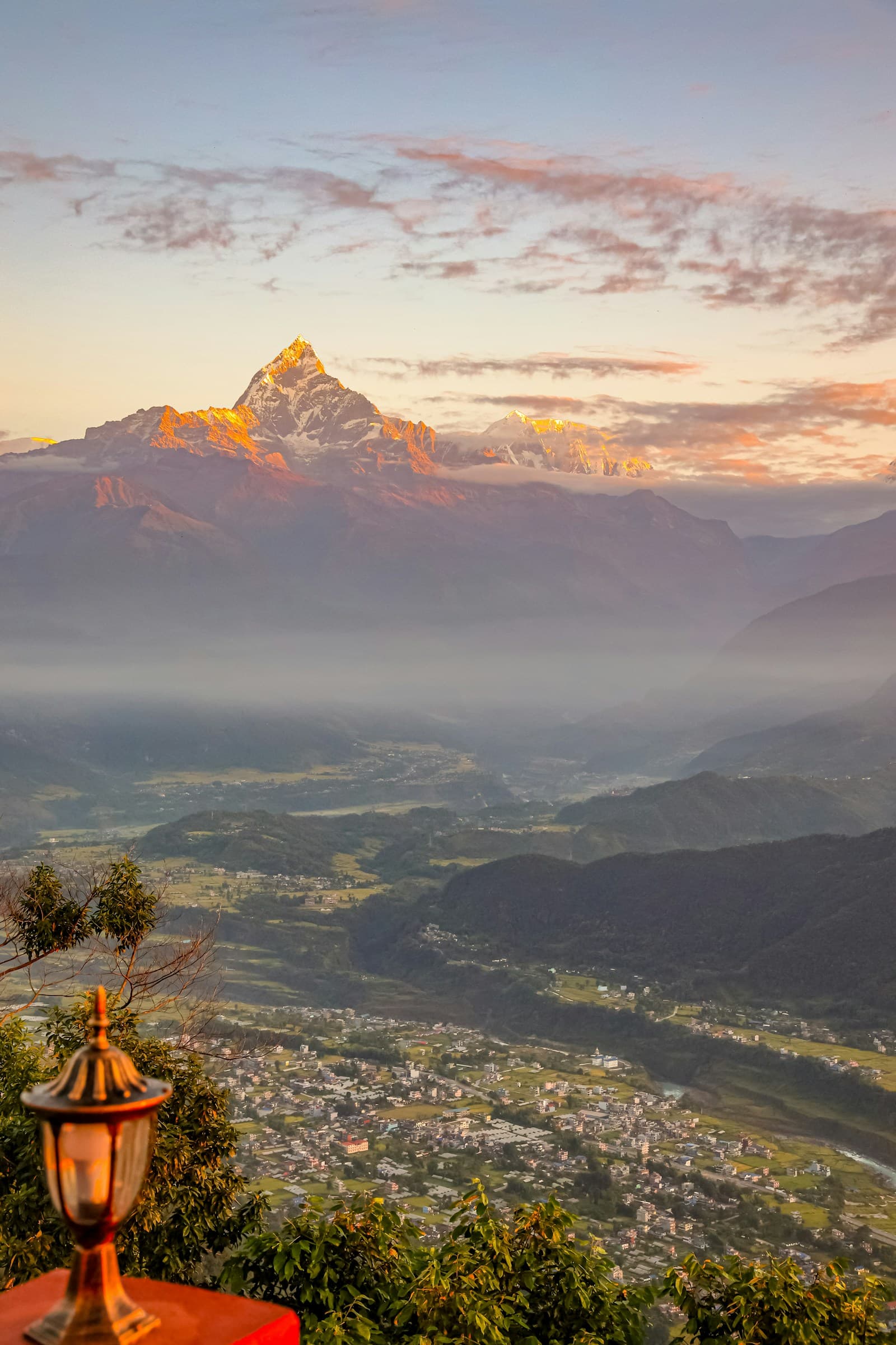
Poon Hill at 3,210 meters is the most accessible viewpoint in the Annapurna region and, on clear mornings, offers a panorama that takes in Dhaulagiri, Annapurna I, Annapurna South, Hiunchuli, Machhapuchhre, and a sweep of peaks extending to the east and west. The standard Poon Hill trek from Nayapul takes three to five days and passes through Ghorepani, a large teahouse village on the ridge between the Modi Khola and Kali Gandaki valleys.
This route is the entry point for a significant number of first-time Nepal trekkers. The maximum elevation is low enough that serious altitude sickness is rare, the trails are wide and well-maintained, and the teahouse network is dense and comfortable. The sunrise view from Poon Hill is one of the iconic experiences of Himalayan tourism. The trail also passes through Tikhedhunga and Ulleri, villages with large Magar communities, and through rhododendron forests that in March and April produce the most vivid color display in the region.
The Mustang Trek and Upper Mustang
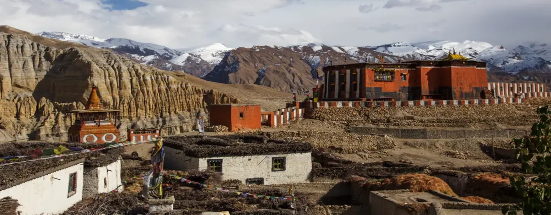
Mustang occupies the rain-shadow valley north of the Annapurna range along the Kali Gandaki, and the upper portion, known as Upper Mustang, was closed to foreign visitors until 1992. The region was a semi-autonomous kingdom, Lo Manthang, until the abolition of the Nepalese monarchy in 2008, and the current king, the Raja of Mustang, still maintains a ceremonial and cultural role. Upper Mustang requires a special restricted area permit (currently USD 500 per person for the first 10 days) and retains a landscape and cultural character unlike anywhere else in the Annapurna region: ochre and white cliffs sculpted by wind erosion, cave cities thousands of years old, walled medieval villages, and a Tibetan Buddhist culture that has survived here with remarkable continuity.
The Mardi Himal Trek
The Mardi Himal trek is a newer, less-trafficked route that branches off the ABC approach and climbs to a high camp at approximately 4,500 meters on the ridge below Mardi Himal's southwest face. The route offers exceptionally close views of Machhapuchhre and Mardi Himal without the teahouse congestion of the main ABC trail. The full route takes five to seven days from Pokhara and has been gaining popularity since the formal trail development in the early 2010s.
Permits and Regulations: What You Need Before You Walk
The Annapurna Conservation Area has a straightforward permit system, but the requirements are non-negotiable and the checkpoints along all major trails enforce them consistently. Failing to carry the correct permits can result in fines and being turned back at checkpoints within the conservation area.
Annapurna Conservation Area Permit (ACAP)
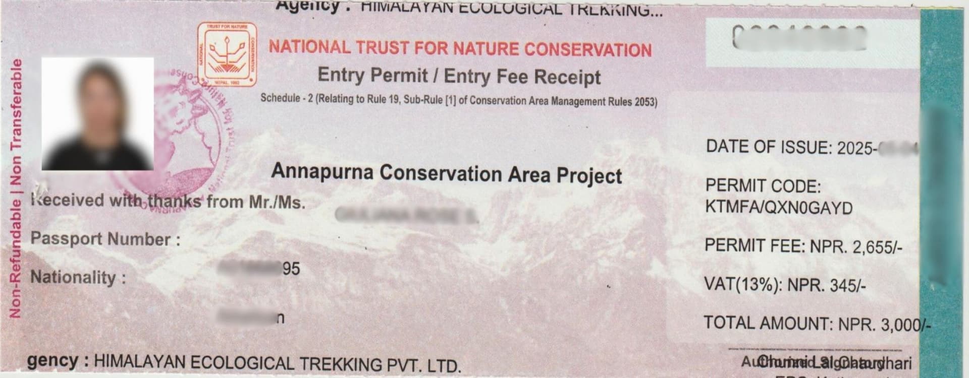
All trekkers entering the Annapurna Conservation Area require an ACAP permit. As of 2024, the fee is NPR 3,000 per person (approximately USD 22 to 25 depending on the exchange rate) for foreign nationals, and NPR 1,000 for SAARC nationals. The permit is obtained at the Nepal Tourism Board (NTB) office in Kathmandu or at the TIMS and permit counters in Pokhara before beginning the trek. It is not available at trail entry points. Bring two passport-size photographs and a copy of your passport identification page.
Trekkers Information Management System (TIMS) Card
The TIMS card is a separate requirement from the ACAP permit and serves as a trekker registration system maintained by the Trekking Agencies' Association of Nepal (TAAN) and the Nepal Tourism Board. The fee is USD 20 for trekkers traveling through a registered agency and USD 20 for independent trekkers (the two-tier pricing that previously applied was equalized). The TIMS card records your details, emergency contact, and planned route. It is checked at the same counters as the ACAP in Pokhara and at various checkpoints on the trail.
Restricted Area Permits for Upper Mustang and Nar Phu
Upper Mustang and the Nar Phu Valley (a remote northern corridor accessed from the Annapurna Circuit near Koto) require separate Restricted Area Permits in addition to the ACAP. The Upper Mustang RAP costs USD 500 per person for the first 10 days, with USD 50 per additional day. The Nar Phu Valley RAP costs USD 90 per week during the September-to-November peak season and USD 75 per week during other months. Both permits must be arranged through a registered Nepalese trekking agency and require a licensed guide. Solo independent trekking is not permitted in restricted zones.
|
Permit |
Cost (Foreign) |
Where to Obtain |
Required For |
|
ACAP |
NPR 3,000 (~USD 22) |
NTB Kathmandu or Pokhara counter |
All Annapurna region treks |
|
TIMS Card |
USD 20 |
TAAN / NTB counter in Pokhara |
All trekkers |
|
Upper Mustang RAP |
USD 500 for 10 days |
Through registered agency only |
Upper Mustang trek |
|
Nar Phu Valley RAP |
USD 90/week (peak) |
Through registered agency only |
Nar Phu Valley trek |
The People of the Annapurna Region: A Cultural Guide
The Annapurna region is not ethnically or religiously uniform. The communities along its trails belong to different ethnic groups, speak different languages, practice different religions, and have different histories of relationship with the mountains. Understanding something of this variety makes travel through the region significantly richer.
Gurung Communities of the Southern Slopes
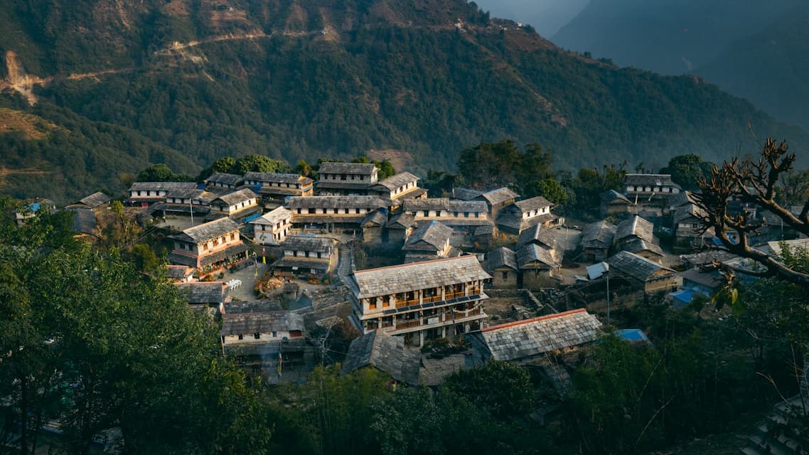
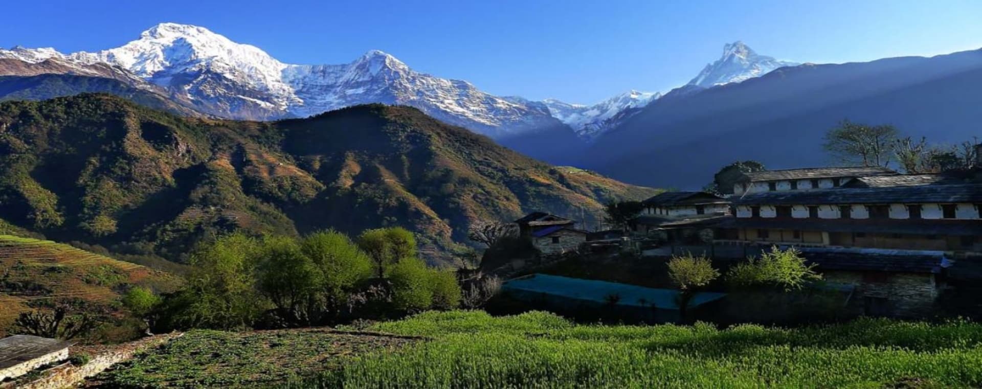
The Gurung people, also known by their self-designation Tamu, are the dominant ethnic group in the mid-elevation villages south of the Annapurna range, particularly around Chhomrong, Ghandruk, Dhampus, and the Modi Khola valley. The Gurung homeland in the Annapurna foothills is sometimes called the Gurung heartland, and the villages here reflect a culture built on a combination of agriculture, animal husbandry, and centuries of service in the British and Indian Gurkha regiments.
Gurung houses are traditionally built in stone with slate roofs and internal courtyards. The ground floor historically housed livestock, with the family living on the upper levels. This design has been widely adapted into the teahouse model: the lower level serves guests, the family occupies the upper level, and the courtyard provides vegetable gardens and drying space. Gurung villages typically have a central chautara, a stone resting platform built around a tree, which functions as a community gathering point. Visitors are welcome to rest at chautaras; they are a gift of public hospitality built into the landscape.
The Gurung practice a syncretic religion that blends Tibetan Buddhism with animist traditions maintained by shaman priests known as Paju and Ghyabri. Buddhist monasteries and Hindu shrines often coexist in the same village, and religious festivals draw on both traditions. The Tamu Lhosar (Gurung New Year), celebrated in December or January according to the lunar calendar, is one of the most important annual celebrations and involves masked dance performances, communal feasting, and ancestral remembrance rituals.
Magar Communities
The Magar people occupy many of the lower and middle-elevation villages along the southern Annapurna approach, including sections of the Poon Hill trail corridor. Like the Gurung, Magar men have a long history of Gurkha military service, and many villages contain the distinctively maintained homes of retired soldiers. Magar culture has historically been more closely connected to the Hindu lowlands than Gurung culture, and the religious practice in Magar villages tends to blend animism with Hinduism.
Thakali Communities of the Kali Gandaki Valley
The Thakali people of the Kali Gandaki valley, particularly concentrated around the town of Tukuche and the surrounding villages between Ghasa and Kagbeni, are among the most commercially sophisticated communities in the Himalayan region. Their prosperity was built over centuries of trade monopoly control over the salt route between Tibet and the Terai lowlands: Tibetan rock salt moved south through the Kali Gandaki corridor in exchange for lowland grains and goods. The wealth accumulated through this trade is visible in the quality of the traditional Thakali architecture, the large multi-story stone houses, the carved wooden balconies, and the caravanserai-style compounds.
Thakali cuisine is recognized as among the finest in Nepal's mountain regions, and the dhaba-style Thakali restaurants found throughout Pokhara and Kathmandu serve as introductions to the flavors of the trail. The traditional Thakali dal bhat set includes rice, lentil soup, two or three vegetable dishes, gundruk (fermented dried leafy greens), pickles, and a meat course if available. The Thakali practice a form of Buddhism influenced by Bon elements, and the central valley villages contain some well-preserved monastery architecture.
Tibetan Buddhist Communities of the Upper Valleys
North of the main Annapurna range, in Manang district and in the Mustang corridor, the cultural environment shifts decisively toward Tibetan Buddhism. The villages of Manang, Braga, and Pisang on the circuit's upper section, and the entire Mustang kingdom north of Kagbeni, are populated by communities of Tibetan heritage whose religious and social structures resemble those of pre-1950 Tibet more closely than anything found in contemporary Tibet itself.
Braga village, located just below Manang at approximately 3,360 meters, contains one of the oldest monasteries in the Annapurna region, the Braga Gompa, which houses a significant collection of clay statues, thangka paintings, and ritual objects that scholars believe date to the 14th or 15th century. The monastery is open to respectful visitors and maintains a small museum collection. In Manang, the Himalayan Rescue Association runs an altitude sickness clinic during the trekking season, staffed by volunteer physicians, which provides free consultations to trekkers.
In Upper Mustang, the walled capital of Lo Manthang contains four active monasteries, the royal palace of the Raja of Mustang, and a population of a few hundred permanent residents who maintain a way of life oriented around the Tibetan Buddhist calendar of festivals and agricultural seasons. The Tiji Festival, held annually in Lo Manthang over three days in May, is one of the most important religious festivals in the trans-Himalayan region and involves elaborate masked dances performed by the monks of Champa Lha Khang monastery that enact the defeat of a demon threatening to destroy the kingdom of Lo.
Cultural Protocol: How to Behave Respectfully on the Trail
A few consistent principles apply across all the communities in the Annapurna region. Mani walls and chortens (Buddhist stone monuments) should always be passed on the left, keeping them on your right side, as a form of clockwise circumambulation that carries religious meaning. Entering a monastery or prayer hall requires removing shoes at the entrance and maintaining quiet; photography inside requires explicit permission from the resident monks or caretaker. Asking permission before photographing people is a basic courtesy that is widely appreciated and that many trekkers skip to their discredit.
In Hindu villages in the lower elevations, the kitchen and the cooking fire are ritually significant, and entering the kitchen of a private home without invitation is inappropriate. When offered food or drink as hospitality, accepting with both hands or with the right hand supported by the left is considered respectful. Saying no to a first offer of hospitality is common in Nepalese etiquette; a host will typically offer again, and accepting on the second offer is the cultural norm.
Food and Drink on the Annapurna Trail
The teahouse food system in the Annapurna region is more diverse and in many places more reliable than in any other comparable trekking corridor in Nepal. The high volume of trekkers, the well-established supply chains, and the competitive teahouse market have produced a standard of cooking that ranges from competent to genuinely excellent, depending on the village and the establishment.
Dal Bhat: The Foundation of Trail Nutrition
Dal bhat is the meal that sustains trekking Nepal. The combination of steamed rice, spiced lentil soup, vegetable curry, fermented greens, and pickle provides a nutritionally complete high-carbohydrate meal that is ideally suited to the caloric demands of sustained uphill walking at altitude. Most teahouses offer unlimited refills of the rice and dal, a policy that allows hungry trekkers to eat to actual satiation rather than the modest portions that fixed-price Western mountain hut food tends to produce. Dal bhat is typically served twice daily, at lunch and dinner, and is the cheapest item on any teahouse menu.
Regional Specialties Worth Seeking Out
Beyond dal bhat, the Annapurna trail has specific regional foods worth seeking out at the right locations. In Gurung villages, dhido, a thick porridge made from buckwheat or millet flour, is a traditional staple that predates rice cultivation in the highlands and is still served in family homes and some traditional-style teahouses. It is denser and more filling than rice, and is traditionally eaten by breaking off a piece and dipping it into lentil soup or curry.
In the Thakali villages of the Kali Gandaki, look for buckwheat pancakes served with local honey and butter, apple products from the orchards of Marpha village (apple brandy, apple pie, dried apple chips, and fresh apples in season), and the fuller Thakali thali set which typically includes more courses than the standard hill-country dal bhat. Marpha, a beautifully maintained whitewashed village at approximately 2,670 meters between Tukuche and Jomsom, has been producing apples since the 1960s when the crop was introduced by agricultural development programs, and the apple orchards now line the entire approach to the village.
In Manang and the upper circuit villages, tsampa (roasted barley flour) and butter tea become more prominent as the local diet shifts toward Tibetan staples. Butter tea, made from brick tea brewed strong and then churned with salt and yak butter, is an acquired taste for most Western visitors but functions as a high-calorie warming beverage at altitude where the body needs both. Refusing butter tea offered by a Tibetan or Manangi household is socially awkward; accepting and sipping slowly, even if you do not finish the bowl, is appropriate.
Food Safety and Practical Considerations
Food safety standards on the Annapurna trail are significantly better than in many trekking corridors because the supply chain is well-established and the teahouse competition for repeat customers creates an incentive for quality. The most common source of gastrointestinal illness is not the cooked food but the water. All drinking water must be treated, whether by boiling (standard practice at teahouses, which charge a small fee for boiled water), chemical treatment with iodine or chlorine tablets, or filtration through a personal filter bottle. Do not drink tap water, stream water, or water from wells without treatment, regardless of how clean it appears.
At higher elevations above 3,500 meters, the boiling point of water drops to approximately 87 degrees Celsius, which affects both cooking times and tea quality but does not compromise the effectiveness of boiling for water purification. Bringing a water purification system rather than relying on purchased bottled water reduces both cost and plastic waste on the trail.
When to Go: Seasons, Weather, and What to Expect
The Annapurna region's weather follows the broader South Asian pattern with two main trekking windows and two periods of difficult or uncomfortable conditions. The choice of when to go shapes the experience significantly, not just in terms of weather comfort but in terms of the visual, cultural, and social character of the journey.
|
Month |
Season |
Conditions |
Highlights |
|
January |
Winter |
Cold; snow above 3,500m; quiet trails |
Solitude; clear skies; Marpha apple brandy |
|
February |
Late winter |
Temperatures rising; rhododendrons beginning |
Quieter trails; improving weather |
|
March |
Spring start |
Rhododendrons blooming in lower zones |
Best forest color; moderate crowds |
|
April |
Peak spring |
Warm days; full rhododendron bloom; clear views |
Excellent conditions; busy but not overcrowded |
|
May |
Late spring |
Warm; pre-monsoon haze builds; Tiji Festival (Mustang) |
Upper Mustang festivals; Manang still clear |
|
June |
Monsoon starts |
Rain; leeches in lower forests; poor visibility |
Mustang and upper valleys stay rain-shadow dry |
|
July |
Monsoon peak |
Heavy rain lower elevations; landslide risk |
Upper Mustang viable; most circuits not advised |
|
August |
Monsoon |
Continuing rain; lush but slippery |
Upper Mustang viable with preparation |
|
September |
Monsoon end |
Clearing; trails drying; vegetation vivid |
Excellent visibility emerging; quieter than Oct |
|
October |
Peak autumn |
Clear; dry; best mountain views; busy |
Peak season; Dashain festival; full visibility |
|
November |
Autumn close |
Cool; clear; trails less crowded by mid-month |
Excellent conditions; decreasing crowds |
|
December |
Winter start |
Cold; snow at altitude; some teahouses closing |
Quiet; dramatic snowy landscapes |
Spring and autumn are the two periods when conditions align most reliably for the full range of trekking options. April and October are the busiest months on the trail, particularly on the ABC approach and the Poon Hill route, where the teahouse accommodation can be stretched to capacity. Booking ahead for the most popular teahouses in Chhomrong and Ghorepani is advisable for April and October travel.
June through August is not a write-off for the entire region. The upper Mustang and Nar Phu valleys sit in the trans-Himalayan rain shadow and receive only a fraction of the monsoon precipitation that hits the southern slopes. Trekking in Upper Mustang during July and August, when the landscape is at its most vivid and the Tiji Festival has just concluded, is a genuinely worthwhile alternative to the main-season circuits. The permit costs remain the same, but the trails are dramatically quieter.
Getting There: Access Points and Transportation
Pokhara is the primary gateway city for the Annapurna region. At approximately 200 kilometers west of Kathmandu by road, and connected by domestic flight in 25 to 35 minutes, Pokhara sits at the base of the Annapurna range with views of the main massif directly from the lakeside promenade. Most Annapurna region treks begin with a drive from Pokhara to a trailhead, typically Nayapul (for the ABC, Poon Hill, and circuit southern approach), Besisahar (for the circuit eastern approach), or Jomsom (accessible by domestic flight for those beginning the circuit from the west or doing a Mustang itinerary).
Pokhara's domestic airport (IATA: PKR) handles multiple daily flights from Kathmandu operated by Buddha Air, Yeti Airlines, and Shree Airlines. Flight time is approximately 25 minutes. The road journey from Kathmandu to Pokhara takes five to seven hours on the Prithvi Highway and passes through the lower Trishuli and Marsyangdi valleys. Tourist buses depart from Kathmandu's Thamel district daily, and private vehicle hire is available for a faster and more comfortable transfer.
From Pokhara, taxis and local buses connect to the main trailheads. Nayapul is approximately 45 minutes to one hour by road. Besisahar for the circuit eastern approach is approximately four hours by road from Pokhara. Jomsom is accessible by domestic flight from Pokhara (approximately 20 minutes) or by road through the Kali Gandaki valley, a journey that has become increasingly feasible as road construction has extended north from Beni. Flight schedules from Pokhara to Jomsom are weather-dependent and cancellations are common, particularly in winter and during the monsoon.
Health, Safety, and Altitude Considerations
The Annapurna region covers a large altitude range, and the health considerations differ significantly depending on which route you are following. The Poon Hill trek reaches only 3,210 meters, at which altitude AMS is uncommon but possible. The ABC trek reaches 4,130 meters, at which altitude a meaningful percentage of unacclimatized trekkers experience mild symptoms. The Annapurna Circuit, with the Thorong La crossing at 5,416 meters, places trekkers in a zone where serious AMS, HAPE, and HACE are genuine risks if the ascent has been rushed.
The Himalayan Rescue Association Clinic in Manang
The Himalayan Rescue Association (HRA) operates a high-altitude medicine clinic in Manang (3,519 meters) during the main trekking season, typically from late September through November. The clinic is staffed by volunteer physicians, usually from Western medical schools, and offers free altitude sickness consultations to all trekkers. Attendance at the HRA's daily altitude sickness awareness lecture in Manang is strongly recommended before attempting the Thorong La crossing. The lecture covers the physiology of acclimatization, the warning signs of HAPE and HACE, and the descent protocols that constitute the correct response to serious symptoms. The clinic can also advise on Diamox use and assess individual readiness to cross the pass.
The Thorong La: Specific Considerations
The Thorong La crossing at 5,416 meters is the most medically significant challenge on the Annapurna Circuit. The standard acclimatization protocol requires spending at least two nights in Manang (3,519 meters) before attempting the pass, with a recommended acclimatization hike to Ice Lake (4,600 meters) or the Gangapurna viewpoint during the rest day. Trekkers who have rushed from Besisahar to Manang in fewer than five to six days are at significantly elevated AMS risk on the crossing.
The crossing should begin no later than 4am from Thorong Phedi (4,450 meters) or High Camp (4,925 meters) to reach the pass before the afternoon winds develop, typically after noon. The descent from the pass to Muktinath (3,760 meters) on the western side is 1,600 meters of knee-intensive downhill on loose scree and rocky trail. The full crossing day is long and physically demanding regardless of fitness level. Rescue horses are available from Thorong Phedi for trekkers who are unable to complete the crossing on foot, at a cost arranged on-site.
Water, Sun, and Cold
At higher elevations in the Annapurna region, the intensity of ultraviolet radiation is significantly greater than at sea level. Sunscreen of SPF 50 or higher should be applied to all exposed skin before beginning each day's walk, including the face, neck, the back of the hands, and the scalp if hair is thin or worn short. UV-protective sunglasses are essential above 3,000 meters; snow blindness, a temporary but painful condition caused by UV reflection off snow surfaces, can occur within hours of exposure without adequate eye protection.
Hypothermia is a risk at altitude, particularly when a trekker who has been sweating on an uphill section stops moving and the temperature drops quickly. The trail profile on most Annapurna routes involves significant elevation gain and loss within a single day, and the temperature swing between the warmth of sustained walking and the chill of a rest stop or cloud cover can be 10 to 15 degrees Celsius. Keeping a wind layer and warm insulating layer accessible in a daypack at all times, rather than stored in the porter's load, is a simple precaution that matters significantly on the upper sections.
Practical Information: Money, Connectivity, and Logistics
Money and ATMs
ATMs are available in Pokhara and, notably, in Jomsom and Manang, which is a significant convenience for trekkers on the circuit route. However, ATM reliability in mountain towns is inconsistent; machines run out of cash during peak season and may be offline due to power interruptions. Carrying sufficient Nepali rupees from Pokhara to cover the full expected duration of the trek, including a buffer for unexpected rest days, is the safer strategy. Card payments are not accepted in teahouses or at trail-side stalls. All trail transactions require cash in Nepali rupees.
US dollars in cash are widely accepted in Pokhara for permit payments and hotel bills, but on the trail only Nepali rupees are practical. Currency exchange is available at Pokhara's Lakeside (Baidam) district at competitive rates. Avoid exchanging currency at Tribhuvan International Airport in Kathmandu where rates are significantly less favorable.
Mobile Connectivity
NTC (Nepal Telecom) and Ncell are the two primary mobile networks, and both provide reasonably consistent 4G coverage throughout the lower and mid sections of the Annapurna region including the full Poon Hill and ABC trails. Coverage thins above Manang on the circuit and becomes intermittent at the Thorong La. In Upper Mustang, coverage is limited and largely restricted to Lo Manthang and Jomsom. Purchasing a local SIM card in Kathmandu or Pokhara (requires a passport copy; costs approximately NPR 200 to 300 with data packages available) provides the most reliable connectivity at the lowest cost.
Tipping Conventions
Tipping guides and porters is standard practice and an important component of their income. A rough guideline is NPR 2,000 to 3,000 per day for a lead guide, NPR 1,000 to 1,500 per day for an assistant guide, and NPR 700 to 1,000 per day for a porter. Tips are given at the end of the trek, in a named envelope to each individual team member, in Nepali rupees or US dollars. The group typically pools a collective tip and distributes it, which allows the total to be meaningful without requiring each individual to carry large sums specifically for tipping.
What the Annapurna Region Asks of You
The Annapurna region has absorbed enormous numbers of visitors over the past 40 years, and the evidence of that pressure is visible in some sections of the trail: the eroded slopes around heavily-used teahouse clusters, the plastic waste that appears in river channels below trail corridors, the uniformity of menu items at teahouses that have optimized for foreign tastes rather than local ones. These are real problems that the conservation area management system is working to address, with mixed success.
The practical implication for travelers is straightforward. Use boiled or filtered water rather than single-use plastic bottles. Stay on established trails in areas where detours create erosion paths. Support teahouses that are locally owned and family-run rather than lodge chains. Eat dal bhat and local food rather than demanding imported ingredients that arrive in the region at significant environmental cost. The choices are not sacrifices. The best teahouse food in the region is the local food, the most interesting cultural encounters happen in villages off the primary congestion points, and the views from the trail are not diminished by carrying your own water filter.
The mountains here have been welcoming travelers for a very long time, long before the trekking permit system existed, long before the teahouse network formalized, and long before the peaks had their names recorded in any Western geography. The communities that have lived in and around these mountains built the trails, maintain the monasteries, and provide the hospitality that makes travel here possible. Treating the region with the attention and respect that its scale, beauty, and cultural depth warrant is the most basic and most important thing any visitor can do.