Island Peak Climbing Nepal: The Complete 2025/26 Guide
Island Peak Climbing Nepal: The Complete Guide to Imja Tse (6,189 m)
Ask any Sherpa guide in the Khumbu which summit they have personally stood on more times than any other and the answer, almost without exception, is Island Peak. That is not just a commercial fact. It reflects something genuine about the mountain's character: Island Peak is technically demanding enough to earn a real place in the record of a climber's achievements, accessible enough that a well-prepared person without a mountaineering history can reach the top, and positioned in the absolute heart of the most spectacular mountain landscape on Earth. The views from the summit, a wall of eight-thousanders stretching from Lhotse's south face across Makalu and past Baruntse, with Ama Dablam's unmistakable spire anchoring the southern horizon, are among the finest from any summit in Nepal.
Island Peak's popularity is backed by real numbers. It is consistently the most climbed technical trekking peak in Nepal, drawing hundreds of permitted climbers per season. Yet the experience on the mountain remains genuinely rewarding and the summit is no formality. Industry-wide success rates hover around fifty percent when all operator types and preparation levels are included. Well-run expeditions with conservative itineraries and experienced Sherpa guides report rates significantly higher than that. The gap between those two figures is almost entirely preparation, acclimatisation management, and guide quality.
This guide is built for anyone who is seriously considering the climb. Everything from the mountain's history and technical character to the step-by-step sequence of summit day, gear requirements, permit costs, altitude management, and how to choose a reliable operator is addressed below.
What Island Peak Is and Where It Stands in Nepal's Mountaineering Landscape
Island Peak, officially named Imja Tse by the Nepal Mountaineering Association in 1983, rises to 6,189 metres (20,305 feet) in Sagarmatha National Park in Nepal's Khumbu region. It is geologically an extension of the ridge descending from the south end of Lhotse Shar, which puts it in the company of some of the most imposing terrain on the planet. The NMA classifies it as a trekking peak, which places it under the same licensing framework as Mera Peak, Lobuche East, and around thirty other peaks in Nepal that sit below full expedition grade. Within that classification, Island Peak is widely considered the most technical of the popular options.
The name dates to 1952, when British mountaineer Eric Shipton observed the peak from Dingboche and recorded that it appeared to rise from the surrounding glacier basin like an island in a frozen sea. That visual impression holds today: when you stand in Dingboche and look east toward the Imja Valley on a clear morning, Island Peak's distinct pyramid shape does emerge from the ice in exactly the way Shipton described. The official renaming to Imja Tse after the Imja Glacier and valley was never widely adopted. Every teahouse, permit office, and trekking agency in the Khumbu still uses Island Peak as the working name.
The southwest summit was first reached on April 20, 1953, by a team from the British Mount Everest Expedition that included Tenzing Norgay, Charles Evans, Alfred Gregory, Charles Wylie, and seven Sherpas. The climb was organised as a training exercise ahead of the Everest push, allowing the team to test oxygen equipment and practise rope and glacier techniques at altitude. The experience proved directly relevant weeks later when Hillary and Norgay stood on Everest's summit. The true main summit was not reached until 1956, when Hans-Rudolf Von Gunten and two Sherpas from a Swiss expedition made the first ascent of that slightly higher point. The Swiss team went on to make the first ascent of Lhotse later the same season.
Since commercial trekking permits became available, Island Peak has attracted climbers from across the world, ranging from complete beginners on their first technical objective to experienced alpinists using it as acclimatisation and skills preparation before Ama Dablam, Baruntse, or higher Himalayan peaks. The Nepal Mountaineering Association improved safety infrastructure on the route in 2009 by installing fixed ladders at the major crevasse crossings on the lower glacier approach, which significantly reduced the risk for groups navigating that section.
The Route: Lukla to the Summit Ridge in Detail
The Approach Through the Khumbu
The expedition begins with a short domestic flight from Kathmandu's Tribhuvan International Airport to Lukla (2,860 metres). The Tenzing-Hillary Airport at Lukla sits on a narrow shelf cut into the hillside above the Dudh Kosi River and is regularly cited among the most dramatic mountain airstrips anywhere in the world. The flight itself takes approximately thirty-five to forty minutes depending on routing and gives the first close-up views of the Himalayan range.
From Lukla, the approach follows the main Everest Base Camp trail corridor north through Phakding (2,651 metres) and up the steep climb to Namche Bazaar (3,440 metres). Namche is the commercial hub of the Khumbu, the last place with reliable internet, a good medical clinic, gear shops, and bakeries before the trail heads into remote terrain. An acclimatisation day in Namche is mandatory in all properly structured itineraries, and a hike up to the Everest View Hotel or the ridge above town provides the first clear views of Everest, Lhotse, Ama Dablam, and Thamserku.
Above Namche, the trail passes through Tengboche (3,867 metres), home to the Tengboche Monastery, the largest and most visited Buddhist monastery in the Khumbu region. Founded in 1916 and rebuilt after a 1989 fire, the monastery sits on a ridge with a view of Ama Dablam that is one of the most photographed scenes in Nepal. The prayer hall houses large bronze statues of the Buddha, Guru Padmasambhava, and Chenrezig, and early morning prayers draw monks and pilgrims year-round. The cultural encounter at Tengboche is worth the time to pause and observe.
From Tengboche, the trail drops to cross the Imja Khola river and climbs through the Sherpa villages of Pangboche, past Pheriche, and on to Dingboche (4,410 metres). At Dingboche, the main EBC route continues west toward Lobuche and Gorak Shep, while the Island Peak approach branches east through the Imja Valley. A second rest day is taken either at Dingboche or at the small settlement of Chukhung (4,730 metres), the last permanent teahouse stop before base camp. The hike from Chukhung to Island Peak Base Camp covers approximately seven kilometres over rocky moraine and easy lower glacier terrain and takes around four hours.
Base Camp and Pre-Summit Training
Island Peak Base Camp, known as Pareshaya Gyab, is positioned at approximately 5,087 metres on a moraine shelf beside the wall of the Imja Lake. The lake itself has been the subject of glaciological monitoring programmes because the warming of the Khumbu glaciers has caused its volume to increase significantly over the past several decades; drainage interventions have been made to reduce the risk of a glacial lake outburst flood reaching the lower valley settlements. At base camp, expedition tents provide the sleeping and kitchen facilities, and most groups spend two nights here with a training day built into the second day.
The pre-summit training session at base camp is the single most practically useful preparation event for first-time climbers. The lead Sherpa takes the group onto the lower glacier above camp and works through crampon fitting and walking technique, ice axe positioning and basic arrest practice, jumar operation on a fixed rope section, harness fit and carabiner clipping protocol, and the rope team movement procedures used on crevassed terrain. This session runs four to six hours and translates abstract gear knowledge into physical habit. Climbers who arrive at base camp having never used crampons or a jumar before leave the training session with the fundamentals in place. The difference in confidence and movement efficiency between the start and end of that session is one of the most tangible markers of preparation.
An optional high camp at approximately 5,600 metres reduces the summit day elevation gain by around 500 metres and is recommended for less experienced climbers, as it brings the summit within a ten to twelve hour round trip rather than a fourteen to sixteen hour push from base camp. The additional night at higher altitude does introduce more altitude exposure, and sleep quality at 5,600 metres is typically poor, but the energy saved on the summit push outweighs that cost for most first-time climbers.
Summit Day: The Glacier, the Headwall, and the Ridge
Alarms go at midnight or 1:00 AM. At base camp altitude, everything moves more slowly in the cold dark than it does at sea level, and simple tasks like boiling water, lacing boots, and organising gear take more time and deliberate attention than they would at home. Breakfast is warm and light, typically porridge, tea, and perhaps a boiled egg. The group forms up behind the lead Sherpa by around 1:30 to 2:00 AM, and headlamp beams cut across the moraine as the approach begins.
The first section from base camp to the glacier edge is a steep hike over rocky moraine. Crampons go on at the glacier boundary where the rock gives way to consolidated ice and snow. The glacier crossing that follows involves navigating a broken surface with undulating snowfields and crevasse zones that require careful footwork. In the lower glacier sections, the NMA-installed fixed ladders bridge the larger crevasse gaps, and rope team travel with the guide sets the pace and manages the route-finding. The character of this section changes between spring and autumn: spring typically provides firmer, more predictable snow, while the post-monsoon autumn can leave softer or more varied surface conditions depending on recent snowfall.
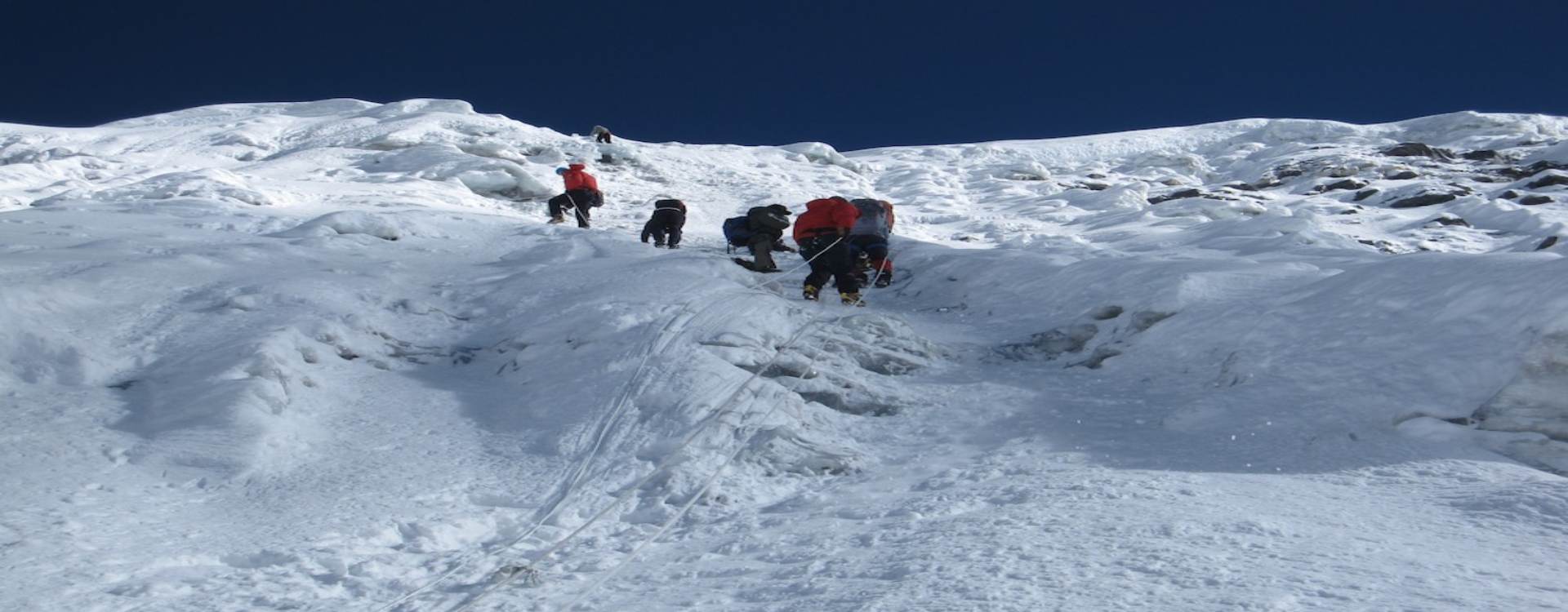
A series of rocky steps above the glacier requires moderate scrambling, with the transition from hiking posture to climbing posture marking a distinct shift in the physical demands of the day. Fixed ropes set by the lead Sherpa begin here. Above the rocky gully, the terrain opens onto a steep snow and ice slope that rises toward the headwall, which is the technical centrepiece of the entire route.
The headwall is a near-vertical face of compacted snow and ice measuring approximately 150 to 200 metres in height depending on conditions. Its angle varies between 40 and 50 degrees across most of its length, with sections steeper than that in certain conditions. The technical assessment of PD in French Alpine grading is accurate but should not be read as 'easy'. At 6,000 metres in the pre-dawn cold, on a slope of that angle, with a jumar clipped to a fixed rope and crampons on ice, a first-time climber will be working at close to their physical and psychological limits. The guides who have done this route thirty or forty times know that pace management is the critical variable: two steps, two breaths, two steps, two breaths, consistently and without rushing, is how the headwall gets climbed. Trying to move faster depletes energy reserves that cannot be recovered at altitude.
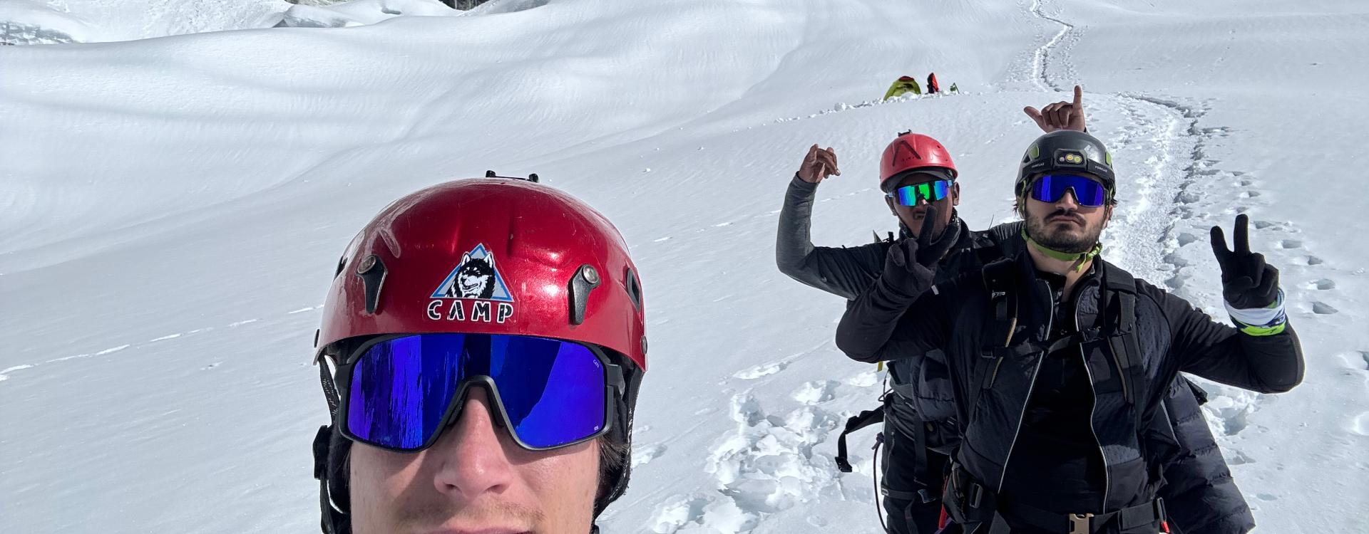
Above the headwall, the summit ridge appears. It is narrow and exposed, with significant drop-offs on both sides, and runs approximately 300 metres to the summit point. Fixed ropes continue along the most exposed sections. The crampon work on the ridge requires deliberate foot placement and correct clipping through each anchor. Most climbers describe this traverse as the most psychologically demanding section of the climb: the physical hardship of the headwall is behind you, but the exposure and the altitude combine to demand a focus that fatigue makes difficult to sustain. Most summit arrivals happen between 6:00 and 9:00 AM, timed to coincide with first light or full sunrise.
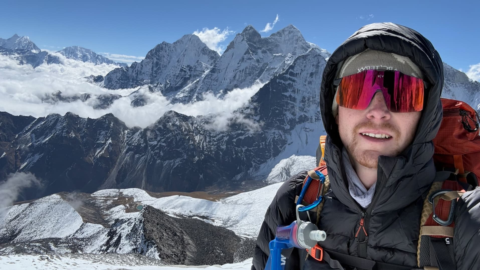
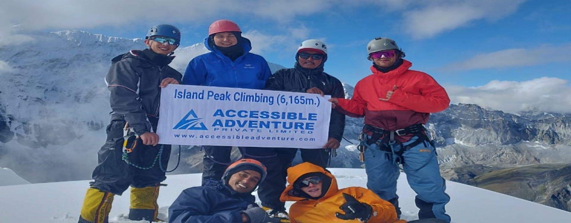
The summit platform is small, with room for perhaps four or five people to stand safely. The view from the top covers the full northern arc of the Khumbu's highest peaks. Lhotse's south face fills the immediate north, so close and so massive that Everest itself is largely hidden behind it. Lhotse Shar, Lhotse Middle, and Lhotse South all present themselves in sequence. Nuptse's long western wall runs to the left of Lhotse. Makalu, standing 25 kilometres to the east, shows its characteristic five-ridged pyramid in full profile. Baruntse and Ama Dablam to the south complete a horizon that takes several minutes simply to read properly. The descent follows the same route back to high camp or base camp, requiring equal or greater care on the headwall than the ascent.
Technical Demands: What You Actually Need to Manage on the Mountain
Island Peak's PD alpine grade positions it at the accessible end of technical Himalayan climbing, but that framing needs context. The skills required to complete the route safely are not trivial, and the altitude at which they are deployed makes any physical or mental gap in technique more consequential than it would be at lower elevation.
Crampon technique is the most fundamental requirement. Walking on ice with twelve-point technical crampons on moderate and steep terrain uses a specific foot placement pattern, flat-footing on moderate slopes and front-pointing on steeper sections, that needs to become habitual before it is done correctly under fatigue. Incorrect crampon technique on the headwall or summit ridge produces inefficiency at minimum and a slip at worst. The base camp training session addresses this directly, but trekkers who have practised crampon walking before arriving at Island Peak are noticeably more confident and efficient on summit day than those doing it for the first time.
Jumar operation is the second core skill. A jumar is an ascending device that slides freely up a fixed rope and locks when weight is applied downward. The technique involves sliding the device up, taking a step, weighting the device, sliding it up again, and repeating. On a steep fixed-rope section like the Island Peak headwall, this motion becomes a rhythmic system of movement where the rope does not support body weight continuously but acts as a safety anchor and progressive aid. First-time users who practise this on the lower glacier at base camp during training typically manage the headwall adequately; those who encounter it for the first time on the actual route lose more time and energy.
Crevasse awareness and rope team protocols apply throughout the glacier sections. Travelling in a rope team means maintaining consistent spacing between team members, keeping the rope off the snow surface to avoid drag, communicating clearly about pace changes, and knowing what to do if a team member breaks through a snow bridge. The lead Sherpa manages the navigation and the pace, but every member of the team needs enough situational awareness to move correctly and respond appropriately if the Sherpa calls a stop or a change of direction.
Mental composure at altitude is the fourth and often underestimated requirement. At 6,000 metres after several hours of effort in the dark, the combination of physical fatigue, cold, low oxygen, and exposure on an open ridge creates psychological pressure that has no equivalent in low-altitude training. Climbers who have practised deliberate attention management, staying methodical and process-focused rather than outcome-focused, handle this environment better than those who have not. Some mountaineering coaches describe this as the difference between managing the next three steps and thinking about the summit.
Gear: What the Mountain Actually Requires
Gear for an Island Peak expedition falls into two categories: standard high-altitude trekking kit used throughout the approach, and technical mountaineering equipment deployed from base camp upward. The approach kit is consistent with what any serious multi-week Himalayan trekker would carry. The technical kit is specific to glacier and headwall climbing at altitude.
For the approach trekking section, the essential items are waterproof trekking boots with solid ankle support, a layered clothing system including moisture-wicking base layers, an insulating mid-layer of fleece or synthetic down, and a hardshell waterproof jacket and trousers. Trekking poles reduce joint stress on the long descents from Namche and Dingboche and are strongly recommended. A sleeping bag rated to at least minus ten degrees Celsius covers the cold teahouse and camp nights. A quality headlamp with spare batteries handles the pre-dawn summit start. Sunglasses with wraparound coverage and UV 400 protection and sunscreen at SPF 50 or higher are non-negotiable at Khumbu altitudes, where UV intensity is significantly greater than at sea level.
The technical mountaineering kit required above base camp includes: double-insulated mountaineering boots rated to minus 40 degrees Celsius, twelve-point technical crampons compatible with your boots (rental crampons in Kathmandu and Chukhung are widely available and adequate, though fit to your specific boots matters), a climbing harness, a jumar, at least three locking carabiners, a belay device for the descent, a climbing helmet, and an ice axe. Warm expedition mitts over liner gloves for the summit push are essential; standard trekking gloves are inadequate at summit temperatures in the pre-dawn hours. Gaiters covering the boot and lower leg prevent snow ingress on the glacier.
Most technical gear can be rented in Kathmandu's Thamel district or from suppliers in Chukhung during the climbing season. Full rental kits for crampons, harness, jumar, carabiners, and helmet typically run between USD 100 and USD 200 for the duration of the expedition. Buying rather than renting makes sense only if further Himalayan climbing is planned. The one item consistently recommended for purchase rather than rental is mountaineering boots. Poorly fitted rented boots cause blisters that are difficult to manage on a ten to fourteen-hour summit day, and properly fitted, broken-in boots that you have hiked in over several weeks of training are the most direct practical investment in summit success.
Permits: What You Need and What Each One Costs
Three permits are required to climb Island Peak legally, and all must be obtained in Kathmandu through a registered trekking agency before the expedition departs. Permit inspections occur at Monjo, Namche Bazaar, Chukhung, and base camp.
The Island Peak Climbing Permit is issued by the Nepal Mountaineering Association and is the primary access authorisation for the climb. As of 2025 and 2026, the fee structure is: spring season (March to May) USD 250 per person; autumn season (September to November) USD 125 per person; winter (December to February) USD 70 per person. Winter permits are rarely used commercially given the extreme conditions on the upper mountain in those months. Permit costs are reviewed periodically by the NMA and the figures above should be confirmed with your operator at time of booking. The NMA also charges a garbage deposit of approximately USD 250 per expedition group, refundable on return of a specified weight of waste from the mountain.
The Sagarmatha National Park entry permit is required because the entire approach from Lukla passes through Sagarmatha National Park, which was established in 1976 and added to the UNESCO World Heritage Site list in 1979. The fee is USD 30 per person. The Khumbu Pasang Lhamu Rural Municipality permit covers the local administrative territory of the Khumbu trekking zone and costs approximately USD 20 to 25 per person plus thirteen percent VAT. Some itineraries that include the Gokyo Valley or Cho La Pass extension also require an ACAP permit; your operator will advise if this applies to your specific route.
A licensed climbing guide is required by regulation for all foreign nationals attempting any NMA-listed trekking peak. This requirement is enforced at permit checkpoints and cannot be circumvented. The guide handles permit inspections, fixes ropes on the headwall and ridge before the summit push, manages the rope team on the glacier, and makes the on-the-ground decisions about pace, weather, and turnaround timing that determine whether the expedition reaches the summit safely.
Costs: A Realistic Budget Breakdown
Fully supported Island Peak expeditions from registered Kathmandu operators range from approximately USD 2,000 to USD 3,500 per person for a standard 16 to 18-day itinerary. Private expeditions with a dedicated guide and porter for a single climber sit at the higher end of that range. Group departures with four to eight participants are priced lower per person. The specific services bundled into a package vary considerably between operators, and comparing headline prices without examining inclusions and exclusions is not a reliable way to assess value.
Breaking costs into components gives a clearer picture. The climbing permit alone runs USD 125 to 250 depending on season. The Sagarmatha and rural municipality permits together add approximately USD 50 to 55. A licensed climbing guide earns USD 30 to 50 per day; on an 18-day expedition that component alone is USD 540 to 900. Porter fees run USD 20 to 30 per day. Domestic flights between Kathmandu and Lukla cost USD 175 to 220 per person each way by regular aircraft; helicopter transfers to Lukla cost approximately USD 450 to 550 per person each way and eliminate the significant delay risk associated with weather-dependent small aircraft operations at Lukla's high-altitude airstrip. Teahouse accommodation averages USD 8 to 25 per night depending on altitude and facility standard. Meals at teahouses run approximately USD 30 to 45 per day. Camping costs from base camp upward, including tents, sleeping mats, kitchen equipment, and cook crew, are bundled into most package prices.
Costs outside most packages that must be budgeted separately include international flights to Kathmandu (USD 600 to 1,400 from Europe or North America depending on season and routing), Nepal visa fees (USD 50 for 30 days on arrival), personal travel insurance with explicit coverage for climbing at 6,189 metres and emergency helicopter evacuation (this is mandatory and non-negotiable), personal gear purchases and rentals, tips for guide, porter, and cook crew, and personal trail expenses including Wi-Fi, battery charging, laundry, extra snacks, and any alcoholic drinks. A realistic all-in budget from Europe or North America ranges from approximately USD 4,500 to USD 7,000 depending on flights, gear needs, and personal spending.
Best Time to Climb: Season by Season
The two standard climbing windows follow Nepal's trekking seasons. Spring runs from March through May, with April and early May carrying the highest summit success rates and the most stable summit weather windows. Post-monsoon autumn runs from late September through November, with October the most reliably clear month for mountain visibility.
Spring has several specific advantages on Island Peak. Snow on the headwall tends to be firmer and more consolidated in April than in autumn, when residual monsoon snowfall can leave varied surface conditions. The longer daylight hours of spring allow summit parties more time before the afternoon weather that can develop in the Khumbu. Rhododendron forests on the lower approach sections from Lukla through Namche are in bloom through March and into April, which makes the approach trekking genuinely beautiful. The downside is that spring is the busier season in the Everest region overall, meaning teahouses near Namche and Tengboche are crowded and the main EBC trail sees significant traffic.
Autumn offers the best mountain visibility of the year. The monsoon clears the atmosphere of dust and haze, and October in particular regularly delivers the kind of deep-blue sky and crystalline air clarity that makes the summit panorama genuinely extraordinary. Post-monsoon trail conditions are dry and reliable by late September. Temperatures fall progressively through October and November, and the nights at base camp and high camp in late November are seriously cold. The autumn window closes by mid-November for most commercial operators as the upper mountain becomes progressively less hospitable.
The monsoon window from June through August is not viable for the summit push. Heavy rain, trail washouts, soft and unstable snow on the upper mountain, and near-zero visibility on the glacier make this period unsafe for a technical climb on Island Peak. The winter window from December through February is technically possible but rarely run commercially; temperatures at high camp and on the summit approach reach extremes that require full cold-weather expedition gear and carry higher risk than the standard seasons.
Altitude Sickness: What Changes Above 5,000 Metres
Island Peak's summit at 6,189 metres represents a significant step above the altitude ceiling of most trekking itineraries in Nepal. The standard Everest Base Camp trek peaks at 5,364 metres at base camp and 5,545 metres at Kala Patthar. Island Peak's summit adds another 600 to 650 metres above that, at a point where the available oxygen per breath is approximately 47 percent of what is available at sea level. The physiological consequence of that oxygen reduction is felt clearly on summit day, and managing it is central to both performance and safety.
The standard acclimatisation profile for Island Peak uses the approach days through the Khumbu to build altitude exposure gradually. The mandatory rest days in Namche and Dingboche are not optional schedule items; they are the physiological foundation of the summit attempt. Above 3,000 metres, the body requires time to increase red blood cell production, adjust respiratory rate, and adapt its enzyme systems to work more efficiently with lower oxygen availability. Trying to compress this process by skipping acclimatisation days is the most reliable way to produce an altitude sickness episode.
Acute Mountain Sickness above 3,000 metres manifests as headache, fatigue, nausea, disturbed sleep, and loss of appetite. These symptoms are common and manageable with rest at current altitude and adequate hydration. The rule above 3,000 metres is clear: do not ascend with active AMS symptoms. If symptoms persist despite a rest day, descend. High Altitude Pulmonary Edema, characterised by shortness of breath at rest, persistent dry cough, and a crackling or rattling sensation in the chest, is a medical emergency requiring immediate descent and evacuation. High Altitude Cerebral Edema, presenting as loss of coordination, severe headache that does not respond to ibuprofen, confusion, or altered consciousness, is equally serious. Both conditions can develop quickly above 5,000 metres and both require the same immediate response: descent and emergency evacuation.
Guides on Island Peak carry pulse oximeters and should conduct oxygen saturation readings from Namche onward. Readings above 90 percent at rest are generally acceptable below 4,000 metres; readings falling below 85 percent at rest at any altitude warrant a rest day or descent decision. Hydration of three to four litres of water per day is the most consistently recommended practical measure for altitude management. Acetazolamide (Diamox) at 125 to 250 mg twice daily is used prophylactically by some climbers, beginning 24 hours before arrival at altitude; this should be discussed with a physician before the expedition given its contraindications. Travel insurance covering emergency helicopter evacuation from the Khumbu is mandatory and must specify coverage at 6,189 metres.
Physical Training: What the Summit Day Actually Demands
Summit day on Island Peak asks for ten to fourteen hours of sustained effort beginning at 1:00 to 2:00 AM, starting at either 5,087 metres at base camp or 5,600 metres at high camp. The vertical gain to the summit is 600 to 1,100 metres depending on starting point. The terrain shifts from rocky moraine to glacier to scramble to near-vertical ice headwall to exposed ridge traverse. The body doing this has been sleeping at altitude for ten to twelve days, eating teahouse food, and is working with roughly half the oxygen concentration it is built for. Preparation that does not account for these specific demands will produce a harder summit day than necessary.
Training should begin twelve to sixteen weeks before departure. The structure that experienced Himalayan guides recommend most consistently is approximately 80 percent low-intensity aerobic volume and 20 percent higher-intensity work. In practice: four to five sessions per week of running, cycling, rowing, or hiking at a conversational pace, building duration progressively over the training period. Loaded hiking with a pack of eight to twelve kilograms over five to seven hours on weekends mimics the approach days in the Khumbu more directly than any gym-based cardio alternative. Stair climbing with a loaded pack is the most useful single training activity for the headwall specifically.
Leg and core strength training should run alongside the aerobic work. Squats, lunges, step-ups, single-leg deadlifts, and Bulgarian split squats build the quad and glute strength needed for sustained steep descent on tired legs. Core stability exercises including planks, dead bugs, and pallof presses build the foundation for correct posture during hours of loaded walking on uneven terrain. Upper body strength matters less on Island Peak than the lower body but is not irrelevant on the rocky scramble sections and the jumar ascent.
If you have never used crampons or a jumar before the expedition, booking a one-day course with a mountain guide in an alpine environment before departure is the single most cost-effective preparation investment available. Arriving at Island Peak base camp with the physical habit of crampon walking and rope technique already established shortens the training session and leaves the summit day feeling substantially less alien. For trekkers based in regions without alpine access, indoor ice climbing walls offer a partial substitute for crampon technique practice.
Combining Island Peak with the Everest Base Camp Trek
The most popular extended itinerary in the Khumbu pairs the Everest Base Camp trek with the Island Peak climb on a combined route of 18 to 22 days. This combination works particularly well because the EBC approach provides a superior acclimatisation baseline for the Island Peak summit. Reaching 5,545 metres at Kala Patthar before descending and heading east into the Imja Valley means the body arrives at Island Peak Base Camp having already adapted to an altitude close to the camp's elevation. Operators running the combined itinerary report higher summit success rates than those running Island Peak alone from a shorter approach, and the additional time also builds in weather buffer for the summit attempt.
The combined route follows the standard EBC trail from Lukla through Namche, Tengboche, Dingboche, Lobuche, and Gorak Shep to EBC at 5,364 metres, then continues to Kala Patthar at 5,545 metres for the panoramic Everest viewpoint. From Gorak Shep or Lobuche, the trail descends back to Dingboche and then heads east through the Imja Valley to Chukhung and Island Peak Base Camp. The extension adds approximately four to six days to the standard Island Peak itinerary but delivers two of the most celebrated mountain experiences in Nepal on a single expedition.
A further extension pairs both Island Peak and Mera Peak on a single 22 to 26-day itinerary, with Mera typically climbed first to build altitude exposure at 6,476 metres before descending through the Hinku Valley and crossing to the Khumbu for Island Peak. The combined Mera and Island Peak expedition is the most comprehensive introduction to technical Himalayan climbing available on a trekking-grade objective and is offered by a growing number of Kathmandu operators.
Choosing an Operator: What the Difference Between Good and Poor Expedition Support Looks Like
The quality of expedition support on Island Peak has a direct, measurable effect on summit outcome and on safety margin. The mountain's technical character means that guide experience, rope-fixing practice, and real-time decision-making on turnaround times are not background logistics but active determinants of the climb's success.
The most important question to ask any operator is how many times the specific guide assigned to your expedition has summited Island Peak. Not the company's total cumulative summit count, not the general experience level of the guide pool, but the number of personal Island Peak summits of the person who will be on the mountain with you. A guide who has summited forty times knows the headwall's seasonal variations, knows the pace required at each section to conserve energy for the ridge traverse, and knows the body language of a client who is starting to struggle before that person has articulated it themselves. These things come from repetition and cannot be replaced by training courses.
Other questions worth asking: What is the guide-to-client ratio on summit day? A maximum of one guide to three or four clients is the standard among quality operators; larger ratios reduce the individual attention available if a client runs into difficulty. Who sets the fixed ropes on the headwall and ridge? In some expeditions these are shared or pre-set by another operator's team; in others your own guide sets them. Does the itinerary include a genuine acclimatisation day in Namche and a rest day at Dingboche or Chukhung? What is the documented turnaround time policy? Can the operator provide contact details for two or three clients from recent seasons?
Local operators based in Kathmandu with guides drawn from Sherpa and other Khumbu-region communities carry practical advantages that are worth considering seriously. Their teahouse relationships along the EBC corridor ensure reliable accommodation during the spring peak season. Their cook crew know the base camp site and the water sources. Their emergency response protocols link to helicopter evacuation companies through existing relationships that translate into faster turnaround when a medical situation develops at altitude. At 6,000 metres with conditions deteriorating, the operational quality of the company behind the expedition is not a secondary concern.
Island Peak rewards the preparation that goes into it with an experience that is genuinely difficult to compare to anything else in trekking-grade adventure. The technical demand is real. The altitude is serious. The summit view, across one of the most concentrated collections of major Himalayan peaks visible from any accessible point on Earth, is extraordinary. And the simple fact of standing at 6,189 metres before the first sun touches the south face of Lhotse, having climbed through the dark on a slope of compacted ice with the Khumbu spread out below, is the kind of thing that stays with a person for the rest of their life.
About Accessible Adventure
Bringing unforgettable Himalayan adventures to everyone. Our expert guides and carefully curated experiences ensure that everyone can explore the beauty of Nepal, Tibet, and Bhutan.
Learn More